Grab your gear and hop on the ski lift! 🏔⛷️ This post written by @vkschoenwald is all about AMOC, an important component of the climate system. Hopefully you'll learn more here than from watching The Day After Tomorrow...
https://t.co/2tMHVeTSrM
New post! 🚨
@mbarcodia introduces us to a topic once considered mysterious, machine learning, and explains how it has become a useful and exciting tool 🔧 for climate science. Warning: you may leave with a hankering for pie... 🥧
https://t.co/Lct8lhddVY
@FerragamoWx Hurricane Isidore had a lower pressure without reaching above category 3 (110kts and 934mb). Others have pointed out there are storms like Katrina were category 3 with an even lower pressure, although it was weakening from category 5.
@greg_koman Unfortunately yes, Ian and Charley had the same wind speed at landfall but Ian was much larger which means longer lasting winds and higher surge.
Some damage in Ft. Myers from #Ian. We had to turn around because the roadway was still flooded. Many cars were stalled on the side of (and in) the road, presumably swamped by the storm surge.
In the northern eyewall of #Ian the building next to us started losing its roof. Several other buildings and hangars had similar damage. @v0rticity has a good video of the building from the front. https://t.co/BYZm3qSbq6
At 4:38pm, we ventured outside into the eye of Hurricane #Ian, when the winds had decreased enough that it was safe to do so. @all4hurricanes1@DaveNolan305
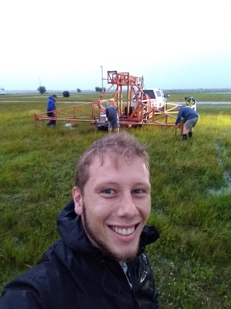
I joined @UFWertheim@DaveNolan305 and @v0rticity today to help set up observation towers in Punta Gorda to measure #Ian. We rode out the storm at Punta Gorda Airport. It's been a wild night but we're safe.
@burgwx@pppapin This did happen recently, it might have been Wilfred and Alpha. I like to think the NHC forecasters race each other to see who issues the advisory first so their storm wins the name.
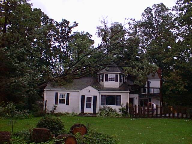
19 years ago today I woke up to this, courtesy of Hurricane Isabel. The storm caused a lot of damage from falling trees. In addition to the wind, Isabel hit the coast at such an angle to create historic storm surge in VA making it the costliest storm in the state's history.
If I may draw your attention away from the EPAC and to the Atlantic (who ever thought I'd need to say that) Earl seems to have unexpectedly intensified and may become a major hurricane after all.
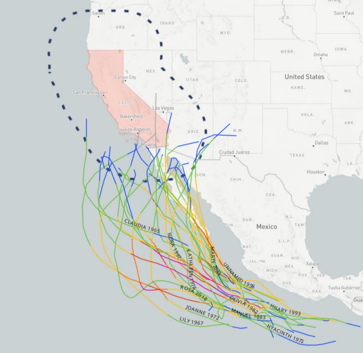
@Giraffemayne Actually it is. Dolores became post-tropical well south of CA (and thus shouldn't technically be included) but the NOAA historical tracker doesn't differentiate between TDs and remnants apparently.
Tropical Storm Kay is just 100mi from California. In the past 71 years there's only been 29 TCs (including depressions) that have even been within 200 miles. Definitely a rare event that is bringing some potentially dangerous flooding rain to the San Diego area.