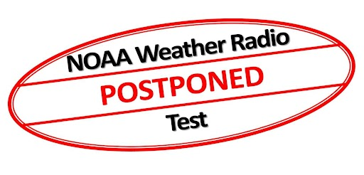
The monthly outdoor warning #siren test that would normally happen today in Allen County, IN will not occur, per @ACHomeland. County plans to test sirens March 12, during statewide #tornado communication test. #tornadosiren#INwx
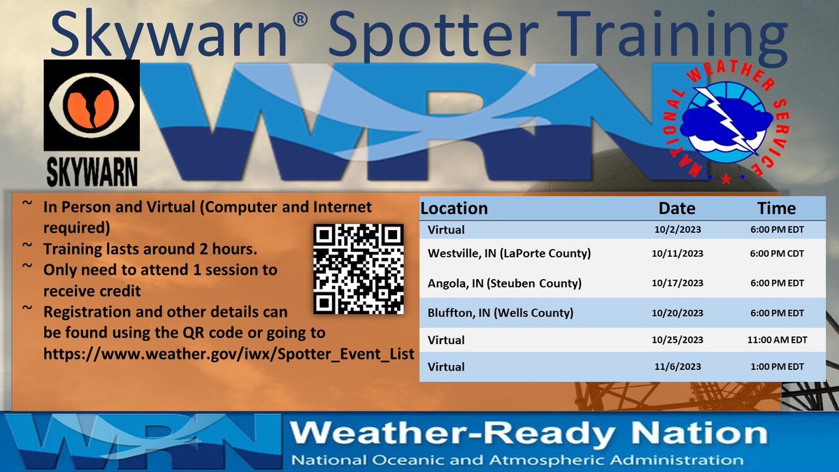
The manager of our #Skywarn net, @RadioW9LW recommends that all #hamradio operators attend this class at least once every 3 years. Every year is even better! It helps #stormspotters know what to look for, what to report, and what not to report. #severewx
We will be conducting a total of 6 Fall 2023 Skywarn Spotter training sessions (3 in-person and 3 virtual) in October and early November. Scan the QR code or go to https://t.co/glT2Aeetp5 for more details
.@ACHomeland has informed us that it has canceled the test of outdoor warning #sirens scheduled for noon today, to avoid any confusion associated with today's weather conditions. The county normally tests the sirens at noon on the first Wednesday of each month. #INwx
Our Allen County #hamradio#Skywarn net control team is monitoring today's #SevereWX potential. If net activation is needed, it seems most likely between 4 p.m. & 6 p.m. ET. #INwx
Our quarterly, in-person meeting is scheduled for 6 p.m. Thursday, Aug. 17, at the Allen County Public Library, 900 Library Plaza, Fort Wayne. The focus will be "go kit" show and tell. #HamRadio#ARES#EmComm#EmergencyCommunication@IN_ARES
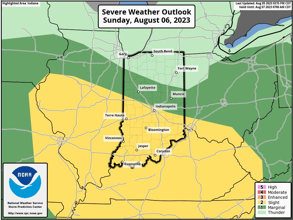
The @nwsspc issued an updated Day 2 Convective Outlook at midday today. It indicates that #severeweather is no longer forecast for Allen County, Indiana tomorrow. #INwx#Skywarn
Risk of #severeweather in Allen Co IN tomorrow (8/6) has decreased to level 1 of 5 (marginal), per @NWSSPC day2 outlook & @NWSIWX DSS packet. #Skywarn spotter activation still possible tomorrow night but less likely. #INwx
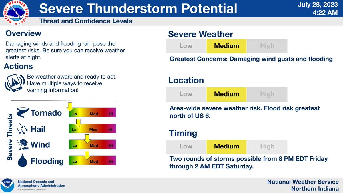
There is a potential of severe thunderstorms Sunday afternoon into Sunday night. There is Medium confidence in severe weather occurring in the area, but lower confidence in exact timing and extent of the severe weather threat. Stay tuned for updates.
#Skywarn storm spotters and especially our #hamradio equipped spotters should watch for future outlooks and prepare for possible activation Sunday afternoon and evening. #INwx#severewx
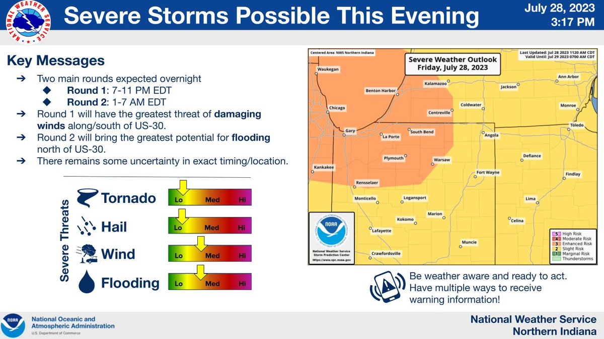
Two rounds of storms are expected overnight. The first will bring a chance for damaging winds 7-11 PM while the second will bring a chance for heavy rain and flooding 1-7 AM. Stay weather aware this evening and have a way to receive warnings overnight.
Leaders of our #hamradio#Skywarn net preparing for possible activation tonight on Fort Wayne 146.88 MHz repeater. Storm spotters should charge battery-powered equipment today & review training for after-dark storm spotting. #INwx#severeweather
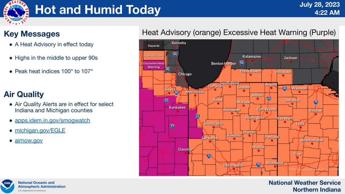
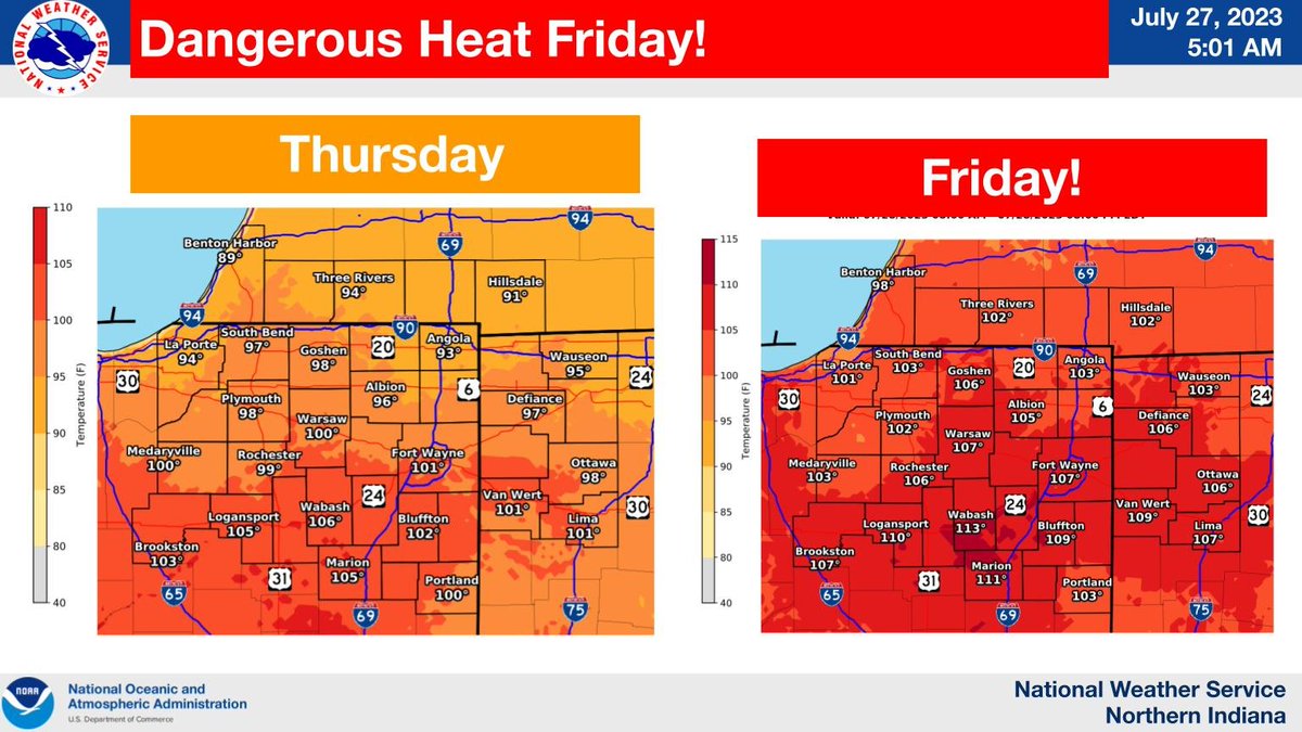
Chance of severe storms late this evening into tonight. Damaging wind gusts are the primary threat. Flooding possible with rainfall rates in excess of 2" per hour. Heat Advisory for today. Highs mid to upper 90s. Peak afternoon heat indices in the 100 to 107 degree range.
Two rounds of storms are possible today. Round 1, which is currently moving through Illinois, will likely come through late morning/early afternoon. Best severe chances with Round 1 north of US 6. Additional development likely later this afternoon/evening with Round 2.