This is the sound of the new Gen 4 Formula E race car driving around the Monaco GP Circuit.
• Up to 815 hp (Attack Mode)
• 200 mph Top Speed
• Permanent AWD
• 700kW Regenerative Braking
• 55kWh Energy Capacity
• Electric Motors with over 90% efficiency
• 600kW Fast Charging
• ~10s faster around a lap quicker than previous Gen.
• 0-60 mph in 1.8s, which is around 30% faster than F1 cars in some metrics.
• Body construction uses 100% recyclable materials and 20% recycled content
The car can generate nearly 50% of the energy required for a full race through regenerative braking.
GIVEAWAY DROP 🚨
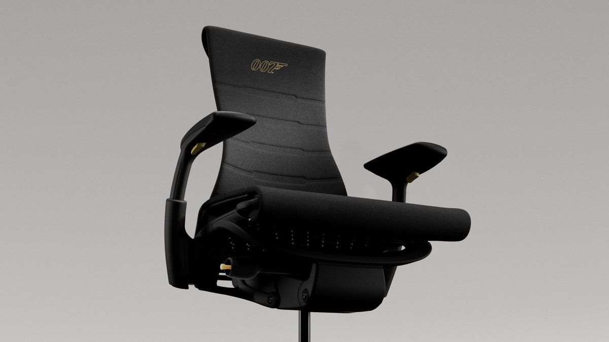
Earn The Number with the best gear an agent can have. This is your chance to win a custom Embody Gaming chair inspired by 007 First Light with @007GameIOI. Become the agent you were called to be.
To enter:
Follow: @HMGaming
❤️ Like + RT this post
💬 Comment: #HMGx007FirstLight and tag 3 friends
⬇️ Enter by the link below for bonus entries!
📅 Ends 6.2
Complete all three and score 4 bonus entries! NO PURCHASE NECESSARY. Starts May 26, 2026 and ends at 11:59pm PST on June 2, 2026. See Official Rules. Open to legal residents of U.S. & DC, Canada, and the U.K. who are 18+. Void where prohibited.
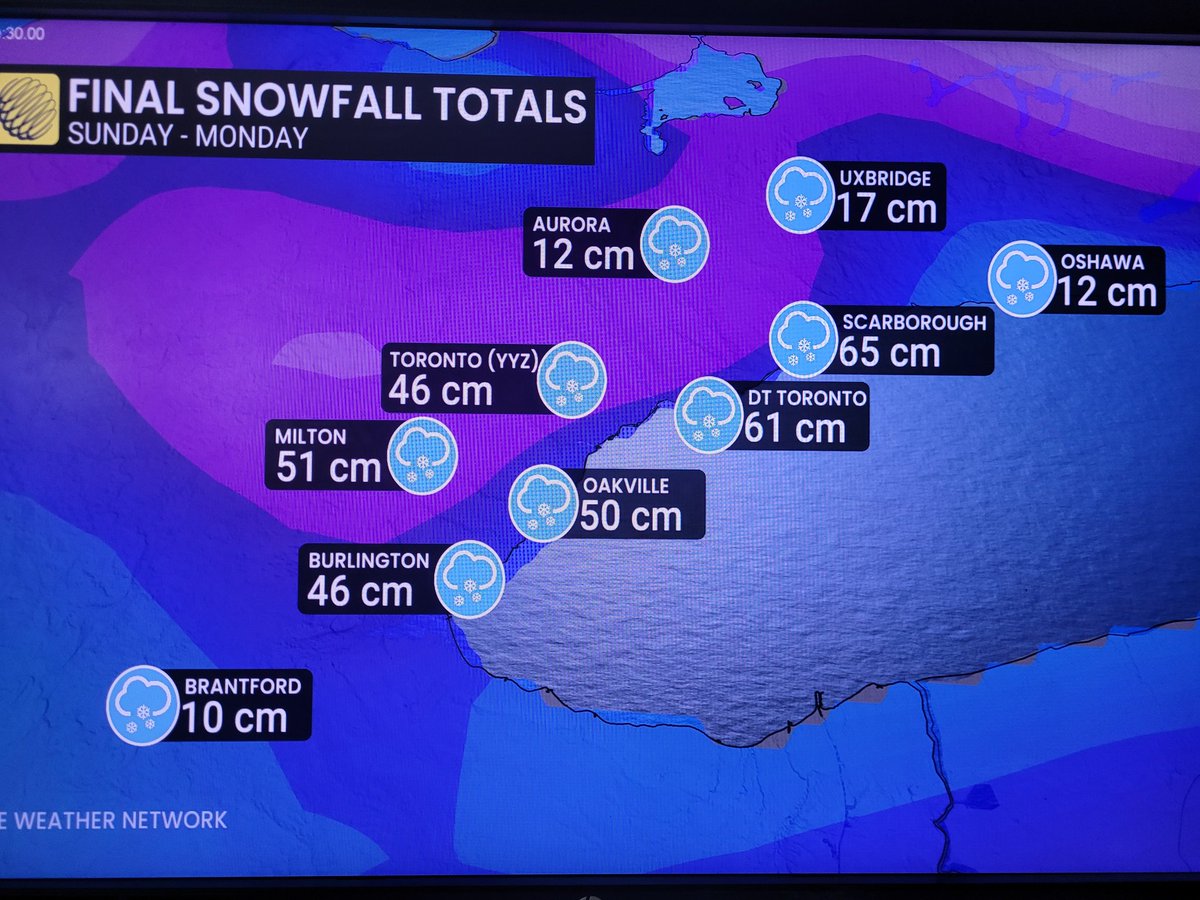
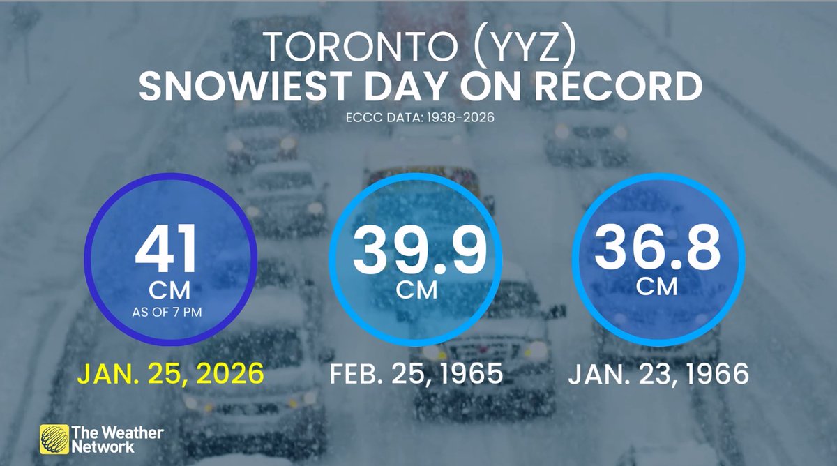
What a contrast for areas that received the lake enhancement & those that did not from Sunday's snowstorm! #onstorm. Today, it's about the cold & snow squalls will be on the move as the wind shifts from southwest to northwest through the day. Thx @golfermet for the graphic.
@PriusChat Superchargers rely on high amperage (up to 650A IIRC) to output 250kW. Other stations use voltage to boost that power output (up to 1000V) so they’re running closer to 400A or even 350A if you take 350kW and 1000V.
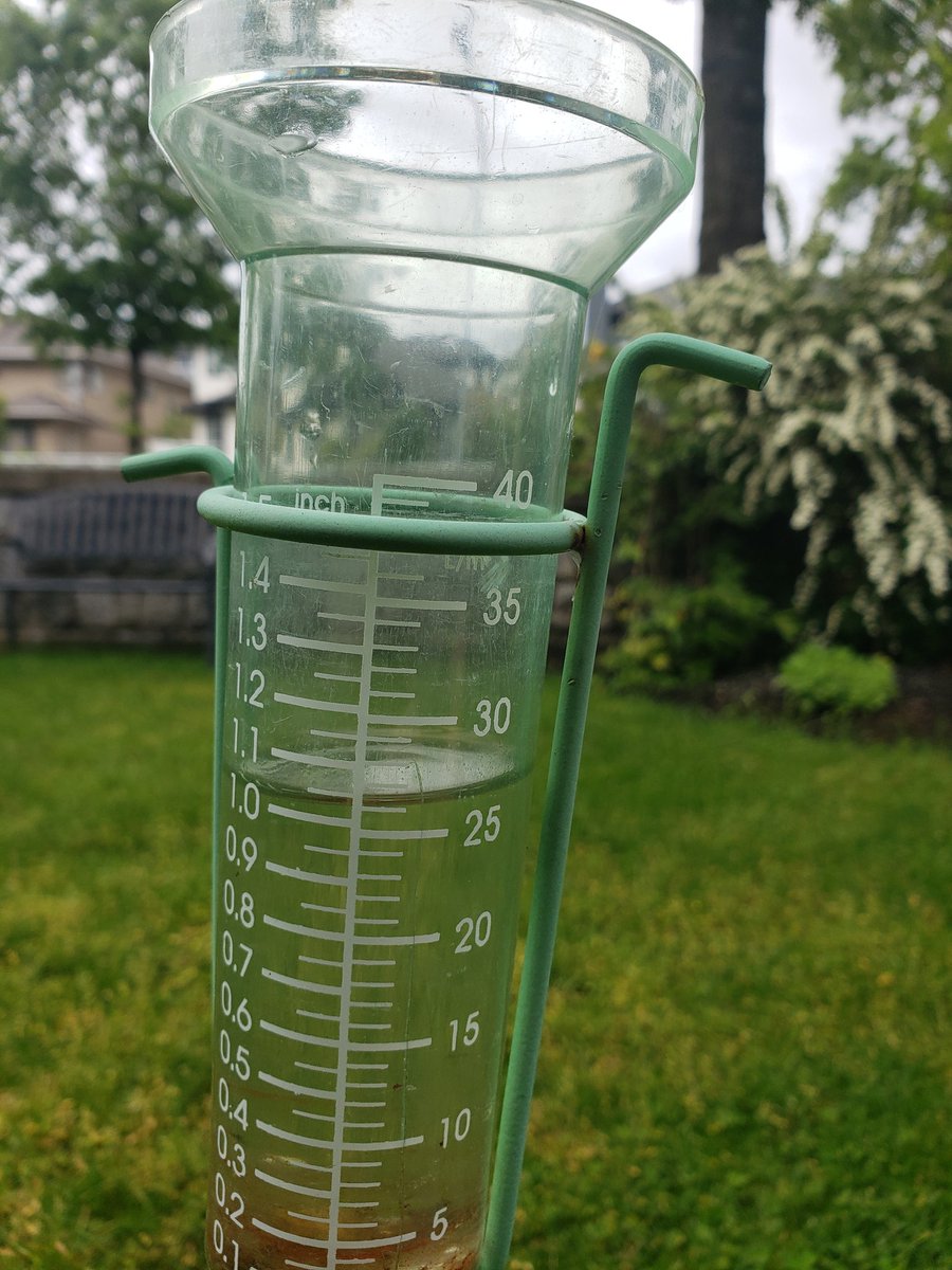
Environment and Climate Change Canada did a great job predicting the rainfall for my area. Here are the two rain gauge shots from my Tri-Cities location in Metro Vancouver near the confluence of the Pitt and Fraser Rivers. 56 mm total through 9 AM today.
@bc_news_addict
1. I am not a professional meteorologist. Please do not ask me any questions. Follow our local Weather experts for proper information.
2. Holy shit! 😬
3. Seriously, follow our local Weather experts for proper information over the coming days.
High tide flood potential Saturday and Sunday!
Two low pressure systems will combine very high tides this weekend to produce the potential for flooding along coastal regions. The highest tides will occur near late morning and midday both Saturday and Sunday.
@Ra_Erickson@badger7575 Had time to take a closer look. Looks like freezing rain will occur Friday afternoon and all night. It could change to rain by noon on Sat.
@Ra_Erickson@badger7575 I haven’t looked that closely but it will be a prolonged event. Weather models tend to warm up the Fraser Valley too quickly so they don’t capture the outflow winds which keeps the surface cold and thus keep the precipitation as freezing rain.
@badger7575@Ra_Erickson If anyone is in the Valley or travelling through, I’d strongly advise against Friday afternoon/evening and Saturday travel due to freezing rain. There’s also heavy rain for later on Saturday through the highways on top of the snow from Friday which may cause issues. Go tomorrow.
@Ra_Erickson Afternoon should be ok for sure. Evening I think is ok too but depends where you are. It’ll start in the eve on the Island and late evening or midnight on the mainland.