#30DayMapChallenge Day 9: Analog - Medieval castles 🏰
Printed small maps of castles on with a portable printer on a thermal paper. I like this dithering effect from low-quality printing
#30DayMapChallenge Day 6: Dimensions - Chiatura 🚡
The city in Georgia with a system of cable cars. Tried to make a 3d map with smth that has full info about itself only in 3d
#30DayMapChallenge Day 2: Lines - ICT networks 🖥️
The purpose of this map was to look at all the networks without basemap. It's interesting to note how the structure differs in different countries
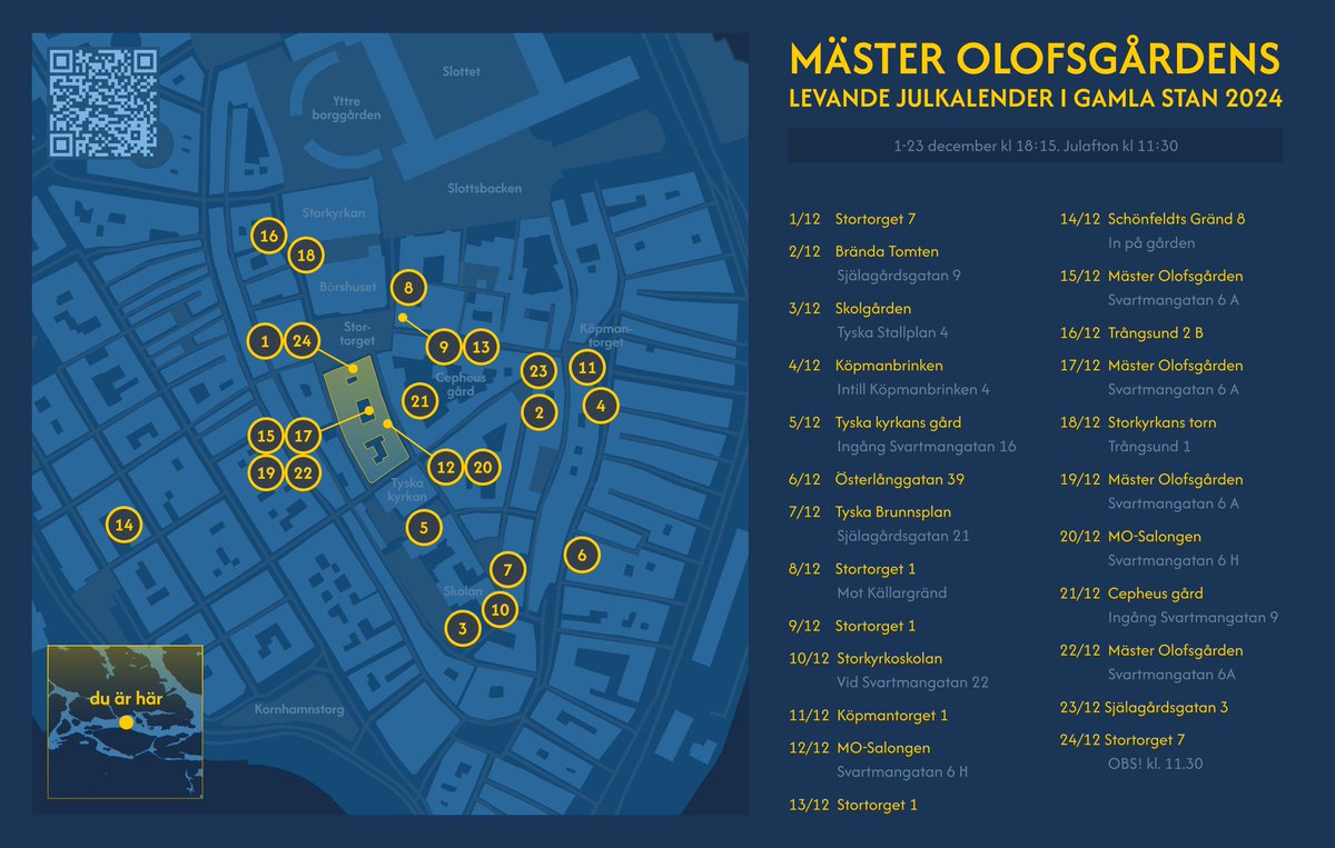
Found out that in Stockholm there is a live advent calendar in December! Mäster Olofsgårdens are making it since 2005. On each day people are performing smth from old city's windows
I don't like their map so created new version. My girlfriend also helped me with design issues
#30DayMapChallenge Day 30: The final map - Marine traffic 🚢
The first map shows vessels by speed, the second - by vessel type. Was excited to make final map with ships, I can spend a lot of time exploring their routes
Data from: https://t.co/KTv4fwgB1E
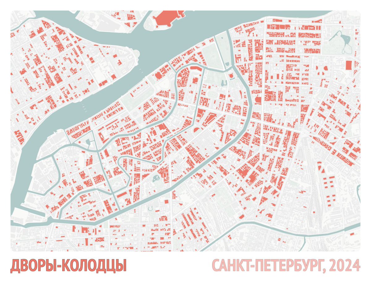
#30DayMapChallenge Day 29. Overture - Saint Petersburg courtyard wells 🟥
Red color represents courtyard wells - courts that are totally surrounded by a building. In Saint Petersburg they are often very narrow and authentic - city's landmark
#30DayMapChallenge Day 27 Micromapping - Ant's routes 🐜
Diving deeper into micromapping, ant's pathes around anthill enters are a good example! The resulting heatmap shows popular places around holes in ground - map of ant's home
Data: https://t.co/lG8ysWOUHr
#30DayMapChallenge Day 26: Map projections - Magellan's circumnavigation 🌎
Found really cool tutorial, how to make projection that minimizes distortion for a particular route: https://t.co/vYkuc7LTRb
#30DayMapChallenge Day 24: Only circular shapes - Roundabouts count in the world 🔄
Kinda ugly viz, but still informative. Day is for circles - so I've plotted data on circle crossroad in the world. Top 1 is France - but with strange driving rules for roundabouts
#30DayMapChallenge Day 23: Memory - First childhood trip 🌅
I was small years old when first time travelled somewhere - parents took me to Anapa. Tried to recall as much places from that trip as I can and put them on a map. Other places are blured - so they are in my memory
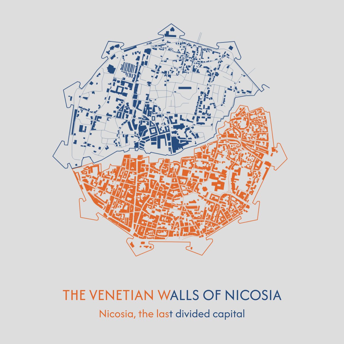
#30DayMapChallenge Day 22: 2 colours - Nicosia 🇨🇾
Wanted to show a place that has one name but separated. Nicosia is divided into two parts, like the whole Cyprus. It is the last capital in the world that is splitted
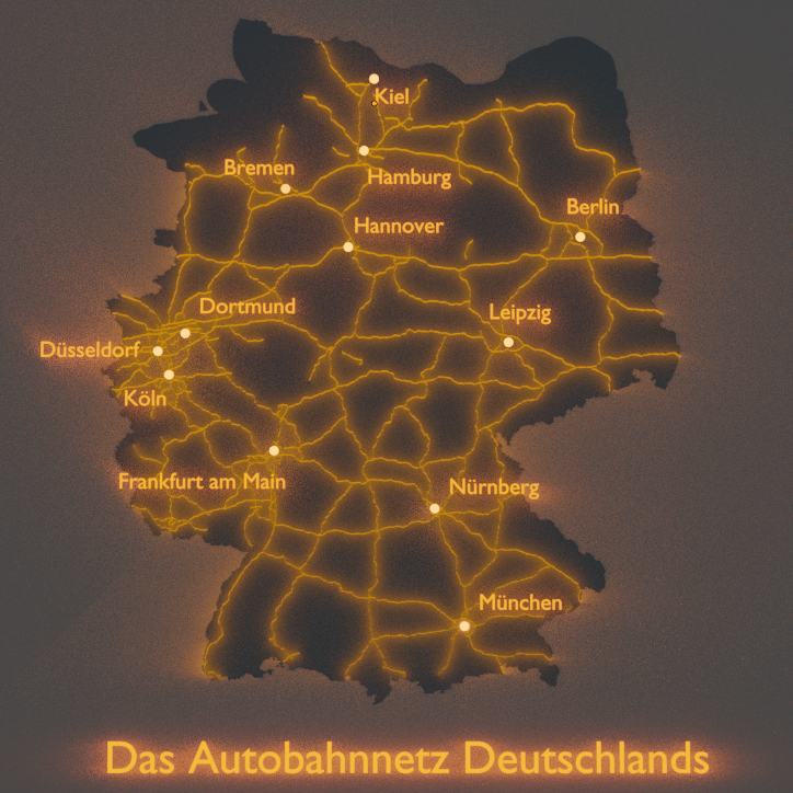
#30DayMapChallenge Day 20: OpenStreetMap - German autobahn system 🛣️
Germany's cities are connected with high-speed Autobahns - you can drive with no speed limits at all
In my imagination from the top it looks like glowing network of cars spreading light all over the country
#30DayMapChallenge Day 21: Conflict - Conflict risk index ⚔️
The level of conflict risk (the total index of many factors) over time. The higher the column, the worse the situation. Visualization tool - Aerialod, data from https://t.co/TFQ22y3hpH
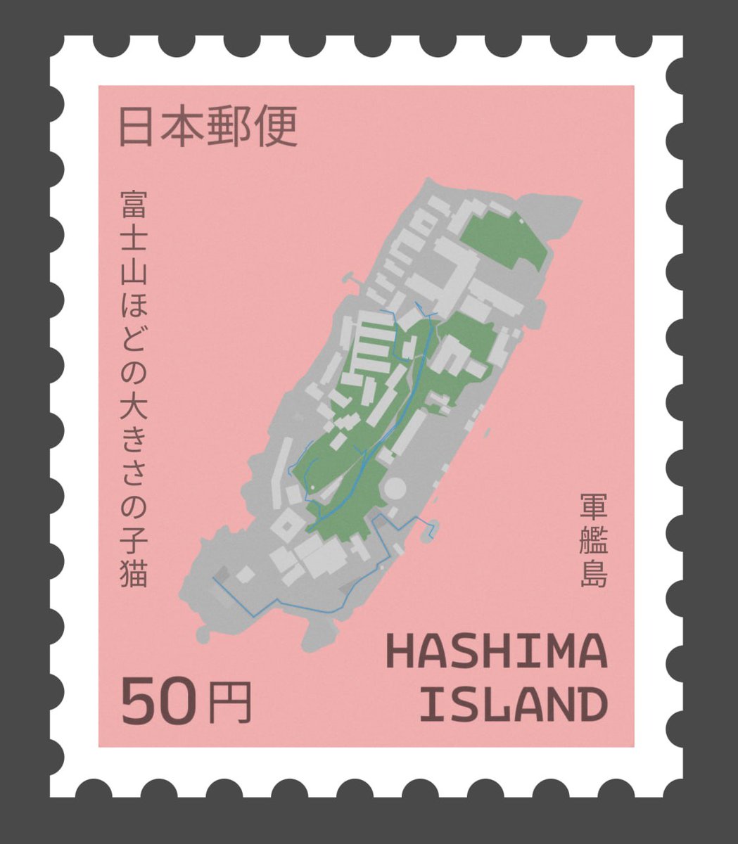
#30DayMapChallenge Day 19: Typography - Hashima Island 🏣
I love Japanese kanji and for the typography day I wanted to create smth in a post stamp. Hashima Island - abandoned island in Japan - is a perfect spot for this purposes and also for romanticizing abandoned places