Como siempre, todo feedback es más que bienvenido, sea del tipo que sea y de la parte del producto que sea.
🎊 Espero que lo disfrutéis (y a los que no, perdón por el spam 😊 🙏 )
🎁 Por si a alguna os puede interesar probar el producto en el que trabajo @lookiero obteniendo además 15€ de regalo (que buenos son💸 ), aquí os dejo este link --> https://t.co/UjaxXL8Ngm
CARTO Workflows: our new analytics tool provides a visual language to design, automate & execute multi-step #spatial analytics.
And it’s now available for @PostgreSQL users 🎉
Using PostgreSQL and want to try your hand at spatial analysis? Test it out: https://t.co/kQyXexKnQG
What's driving innovation in geospatial analytics today?
Accessible tools that allow all users to perform #spatial analysis.
CARTO Workflows empowers users to do just that, and it’s now available for @SnowflakeDB users in public beta! ❄️
Check it out: https://t.co/I7pnv3Fygq
Today we launch CARTO Workflows in public beta, our no-code analytics tool!
Build, run & automate advanced #spatial analytics using our cloud-native visual interface, no SQL knowledge needed!
Check out how you can automate your geospatial analysis here:
https://t.co/QqpLIpzmUA
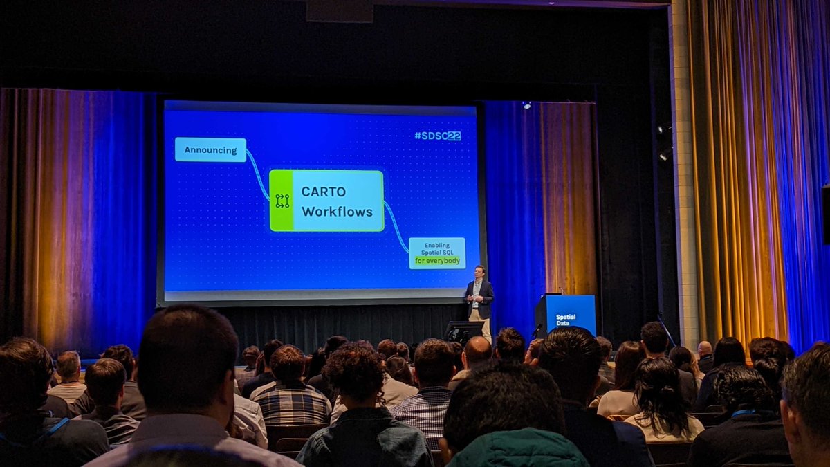
Here it is! Today at the Spatial Data Science Conference in New York City we announced CARTO Workflows, an exciting new tool that enables users of all types and skill levels to harness the power of cloud DW, spatial SQL, and advanced spatial analytics >> https://t.co/NI2Rpumulb
If Tuesday was an exciting day because we published our #python packages to work with CARTO (https://t.co/A9ha0W17vr), what comes today is from another planet. I'm happy, nervous and eager to show you it. Today we present it in the SDSC (NY) and I share it with you here too, ofc
I’m very excited to share with you that we have released in beta a new platform feature to facility the possibility of working with the CARTO platform from Python notebooks. Data Scientist, enjoy a lot these two Python packages ;) https://t.co/HXZTZlWDFh
Heading to NYC for #sdsc22 at Columbia university. This year is going to be epic. With workshops from @CARTO@databricks@googlecloud@SnowflakeDB and @awscloud and presentations from great spatial data scientist. And I will be showcasing a new way of doing SQL on the keynote!!🤘
Did you miss our 📗 blog: using trade area #analysis for #CPG merchant segmentation?
Explore the new CPG module in @CARTO's Analytics Toolbox for #BigQuery & learn about trade area generation, #data preparation & more.
Read now!
https://t.co/D0ExBHwslz
Just how big is #BigData? Is 7.2 billion points big enough?
Check out this 🗺 #map of every node from @openstreetmap 😲 built with @CARTO.
https://t.co/WRdeBdIR4u
📣 A new #CPG module in CARTO’s Analytics Toolbox for #BigQuery.
Segment CPG points-of-sale based on trade area characteristics.
Learn how spatial #data & cloud native #analytics can drive more effective product launches, market expansion & more at: https://t.co/65q7tTGvin.
How are #CPG companies using Location Intelligence to gather accurate shopper #insights to address changes in #consumer behavior & support better decision-making? 🛍
Explore real-life examples & key applications of #spatial analysis in CPG.
Read more ⤵️
https://t.co/o2G6E5wHqF