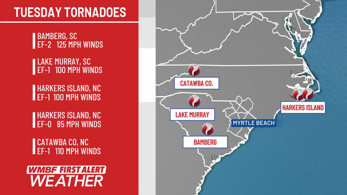
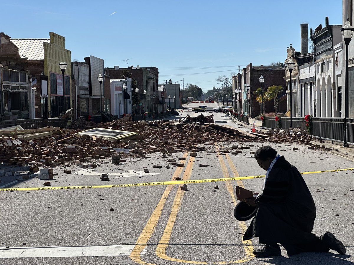
A total of 5 tornadoes confirmed in the Carolinas yesterday. The strongest was EF-2 in Bamberg, SC with 125 mph winds. Interestingly, the two tornadoes in Harkers Island, NC came ashore 1 mile apart and at the exact same time. #SCwx#NCwx@WMBFnews
The NWS has a preliminary rating of EF2 on the tornado in Bamberg, and EF1 on the waterspout/tornado that came onshore on the north side of Lake Murray near Chapin. More details will be passed along later.
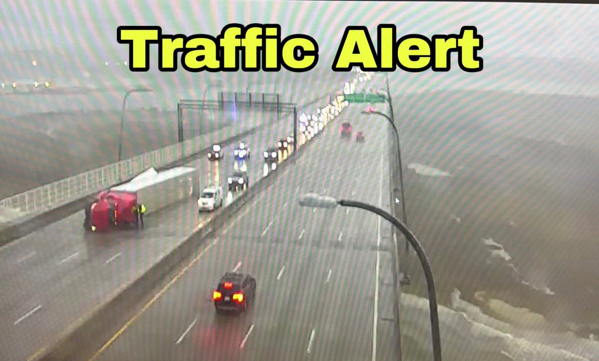
There is an overturned truck on the Ravenel Bridge. 2 lanes are closed northbound and one lane is closed southbound. Expect heavy delays. #chstrfc#chsnews ^wm
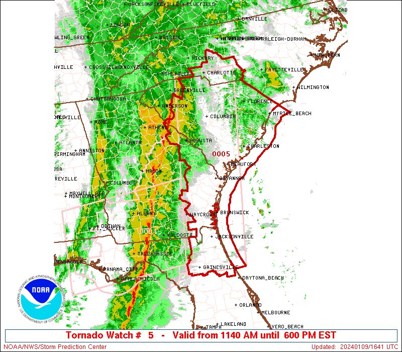
Lousy weather day ahead Tuesday with strong non-thunderstorm winds, morning tidal flooding, and the risk for some severe storms in the afternoon and evening as a squall line pushes through. The details and the caveats in the forecast are on the blog:
… https://t.co/SwVXYCD3jm
A rare High Wind Watch has been posted for Charleston and Tidal Berkeley for Tuesday as we monitor the risk for gusts 50-60 MPH outside of thunderstorms.
[8 PM] Multiple weather hazards are still possible for Tuesday. Our latest briefing for the event can be found here: https://t.co/gH82utMPqz. In the following tweets we will go through each one of the hazards with potential timing and impacts (1/4) #scwx#gawx
Fun Fact: This morning's low of 31F at Logan Airport in Boston was warmer than the low temperature in Charleston, SC (27F)! 🥶
Where's the cold air? It arrives briefly Thu/Fri with highs in the 30s and lows in the teens & 20s.
#ctwx#mawx#riwx