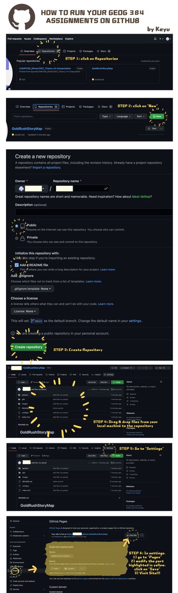
One thing forgot to mention: wait for about 30 sec after STEP 6 for your website to be published! refresh & you can now see the "visit site" icon on the top #neogeoweb
#neogeoweb Figured out how to run our assignments on GitHub!! 🤩 Here is a step-by-step tutorial made by me:)
Hope it helps & comment if you have any questions!
If by any chance you are a person taking this course in Fall 2023 reading my tweet, I want to say that GEOG 384 is one of my most rewarding experiences & is my favourite course so far.
#neogeoweb now is my 40/39 tweets for GEOG384.. Thanks again to Renee, Ian & Nicolas for the amazing course!! I want to express how meaningful this course is to me. It made me certain about going into the field of web dev as I’ve been very confused about my future/grad school...
BIG thanks to my group members:
@Essstherccc girl good luck with grad school, hardworking people do well anywhere
@joy amazing programmer, enjoyed working with you☺️ @mailmcgillca our brainstormer! thanks for all the interesting ideas & topics:)
#neogeoweb
I never thought I would find my direction from a geography class that I initially thought to take for fun. The 5 assignments we worked on were very fulfilling.. 👍also showed them to 4 friends in comp sci & they now regret so much abt not knowing a GIS minor existed before haha
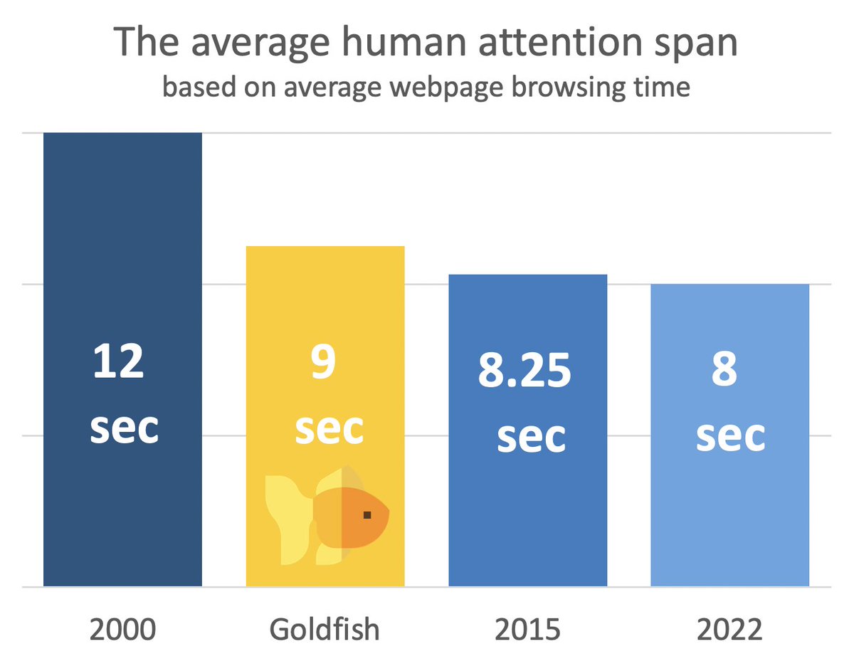
#neogeoweb HAHAHA too much information at the same time😂
from the replies: (@vycanismelodis)
-only portugese and germans wear trousers
-turks, italians and a few others have no knees
-norwegians and belgians walk slowest
-the brits like to oppose their neighbours and walk right
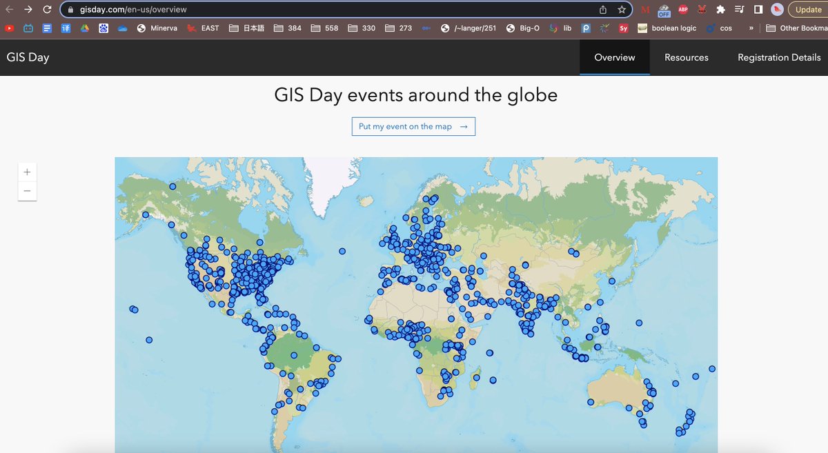
Also, after having so much experience in web mapmaking after this course, the 1st thing that came up to my head after seeing this map is that "I can also easily create the point layers & the pop-ups" haha. step 1 of being qualified to work in ESRI? #neogeoweb
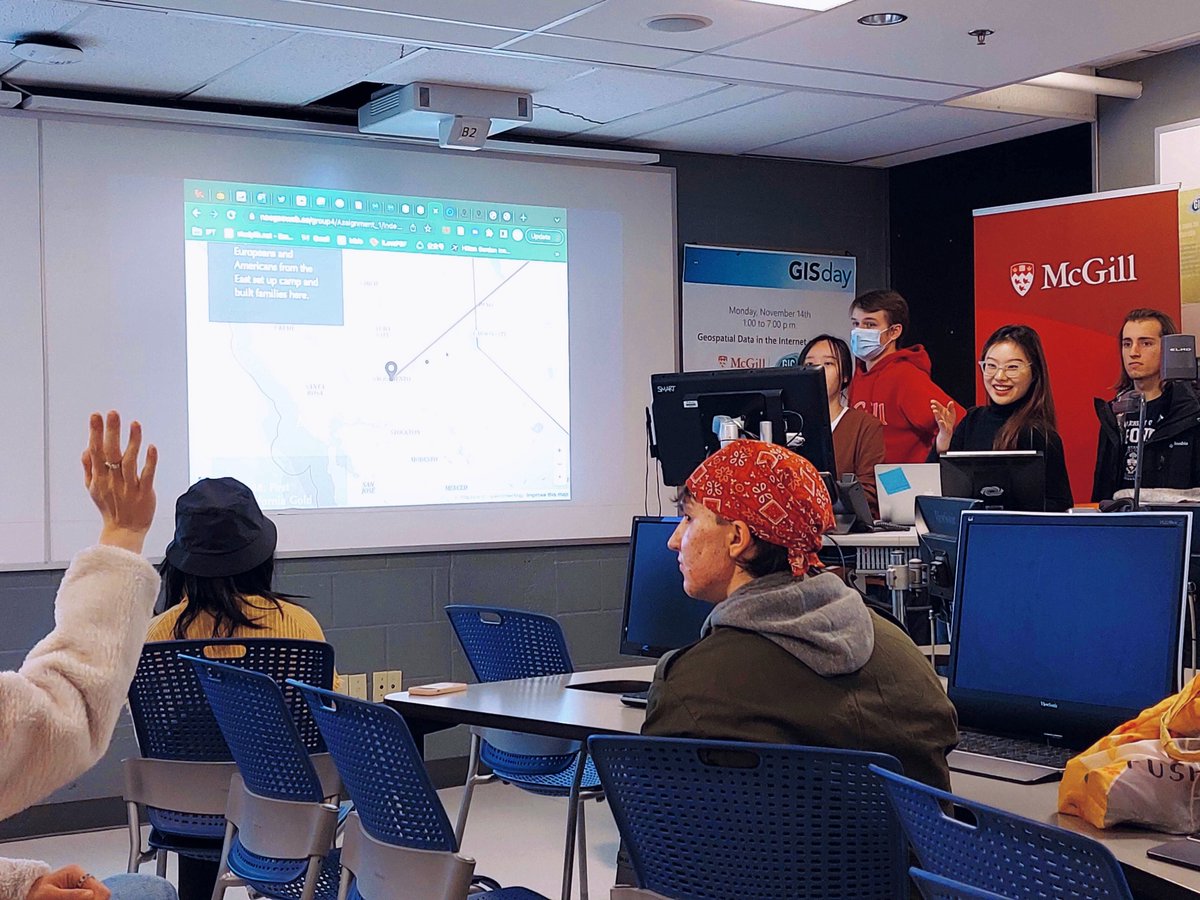
#neogeoweb wow McGill GISDay can be found on the ESRI GISDay website!! Very proud of being able to showcase our projects & advertise geog384 on that day☺️
#neogeoweb lovely storymaps💗💗 love "The Sundarbans: A Gift to Bengal" which talks about how the world's largest mangrove forest is full of biodiversity and is under threat..
Celebrate #GISDay with the 2022 @Esri Storytellers of the Year!
Meet the winners & runners up of the 2022 ArcGIS #StoryMaps Challenge for #dataviz.
+Check out special award winners in best map choreography, visual language & storytelling with data 🏆 https://t.co/qSpGTBEX5U
#neogeoweb WOW very insightful talk about how NASA visualizes satellite imagery!! especially after 38:00 when they start to talk about the methods, interactive & online media used👍👍
NASA produces a huge amount of satellite images but because of it's complexcity they're outside most people's reach
That's where visualisations come in
Here's my conversations with @jscarto from @NASAEarth on how he makes satellite images more accessible
https://t.co/JXkxe8s6hf
#neogeoweb#DataVisualization#inflation
Visualization of inflation on different products since pre-COVID as a video😮😮 gas price is going crazy...
https://t.co/lt5RCE94Ao
#neogeoweb excellent graph!! this is acc what our group was initially thinking of visualizing about for A5 but gave up because of the difficulty to find a preexisting dataset
https://t.co/3hASlfRU4R
#neogeoweb Hahaha very cute dataviz!! Poland being a stickman, Morocco making a lizard shape 🦎& Serbia being a Christmas tree🎄
https://t.co/5lJwObfEWr