🌩Future met- Weather model addict - New to the online weather scene & willing to learn!🌩
"Your weather forecast just got more unique."
🌪️-2
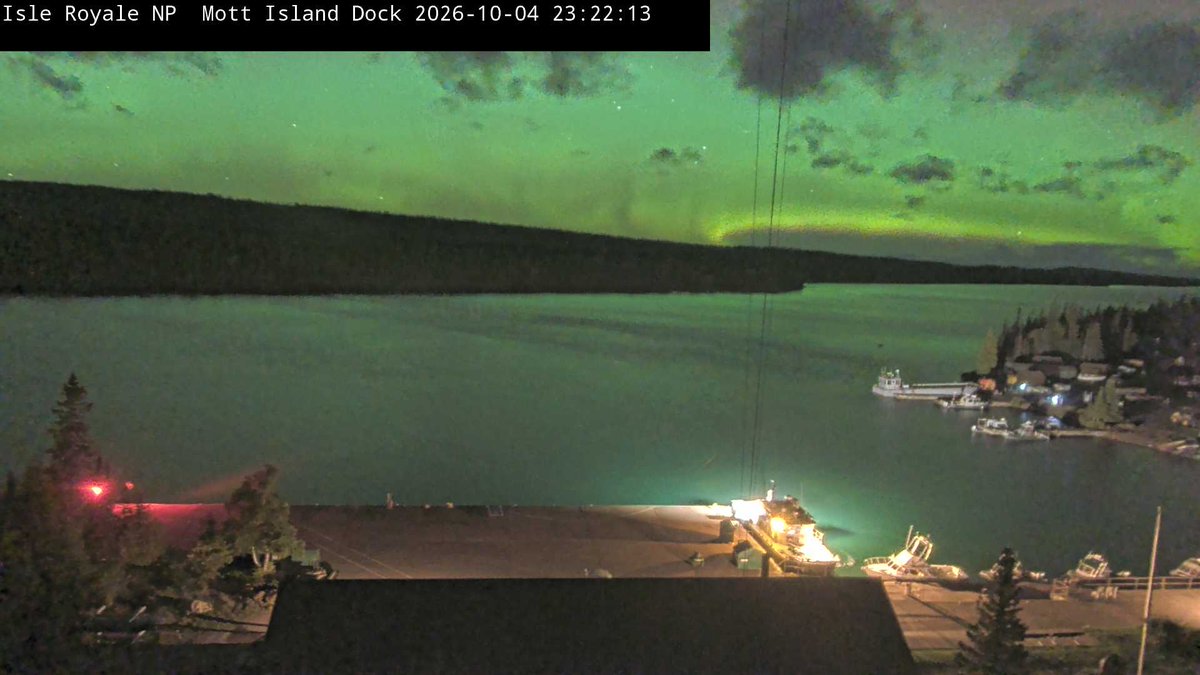
🌌-13 (Aurora)
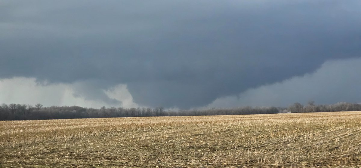
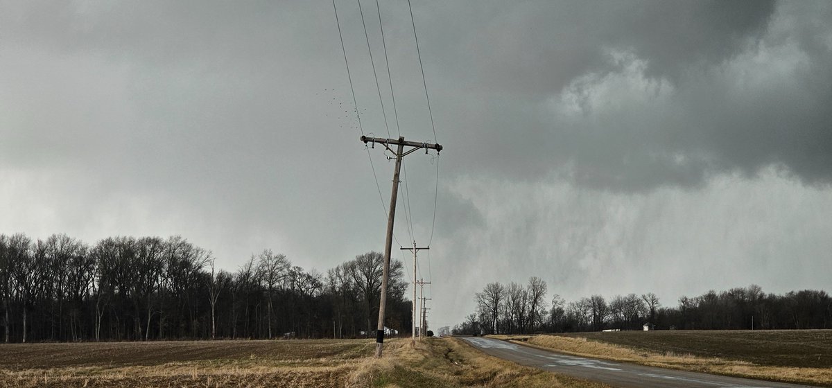
Hey everyone! Just went on my first ever storm chase yesterday with a group of friends. We targeted SE Illinois, where we would see 1-2 tornadoes! Believe it or not, this the first ever time seeing a tornado in person and it was exhilarating!
📍Flat Rock, IL
#wxtwitter
@BaroClinicWx Wowww! I really love what you're doing dude! Making all weather data free for public access is a fantastic step forward! Are you planning on going fully customizable with broadcast graphics like Aguacero? :)
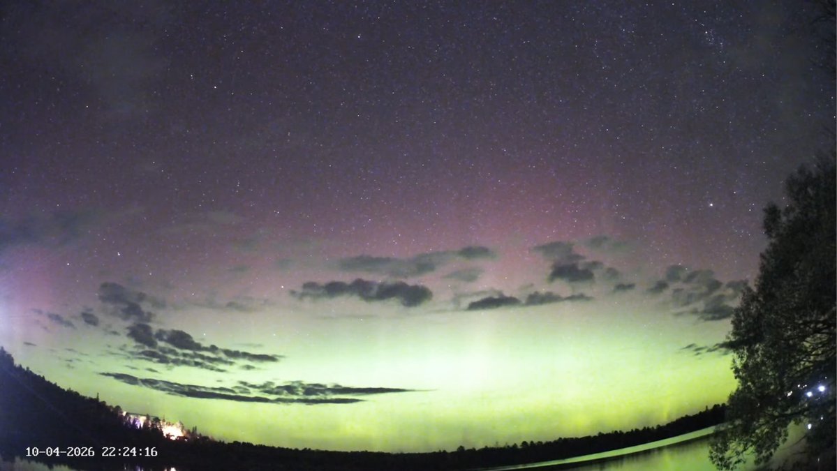
Attention folks at high latitudes and upper mid latitudes: Periodic substorming is ongoing and the northern lights are beginning to get brighter and drift further south! Get outside if you can since these are likely naked eye visible!! #wxtwitter#aurora
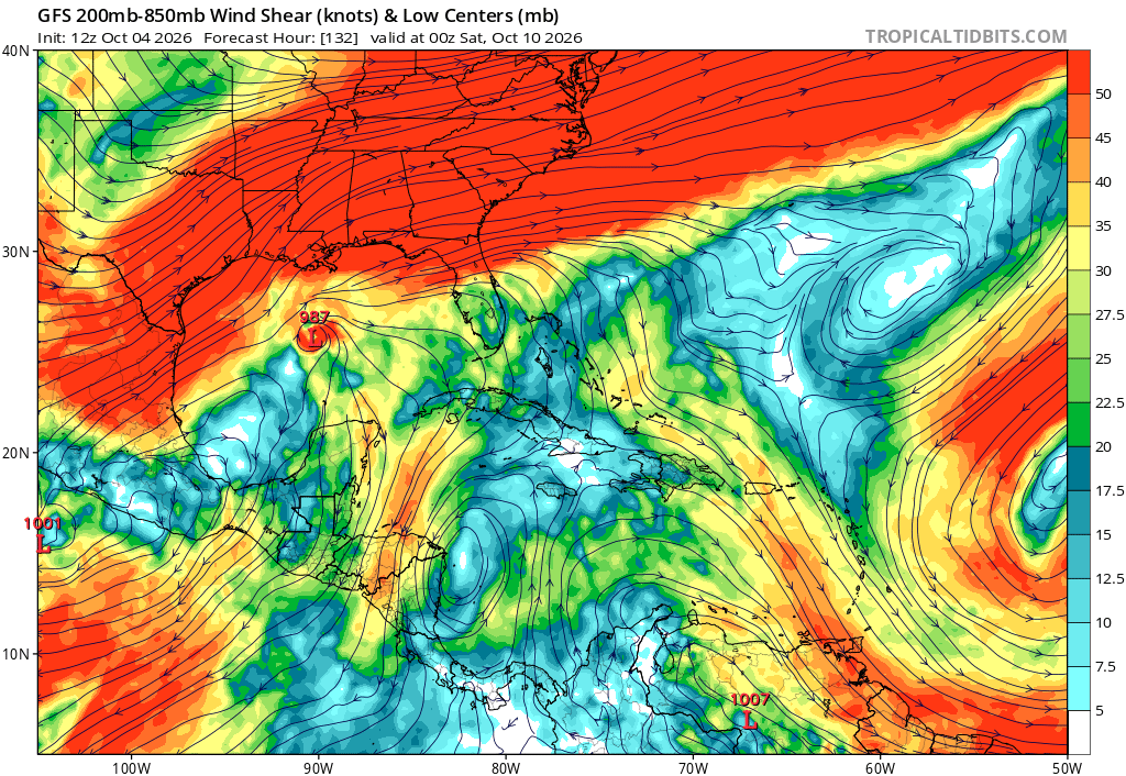
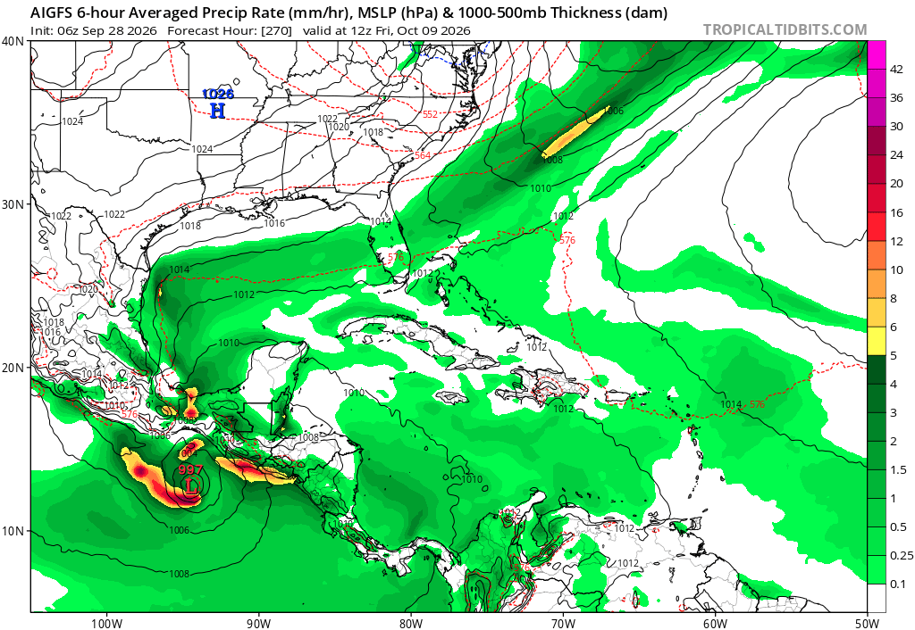
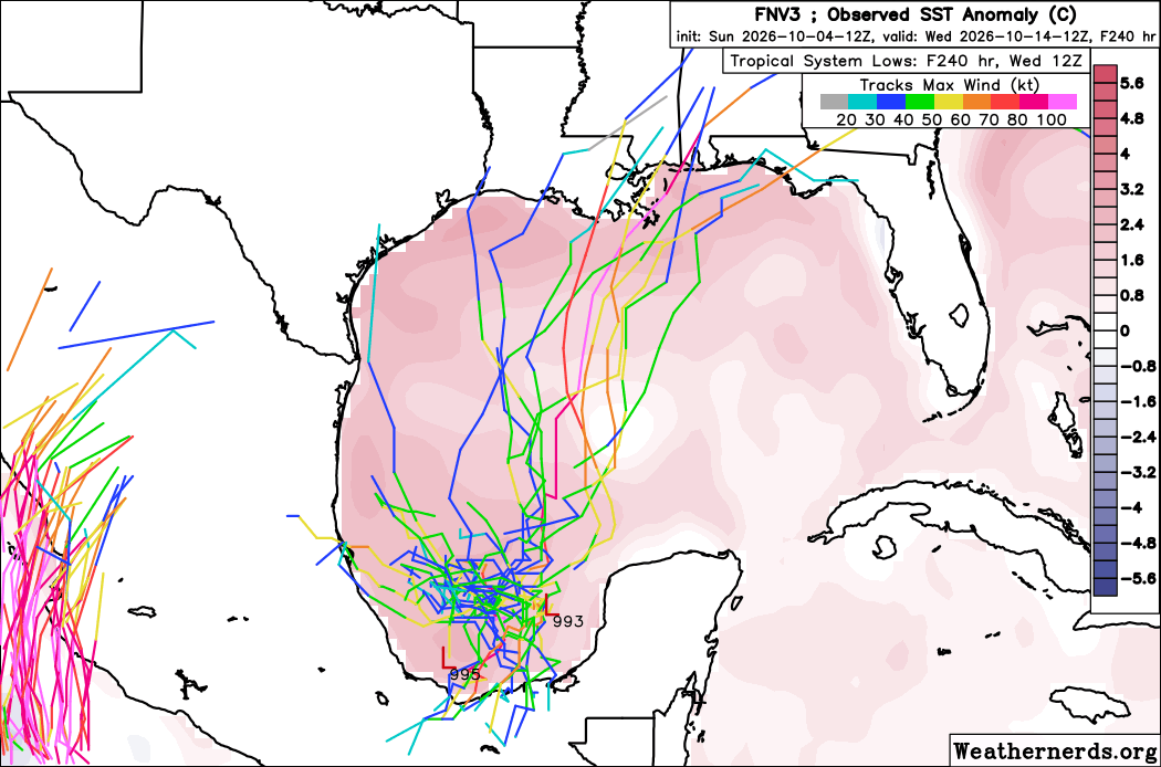
Even though AI models are going wild, didn't they try and do that earlier this season? Remember, nothing came from those previous signals. Of course we should still watch this system, but expect only a weak TS at best. Flooding and severe weather are the main concerns.🧵(2/2)
Alright everyone, want to hear my honest opinion on that Gulf system? I don't think it will develop much at all. You've got 30 to 50 knots of wind shear to the north of it with high uncertainty that a tight, fully closed low even develops in the first place 🧵(1/2) #wxtwitter
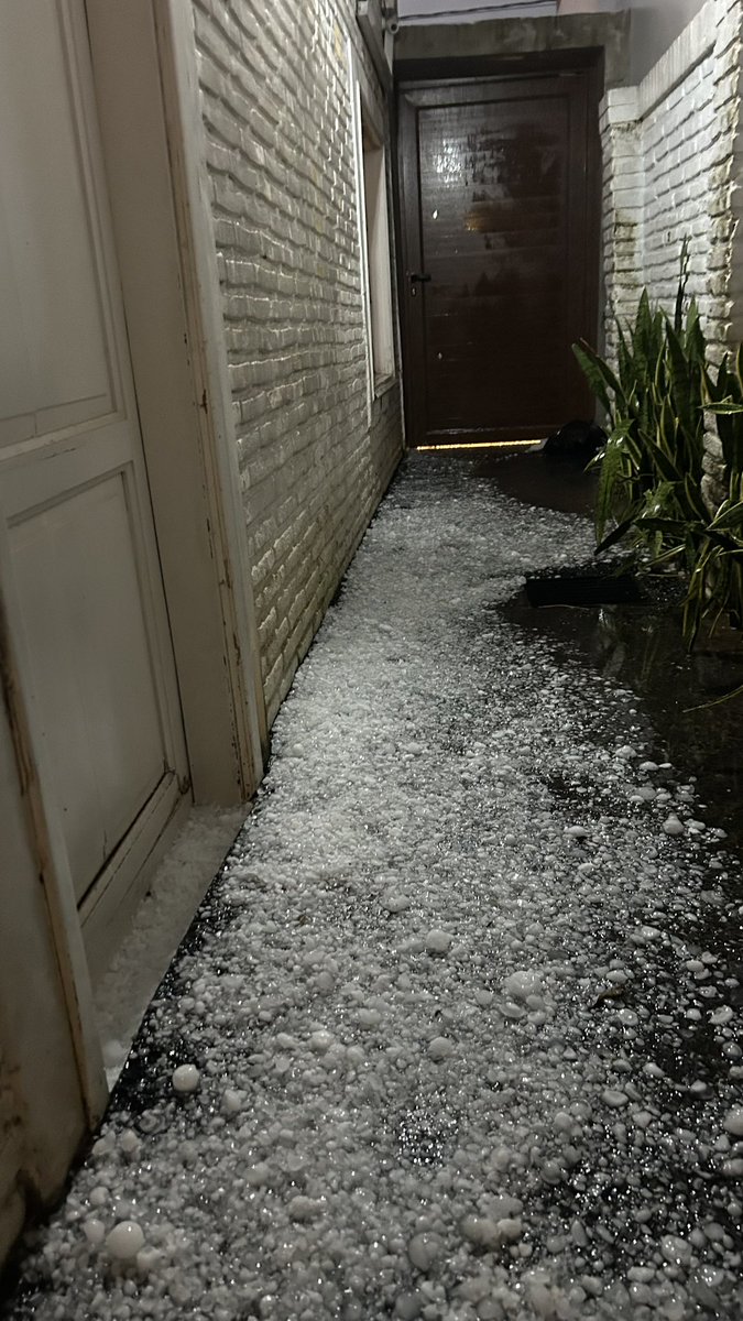
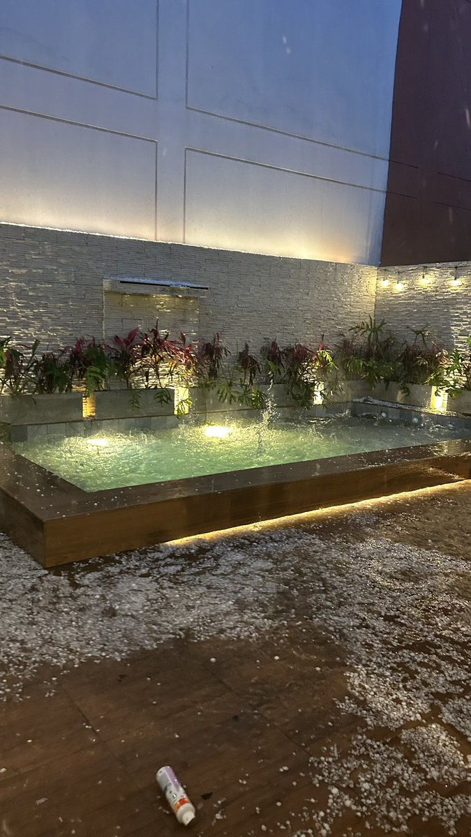
This massive hailstorm tore through Asunción and parts of Paraguay’s Central Department yesterday evening.
Hail smashed windscreens, badly dented cars, punctured roofs and caused widespread power cuts across areas including Luque, Lambaré and San Lorenzo.
Thankfully, this event was mainly an urban disaster, unlike the agricultural destruction caused by storms in September.
@Weatherunited1 David, please don't lose hope yet! The El Nino winter pattern doesn't usually start kicking in until mid to late November. You're just experiencing a major end of summer pattern flip. It was stupidly hot by me, now it's not because it all moved out west.
@Weatherunited1 We're definitely entering the home stretch now! Thinking this big last prolific burst will cause more records to get obliterated if there are any left lol!
This is the first official wave of our el nino pattern. Unfortunately, due to it being so early, this pattern would be more akin to a weak el nino. Notice how the westward extent of the rain is not forgiving at all. #wxtwitter#eln
Sad news for a lot of the Mid-South this weekend...
Areas that desperately need some good rain could miss out on the widespread rain, where the Gulf Coast and eastern portions of the Southeast continue to see some good soaking rain over the next few days.
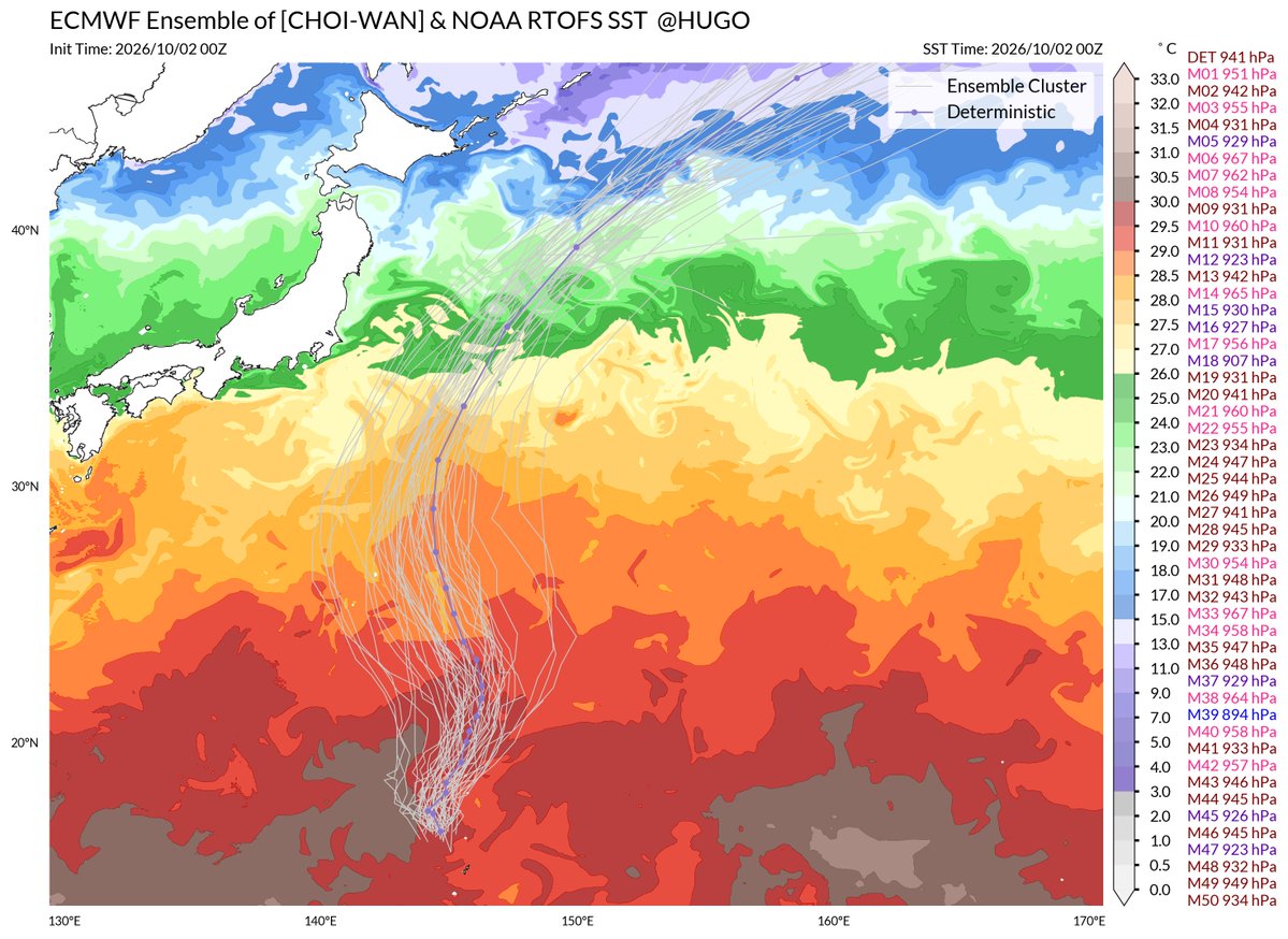
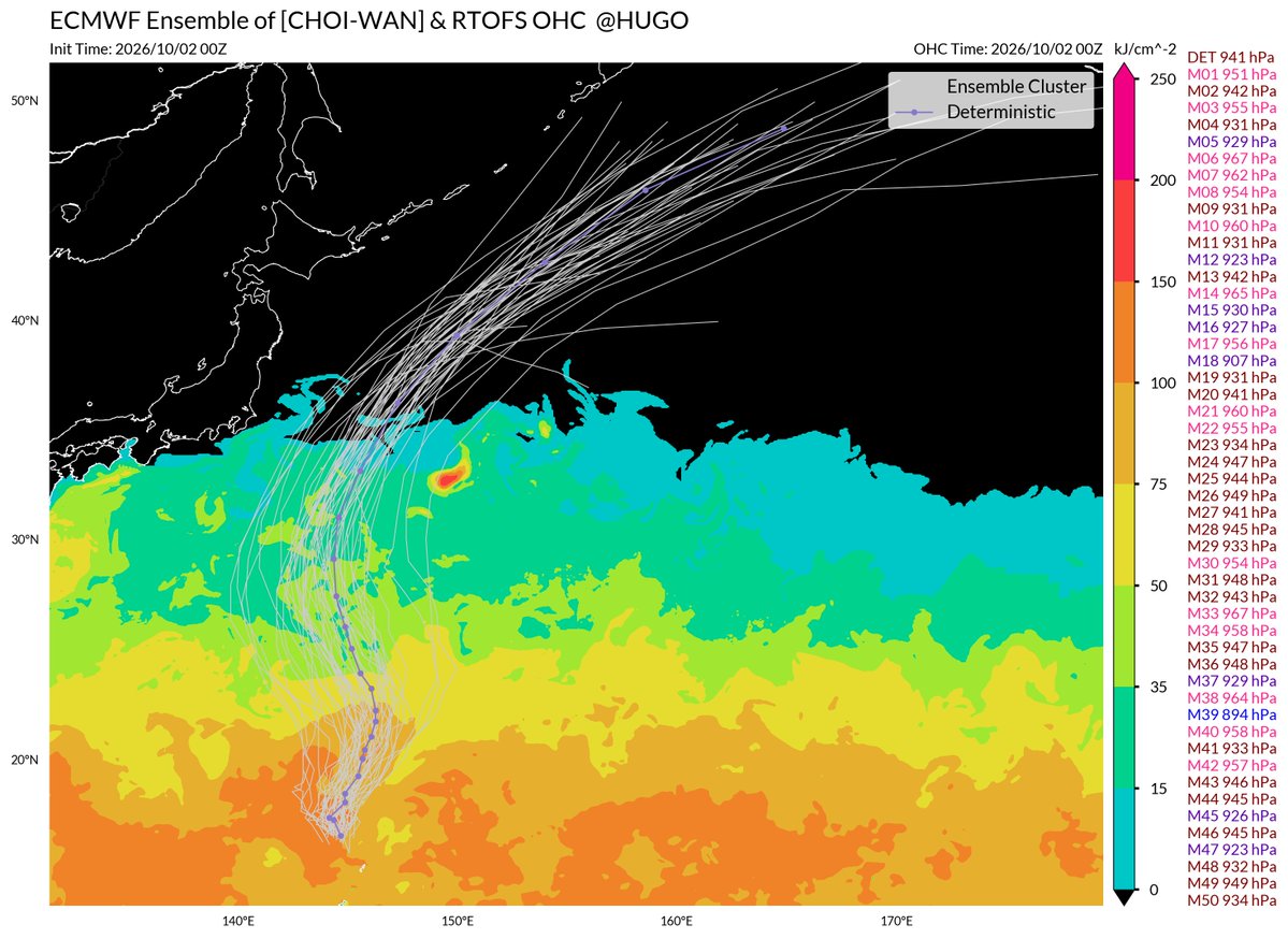
With extremely favorable atmospheric and ocean conditions, Typhoon #CHOIWAN will soon undergo extremely rapid intensification and become a extremely strong tropical cyclone (strongest TC in 2026 is possible) in next 2-3 days.
@Weatherunited1 This is very true! Almost the same thing as trusting weather models on the day of a severe weather event. If it can't initialize properly, then it's completely wrong. :)
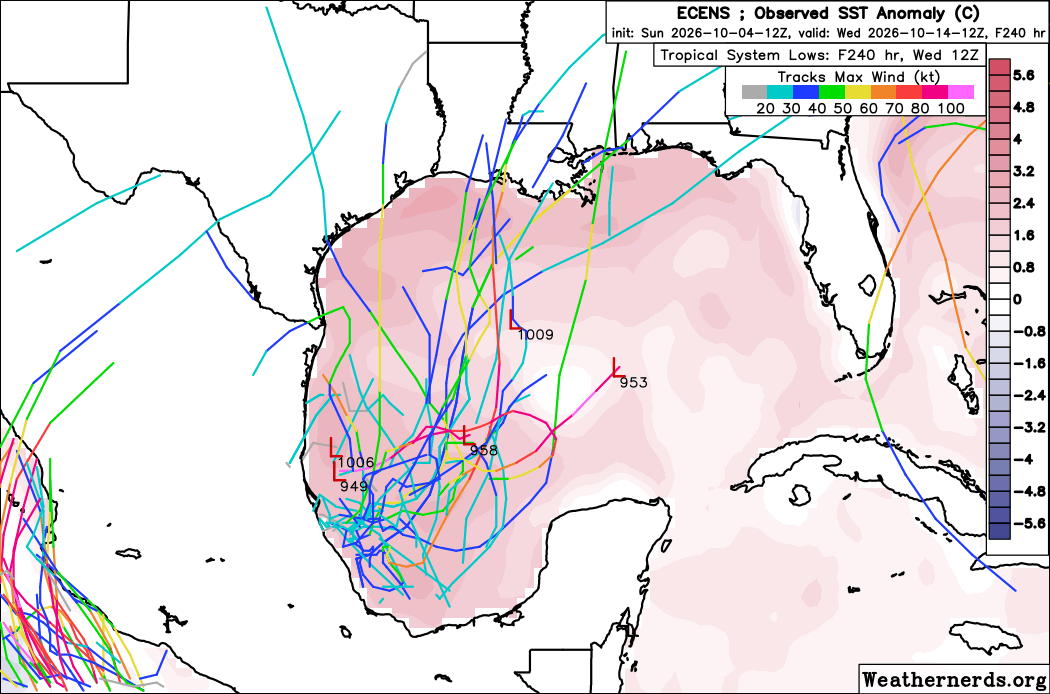
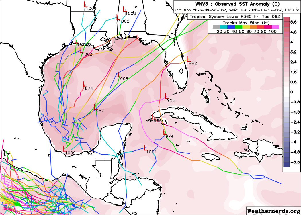
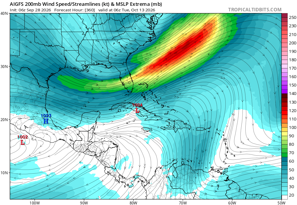
The final thing to watch for any real Atlantic candidates this year is something near the Yucatan or Southern Gulf over the next couple of weeks.
Google DeepMind (both the 1000-member version and the newer WNV3) has had a fairly persistent signal, though it's only ~20% of members right now.
The mechanism for development would likely be convergence along the tail end of a front, and possibly a contribution from something crossing over from the East Pacific. These are plausible development pathways, but historically we haven't seen anything significant come from this during very strong El Niños.
If nothing comes from this signal, I think there's a very real chance we end the season with zero Atlantic hurricanes. We are already starting to see indications of a robust subtropical jet starting to drop south in a couple weeks. This will probably end the hurricane season for the CONUS and start the transition to what will likely be a very wet winter along the Gulf Coast.
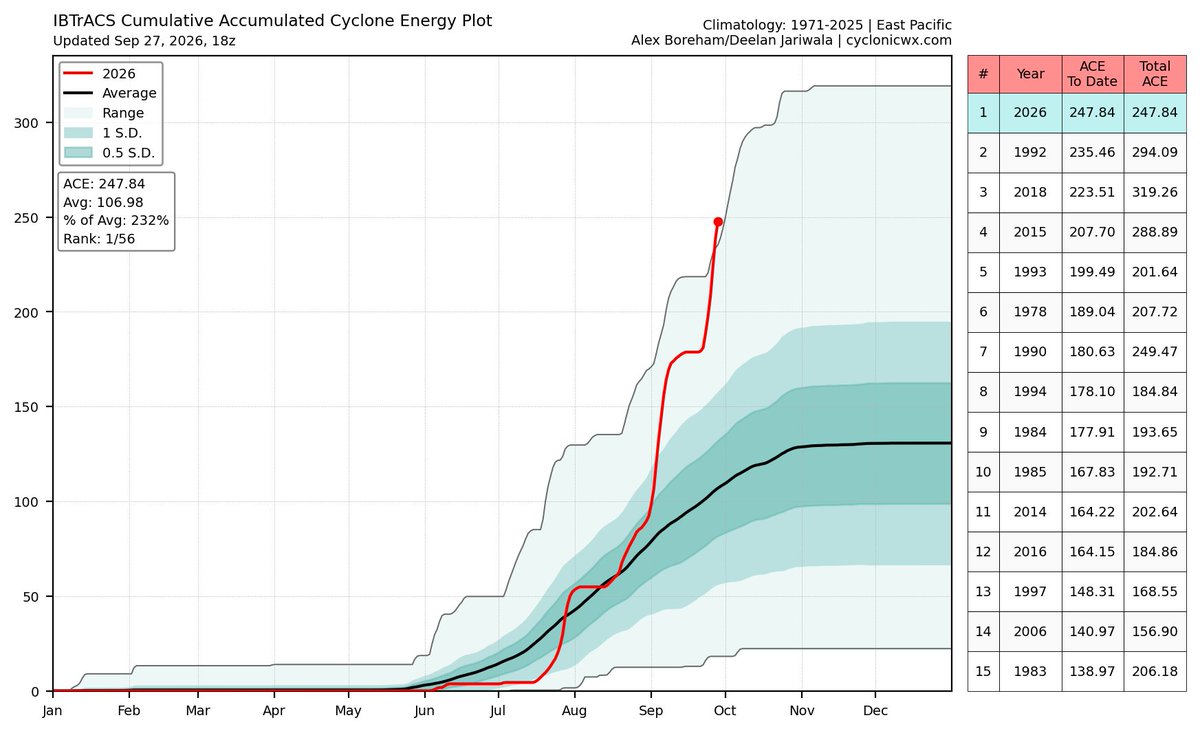
Absolutely record shattering. We have NEVER seen the Pacific get this active before, at least in recorded history! Believe it or not, we still have ALL of October to go! #wxtwitter#eln
I want to make it official here on X. That, as of 18z September 27, 2026, the Pacific is now breaking the all-time record in ACE for this date, going back almost 60 years. And with Nolo, more than likely a high-end Category 3, and Polo remaining a major hurricane, plus Rachel that just got designated, it's very possible we are going to add 8-15 ACE points per day. This is a crazy season in the Pacific. HOLY COW
Good evening everyone! I've just uploaded a video on major hurricane Polo and the serious impacts it could have on Baja California and mainland Mexico!
https://t.co/Z0pipUiQ0S
#wxtwitter#Polo
@Weatherunited1 Yeahhh I've noticed how many winters the East Coast has been favored lately. I'd recommend not taking the west coast ridge seriously yet. Things can and will change.
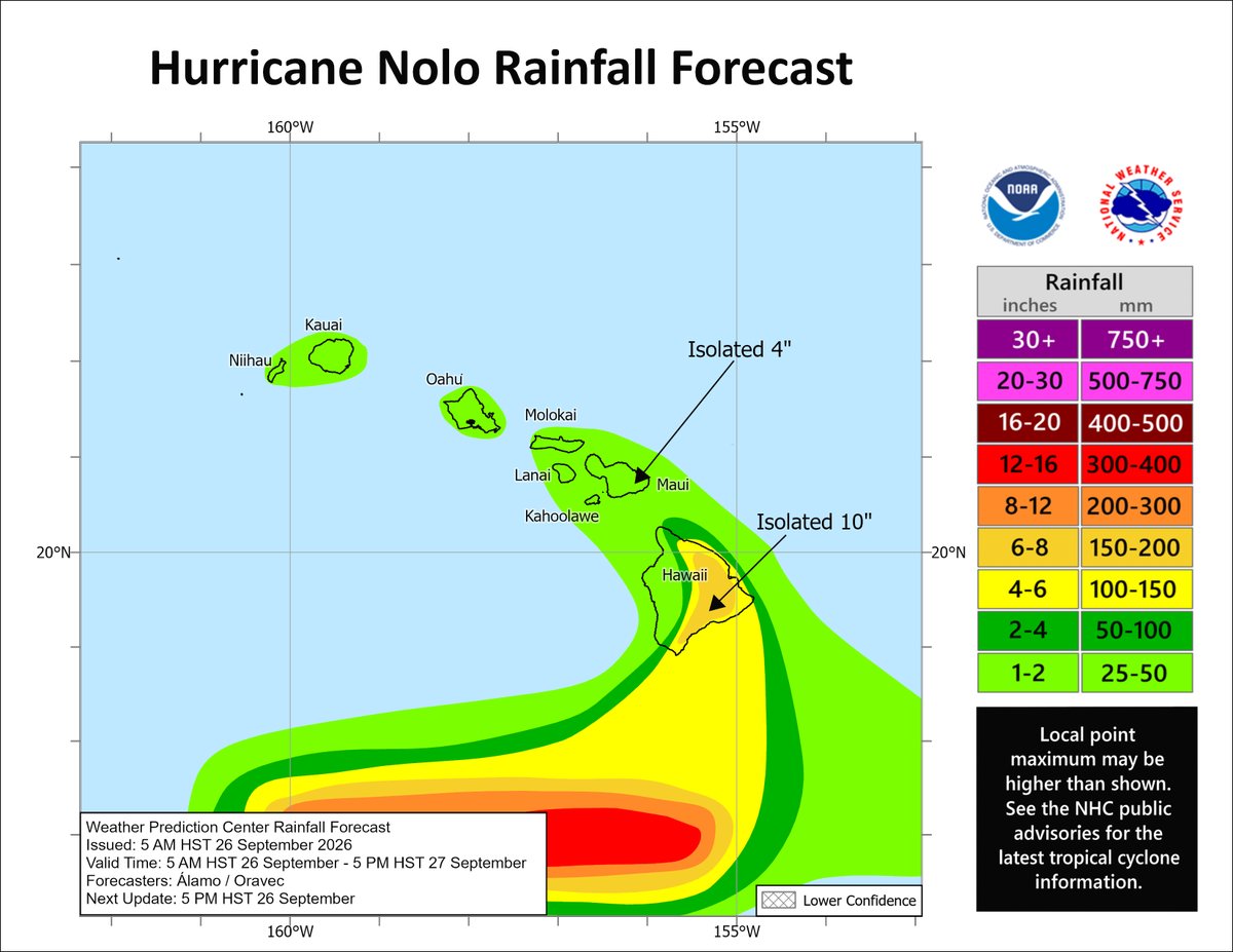
For once in what seems like an eternity, I finally have good news for Hawaii! It appears that Nolo is going to stay well south of all the islands and minimal impacts are expected! Maybe isolated flooding. Glad that stressful forecast is over! :) #wxtwitter#Nolo