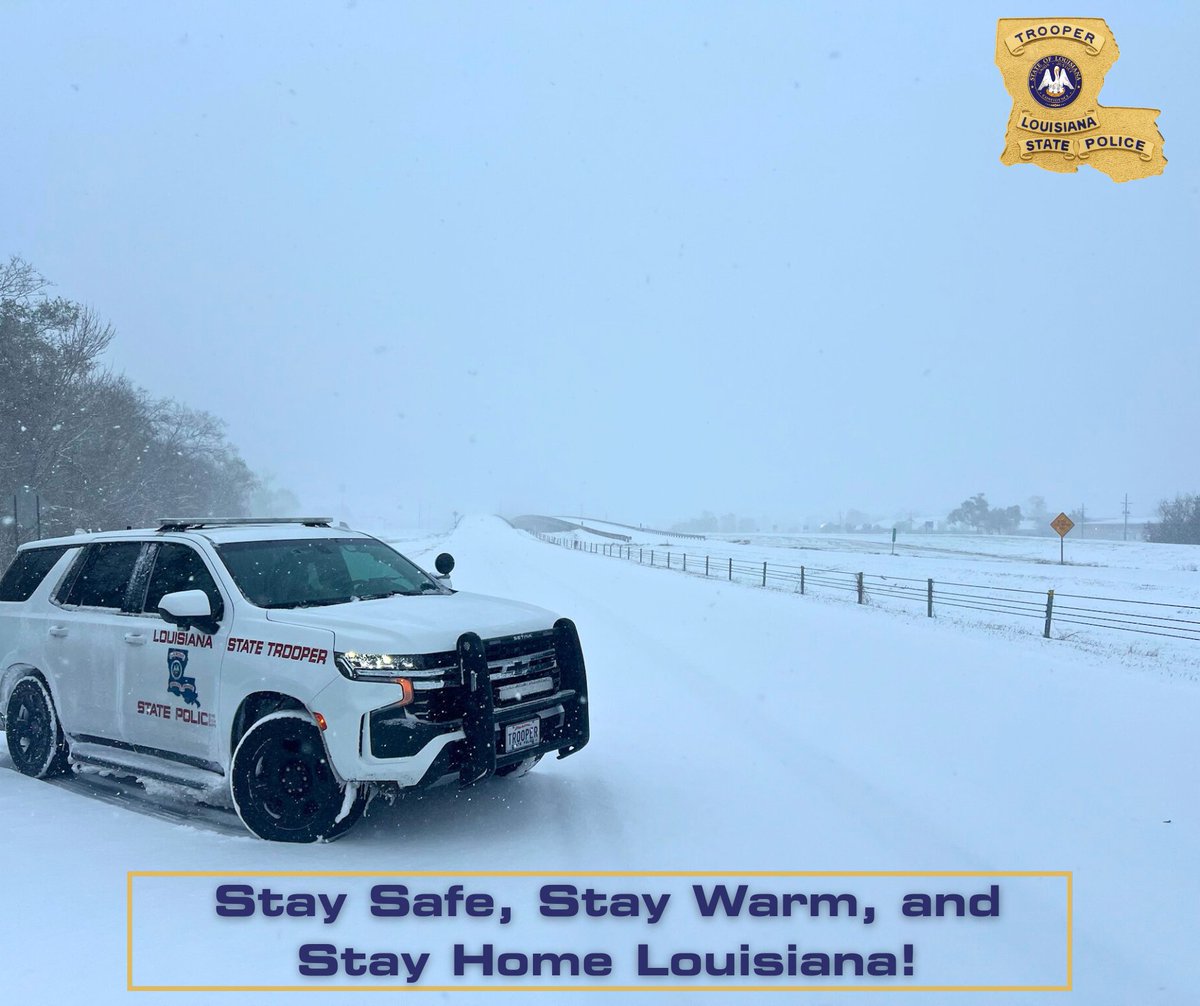
DOTD Police continues to assist crews in de-icing the roads on the overpasses and elevated portions of US 90. #lawx
As crews continue to work clearing roadways, please refrain from driving unless necessary.
Check https://t.co/XMr3BW6Fr6 for the latest updates. #lawx
Troopers strongly urge everyone to stay home and avoid ALL TRAVEL as snow blankets the state, making travel hazardous!
High speeds, limited visibility, and unnecessary travel are causing crashes—Troopers have responded to 50+ statewide today.
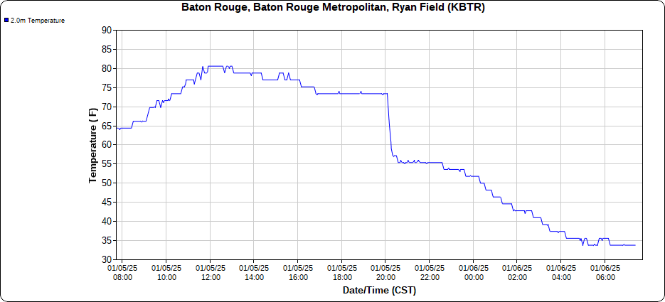
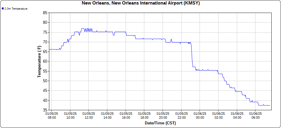
📉🌡️ Let's play a game of "Find the Cold Front"
We're waking up to temperatures nearly 30°F colder than 24 hours ago. Temps fell a whopping 25+ degrees in 30 minutes as the front passed last night.
8AM Temps:
34°F Baton Rouge
38°F New Orleans
37°F Slidell
40°F Gulfport
We want to enjoy a great day of bird surveying with you! If you have never tried birding before or if you have been doing it for years. . . this event is for you. Make sure to let us know you’re coming by registering at this link:
https://t.co/uy27awRFXM
📢 Announcement! We've got our first in-person Basic SKYWARN course for the Fall/Winter season coming up next week, Wed Nov 13th at 10AM at St. Charles Parish! RSVP by calling the number in the graphic. Many more (and virtual options) coming soon so stay tuned! #skywarn
Storms moving into central LA have had a history of producing tornadoes. We are closely monitoring them as they approach southwest MS and SELA. @NWSWPC does not anticipate issuing a tornado watch into our area but will continue to evaluate the potential. #MSwx#LAwx
'Hellacious' rain hit these areas of Louisiana in 2021. New research shows how bad it was. https://t.co/5bw1J2zLL9 via @nolanews
Research article in Physical Geography here https://t.co/x1QvRyEISN
📢Weather enthusiasts around the world📢
#Weather101 returns Monday, Oct 21!
Check out this season's lineup and get registered for any or all of our classes here: https://t.co/6H8Bl6bgZG
It hasn't changed: anyone from anywhere can attend! #free#weather#education#wxtwitter
CRAZY STAT: #Helene became the 7th Category 4 or 5 hurricane to strike the U.S. Gulf Coast since 2017 (if Irma is included).
The previous 7 Category 4 & 5 Gulf Coast impacts occurred over the course of 70 years.
A couple of notes below...
Coming up this Saturday, celebrate National Hunting and Fishing Day with family activities at four locations around the state (including Baton Rouge). More from @LDWF here https://t.co/9z5qTqGwq0
The next update to the track and impacts will be at 10 AM CDT and we will send updated graphics shortly after. For now, you can check out our latest briefing slides which has all the current information and impacts: https://t.co/8Br10fwAuW
LPB will carry @LAGovJeffLandry remarks on storm preparedness today at 4:30pm. You can watch that at https://t.co/NRER1mTY8I or on the LPB YouTube channel. Check out #GetAGamePlan for a hurricane planning guide.
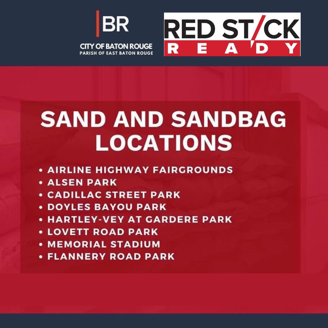
City-Parish Officials have pre-positioned sand and sandbags at eight (8) locations across the parish.
To view the complete list and find the sand location near you visit: https://t.co/JdUcIC4fy4.
*Residents should bring their own shovels to fill the sandbags.
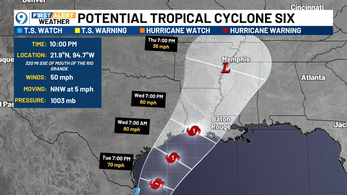
JUST IN: 10 PM advisory and forecast track for PTC #6. No major changes in track, just a slight nudge to the east. Shown making landfall as a hurricane late Wed.
Per NHC: Hurricane, Storm Surge, and Tropical Storm Watches will likely be required on Monday. #Francine