@Nathan_Renner_ If you have Google Maps and look at the satellite view, it’ll show you any gaps in the trees along the roads. If you hold your finger down at a point on a road and drop a pin, you can actually see what the terrain/view looks like through Google Street View.
@Nathan_Renner_ I had just turned 19 before my 1st chase. I almost wrecked twice while it was raining going too fast around curves on this secondary road in Cannon Co. 🫣
But fr, it’s an awesome feeling being out in the field for the first time, especially before sunrise. Enjoy it! 😃
@Nathan_Renner_ 1/11/20 was my 1st chase. Went to Lobelville. Chased east all the way to Smithville. I don’t recommend trying to stay out ahead of storms in Tennessee. Roads don’t go where you want them to. It’s better to pick a spot, position, let the storm go by, report, then call it a day.
@NWSMemphis Hwy 70 in Haywood Co. southwest of Brownsville early yesterday morning had a few inches of water covering several hundred yards of the road in multiple areas.
Some of the road might still have standing water on it, according to Google Maps.
@BrokerWx @NWSAtlanta@BradNitzWSB@BMonahanWSB@lh0ch Thank you for sharing these pics! Any structural damage or trees blocking roads with precise locations or nearest crossroads is very helpful :)
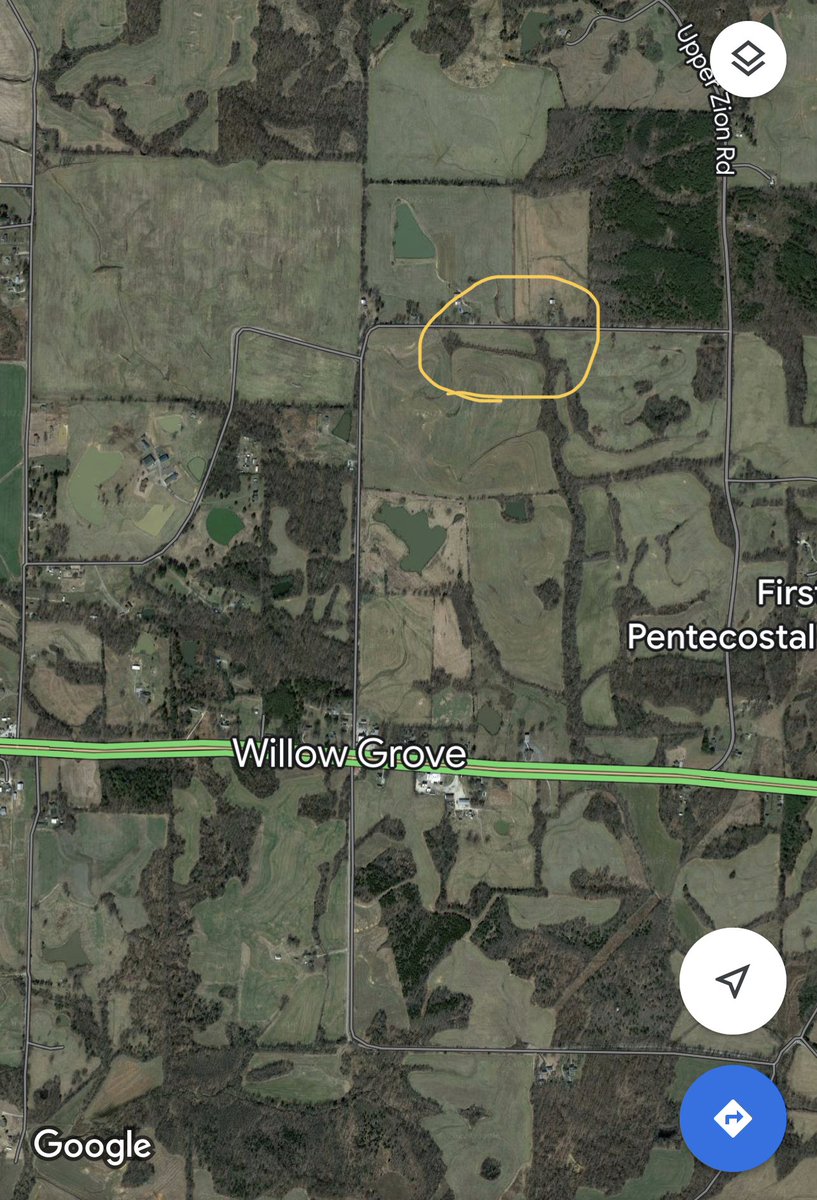
(4/5) This tree fell on Bratt Thomas Rd 5 miles E of Brownsville, just north of Hwy 70. Several trees came down and many small branches were covering the roads in the Willow Grove area. I think the damage that occurred here was from thunderstorm winds. #tnwx@NWSMemphis