Hurricane Polo likely received a relatively direct boost from the strongest El Niño on record.
Surface waters near Polo are around 88°F (31°C), while an El Niño-fueled Kelvin wave has left water warmer than 80°F (26.5°C) extending about 240 feet below the surface.
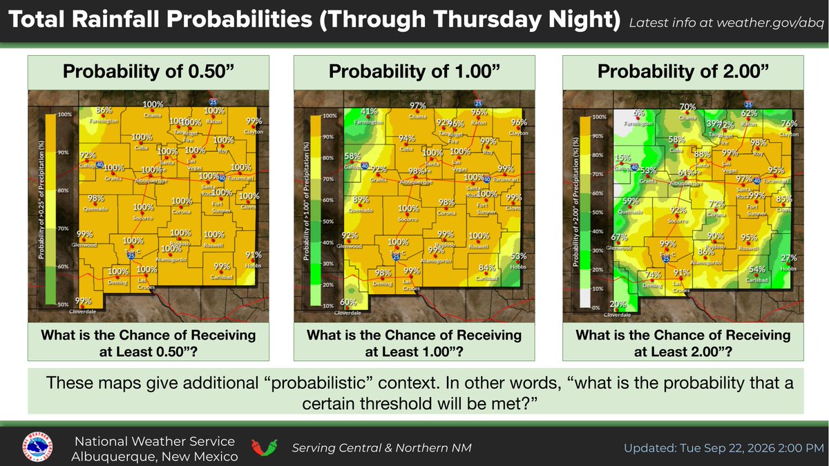
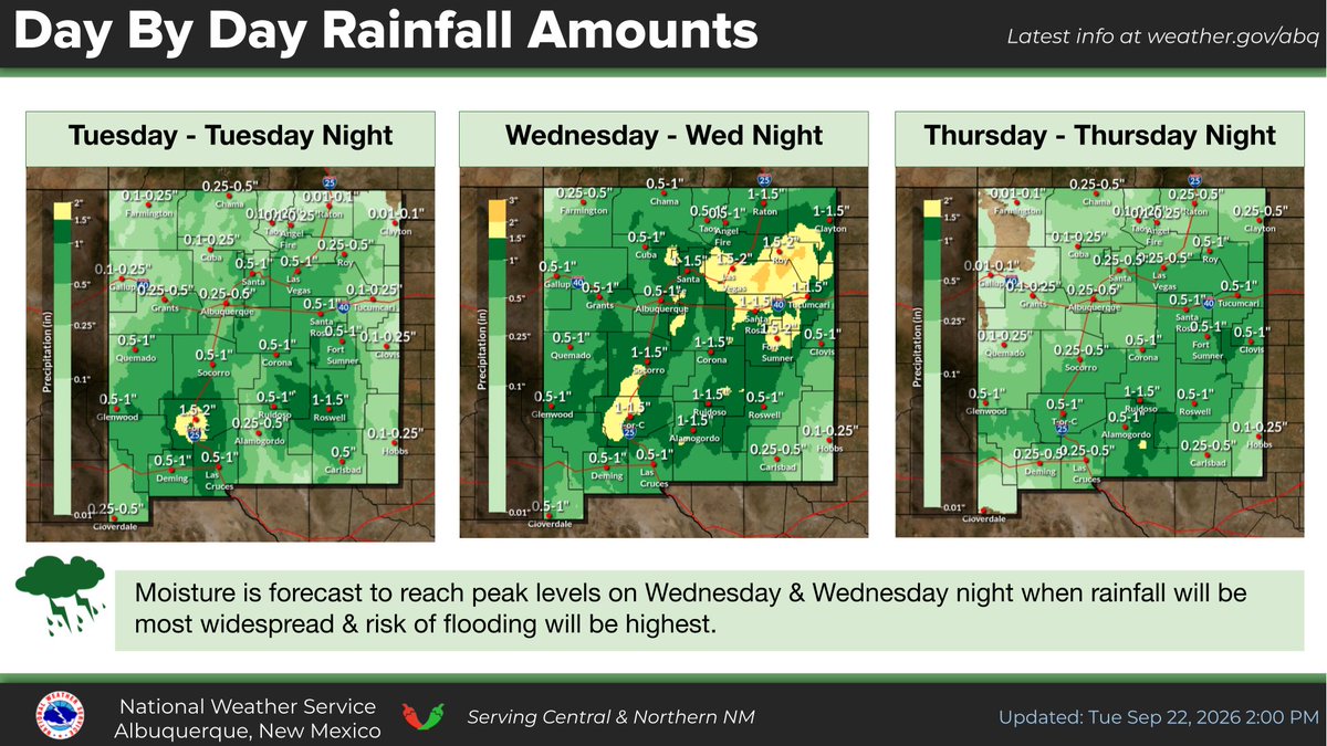
Nearly all of New Mexico is under a flood watch through at least 6 a.m. Thursday as residents brace for a significant — and potentially dangerous — surge of monsoon moisture that will spur widespread heavy rain and potential flash flooding. https://t.co/8tMUDQQSHk
Ordinarily, when a hurricane slows down/stalls long enough, it upwells cooler waters from below – inducing its gradual weakening even if nothing else changes.
But not Polo.
Bath-like warmth extends nearly 200 feet below the sea surface. The result? Churning up more warmth.
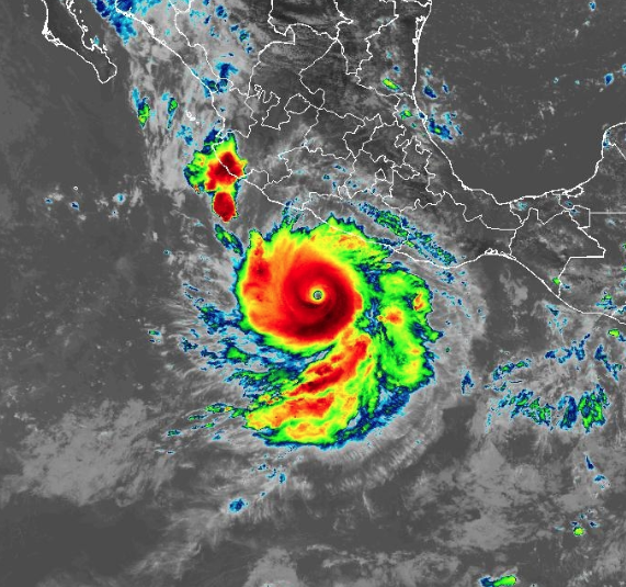
Hurricane Polo off the west coast of Mexico has intensified at one of the fastest rates we have ever documented. Tropical depression to raging Category 5 in no time.
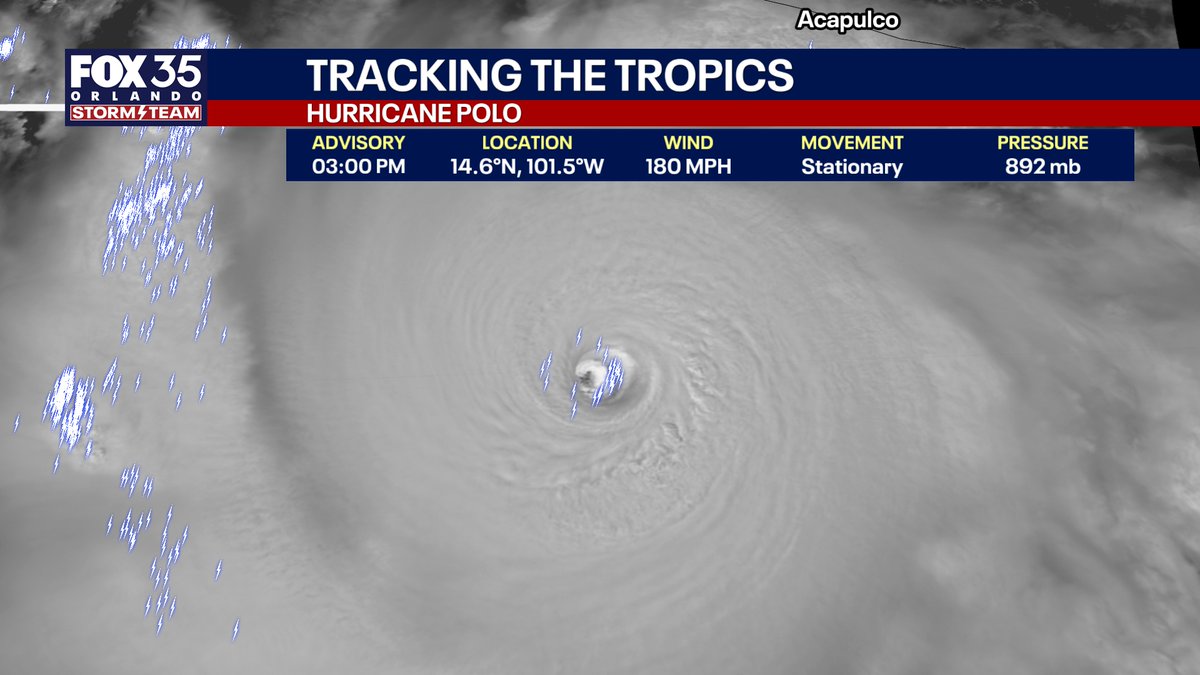
Sunset is near, and the visible satellite reveals intense convection and gravity waves emanating outward from the eye. Like dropping a rock in a pond - the energy takes a while to disperse outwards and away from the center. Extreme heat release and transfer from the ocean to the atmosphere.
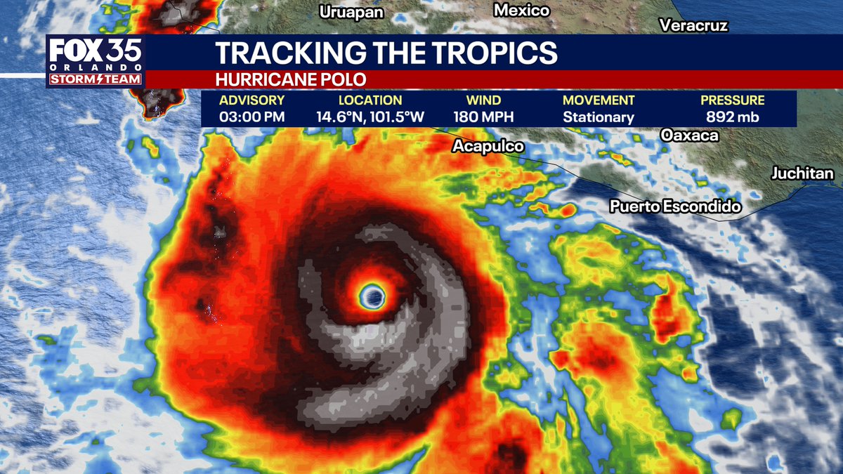
PROLIFIC POLO: This hurricane has explosively intensified Tuesday into one of the strongest hurricanes in the eastern Pacific Ocean ever recorded.
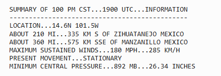
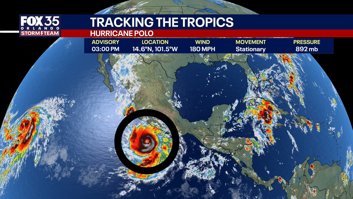
Sustained winds: 180 MPH with gusts to 220 MPH in the eyewall.
Look at the tremendous lightning around the eye, which is nearly stationary. This intense of a Category 5 hurricane if remaining still will "upwell" a lot of water and eventually weaken itself slightly unless it starts moving.
Strongest east Pacific hurricanes by pressure:
872 mb -- Patricia (2015)
892 mb -- Polo (2026)*
902 mb -- Linda (1997)
906 mb -- Rick (2009)
A flash flood EMERGENCY is in effect in Mora, New Mexico.
Radar estimates more than 5 inches has fallen in spots; given the sandy soils and ground’s impermeability, this will lead to serious runoff and inundate vulnerable areas.
Move to higher ground!
⛈️ A significant & potentially dangerous surge of monsoon moisture will bring widespread heavy rain through Wed night.
⚠️ Repeated rounds of rain & thunderstorms will increase the risk of flash flooding
🚣♂️ Low (10-40% chance) of flooding in main stem rivers & tributaries
#NMwx
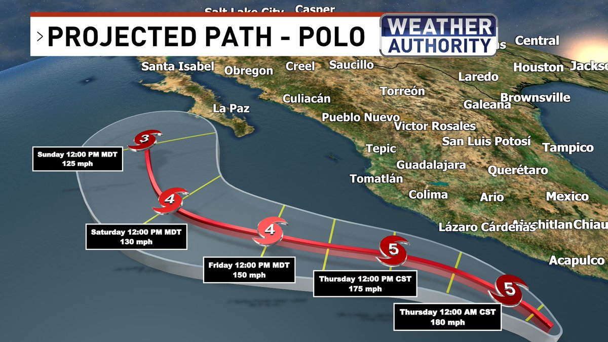
NEW: There is a 2 in 3 chance that Polo is scooped northeastward by an approaching upper-air disturbance.
That would increase the risk of a hurricane hit somewhere on the Baja Peninsula AND perhaps some tropically-invigorated flooding rains in Arizona/New Mexico in ~5-7 days.
Hurricane Polo strengthened from a Tropical Depression to a Category 5 hurricane in just 39 hours, faster than any storm on record in the East Pacific or Atlantic. Polo is just off Mexico’s Pacific coast, threatening flooding rain, damaging winds, storm surge and dangerous surf this week. https://t.co/0RcYBqmcge
Americans have just now hit a milestone: $71 billion more spent on gasoline since March 1 (vs a year ago). Adding $41 billion more on diesel costs since March 1 (vs a year ago) leads to a combined total additional cost of $116.1 billion. (link in bio to see real-time clock)
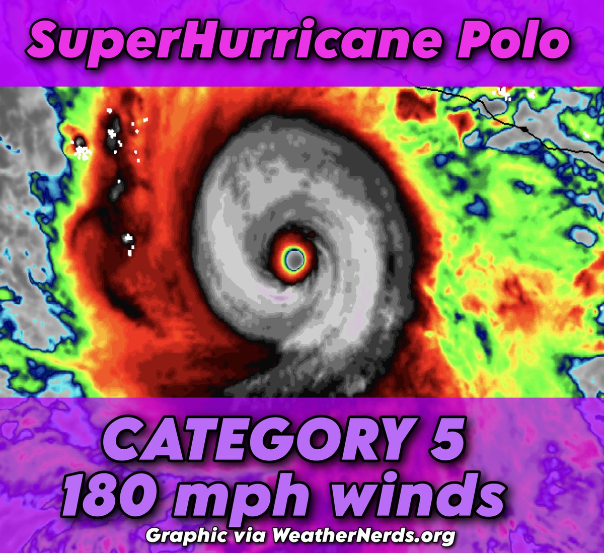
WOW! #Polo is now a CAT 5 with 180mph sustained winds.
#Polo is expected remain a major hurricane (CAT 3 or stronger) over the next several days.
#CaboSanLucas should be watching this very closely.
As of now, moisture from #Polo is expected to head into eastern #Arizona and #NewMexico.
More updates to come.
@News3LV@NWSVegas #WeatherAuthority #vegas #Vegasweather #monsoonseason
SuperHurricane Polo, an extreme Category 5 hurricane, is now the second most-intense eastern Pacific hurricane on record!
The storm likely contains maximum eyewall sustained winds of 170 to 180 mph, with gusts exceeding 200 mph.
The system strengthened from a 50 mph tropical storm to a 160 mph hurricane in 24 hours, marking the second fastest intensification on record in the eastern Pacific – behind only Patricia in 2015.
Polo's rate of strengthening was more than THREE TIMES what is necessary to qualify as "rapid intensification".
SYNOPSIS: Hurricane Polo is a powerhouse and is continuing to strengthen. Its eye is surrounded in lightning, known as an EEL (enveloped eyewall lightning) signature. That indicates continued strengthening is likely.
It's located over water temperatures between 86 and 88 degrees. Those 86+ degree waters extend to 190 feet below the sea surface, meaning that it can't churn up cooler waters. No matter how much it slows and stirs up the seas, it won't be able to upwell anything to slow it down.
Meanwhile, it's located in an oasis of calm winds aloft, meaning there are no harsh winds to disrupt it or knock it off kilter. AND there are broad clockwise winds aloft, helping fan "exhaust" air away from the system. The more efficient the outflow, or exhaust, the more heat and moisture that can enter the storm from below, supporting continued strengthening.
DISCUSSION: Polo's air pressure is now BELOW 890 MILLIBARS! That's virtually unheard of!
At flight level, the eye is about 29 degrees warmer than the surrounding atmosphere. Tropical cyclones are "warm core" systems. That heating from the oceans below causes warm air to rise, lifting air away from the surface and leaving a "void", or deficit, of air.
It has lifted 565.3 BILLION pounds of air, or about HALF A TRILLION POUNDS! That's the equivalent to 47 Great Pyramids of Giza!
That "missing" air creates a vacuum of sorts. That's why hurricanes have powerful inward suction, resulting in extreme winds.
When we talk about air pressure, we're talking about how much air there is! In this case, 12.2% of the air is missing from the middle! That's incredible!
PATH: Polo will stall through early Wednesday, then drift northwestward, parallel to the west coast of Mexico. That should keep it offshore for the time being.
Uncertainty increases by Friday, at which point competing influences complicate Polo's forecast. It could be tugged west by Odalys, another tropical system with which Polo will interact. That "Fujiwhara effect" could help Polo to be pulled westward.
Alternatively, an approaching upper-air disturbance could tug Polo east, increasing the risk to the Baja Peninsula. In that scenario, Polo's moisture may impact the Desert Southwest in about 7 days' time.
Ella Langley’s “Choosin’ Texas,” a simmering, midtempo, country-and-then-some heartbreak song released last October, is the longest-running No. 1 hit in the U.S., with 23 weeks at the top spot on the all-genre Billboard Hot 100, it was announced Tuesday. https://t.co/Nu9zFWjWQa
Hurricane Polo has strengthened even more!
NOAA Hurricane Hunters found 180 mph winds and a pressure of 892 mb, the second-lowest on record in the Eastern Pacific 🌀
9/22 1pm CST: NOAA Hurricane Hunters have found that Category 5 Hurricane #Polo, located offshore of #Mexico, has strengthened to a 180 mph hurricane
See https://t.co/NyUGSIFCuo for the latest forecast.
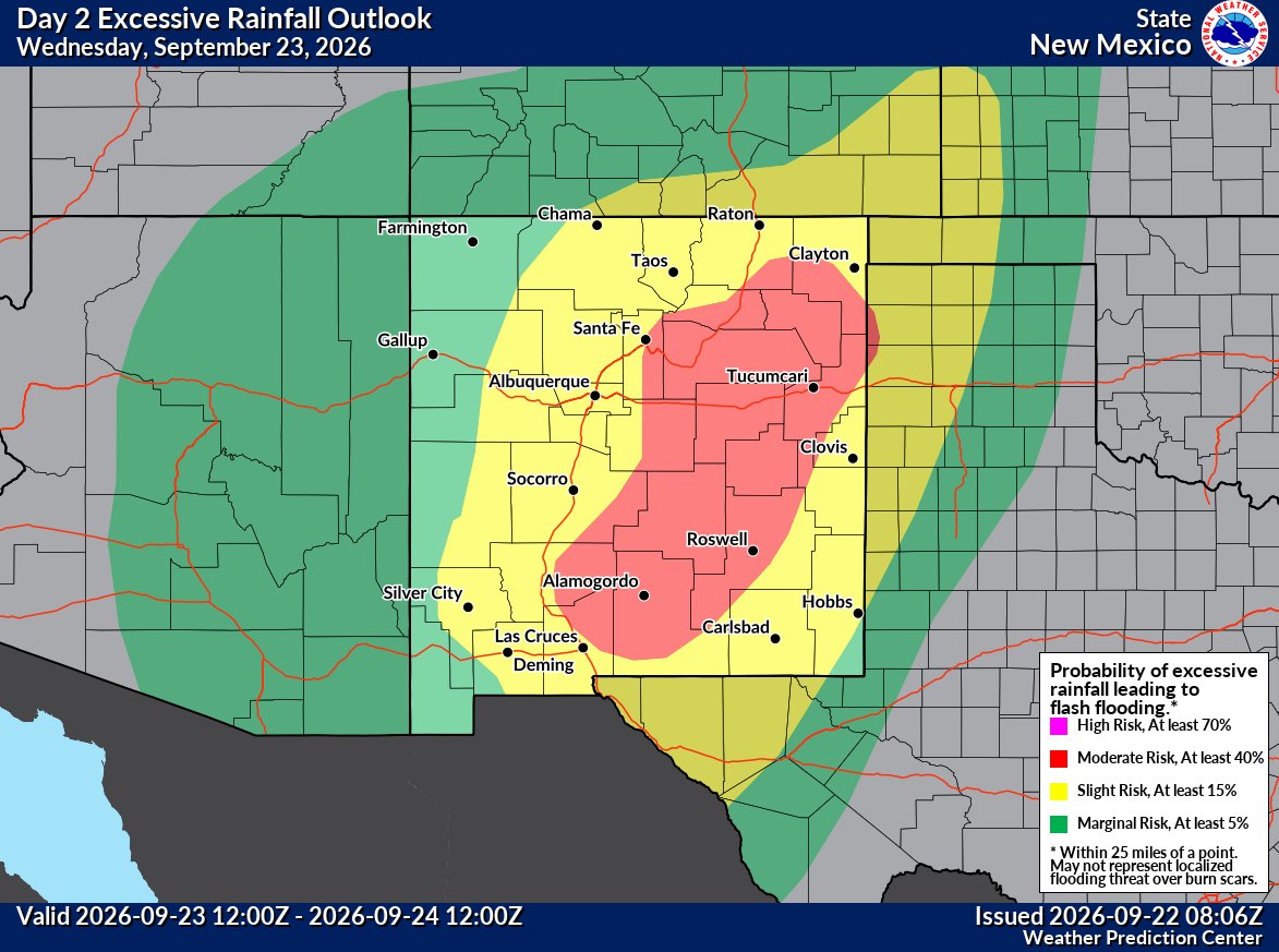
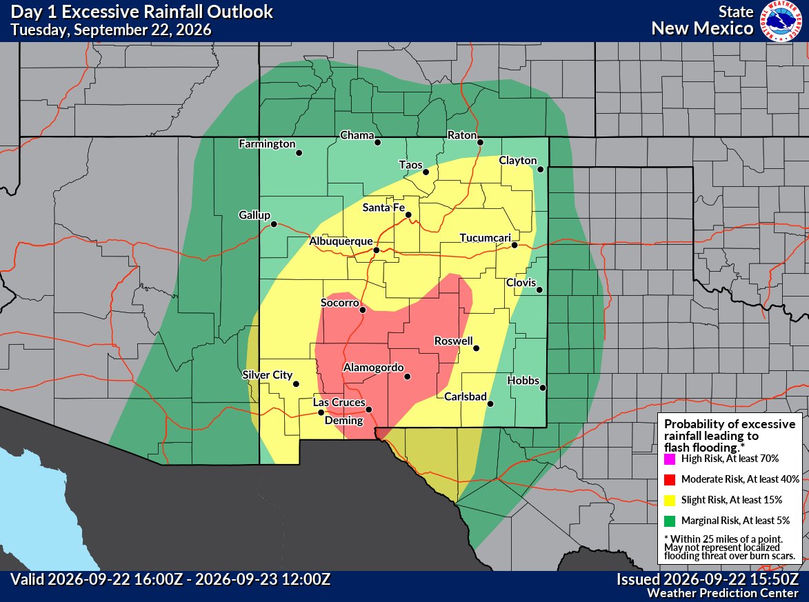
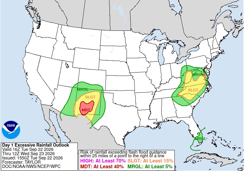
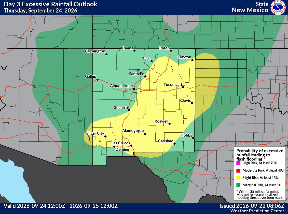
⚠️ A high flash flooding threat will continue across New Mexico through Thursday.
A Moderate Risk is in place across southern NM today, then shifts and expands across central and eastern NM Wednesday.
With very wet ground, it may not take much rain to cause flooding. 🌧#NMwx