📢 Call for Participation: UCGIS 2026 Symposium
📍 UMD College Park | June 15-18
🤖 Theme: AI Everywhere
📝 Abstracts due: Feb 9, 2026
🔗 https://t.co/4ckTwDteb7
🤖 "Exploring Rurality and Biophilia: The Role of AI in Understanding Nature's Impact" by @azzhou1 examines how AI interprets rural identity through generated collages! @RuralGeo_AAG@theAAG Read our Just Rural Futures blog: https://t.co/KFZeMkHckQ
Photo gallery: The #CPGIS get-together dinner at #AAG2025 was grandly held at Andiamo Detroit Riverfront https://t.co/VW2bNaQ5Bj Thanks for the awesome organization work by our Social Event Committee! Dr. Siqin Wang and @BarrettBingZhou You connected our hearts together🧡
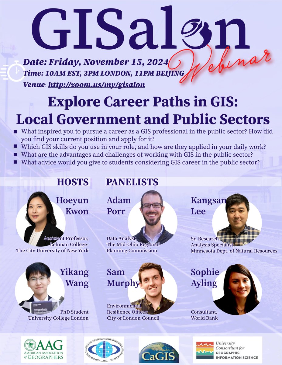
🚨 Attention GIS students! 🚨
Join us for GISphere's 6th #GISalon webinar "Exploring Career Paths in GIS: Local Government & Public Sectors" 🌍
📅 Date: Nov 15, 2024
⏰ Time: 10 AM EST
📍 Zoom Link: https://t.co/nF2vITKzAu
#GISphere#GIS#Geography#Edu#Career#PublicSector
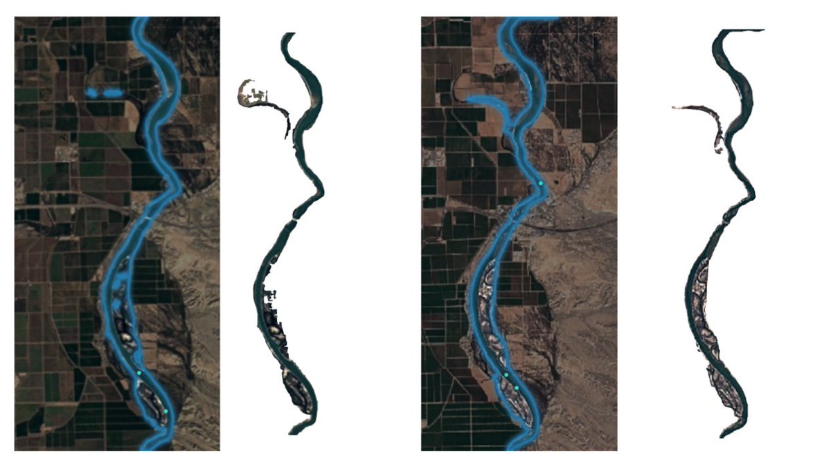
#30DayMapChallenge Day 2: Lines
Trying to extract the river boundaries near Blythe, CA, 1984 vs 2020, from Google Earth Imagery, using the Segment Anything Model!
🌟 #30DayMapChallenge Day 1: Points 🌟
Check out this map of "Chop Suey" restaurants in Chicago, IL! 🍜📍 Dive into the city's vibrant food scene and discover your next favorite spot!
Source: Chicago Data Portal Food Inspections Data.
#ChopSuey#ChicagoEats#FoodMap
🌟 #30DayMapChallenge Day 1: Points 🌟
Check out this map of "Chop Suey" restaurants in Chicago, IL! 🍜📍 Dive into the city's vibrant food scene and discover your next favorite spot!
Source: Chicago Data Portal Food Inspections Data.
#ChopSuey#ChicagoEats#FoodMap
#AAG2024#GISphere#GISalon Join us in the session! GISphere: Facilitating Global Connections in Geographic Information Science (GIScience) Education, Research, and Practice!
See AAG session details at: https://t.co/NGj1BTbjxu
@EHillLab@femifemiwale@predoc_org@econ_ra Hi Prof. Hill, sorry to bother you again, I wonder if international students currently enrolled or just graduated from an accredited university/college in the U.S. will be considered for the position? (Using opt while maintaining F-1 student visa) Thanks!
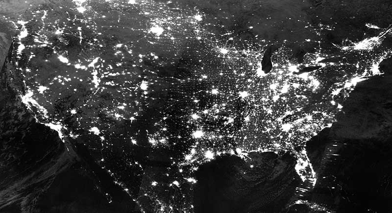
Soon we won't be able to use nightlights as a proxy for economic growth.
Why?
It's due to limitations of its spectral bands.
Here's the breakdown in simple terms:
Fun online interactive tool to play (procrastinate, really) with pathfinding algorithms on a real map anywhere in the world https://t.co/cszG3S9lmu #routing#transportnetworks
#30DayMapChallenge Day 7: Navigation.
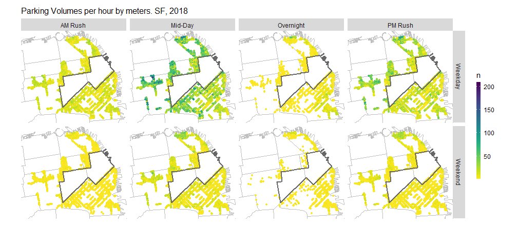
🚗🏙 Exploring the connection between parking volume at meters - and time period near San Francisco's downtown. #UrbanNavigation#Parking#SF🗺" Collaborated with Chi Zhang, as a MUSA course project.
@GISphereGuide
🤷♂ Who knew footprints could be so artistic? 🚶♀🎨 #BadMaps#GPSGoneWild From some angle, it may just look like a manlying on a sheet with both handsplaced behind the head as a pillow- art or map, the mystery deepens!
🗺 Day 4 of #30DayMapChallenge: Bad Maps 🌍 Check out our "masterpiece" - the Blomquist Trails! 😂🤷♂ Who knew GPS footprints could be so artistic? 🚶♀🎨 #BadMaps#GPSGoneWild r map, the mystery deepens! with Athena Liu & #GISphere
(A) Behold the majestic full extent of our trail network. Is it a map, or abstract art? You decide. (B) Zooming in to uncover the "gems" of random GPS signal wanderings.
#30DayMapChallenge Day3: Polygons.
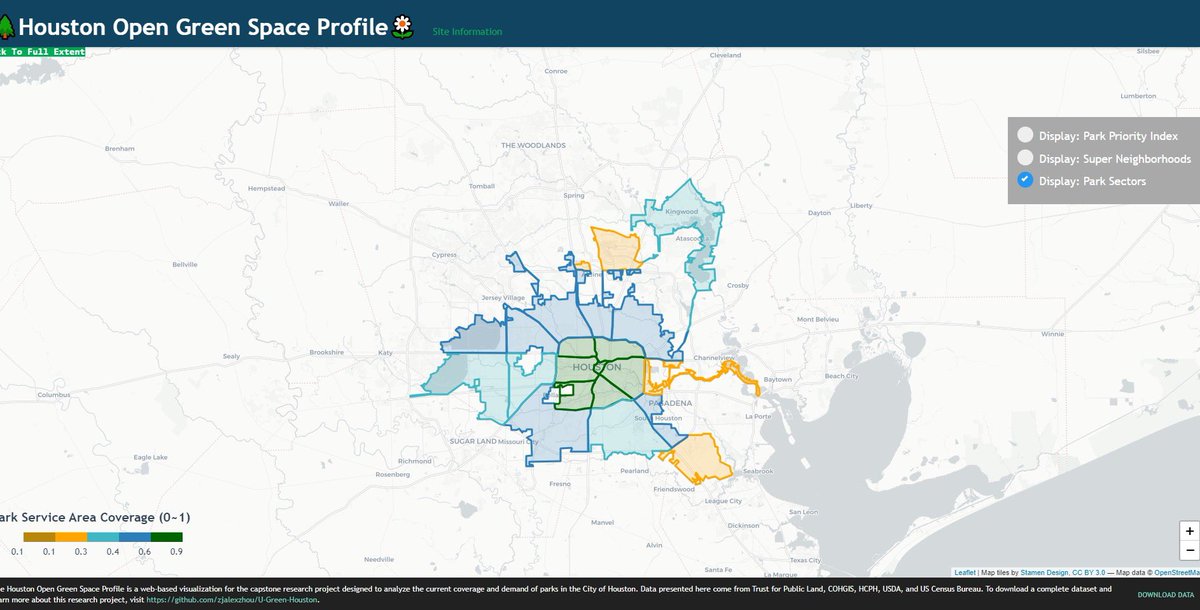
This is a screenshot of a web-based visualization illustrating the service area of urban parks in Houston, TX. Data was dated back to 2020. Created as part of my 1st master capstone project at UPenn MUSA.
With @GISphereGuide