@cornu__copia Yeah lots of planning departments are looking for people here, I don't think lack of fluency in Swedish should be an issue. Many of my former colleagues at the Stockholm planning / GIS-department initially, came from abroad, spoke English and then picked it up over time.
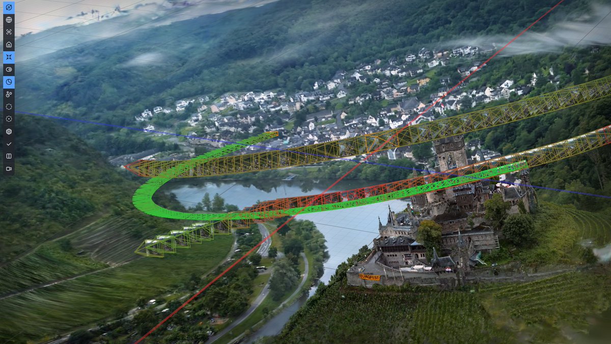
Interesting one from Alibaba.
ABot-Earth - converts flat satellite images into interactive 3D worlds.
- brings high-detail 3D views to regions that currently only have flat 2D maps.
- generates at 10 mins/sq km
- OGC 3D Tiles compliant
- makes city-scale digital twins + UAV simulation.
https://t.co/xvkff9itRR
@Azadux How do you reckon they do off axis views? My experiments with splatting proper aerial surveys have mostly failed and struggled because of that :/
Struggling with Gaussian splats in ArcGIS :/ Partly because it's still a poor renderer, but also in part due to the splats below ground being clipped. I reckon better priors would help for urban reconstruction.
@Christo25568024 I don't think training anything is required for nice cross sections, simply filtering and using an orthographic view / camera should be enough, although a model could perhaps be nice for removing e.g. shadows.
Interestingly, Ericsson, the world's second-largest telecom equipment maker, is exploring using Neural Radiance Fields to reconstruct 3D geometry and RF propagation for real-world mobile network modelling.