THEORY THREAD | What happened in Pensacola, Florida during Hurricane #Isaias.
The strongest winds in a tropical cyclone is typically seen in the NE Quadrant of the cyclone. However, Isaias strongest winds near landfall occurred in the NW & SW quadrants. So what happened?
2 years ago today, Tyler, The Creator surprise-dropped ‘ST. CHROMA’ ft. Daniel Caesar 🔥
It would go on to serve as the lead single & intro to 2024’s ‘CHROMAKOPIA’.
⛈️💨 The squall line has pushed its way through Happy Valley, and continues its march eastward through Pennsylvania this afternoon. Here’s Jacob Hohl with what you can expect. #pawx#storm#severeweather#squall#wind
A severe thunderstorm watch has been issued for parts of District of Columbia, Maryland, New York, Pennsylvania, Virginia and West Virginia until 8 PM EDT
⛈️ Friday, October 16th, 2026
Good morning Northeast USA! We have a very unsettled day of weather ahead of us, as we have a disturbance that will be moving through the region. Dreary morning skies will likely lead to some sunshine in the afternoon, building fuel for storms in a high wind-shear environment.
➡️ Strong to severe storms likely 3-9 PM, associated with a squall line
➡️ Damaging wind gusts, heavy downpours, and a brief tornado, mainly across Eastern Pennsylvania, Western New Jersey
➡️ Activity fizzles at the coast by midnight
➡️ Rush of cold air to follow, spotty snow showers overnight into Saturday for Northern Pennsylvania, Western New York, and Northern New England
Highs today will soar into the 70s for much of the area as a warm front lifts northeastward this morning. Places that see more sun may get close to 80.
Have a great Friday! #weather #forecast #pawx #njwx #nywx #mdwx #dewx #mdwx #vawx #wvwx #ohwx #mawx #ctwx #riwx #mewx #nhwx #vtwx
⛈️ WEATHER WHIPLASH 🥶💨
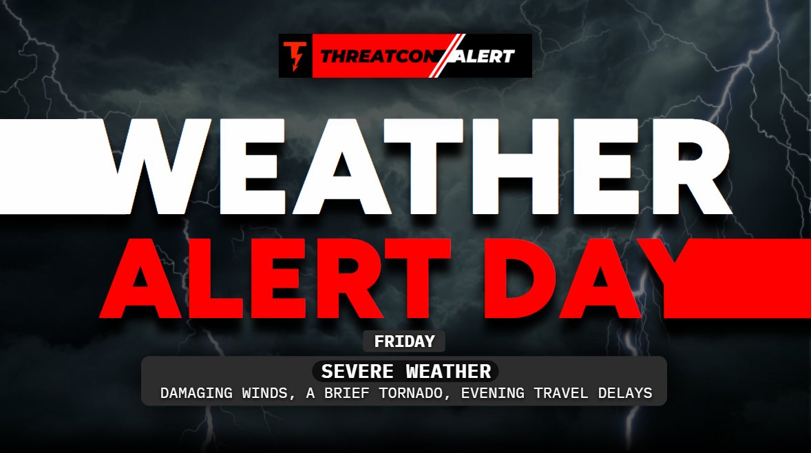
A strong cold front looks to make its way across the Northeast Friday afternoon and evening (10/16/2026), bringing an unusual severe weather setup for mid-October.
Behind it, some areas may see the first flakes of the season, with the coldest air mass impacting our area since April! A reminder that winter is just around the corner!
Here’s Joe with the latest. #weather #forecast #snow #storm #severeweather
Tracking Severe Weather ⚡
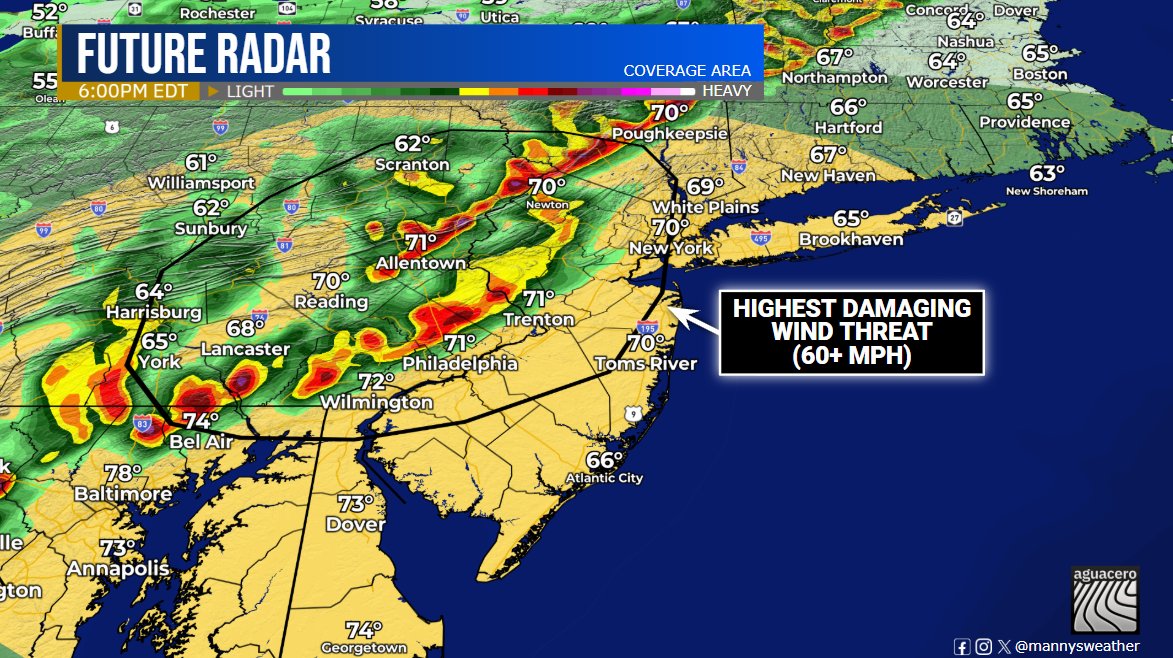
A squall line will develop along a cold front Friday afternoon. With a sufficient environment in place, damaging winds (60+ mph) are the main concern, and a brief tornado can't be ruled out. Stay Tuned!
#NJwx#PAwx#NYwx#MDwx#severewx#wxtwitter
A Civil Emergency Message is in effect for all of Los Angeles County in California, due to the threat of fast spreading wildfires.
Dangerous Red Flag conditions will result in fires spreading very quickly. If you feel unsafe near a fire, leave ASAP, do not wait for official guidance or evacuations orders.
🚨Severe Weather Update 🚨
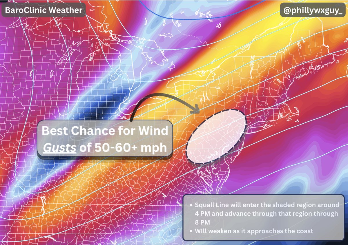
As a cold front approaches tomorrow, a squall line will develop and bring some gusty winds along with it. The highlighted region has the greatest chance to see wind gusts upwards of 60+ mph (not everyone will, but this area has the highest chance)
1/3
Friday 10/16 is a classic low CAPE, high shear setup which is common in the Northeast and during cool season. This favors a fast moving QLCS with enough horizontal rotation to produce a couple supercells.
Mainly looking at damaging winds but an isolated tornado or two is possible