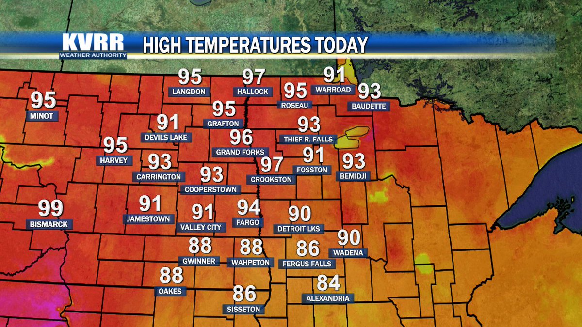
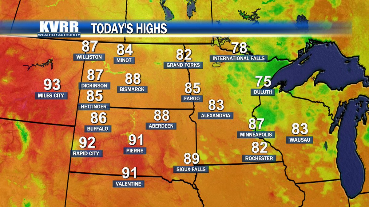
Another hot day in the books for the valley. Expect the hot weather to stick around until Labor Day, than some significantly cooler weather arrives Tuesday. Watch your latest video forecast at https://t.co/wt0JiyJBeZ
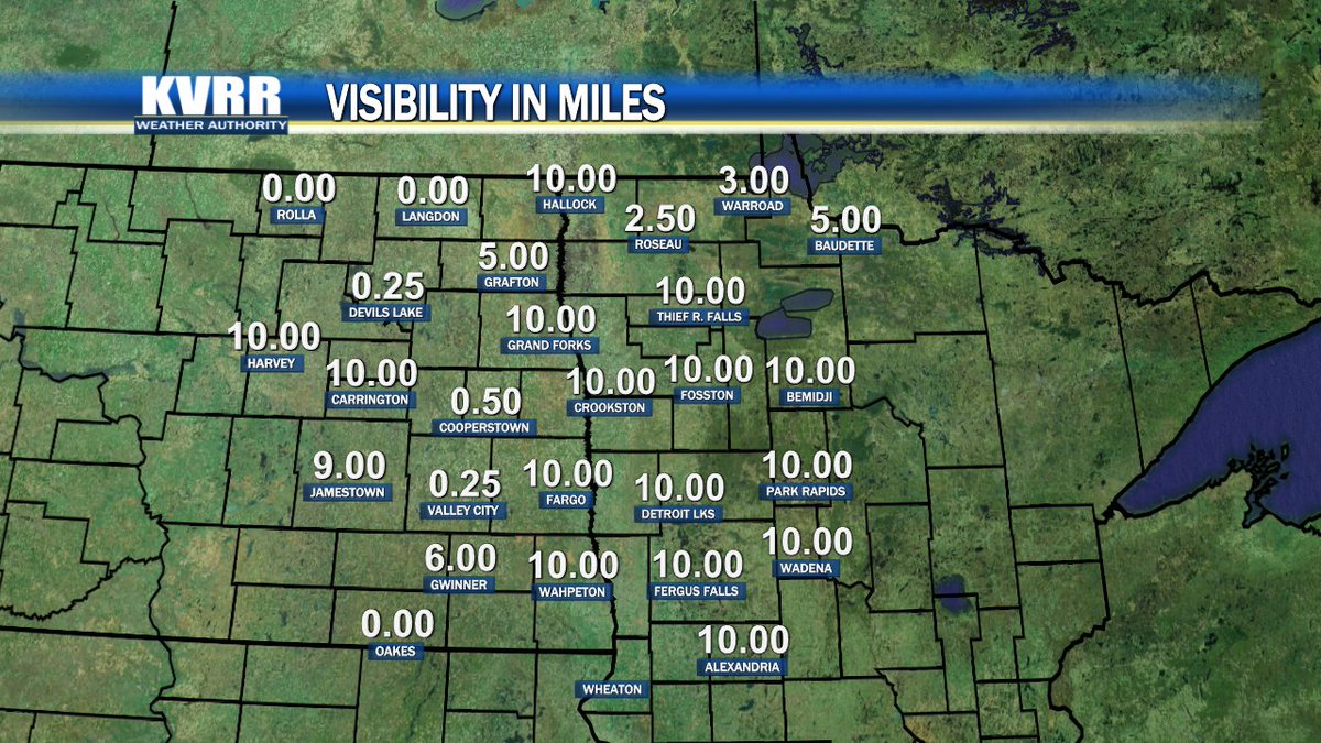
Canadian wildfire smoke has returned to our region and it has decreased our visibilities and air quality. Find out how long it is expected to stick around at https://t.co/wt0JiyK94x
Quite pleasant weather to kickstart your work week! Expect sunny skies to stick around for the remainder of our afternoon. However, there is a chance for an isolated shower overnight for portions of our area. Find out where at https://t.co/wt0JiyJBeZ
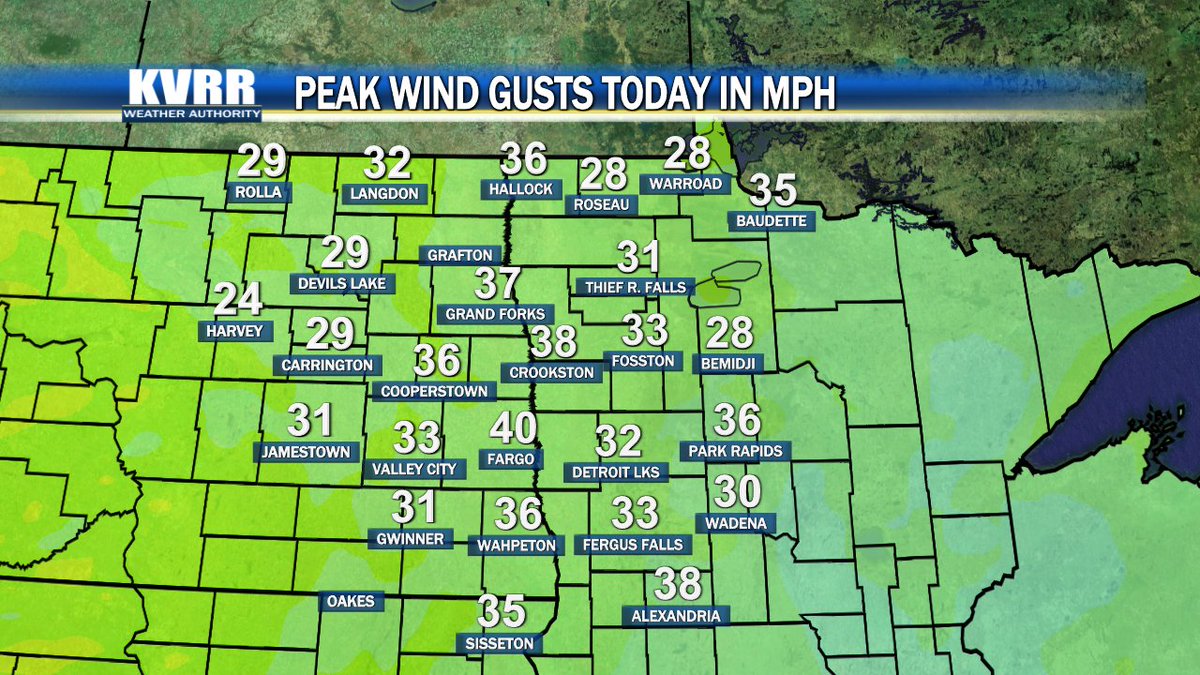
Another breezy afternoon for our valley with peak wind gusts reaching near 40 miles per hour in some spots. Expect breezy winds to return for Saturday with also some warmer weather. Check out the latest video forecast at https://t.co/wt0JiyJBeZ
Expect cloud cover to increase for the remainder of our afternoon hours. Cloudy skies should stick around for Sunday and bring rain chances to our area. Find out more details at https://t.co/wt0JiyJBeZ
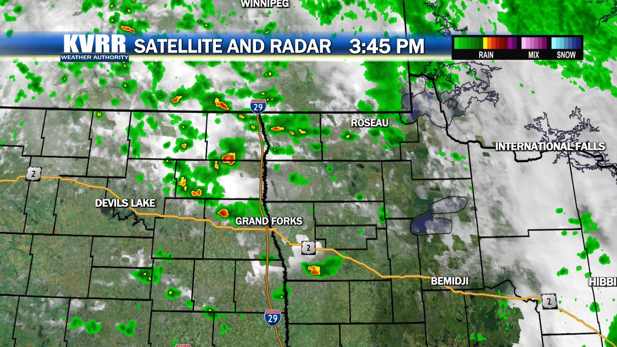
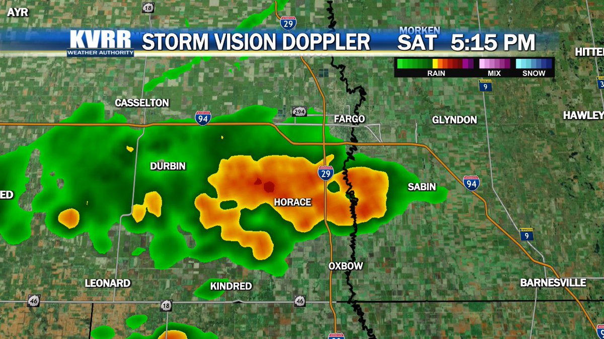
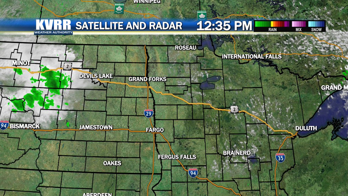
We are tracking areas of isolated showers and thundershowers in our valley. Storms are not expected to turn severe, but still something to keep an eye out for. Get the latest details on the storms at https://t.co/wt0JiyJBeZ
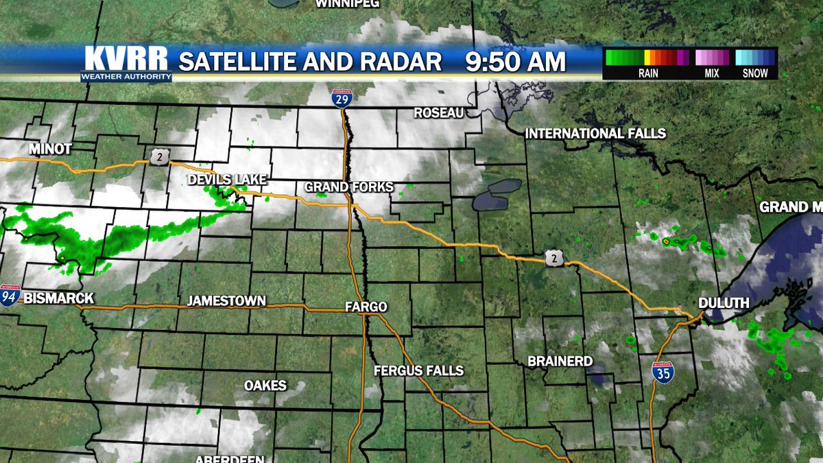
We are watching a batch of showers lifting northward into parts of southeastern North Dakota. Later this afternoon, expect more showers to develop and affect our area. Check out your latest video forecast anytime at https://t.co/wt0JiyJBeZ
Plenty of sunshine has been seen across the valley. Expect a few more afternoon clouds to roll into the area later this afternoon. For Sunday, there will be a chance of showers for parts of our region. Get the latest details at https://t.co/wt0JiyJBeZ
Temperatures are considerably cooler compared to twenty four hours ago. Expect the cooler weather to stick around for Saturday. Stay up to date with your latest forecast at https://t.co/wt0JiyJBeZ
We are watching more clouds working into the area. As they push eastward, they will bring the chance for a shower primarily for the northern valley.Get the latest details at https://t.co/wt0JiyK94x
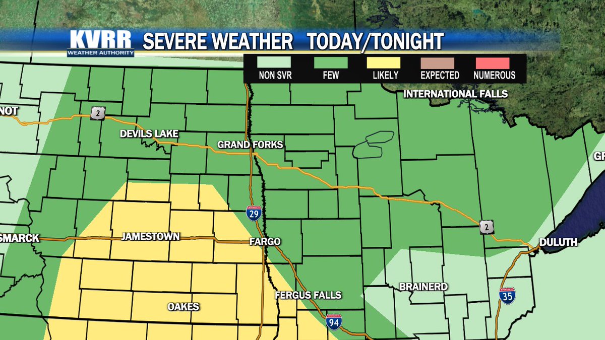
There is a potential for storms to turn severe in the afternoon and early evening hours. The main concerns are damaging winds and small hail. Keep an eye on the weather tonight and remain Weather Aware at https://t.co/wt0JiyJBeZ
A nice afternoon for the tri-state with highs jumping into the mid 80s. However, we are expecting a big warm-up heading into next week with temperatures soaring into the 90s. Stay up to date with the latest forecast at https://t.co/wt0JiyJBeZ
The National Weather Service issued an Air Quality Alert until 3 PM Saturday due to the Canadian wildfire smoke that has spread southward. Please make sure to limit your time outside since air quality will be poor.
We are still monitoring showers and thundershowers rolling southeastward through the valley. The main concerns with these storms are heavy rain and small hail. Find out when the storms will push out at https://t.co/wt0JiyJBeZ.
A cool and mostly cloudy afternoon was observed for our valley. Expect the clouds to depart the area later this evening and our temperatures to rebound for Thursday. Check out your latest forecast at https://t.co/wt0JiyJBeZ
We are still watching a few spotty showers in southeastern North Dakota. Expect another shot for rain showers Sunday. Find out when they are anticipated to arrive at https://t.co/wt0JiyJBeZ
It was a pleasant afternoon across our valley with just a few passing clouds. Expect similar conditions to return Saturday with a slight jump in temperatures. Check out your latest forecast anytime at https://t.co/wt0JiyJBeZ