❄️🎄Wishing everyone a joyful holiday season from all of us at VRGeoscience Limited. 🤶🏽🎅🏾
We hope you enjoy this Advent Countdown video created in #VRGS using the flight path tool – with a touch of bespoke coding magic! ✨🎁
Need a dedicated #VRGS module or geospatial solution? At VRGeoscience, we provide friendly geospatial software consultancy with a continuous integration approach. Let's drive innovation together! Contact us👇 https://t.co/rKUAyOItoz
Enhance virtual field trips with #VRGS ! 🌍✨ Use our web browser and HTML editor to create engaging guides. In this video👇, we explore Jurassic sediments in northeast England.
Revolutionise geoscience education! 🌋📖 #VirtualFieldTrips#InteractiveLearning
Excited to share #VRGS used as a centralised database in this geotechnical paper! 😃
Pauzi et al. combine slake durability, knocking ball test & electrical resistivity tomography data with VRGS models to aid understanding of weathered slope stability.
https://t.co/gOdQwViaOM
😎 As summer approaches, it's the perfect time to explore geological wonders and gather valuable data for digital outcrop modelling. Stay curious, stay adventurous, and stay safe! Let's make this summer one to remember! ☀️🌍
#geology#geoscience#fieldwork#VRGS
#iPhone#lidar, iPhone #camera, or mirrorless camera for #outcrop models? With increasing accessibility to digital outcrop tools, it's crucial to understand the pros and cons of each. Find out more on our blog: https://t.co/aDwlTEvJoA
#geology#geoscience#geospatial
This is such a powerful video that shows what data you might actually be missing using different #outcrop modelling methods. Each method does have its own place though, so choose wisely!
Phone #lidar vs #photogrammetry with a camera phone vs photogrammetry with a mirrorless camera. Which is best?🤔It depends on what you want from the data
Video shows photorealistic models, then the coplanarity attribute showing how much detail is in the mesh without the texture.
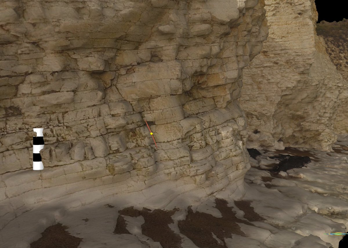
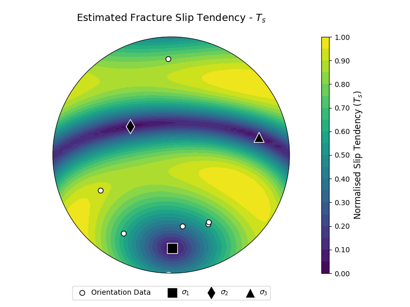
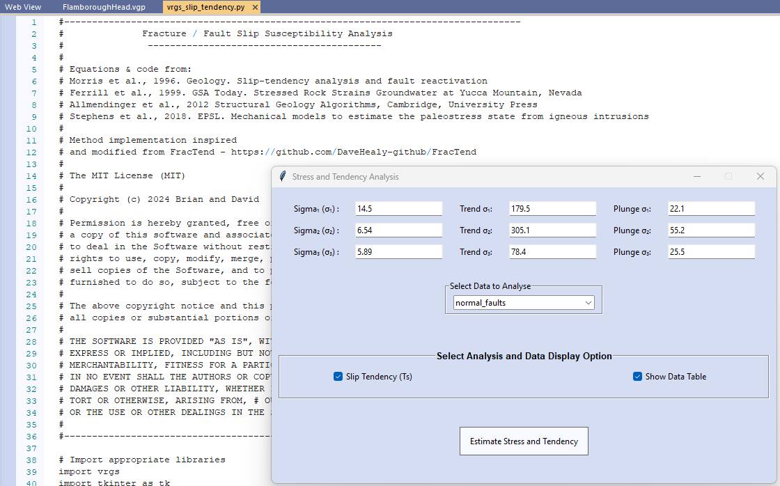
New tool using the #python interpreter in #VRGS that integrates a known stress field and interpreted outcrop data to estimate slip tendency. Eg 👇normal faults at Flamborough Head, England (scale bar 1 m). https://t.co/fMYahDN9Iz.
New tool using the #python interpreter in #VRGS that integrates a known stress field and interpreted outcrop data to estimate slip tendency. Eg 👇normal faults at Flamborough Head, England (scale bar 1 m). https://t.co/fMYahDN9Iz.
Coming soon to #VRGS - The geobody construction toolkit.
The Geopolygon tool in VRGS enables you to map the outcrop expressions of geobodies, but with the upcoming new features, you can create 3D bodies from those outcrop expressions.
We have preserved the initial release of the VRGS-Python repository through #Zenodo. This initial release contains the beginning of the VRGS-Python API that will be updated as we continue to advance the #Python integration in #VRGS. Check it out at
https://t.co/fMYahDN9Iz
Outcrops give us insight into what the subsurface #Earth looks like, even from unassuming features like this Chatsworth Grit dry-stone wall. This wall 👇is integrated with outcrop that could easily go unnoticed. #3D model from mobile phone pics.
#FieldworkFriday#UrbanGeology
We're revisiting the Tanqua Karoo Basin Floor Fans for #ThrowbackThursday this week. From data collected in the early 2000s to reprocessing in 2024, our latest blog gives more background on the Fan 2 model.
https://t.co/SBJP7Fu5fM
So.. I'm doing a thing in a couple weeks @GeolSoc. I'll be giving a Public Lecture on 3D digital outcrops. It's open to the public, so if you fancy hearing some digital outcrop history, what they're all about, and why they're imprtant, come and hang out (in person or virtually!).
📢A date for the diary! @bsburnham will be giving a Geological Society of London Public Lecture 'Virtual Geosciences: Geology's Vision Quest' 😊
📆 Tuesday 14th May 18:00 hybrid event open to the public and free.
More info👇
https://t.co/FuJVDQx4AX
#GSLPublicLecture
The built-in #python interpreter in #VRGS leverages the full python package ecosystem & facilitates further analysis of outcrop data and interpretations. Simultaneously plot the data & create figure ready graphics.
👇Joint sets & bedding orientation Trefor Rocks NE Wales.
The built-in #python interpreter in #VRGS leverages the full python package ecosystem & facilitates further analysis of outcrop data and interpretations. Simultaneously plot the data & create figure ready graphics.
👇Joint sets & bedding orientation Trefor Rocks NE Wales.
Today's Quick Tip - Colour Maps Part 2🌈. The last #VRGS Quick Tip showed you how to make a simple colour map. This time we take it further by importing more complex colourmaps and changing their display styles.
#TutorialTuesday