Our Forecast Severity Rating maps are posted to the CWFIS site! Take a peak at forecasted seasonal severity ratings for the next few months. These maps show the predicted conditions unadjusted for climatology. #CWFIS#forecast https://t.co/p7TBFxjsM7
🎉Cover for Issue July 2019 (Issue 7): #Peatland#Hydrological Dynamics as A Driver of #Landscape Connectivity and #Fire Activity in the #Boreal#Plain of Canada by Dan K. Thompson et al. from 👉Paper link: https://t.co/JveStsC3q7 👉More papers in Issue 7: https://t.co/DnAZud9gkt
#mdpiforests Peatland Hydrological Dynamics as A Driver of Landscape Connectivity and Fire Activity in the Boreal Plain of Canada https://t.co/HLUbp6FfBg @MDPIOpenAccess
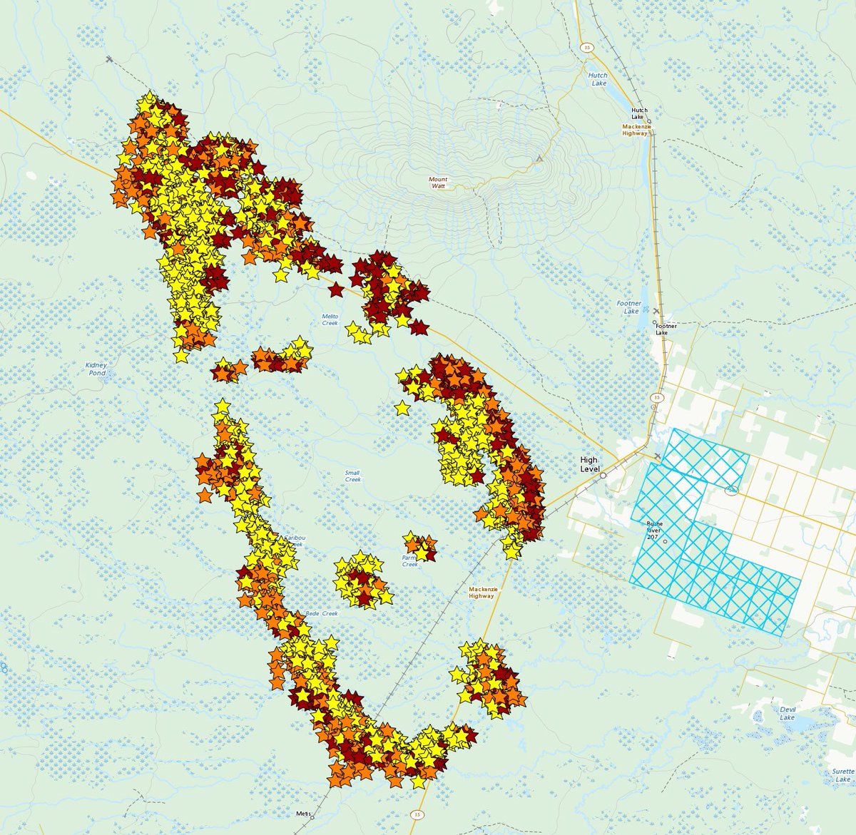
Tuesday evening Chuckegg Creek wildfire (HWF-042) near High Level AB (May 21 2300MT) 24 hr hotspot map for fires #ABWildfire. Red (last 0-6 hrs), Orange (last 6-12 hrs), Yellow (last 12-24 hrs). From @CWFIS#ABfire
The First Nations Wildfire Evacuation partnership is very excited to release this summary infographic of our research results from a 6 year research project with over 200 participants! #Wildfire#Canada#Evacuation#nativetwitter
Thursday evening (July 19 20:00PT) 24 hr hotspot map #BCWildfire#Peachland#Summerland#MountEneas Red (last 0-6 hrs), Orange (last 6-12 hrs), Yellow (last 12-24 hrs). Fire perimeters and hotspots are estimated (note hotspots in the lake). From @CWFIS
24hr Hotspot map for fires near Peachland & Summerland based on last satellite reading #BCWildfire. These are estimated (note the ones in the lake ☺️). From https://t.co/aQxtc9XVKF @CWFIS@Kamscan@BradyStrachan@CBCKelowna
A 27-person crew of Nova Scotia wildfire fighters arrives at Halifax Stanfield @HfxStanfield . They’re answering the call to help control forest fires in Alberta.
People made the most trips to ER following days with the densest smoke (heart attacks up 42%). Fewer on medium smoke days, and fewer than that on light smoke days. Wildfire smoke hurts heart, not just lungs, study finds https://t.co/UcGn6E8na3
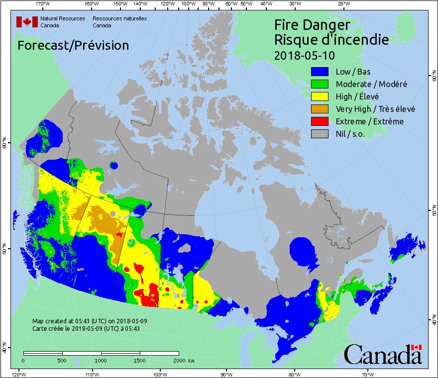
Fire Danger is a relative index of how easy it is to ignite vegetation, how difficult a fire may be to control, and how much damage a fire may do. Check out the daily Fire Danger map at https://t.co/ToY6svEgDr! Here is today’s map: