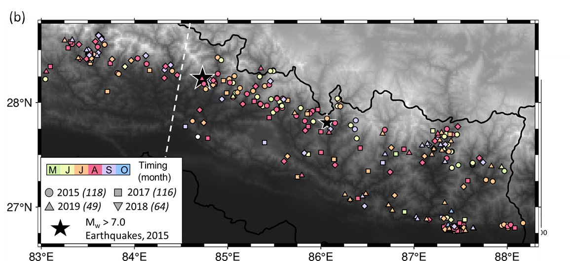
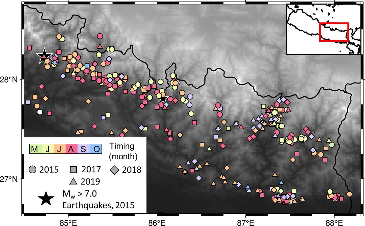
In our new paper, we use Sentinel-1 to derive the timings of 579 monsoon-triggered landslides over 4 years in Nepal and explore how these are affected by intense rainfall and post-seismic hillslope weakening following the Mw 7.8 Gorkha earthquake (1/2). https://t.co/zFB0d8VqiQ
This Thursday (28th) I'm presenting in the online Landscapes Live seminar series! Register at https://t.co/dEicemoNxn if you're interested in how we can use Sentinel-1 to better follow shallow landslide evolution through time during sequences of earthquakes and storms 🗻🛰️
If you use modern methods in geomorphology (GIS/remote sensing/cloud computing/AI) and you're looking for an EGU session to present your work in, we invite you to submit to our session on Geomorphology in the Digital Era (deadline Jan 10th!) https://t.co/U4ZiZdH3cL
I’m at the world landslide forum in Florence this week. Come and talk to me about landslides and SAR or DOA publishing with @Geomorphica (or both!) #WLF6
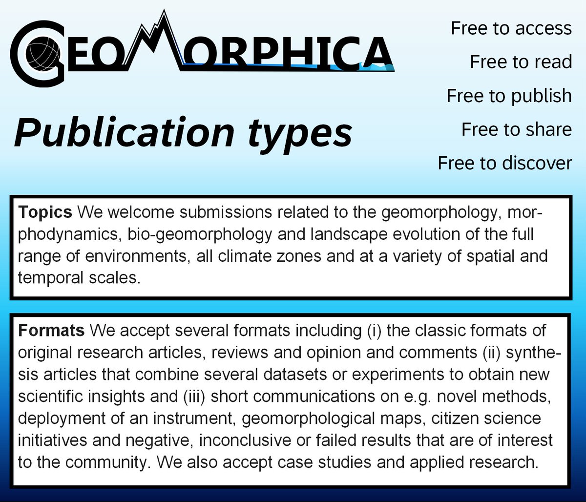
This #factfriday, we explore the wide range of publication types you can submit to Geomorphica! You can publish your research on any area of #geomorphology in a wide range of formats. We look forward to receiving your submissions!
In the @Geomorphica communications team, we are trying to spread the word about #DiamondOpenAccess publishing and #geomorphology! Find out more about the journal and submit your manuscript at https://t.co/rH6bzH67Qw 🏔️🏝️🗻💎📚
Who are the people who keep you up to date? This #teamtuesday we introduce our #communications commission! We are here to let you know everything about #Geomorphica on #socialmedia and anywhere else. Do you want to become part of the #community? Contact us!
Want to publish in #geomorphica? This #factfriday we summarize all facts you need to be aware of. Full guidelines can be accessed on https://t.co/vZHywlyKnr. Want to review? Info is summarized next #factfriday!
#geomorphology#openaccess
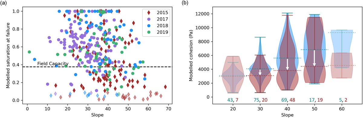
By modelling the soil water content at the time of failure, we showed that landslides failed in dryer conditions during the 2015 monsoon and demonstrate that this can be explained by temporary weakening of the hillslope following the earthquake (2/2)
In our new paper, we use Sentinel-1 to derive the timings of 579 monsoon-triggered landslides over 4 years in Nepal and explore how these are affected by intense rainfall and post-seismic hillslope weakening following the Mw 7.8 Gorkha earthquake (1/2). https://t.co/zFB0d8VqiQ
#Geomorphica is OPEN for submissions 📢
The team is extremely happy to share that the new #DiamondOpenAccess journal in the field of #Geomorphology is open for submissions. Please visit our new homepage https://t.co/vZHywlyKnr
Today I started a new job @esa esrin in Frascati as a research fellow in Earth observation for Earth systems science. I’ll be working on satellite remote sensing of erosion/landslides and soil moisture ⛰🌧🛰
What can the timings of 300 monsoon-triggered landslides in Nepal tell us about the impacts of earthquakes and cloudburst events? Come to my talk tomorrow at 15:12 #EGU23 session GM3.1 to find out🏔️
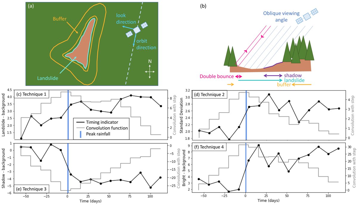
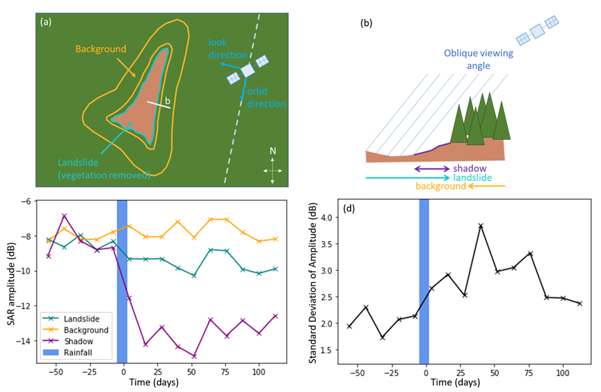
When clouds obscure optical satellite images for long periods, it can be hard to constrain landslide timings (and so to relate them to rainfall or earthquake sequences). Our method to time landslides using SAR time series has just been published🏔️🌧️🛰️ https://t.co/ESZxHLUIwt
New research article: Using Sentinel-1 radar amplitude time series to constrain the timings of individual landslides: a step towards understanding the controls on monsoon-triggered landsliding https://t.co/6tBVLCKsgy
In my talk at #EGU22, we used SAR time series to obtain landslide timings during the Nepal monsoon, allowing the landslides to be tied to specific rainfall conditions. Come along to NH9.8 on Tuesday to find out more or see the online material here: https://t.co/0cCX7XLHsQ
Have you ever mapped a large number of landslides, but been unable to know when they happened due to cloud cover in optical satellite images?
In our new discussion preprint, we solve this problem using Sentinel-1 time series! 🛰️🏔️
https://t.co/Zoa0VHHdHR
The last chapter of my PhD thesis is now published! We show that more accurate information on earthquake-triggered landslide locations can be generated by combining empirical models and InSAR coherence methods. 🏔️🛰️@DurUniEarthSci@_IHRR