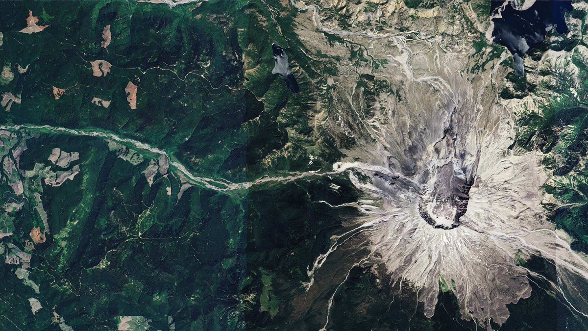
#EOchat: Following the recent release of #NISAR 🛰️ data for *everywhere*, here's a sample viz of ascending orbit data from 28.06.2026 over #Belize. Forests are mainly displayed in shades of green, while non-forest areas are shown in darker tones. #EarthEngine#GoldenAgeOfSAR
“Being part of the global GEO network assures the sharing of knowledge and provides opportunities for collaboration and co-creation of tools, training and education materials, and innovative technologies.” - Freek Van Der Meer, GEO Principal, ITC.
Did you know? 🔎
ITC is a GEO Participating Organization applying earth observation data and geoinformation science in four profiling themes closely aligned with GEO’s priorities: GEO AI, resource security, urban futures and disaster resilience.
🎥 Watch the full statement at the GEO-21 Plenary:
https://t.co/tTbPNGrYq8
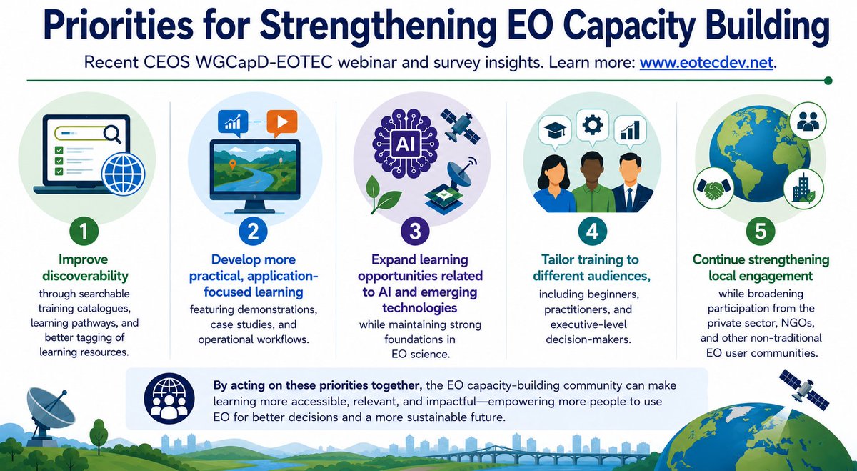
⁉️What does the Earth observation community need most from capacity building today?
More than 200 people shared their views on this question in a recent EOTEC-@CEOSdotORG WGCapD survey. Results captured in the image below.
Detail on the responses: https://t.co/b3cPnMJg6S
The singularity is often regarded as the point at which artificial intelligence surpasses human intelligence and begins advancing at a pace that's difficult for people to predict or control. https://t.co/mrILyJYqfo
What's the difference between drone and satellite Imagery? 🔎
Become an expert in identifying imagery types and capture methods. Read the article:
https://t.co/gPBe48Z4It
Generate your script, inspect the diff, merge with confidence.
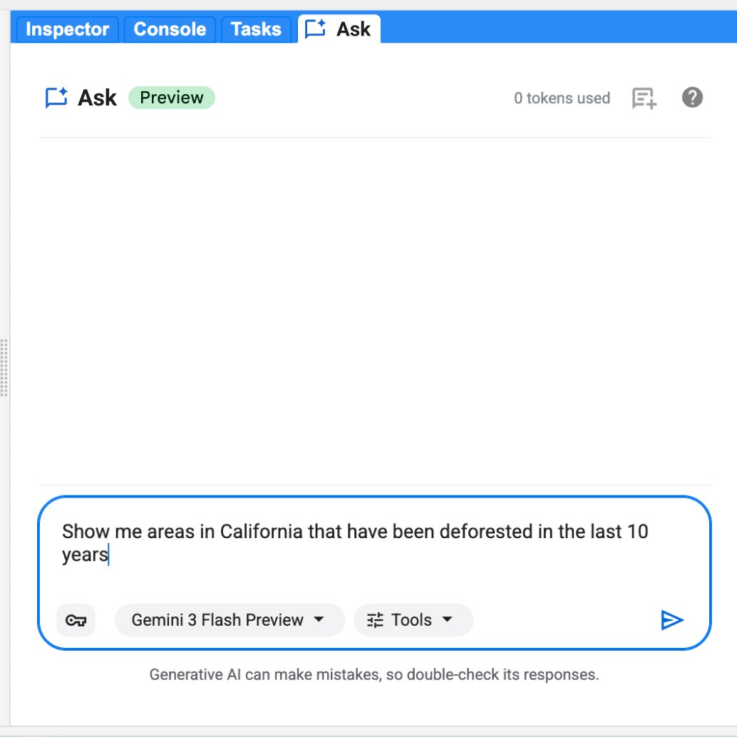
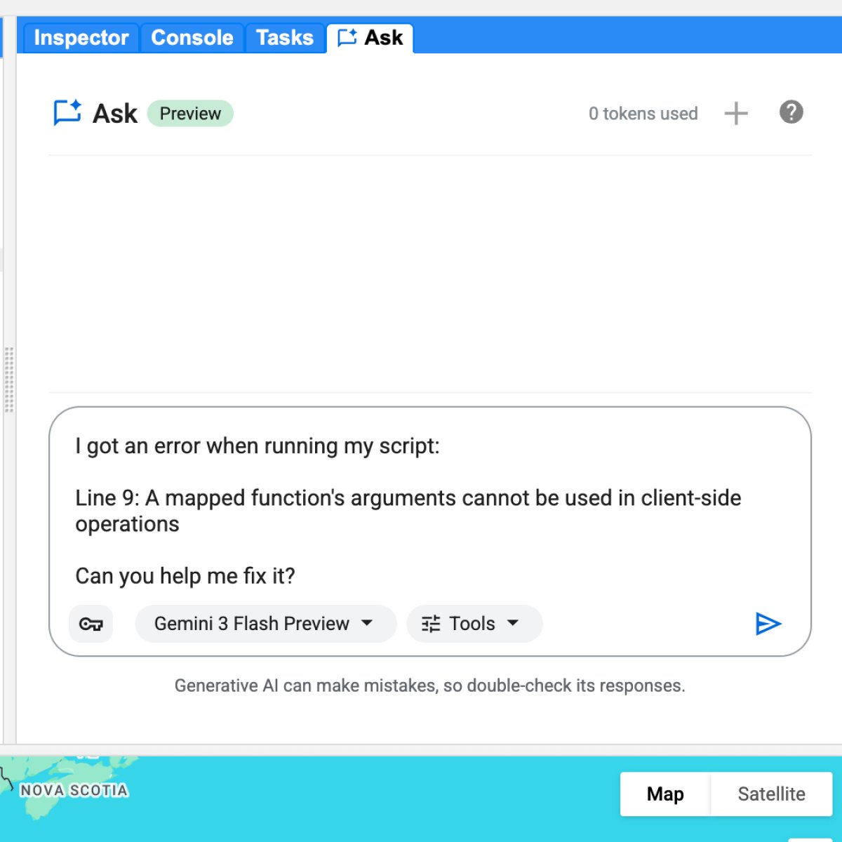
We just launched Ask in the Google Earth Engine Code Editor. It brings Gemini capabilities directly into the Code Editor to help you write, debug, and understand geospatial queries without leaving your workspace. https://t.co/9DxutFBBXc
Here is what you can do today:
🗺️ Ask in plain English: get clean JavaScript for cloud masks, NDVI composites, charts, and more.
🛠️ Troubleshoot with one click: let Ask automatically diagnose console errors and generate syntax fixes for you.
🔍 Keep full technical control: review side-by-side code diffs before merging anything into your active script.
Ask is context-aware. It reads your active code, imported information, and session history, acting as a collaborative colleague that knows your project structure.
#GISchat: The following was said yesterday during the #EsriUC2026 Plenary: "ArcGIS is the most widely used GIS program in the world."
#QGIS: "Say what now?"
👋👋 Evaluating #Global and National Datasets in an Ensemble Approach to Estimating #Carbon#Emissions as Part of SERVIR’s #CArbon Pilot
✍️ Christine Evans et al.
🔗 https://t.co/t9VZwkmAHH
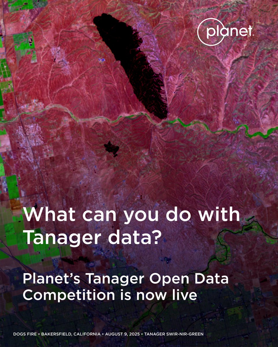
#EOchat 📢: Regarding @Planet's ongoing #Tanager competition, I have put together the following doc, "Resources for Planet's Tanager Open Data Competition": https://t.co/6SWv1dlxsK.
https://t.co/uDRQpK2nmJ
We’re calling on researchers, students, and analysts to put hyperspectral data to use. 📣 Our Tanager Open Data Competition is now live! Participants can use our Tanager open source imagery to showcase real-world examples that are helping make a difference for life on Earth.
Learn more about the competition and register here: https://t.co/LdcD3xwf8Q
We’re calling on researchers, students, and analysts to put hyperspectral data to use. 📣 Our Tanager Open Data Competition is now live! Participants can use our Tanager open source imagery to showcase real-world examples that are helping make a difference for life on Earth.
Learn more about the competition and register here: https://t.co/LdcD3xwf8Q
🌍 IN FOCUS: The History of IEEE GRSS at 65 (1975–1978)
As IEEE GRSS celebrates 65 years of impact, we continue our journey through the Society’s history—this time exploring a pivotal era of renewal and transformation.
The years 1975–1978 marked a turning point, as the community moved beyond early challenges and embraced scientific reinvigoration and multidisciplinary collaboration. Advances in satellite Earth observation, digital computing, and image processing opened new possibilities—shaping the future of geoscience and remote sensing as we know it today.
✨ From rebuilding momentum to redefining scope, this period laid the foundation for the integrated, data-driven field we see today.
🔗 Read more: https://t.co/JOOg0L3HvM
#IEEEGRSS #RemoteSensing #EarthObservation #History #Geoscience