Hurricane Fausto looks magnificent on satellite. While of course not the most impressive by far, note the gravity waves rippling away from the dense core convection wrapping around the center of the hurricane. Can quite literally see the disruption in the local clouds by such immense energy transfer ongoing inside the storm. Like a rock tossed into a pond. I adore meteorology
#Fausto
The Atlantic Basin was barely able to churn out a very weak Tropical Storm Bertha this week, and now there is no cyclonic activity expected there for at least the next 15+ days.
Meanwhile, this is a look at the West Pacific (which has already seen multiple 180+ MPH Cat 5s) over that same timeframe.
The historically powerful 2026 El Niño is in full swing.
BREAKING: The Japan Meteorological Agency (JMA) has also issued its first tropical cyclone advisory for Tropical Depression #KiyapoPH, which is located east of Central Luzon.
The RSMC for the Western Pacific (WPAC) basin forecasts the system to reach tropical storm strength tomorrow, July 24. However, it is not expected to intensify into a severe tropical storm, making JMA's forecast an outlier compared to those of the other agencies.
The next international storm name in the list is #Noul.
📷: JMA
🌀 TROPICAL STORM #BERTHA 🌀
#TropicalStormBertha / #Texas / #Louisiana
Wednesday, July 22, 2026
– 4:00 AM CST/CDT
🌀 Current Status
Tropical Storm Bertha continues to move across the northern Gulf Coast with maximum sustained winds of 50 mph, moving west at 6 mph. Bertha is approaching Plaquemines Parish, Louisiana, where landfall is expected later this morning as a TROPICAL STORM.
Recent forecast trends have shifted Bertha's track slightly farther south. This is expected to keep the center over the warm waters of the Gulf of America (Gulf of Mexico) longer after its initial Louisiana landfall, allowing the circulation to remain over water as it tracks westward roughly parallel to the Louisiana and Texas coastlines.
Although sea surface temperatures are very warm—around 86°F (30°C)—atmospheric conditions are not favorable for strengthening. Persistent strong wind shear will continue to disrupt the storm's structure and prevent significant intensification. As a result, no HURRICANE is anticipated, and Bertha is forecast to remain a TROPICAL STORM throughout its lifetime.
Current projections indicate Bertha will continue westward along the Gulf Coast before making a second landfall along the Texas coast on Thursday, July 23, 2026, with maximum sustained winds of 40 to 45 mph, remaining a TROPICAL STORM.
A Tropical Storm Warning is in effect for...
* Okaloosa/Walton County Line in Florida to Morgan City, Louisiana
* Metropolitan New Orleans and Lake Pontchartrain
A Tropical Storm Watch is in effect for...
* West of Morgan City, Louisiana, to Cameron, Louisiana
* Lake Maurepas
🌀 Expected Impacts
Louisiana
Rainfall: Widespread totals of 4 to 8 inches, with isolated amounts up to 10 inches, may produce localized to scattered flash flooding, especially across southeast Louisiana.
Storm Surge: 2 to 4 feet above ground level is expected along portions of the southeast Louisiana coast, including Plaquemines Parish, with locally higher water levels possible in bays, marshes, and other vulnerable coastal locations.
Winds: Sustained Tropical Storm winds of 40 to 50 mph, with higher gusts, may bring down tree limbs and cause scattered power outages.
Marine Conditions: Dangerous surf and life-threatening rip currents will continue along the Louisiana coastline.
Texas
Rainfall: 2 to 5 inches of rain is expected along portions of the upper and middle Texas coast, with isolated totals up to 6 inches, which may result in localized flash flooding.
Storm Surge: 1 to 3 feet above ground level is possible near and east of the expected landfall location on Thursday.
Winds: Tropical Storm winds of 40 to 45 mph are expected near the coast around landfall, with higher gusts possible.
Marine Conditions: Rough surf, dangerous rip currents, and minor coastal flooding are expected along the Texas coastline.
🌀 Forecast Summary
While Bertha is expected to spend additional time over the very warm waters of the Gulf of America, the hostile upper-level wind environment will prevent the storm from organizing into a stronger system. Forecasters expect Bertha to maintain Tropical Storm intensity as it parallels the Louisiana and Texas coasts before making its expected Texas landfall on Thursday.
Residents along the Louisiana and Texas Gulf Coast should continue to monitor the latest forecasts from the National Hurricane Center and their local National Weather Service offices. The greatest threats from Bertha will continue to be heavy rainfall, localized flash flooding, storm surge flooding, gusty winds, rough surf, and dangerous rip currents.
🌀 No hurricanes are anticipated with Tropical Storm Bertha.
Respectfully,
Roshin Rowjee 🌀
Hurricane/Typhoon/Cyclone Updates & Information
Tropical Storm #Bertha has 50 MPH sustained winds as it battles some serious wind shear in the Gulf.
Modest strengthening today won't last long as the winds tear the storm apart. No impact for the Carolinas as the storm tracks westward along the Gulf Coast this week.
#tropicswx |
This is the first time we mentioned #Fausto but Fausto is doing pretty good & successfully pushing convection upshear. With the MLC & LLC aligning, this will help Fausto reach hurricane status. It’s expected to be near C3 status but it could cross that threshold if you play your cards right.
Might have to keep a close eye on this one later in the week. Seeing a few models and their ensemble members aggressively developing this feature in the South China Sea over the upcoming weekend.
I mean I wouldn't be against an excuse to head up to Hong Kong 🤷♀️
#WPAC#typhoon
🌀Gulf Coast #TropicalUpdate / #Tropics
– Invest #91L / #Bertha possible
Sunday, July 19, 2026
Invest 91L over the northeastern Gulf of America continues to become better organized, and the National Hurricane Center has increased the probability of development to a 60% chance during the next 2 days, July 19-21, 2026, indicating a medium chance that the system could become a TROPICAL DEPRESSION or TROPICAL STORM BERTHA next week if a well-defined surface circulation develops.
Forecast guidance continues to show considerable uncertainty. The ECMWF (Euro) and several AI-based (FNV3) models generally favor a westward or west-northwest track toward the Texas coast, while the GFS and some other guidance continue to favor a track toward Louisiana or the Florida Panhandle. Because the system remains broad and somewhat disorganized, confidence in the eventual track is still low, and future forecast adjustments are likely. The HAFS-A model run has TROPICAL STORM or HURRICANE south of the Louisiana coast tracking west towards the middle or upper Texas coasts mid to late week next week, July 22-24, 2026.
If development occurs, current indications suggest the system would most likely become a TROPICAL DEPRESSION or a moderate TROPICAL STORM, although environmental conditions will determine how much strengthening is possible over the Gulf.
Everyone along the Gulf Coast—from #Texas, #Louisiana, #Mississippi, #Alabama, and #Florida—should remain weather aware, as forecast changes are possible over the coming days. Even if Invest 91L develops into only a TROPICAL DEPRESSION or TROPICAL STORM BERTHA, it could still produce periods of heavy rainfall, gusty winds, rough surf, and localized flooding.
Continue to monitor the latest forecasts and updates from the National Hurricane Center-Miami & Hurricane/Typhoon/Cyclone Updates & Information.
Respectfully
Roshin 🌀
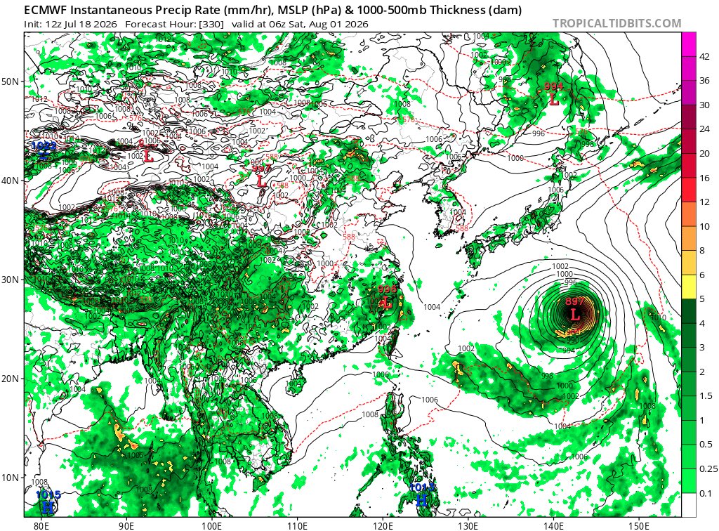
ECMWF and GFS both show a CAT5 super typhoon the last week of July headed into the first week of August. ECMWF shows 897 mbar and the GFS shows 913 mbar. Remember this is over 300 hours out and is not a forecast. Take these models with a grain of salt this far out. #wpac#typhoon
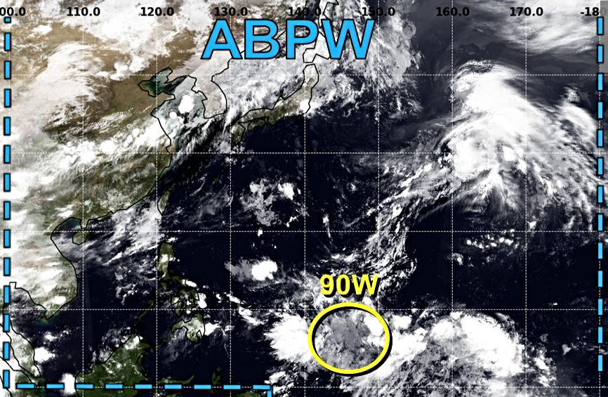
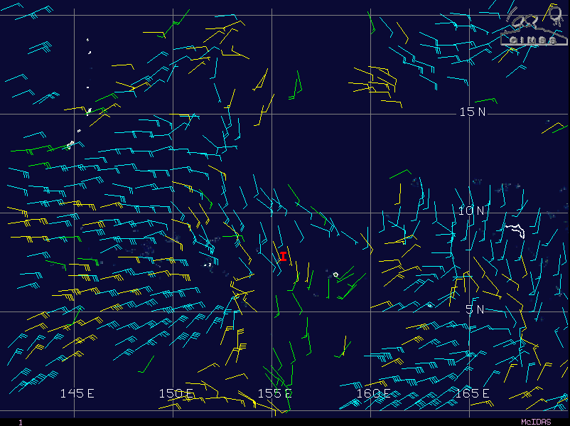
UPDATE: The Low Pressure Area (LPA 07c; Invest #90W) remains broad and disorganized over Micronesia. Due to the lack of a well-defined center, restricted outflow, and its nearly stationary movement, the system's development is expected to be remain limited over the next 5 days.
By next week, as #90W moves northwestward, a more favorable environment may support its gradual development, with model guidance beginning to converge on this scenario.
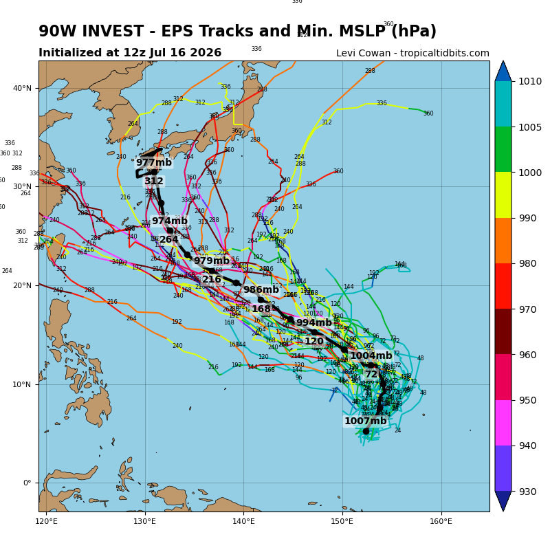
The GFS (US), GDPS (CA), and a few ECMWF (Euro) ensemble members have remained bullish in recent runs, indicating the potential for a significant typhoon by next weekend as the system move towards the Ryukyu Islands.
Meanwhile, Japan's GSM and Google's DeepMind models continue to show little to no development of the LPA #90W. However, the latter indicates another disturbance may form northeast of Palau by early next week, which could potentially affect the Philippines.
📷: Himawari-9 via CyclonicWX, CIMSS, JTWC, Weathernerds (GEFS)
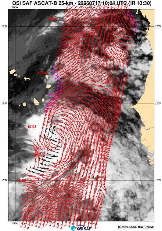
The tropical wave nearing Cape Verde today is in its best shape. Convective activity has improved, w/ prevalence of a band & associated curvature. Could argue it's close to TC status, but these features are fairly new & quite anemic, a testament to the highly dry environment.
Regarding Tropical Depression #90W near the Federated States of Micronesia, there are currently three possible scenarios for its future intensity and track based on agency forecasts and numerical model guidance. The global models remain in significant disagreement regarding the disturbance's potential development over the next several days.
1. The Japan Meteorological Agency (JMA) no longer forecasts the disturbance to intensify into a tropical storm, as environmental conditions have become unfavorable.
2. Models such as the ECMWF (Euro), GSM (JP), and DeepMind (Google) show little to no development over the next few days, although a few deterministic ECMWF member runs indicate gradual development.
3. The US (GFS) and Canadian (GDPS) models are the only ones showing a bullish solution, forecasting the system to reach typhoon intensity next week as it move towards the Ryukyu Islands.
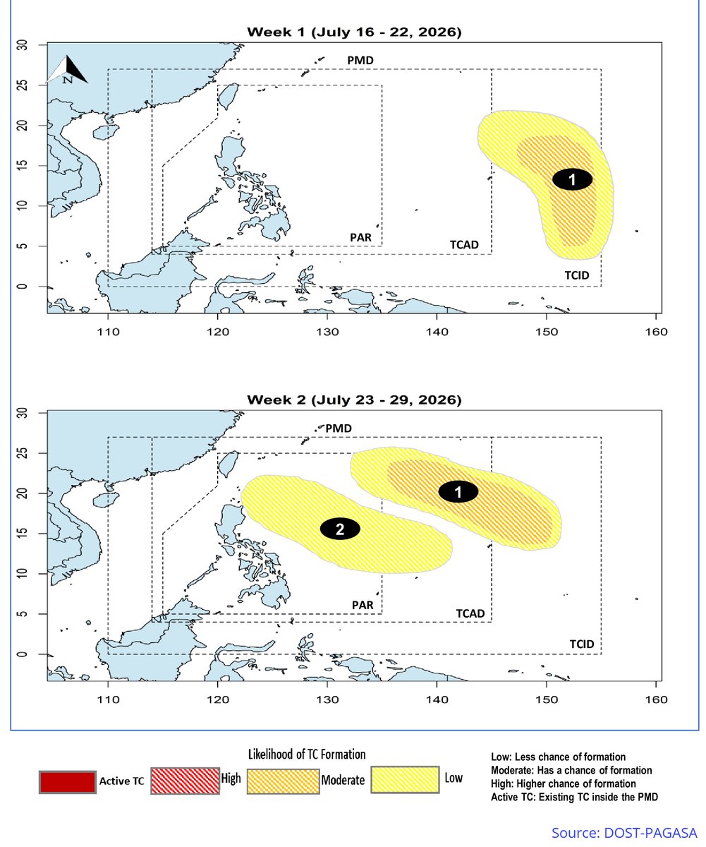
Meanwhile, @dost_pagasa has updated its Tropical Cyclone (TC) - Threat Potential outlook, indicating that TCLV-1 has a MODERATE chance of tropical cyclone formation over the next two weeks. Assuming this refers to #90W, the system may enter the Philippine Area of Responsibility (PAR) sometime between next weekend and the following week, but it is expected to remain offshore.
On the other hand, the Subtropical Depression #91W will NOT become a warm-core tropical cyclone anymore, as it has already encountered the mid-latitude westerlies.
📷: Himawari-9 via NRL-Monterey, Weathernerds (GFS), Tropical Tidbits (EPS), DOST-PAGASA
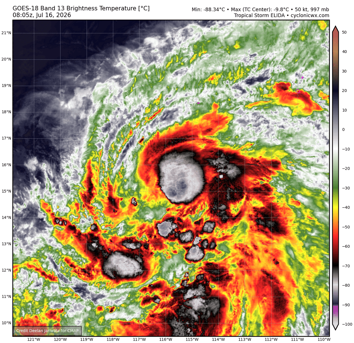
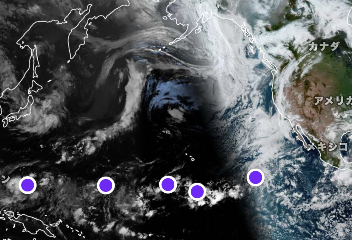
Tropical Storm #Elida continues to meander in the Eastern Pacific and is expected to meander around and potentially become a low-end Category 2 hurricane before tracking down to lower SSTs and increased wind shear. Meanwhile, another AOI is expected to form mid next week and could follow the footsteps of Elida.
In the central pacific, Invest #90C continues to consolidate, however, models have backed down quite a bit regarding its future formation. #91C meanwhile, had a decent circulation in the last few days, but its convective state has reduced.
Next names for the EPac and CPac respectively: #Fausto and #Lala
Tropical Storm #Bavi (formerly #IndayPH) is about to make landfall in #NorthKorea this evening. It has become the 17th longest-traveling tropical cyclone on record in the Western Pacific (WPAC) basin, having traveled approximately 6,640 kilometers so far, and the fifth longest this century.
With a current lifespan of 12 days and 12 hours, it has also become the longest-lasting named storm in the basin since TY Khanun in 2023.
The storm is now undergoing extratropical transition as it enters the baroclinic zone and becomes embedded within a frontal system. TS Bavi is expected to become a fully extratropical low within the next 6 hours as it emerges over the Sea of Japan tomorrow morning.
📷: Himawari-9 via Dapiya, Japan Meteorological Agency (JMA)
BAGYO UPDATE #JosiePH 🌀
11AM, July 14, 2026
Josie weakened into a tropical depression and may exit the Philippine area of responsibility this afternoon or evening, according to @dost_pagasa.
It may weaken further into a remnant low pressure area in the next 12 hours. | via @arielrojasPH
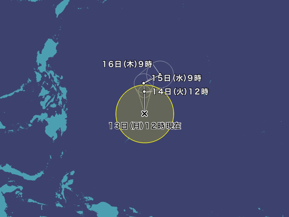
Well, that escalated quickly! The tropical depression located northeast of Palau has been upgraded to a tropical storm by the Japan Meteorological Agency (JMA). It has been assigned the international name #Haishen, becoming the 11th named storm in the Western Pacific (WPAC) basin this year.
This is now the third-highest year-to-date (through July 14) storm count on record (tied with 1965) and the highest since 2015. The name "Haishen" was contributed by China and means "god of the sea" in Mandarin.
DOST-PAGASA has assessed the system as a tropical depression, while the Joint Typhoon Warning Center (JTWC) continues to classify it as a tropical disturbance (Invest #97W). However, the latter has already issued a Tropical Cyclone Formation Alert (TCFA).
TS Haishen will remain offshore and is not expected to affect any landmass. Both PAGASA and the JTWC predict that the storm will cross 135°E, entering the Philippine Area of Responsibility (PAR) between tonight and tomorrow morning, July 14. Once inside the PAR, it will be assigned the domestic name #JosiePH.
The system is expected to be short-lived and may only persist for the next 2–3 days.
📷: Himawari-9, JMA via WNP