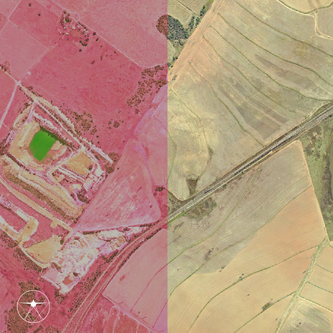
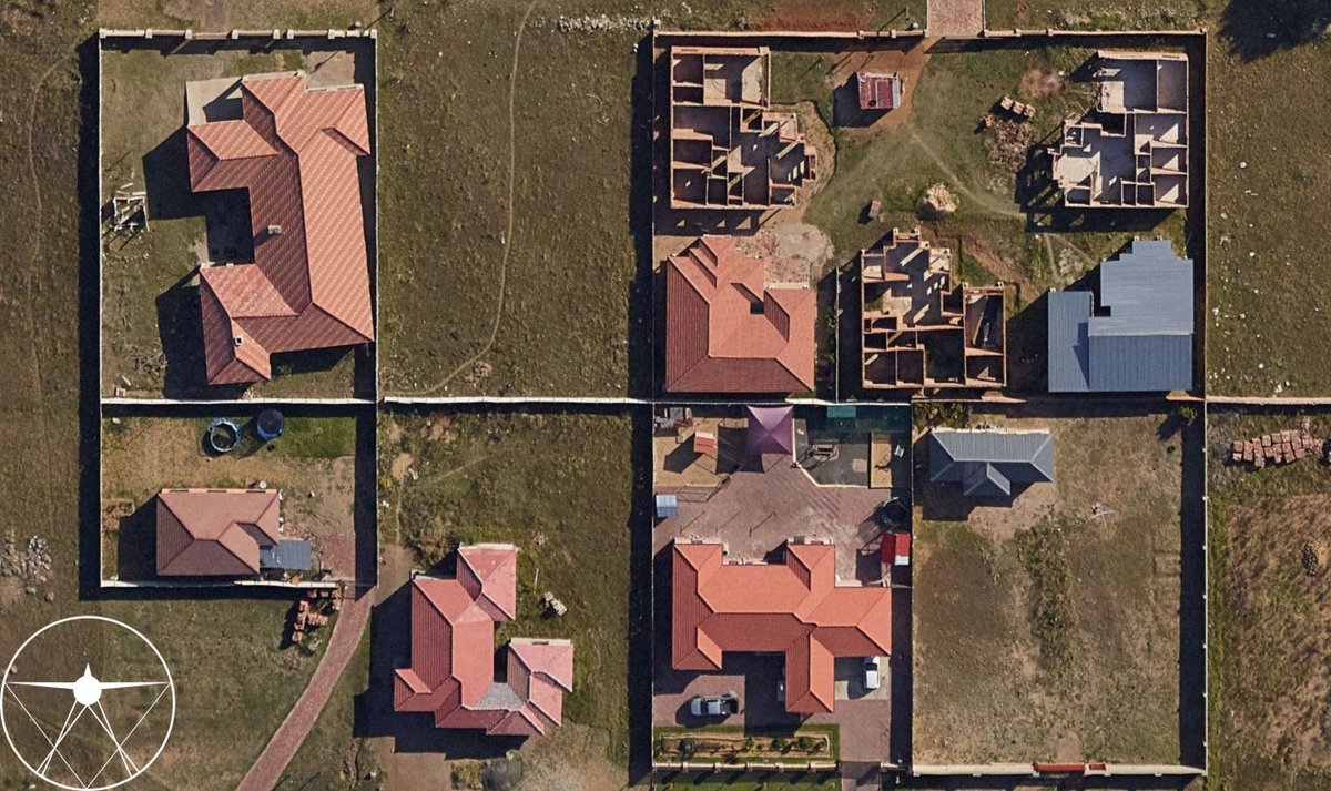
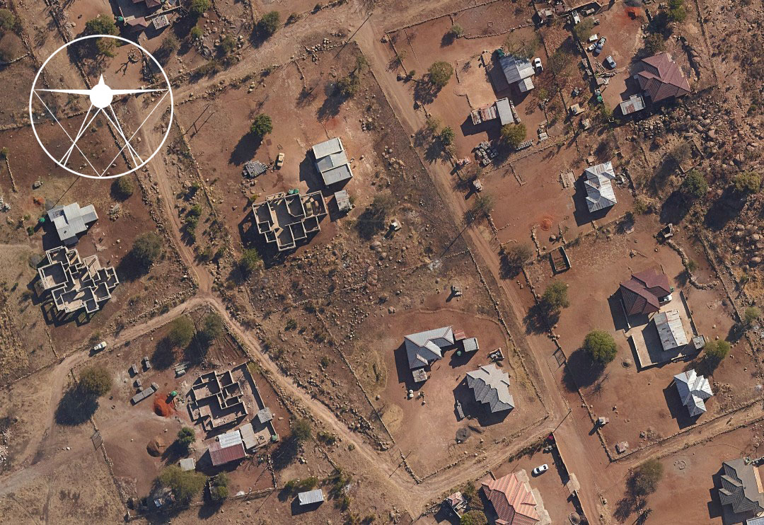
Aerial imagery and high-resolution orthophotos serve as essential base data for environmental monitoring and analysis.
Empowering sustainable planning, informed policy-making, and effective conservation starts with accurate, up-to-date geospatial data.
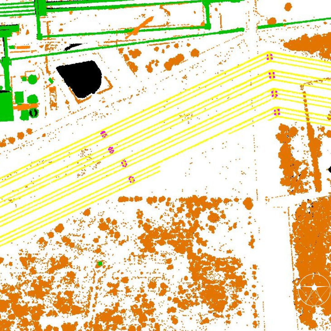
LiDAR technology enables us to classify the point cloud data with pinpoint accuracy!📷 At CAD Mapping, we use LiDAR to create detailed classifications of man-made infrastructure and natural entities, providing the AEC market with valuable insights for their projects.
#CADMapping
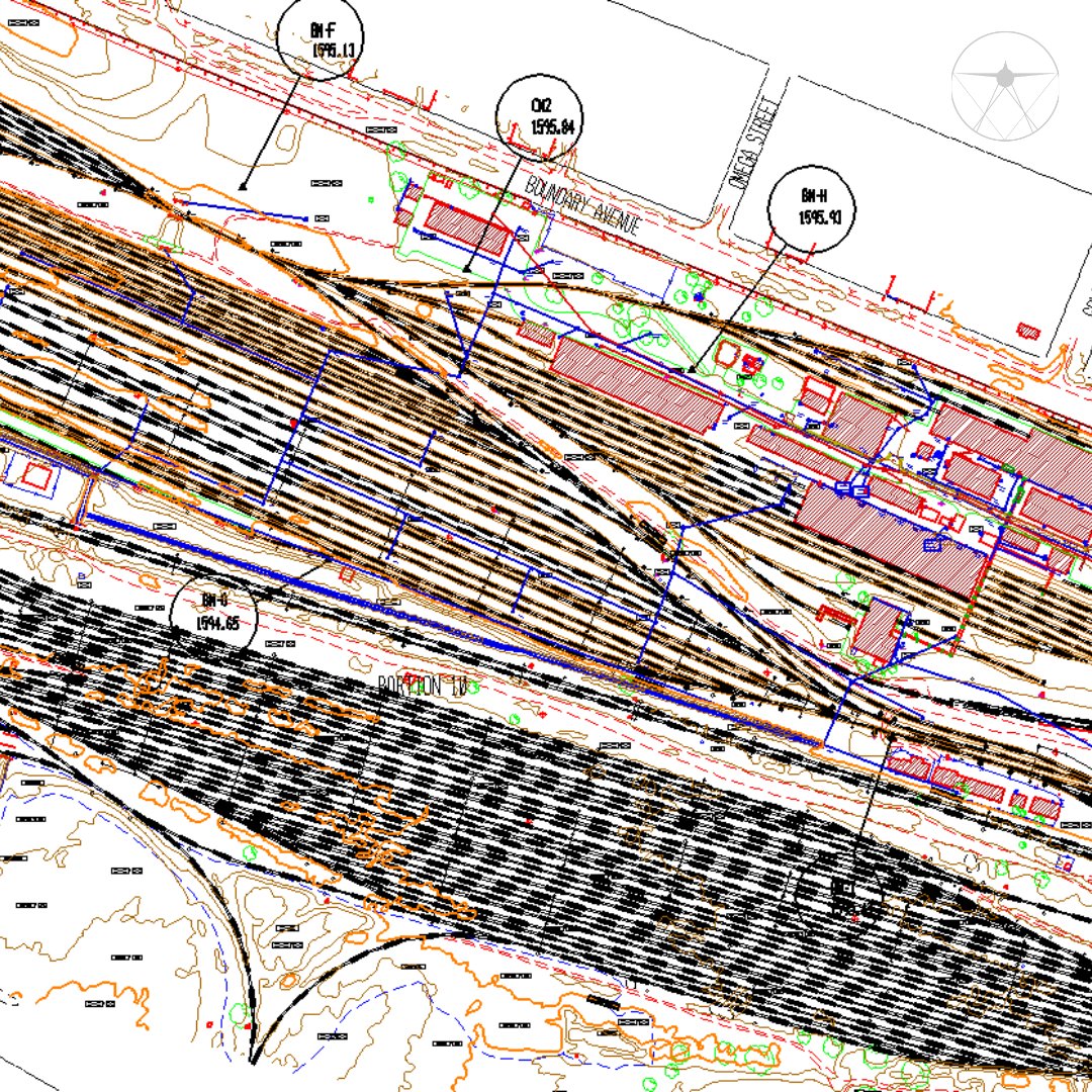
CAD Mapping offers precise photogrammetric detail mapping services for railway station layouts, track alignment, and infrastructure planning, using high-resolution imagery and LiDAR data.
Ready to upgrade rail infrastructure? Let’s get started!
#RailwayMapping#AerialImagery
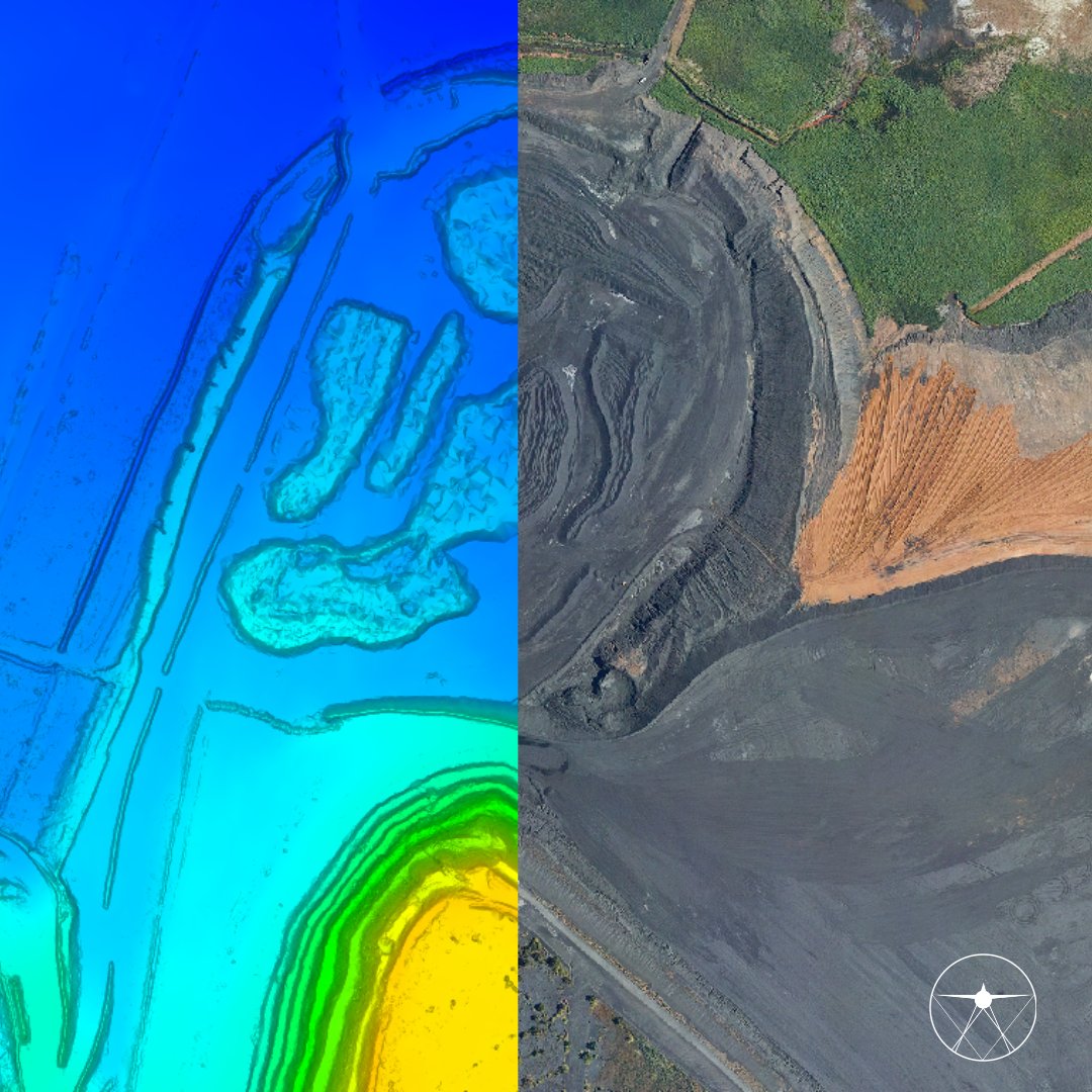
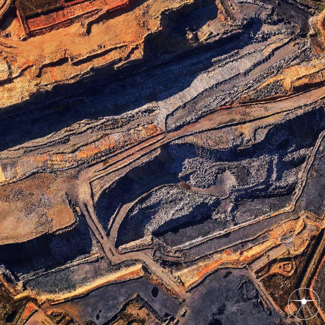
Accurate volume calculation is critical for mining, construction, and earthworks projects. We provide high-resolution imagery and LiDAR data with short turnaround times and precise results
📷 Transform your volume calculation process, reach out today and say goodbye to guesswork!
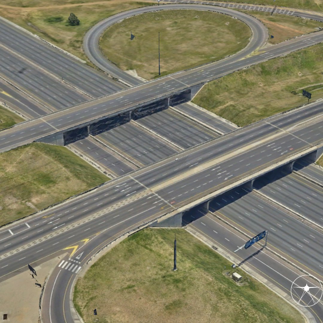
🚧Paving the way for smarter road planning! Transform road planning with precise 3D mesh models from LiDAR and aerial imagery, offering detailed terrain insights for efficient and cost-effective road construction.
#3DModeling#RoadPlanning#CADMapping
🌲Sustainable forestry starts with precise data. Our aerial imagery and LiDAR surveys provide comprehensive forest mapping, helping with tree density analysis, deforestation monitoring, and sustainable resource management.
Preserve, plan, and protect with us.
💧Our detailed aerial surveys and LiDAR technology deliver accurate terrain models, helping ensure safety, efficiency, and sustainability in dam development.
Let’s build the future of water infrastructure together.🌊
#DamDevelopment#InfrastructureMapping#WaterManagement
📡 Efficient. Accurate. Cost-effective. Drone data is revolutionizing how we capture information.
From urban planning to agricultural analysis, our drones deliver unparalleled insights and high-resolution imagery in record time.
Let’s take your project to new heights—literally!
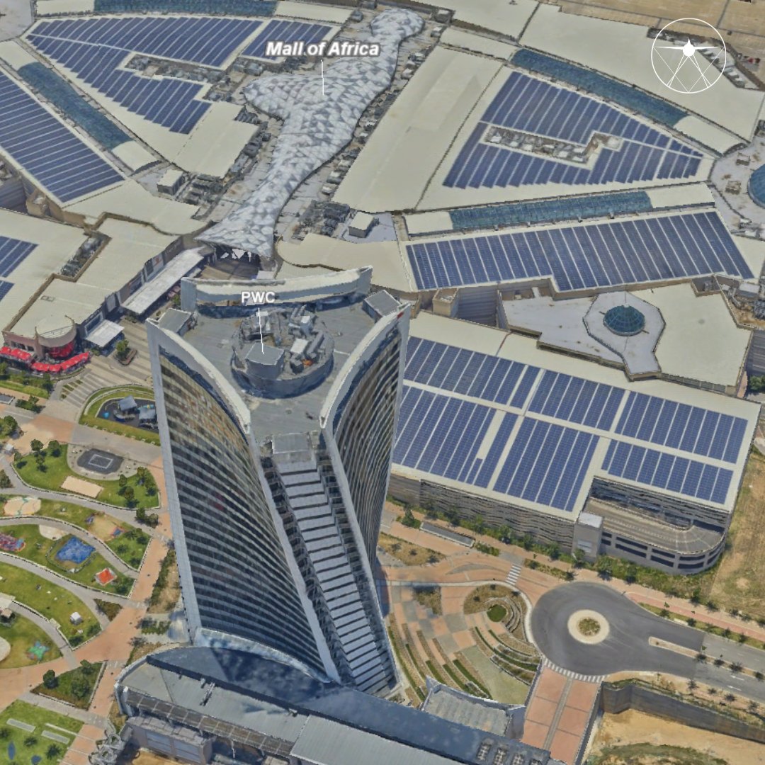
📷 Precision meets innovation with our high resolution aerial imagery and LiDAR! Using photogrammetry techniques and laser scanning, we generate detailed 3D mesh models of any natural and/or man-made asset.
📷 Ready to digitize your assets?
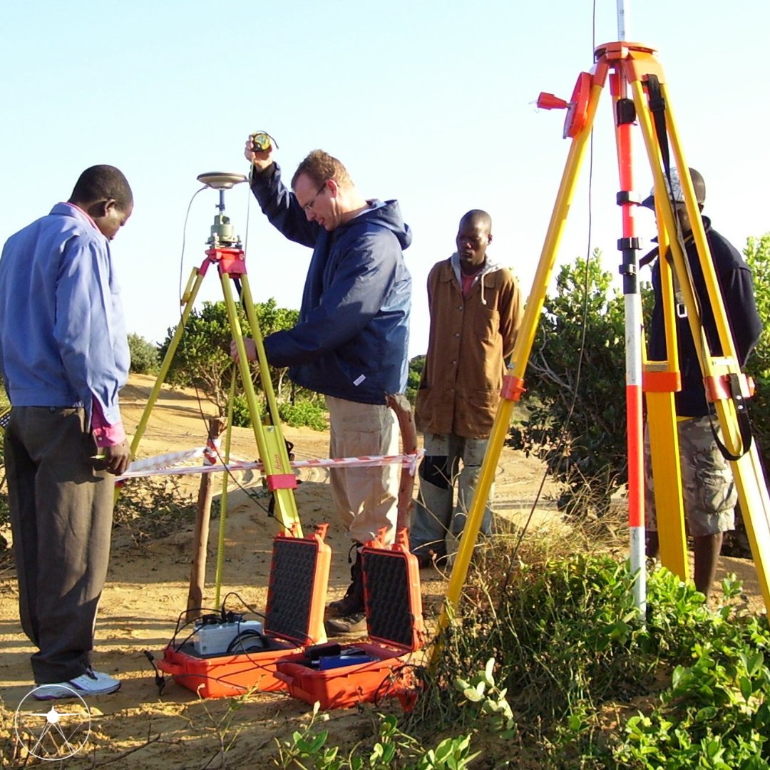
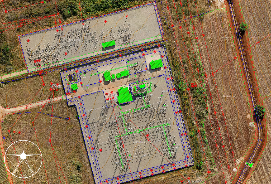
The precise geometric accuracy of aerial photographs and LiDAR point cloud data depends on the careful measurement and placement of Ground Control Points. These critical markers ensure accurate orientation and alignment for seamless mapping results.
#aerialphotography#GCP
⛏ Did you know our high-resolution aerial imagery and LiDAR data are game-changers in mining? We optimize resource extraction and provide detailed volume calculations for accurate planning to ensures your operations run smoothly.
#CADMapping#Mining#LiDAR#VolumeCalculations
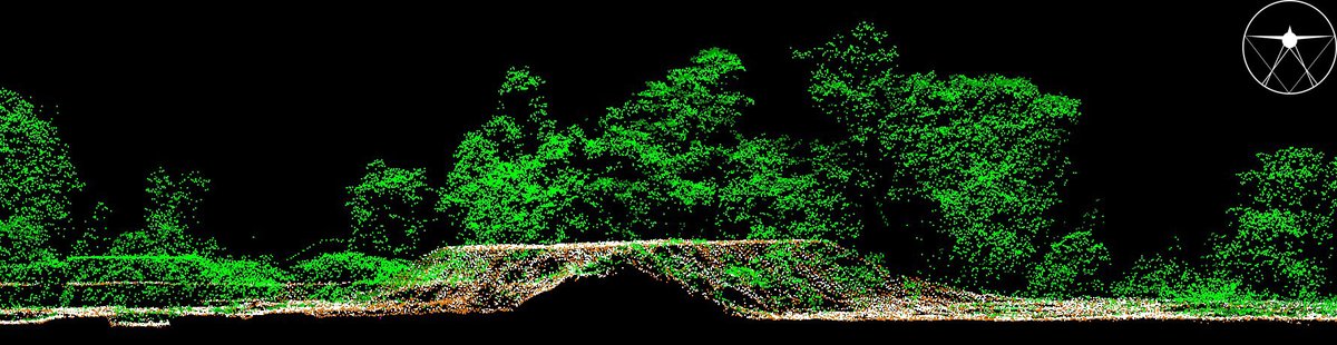
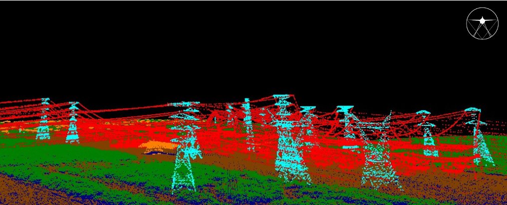
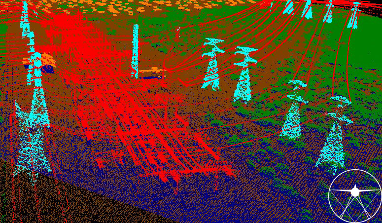
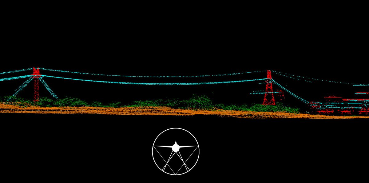
LiDAR point clouds help manage powerline vegetation by measuring distances between tree branches and powerlines, preventing outages and fires. Ensures safety and reliability. #CADMapping#LiDAR#pointcloud#vegetation#monitor
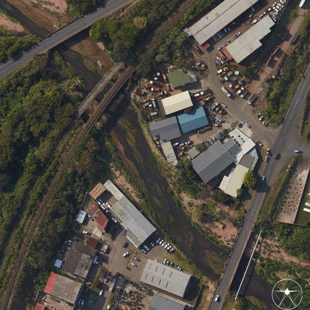
Seamlessly integrate high resolution aerial imagery into your network planning workflow to keep tabs on the planning and execution of your assets without wasting resources and site visits.
#CADMapping#aerialimagery#aerialphotography#network#plan#asset
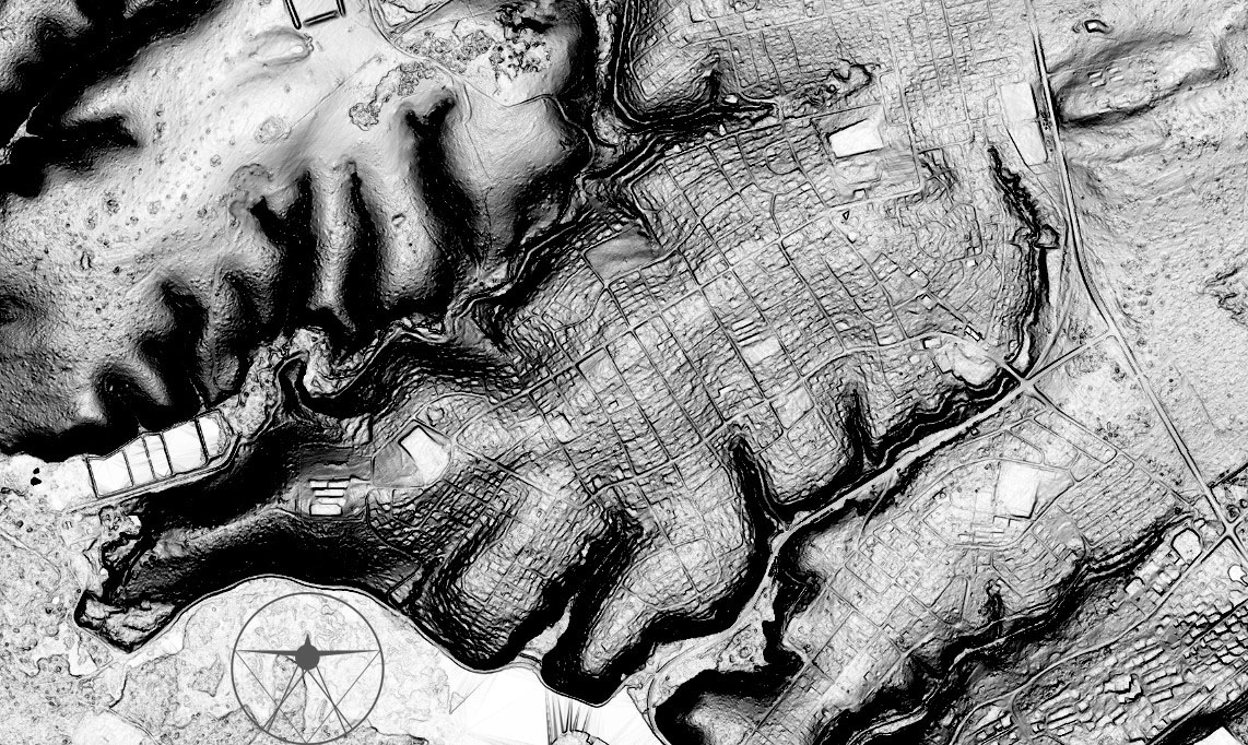
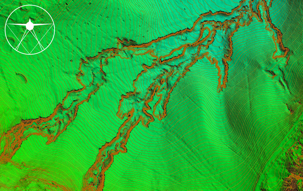
Explore this amazing image of contours and surface models from our latest aerial survey! Our LiDAR data and precise processing capture terrain details with stunning precision. #CADMapping#AerialSurvey#TechInnovation#UAV#geospatial