@NWSBayArea Looks like a tornado touched down in on the main road Scotts Valley. I just saw the aftermath with multiple flipped vehicles and power lines down, but there’s multiple videos and photos on social media with a clear funnel cloud.
@alaskapublic I’m really missing the Iditapod this year! I fell in love with it last year and have been looking forward to it all year. I hope you can bring it back. #iditarod2024
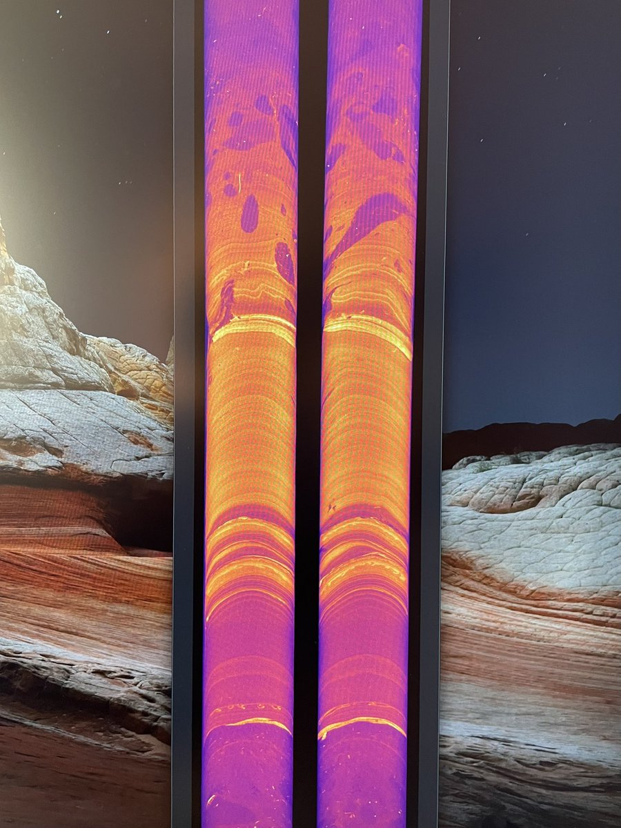
Ever wonder what happens to all those sediment cores we’ve been collecting offshore and in lakes? Here’s a great overview of our USGS PCMSC core lab in Santa Cruz. Full video in the link shows some of our amazing imaging capabilities. #mud#science
By collecting information about the past found within core samples, #geologists contribute towards a better understanding of how conditions may change in the future. Ready for a virtual tour of the @USGS Sediment Core Lab? We thought you'd never ask! https://t.co/OmazN76fWS
To foster scientific exploration and understanding of the seafloor and offshore geohazards, the @USGS and @BOEM have collaborated to expand data access on the National Archive of Marine Seismic Surveys (NAMSS) portal: https://t.co/xTrdSzBU82
@Harold_Tobin Whoa. So interesting. I am in the middle of reading The Deepest Map by Laura Trethewey, which profiles the vessel/sub used here - another recommended read.
This is a super cool new paper that highlights innovative, interdisciplinary methods for addressing earthquake hazards. Nice job @swampmonstah and team!
https://t.co/xerChvComh
@joshritter Several of the rocks around the center one look metamorphic (gneiss, schist), so if it’s from the same place, alas probably not a fossil. Any other other Geo Obies want to weigh in? @MelissaBerke @paulharnik @OberlinGeology
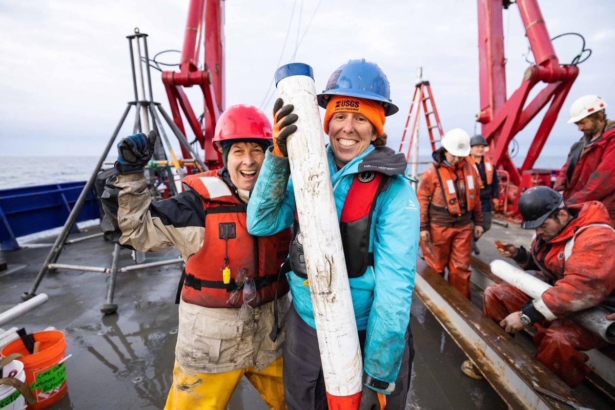
#Fieldwork: @USGS & @uafairbanks researchers are collecting sediment cores from shallow parts of the Bering Sea to reconstruct past #BeringLandBridge vegetation & sea ice and primary productivity as the ice age receded ~8,000-13,000 years ago. #ClimateR_D@NSF
Starting in May 2023 in the Gulf of Alaska, @USGS, @NOAAcharts, and partners are conducting a regional seafloor mapping campaign called Seascape Alaska: https://t.co/Q9wL5rJ0Wf
📷: NOAA
I’m giving a talk @theNASEM today highlighting our work on submarine #landslides & #earthquakes in Cascadia —
Bathymetry and Topography at the Land-Ocean Interface: Committee on Solid Earth Geophysics Spring 2023 Meeting https://t.co/4hvDMFds2S
@patton_cascadia@UW It’s going to be mid canyon (1500m) b/c of instrument depth limitations, but we should get a better handle on bottom boundary layer conditions there, so we can model any flows that run out farther. Although I’m guessing oceanographic triggered flows might not get that far.
Check out our exciting new tool for deep water oceanographic instrumentation. It will be deployed in Astoria Canyon, offshore Washington next month as per our joint project with @UW to investigate #oceanographic vs #earthquake triggered turbidity currents.
The Free Ascent Tripod tested here will be deployed in deep-sea environments along the Cascadia Subduction Zone. It will provide @USGS an up-close look at the seabed, measuring processes such as sediment transport thousands of feet beneath the surface: https://t.co/9sALrimSNk
The Free Ascent Tripod tested here will be deployed in deep-sea environments along the Cascadia Subduction Zone. It will provide @USGS an up-close look at the seabed, measuring processes such as sediment transport thousands of feet beneath the surface: https://t.co/9sALrimSNk