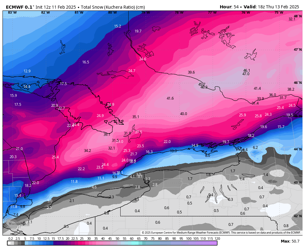
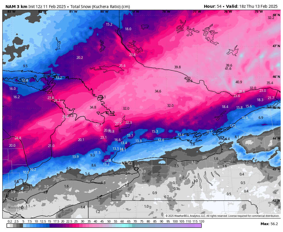
Models have low tracking south meaning more snow but uncertainty on warm pocket of air which could bring temps above freezing by Thur. a.m. reducing amounts for shores of Lake ON - Euro (left) vs NAM (right). 15-25 cm still poss. for Toronto/20-40 cm north of the city. #onstorm
The past week was my last at Global News Peterborough. I’m grateful to everyone who trusted me with their stories, all the friendly faces around the region & to have worked with the most supportive, amazing people for the last 2 years🫶🏼
New snow squall watches are up for late Tuesday and Wednesday. Winds will switch back to the southwest bringing the heaviest squalls into some areas that have yet to be hit like Kington, PEC and parts of Niagara. #onstorm
I need another round of photos for our Dog Walking Forecast!
Reply below with your pup photos (including their name and yours) for our nightly feature. --->
Update 6:20 PM EDT Thurs: Helene now an extremely dangerous Category 4 hurricane
A NOAA Hurricane Hunter aircraft currently investigating Helene recently found that the maximum sustained winds have increased to 130 mph (215 km/h). The minimum central pressure has also decreased to 947 mb (27.96 inches) based on dropsonde data.