New: Severe Thunderstorm Warning for northern Green and northwest Rock counties in southern Wisconsin until 7:45pm. Storm is moving east at 45 mph and capable of producing 60 mph wind gusts. @MyStateline
Tornado Watch issued for Green County in S. WI until 9pm. Keeping an eye on the tornado warned storm east of Prairie du Chien, WI as it moves east this evening. @MyStateline
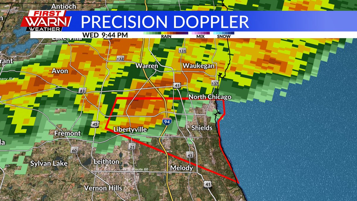
Another round of heavy rainfall with the risk of localized flash flooding possible Wednesday with a couple rounds of thunderstorms moving through. Severe storms are also possible, especially in the afternoon. @MyStateline
Cloud cover sticks with us Monday night as temperatures fall to the mid-50s. There will be a few showers around during the morning with a gusty west wind expected during the afternoon. Highs in the low/mid 70s. @MyStateline
Severe thunderstorm warning has expired for Winnebago, Boone, northeast Ogle and northwest DeKalb counties. It remains in effect for McHenry and northeast DeKalb counties until 7:15pm. @MyStateline
4:35pm: FLASH FLOOD WARNING for southeast Green and western Rock counties in southern Wisconsin until 7:45pm. An additional 1-2 inches of rain is possible, on top of the already 1-1.5 inches that has already fallen. @MyStateline
3:47pm radar update: This storm near the Ogle/Lee County line will be capable of producing some stronger wind gusts around 50 mph. Will continue to watch for further strengthening. @MyStateline
A line of non-severe thunderstorms is currently moving through the region. Biggest impacts will be lightning and heavy downpours. There may be some gusty winds (around 40 mph) in S. WI. @MyStateline
6:42pm: A Tornado Warning has been issued for SE Whiteside County until 7:30pm. This is for the little spin within the line of storms near Geneseo. The storm is moving to the east at 50 mph. The strongest of this storm may remain just south of the county line. @MyStateline
The severe threat has come to an end locally, for now, as we wait for the storms that have quickly developed in southern Iowa and northern Missouri. These will move in our general direction this evening, after 7pm, but the strongest may remain just to our south. @MyStateline
NEW: Severe Thunderstorm Watch issued for all of N. IL and S. WI until 7pm. Main threat with the incoming storms will damaging wind gusts. @MyStateline
The 'marginal risk' that was in place across N. IL & S. WI for late tonight (Tuesday night) has been taken out. While we may see an isolated shower/storm try to develop, the chance/coverage remains low after Midnight. @MyStateline
Severe storm chances will increase locally for both Wed. & Thu. with both days under an enhanced risk for severe weather. A couple rounds of thunderstorms will be possible Wednesday, one in the afternoon & evening. Thursday could see mid-day severe storms. @MyStateline
Showers continue to move east of Freeport, lifting north/northwest into Wisconsin. Once this batch of rain passes, isolated activity can be expected for the rest of the night. Patchy fog will be possible through early Tuesday morning. @MyStateline
While we'll see a little more cloud cover this evening, skies will likely remain dry until very early Friday morning. A southerly breeze will keep overnight lows in the low to mid 60s. @MyStateline