🚨 EMERGENCY ALERT TEST – November 18, 2026
On Wednesday, November 18 at 12:55 p.m. EST, a test of the National Public Alerting System will take place across Ontario.
You may see or hear the alert on: TV, radio or compatible mobile phones and wireless devices. No action is required. This is only a test.
Important notice:
If you or someone you know relies on a hidden phone for safety, be aware that it may emit a sound during the alert. Please turn it off or move it to a safe location in advance.
Please don’t call 911 for information about the test. Misusing 911 for non-emergencies can delay urgent help for people facing real crises.
To learn more, visit: https://t.co/tQFAHlCa6d
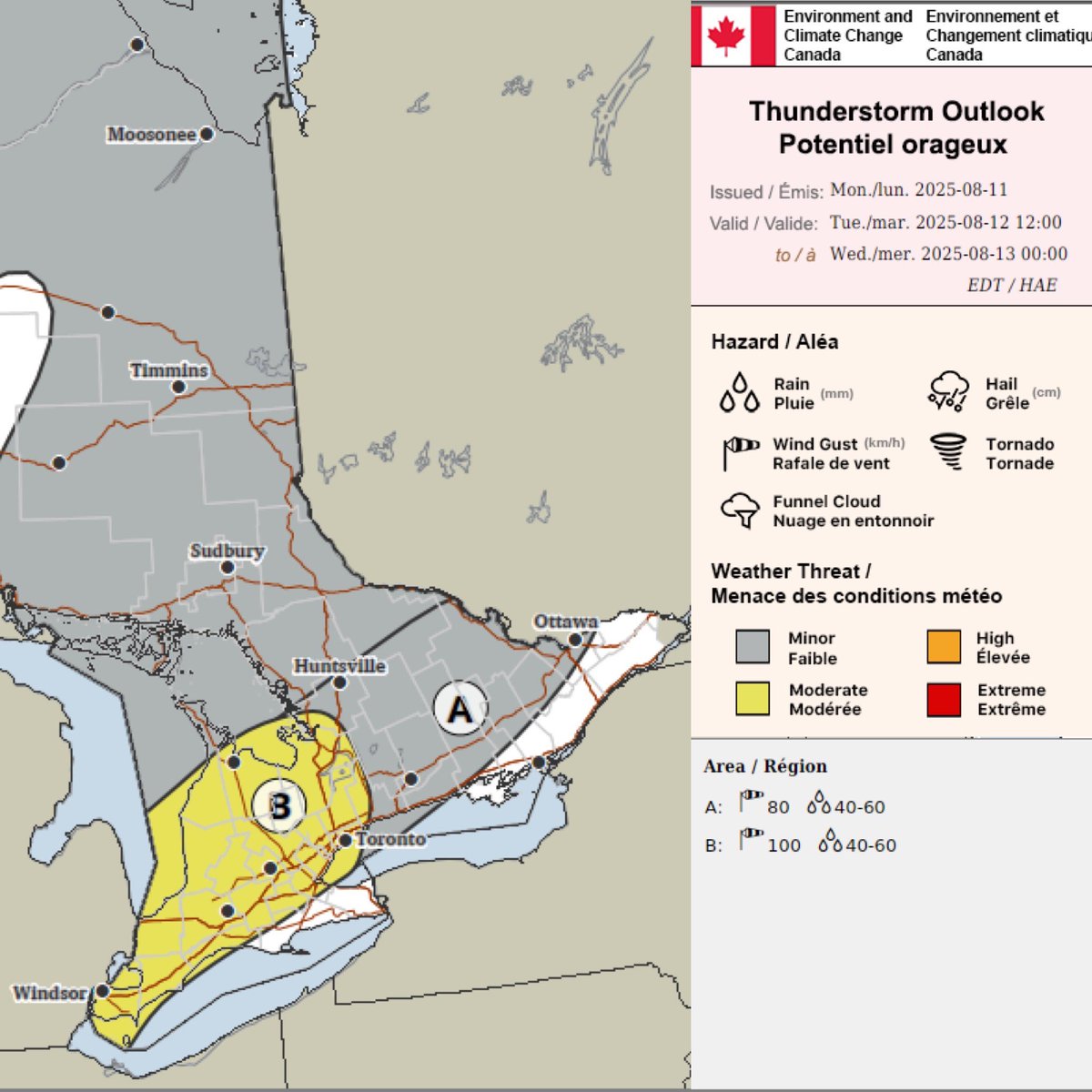
#onstorm ⚠️ BREAKING 💨: Environment Canada forecasting the risk of 100km/h damaging wind gusts & 40-60mm with the risk of flash flooding for isolated parts of Ontario on Tuesday, August 12, 2025 in the “B”, yellow region of the map. This forecast region includes #Toronto, #London, #Barrie, #Windsor, #Sarnia, #Kitchener, #Waterloo, #OwenSound, #Guelph, #Orillia, #Collingwood, #Midland, #StThomas, & surrounding communities.
“A” region has a risk of 80km/h wind gusts & 40-60mm of rainfall.
More details ASAP.
Adam #ontario
#ONStorm#ONwx 🔥 ACTIVE WILDFIRES IN SOUTHERN ONTARIO 🔥
With the ongoing hot and dry conditions across much of Southern Ontario, wildfires have started to pop up over the past 24 hours.
There are currently four active fires in Central Ontario, with three not under control and one being held.
Three of these fires are burning in the Kawartha Lakes region, east of Lake Simcoe, and the fourth is located south of Bancroft. They range in size from 1 to 5 hectares. Water-bombers have been dispatched to help battle the flames and slow the spread.
The largest blaze, named HAL019, is located north of Bobcaygeon. It was reported today at 5:03 PM and has already grown to 5 hectares.
Please respect all local fire bans that are currently in place. Many municipalities in these areas have total bans on any outdoor burning, and it’s clear why as these fires are spreading fast.
Let’s hope crews can get these under control quickly and prevent any further spread.
- Brennen
7:13 PM - Saturday, August 9, 2025
On this day 15 years ago One Direction started a journey that created a whole lot of history. This is for Harry, Liam, Louis, Niall, Zayn and all of the Directioners. Liam Payne you will be forever loved.
#OneDirection#OneDirection2025#15YearsOfOneDirection#15YearsOf1D
Just a reminder my Canadian friends. Many spring projects.
Home Depot is 100% American owned. The owner is Bernard Marcus is a huge Trump supporter.
Home hardware is 100% Canadian owned.
Pass the word repost.
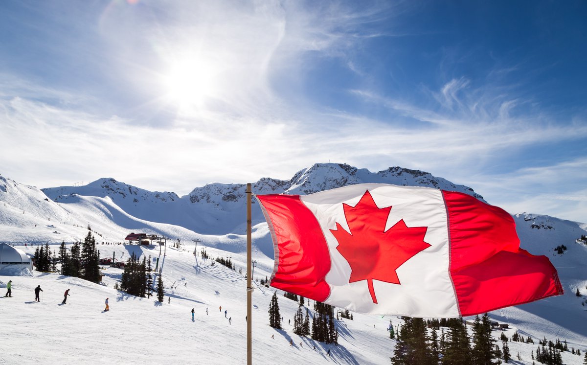
The iconic #Canadian flag was first raised in 1965, and it represents the values we all cherish: generosity, openness, respect and equality! Share your pride and drop your photos of #Canada’s flag raised in your area! #CanadianFlag 🇨🇦
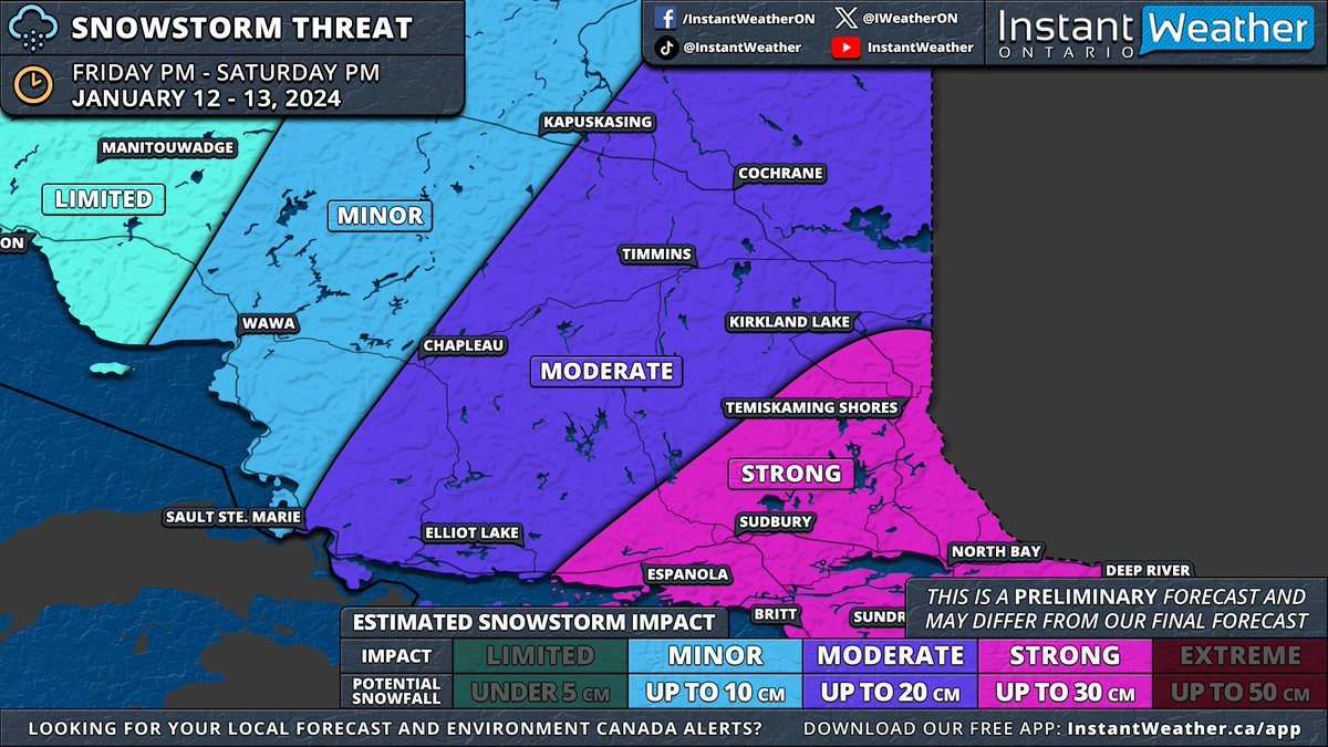
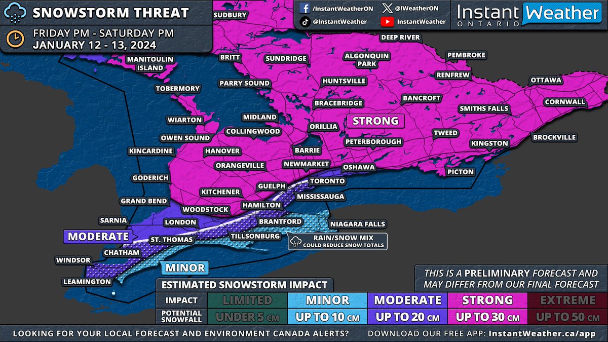
#ONStorm#ONwx ❄️ SNOWSTORM PREVIEW: Widespread Significant Snowfall of Up to 30cm on the Way for Most of Southern & Northeastern Ontario
📅 Friday, January 12 - Saturday, January 13, 2024
——
After reviewing the latest model data from this evening, it appears increasingly likely that Southern Ontario will experience its first widespread significant snowstorm of the season starting Friday.
We'll publish a detailed forecast article in the morning. For now, here's an early look at the forecast maps based on this evening's model runs. Remember, this forecast is preliminary, as the storm is still about 36 hours away. Although there's time for model adjustments, any changes should be minor given the high confidence in this event.
Before Friday's main event, a weaker system will pass through Southern Ontario on Thursday morning and afternoon. While significant accumulation isn't expected, a few centimetres may cover Central and Southwestern Ontario, including the Greater Toronto Area. Lake enhancement east of Lake Huron could increase totals to 3-6cm in the Owen Sound to London corridor, tapering off by late afternoon.
The main storm is expected to start between 2-5 PM on Friday, beginning in Extreme Southwestern Ontario. Initial bands could bring heavy snowfall, with rates of 5-10cm per hour, and the potential for thundersnow, a phenomenon we haven't seen since last winter's major blizzard. ⚡️
Strong wind gusts of 60-80km/h, locally reaching up to 90km/h, will likely create treacherous driving conditions. Areas might experience localized blizzard conditions, especially in Southwestern Ontario, the Golden Horseshoe, and parts of Central Ontario.
These heavy snowfall rates will move through Southwestern Ontario, affecting London, Kitchener, and Hamilton by early evening. The Greater Toronto Area will experience this intense snow later in the evening, eventually spreading northeast to Central and Eastern Ontario, continuing overnight into early Saturday.
While the heaviest snowfall will be brief, moderate snow will persist behind the initial band throughout the night into Saturday. Around the Lake Ontario and Erie shorelines, a brief surge of warmer air Friday night into Saturday morning could lead to a temporary changeover to rain, potentially reducing snowfall totals in the Niagara region and parts of the Greater Toronto Area near the lakeshore.
A sharp cooldown early Saturday morning will bring temperatures back below freezing, switching precipitation back to snow and creating a risk of flash freezing. Icy road conditions are likely on Saturday morning.
By Saturday's end, most of Southern Ontario, excluding Deep Southwestern Ontario and the Niagara region, can expect 15-30cm of snow. The Lake Erie shoreline and Niagara region are projected to receive 5-15cm, while the Greater Toronto Area could see 10-20cm, with higher amounts further from the lakes.
This event will also affect Northeastern Ontario with over 20cm of snow on tap for Sudbury, North Bay and Temiskaming Shores starting late Friday evening and continuing through Saturday.
As the system exits, lake effect snow will intensify late Saturday around Lake Huron and Georgian Bay, with snow squalls likely into next week. This could result in substantial snowfall over the week in areas like Goderich, Kincardine, Hanover, Owen Sound, Wiarton, Barrie, Orillia, Midland, Bracebridge, Huntsville, Parry Sound, Britt and Sundridge
We'll provide more details in our full forecast article on Thursday morning and a final forecast with precise totals either Thursday evening or Friday morning.
- Brennen