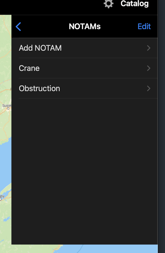
Custom text and graphical NOTAMs for Waypoints and Airports for @foreflight content packs now available in @cartolake 1.5. These are enterprise features. Contact us at [email protected] for more info!
We implemented support for third party tile server access to our seamless USGS topo quad layer. Contact us at [email protected] for more info! #gis#mapping
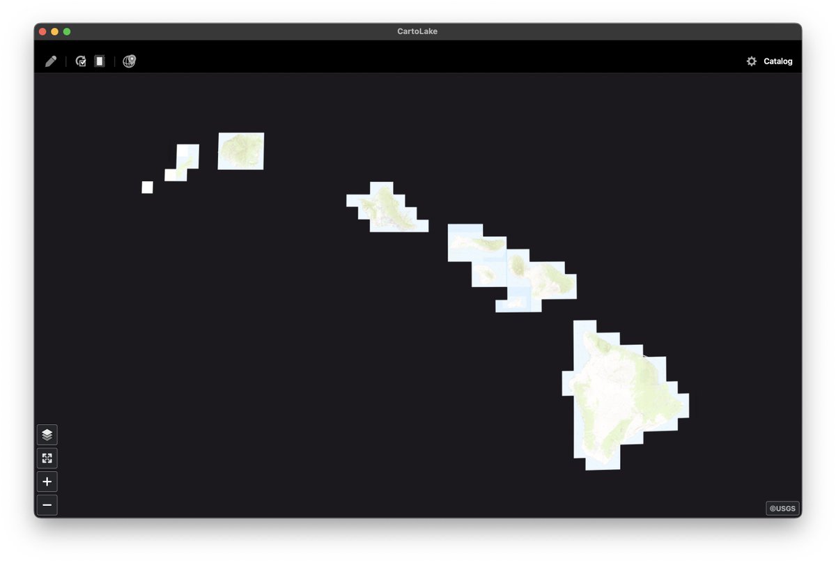
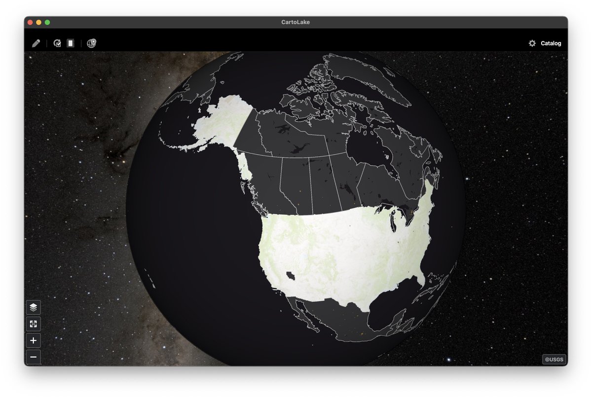
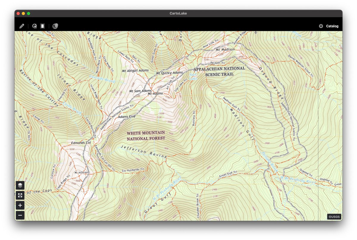
Did you know? The CartoLake app includes a seamless layer of all 65,000+ USGS Topo quads stitched together. Contact us if you're interested in licensing this layer in your own project. #gischat
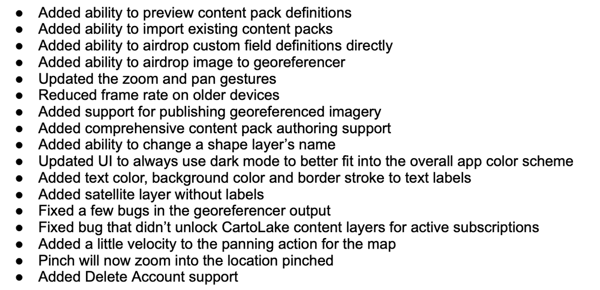
It's been a busy month since 1.4 has been released. Some bug fixes, but a whole lot of new functionality. Many thanks to all the user feedback! More to come in October! #gis#mapping
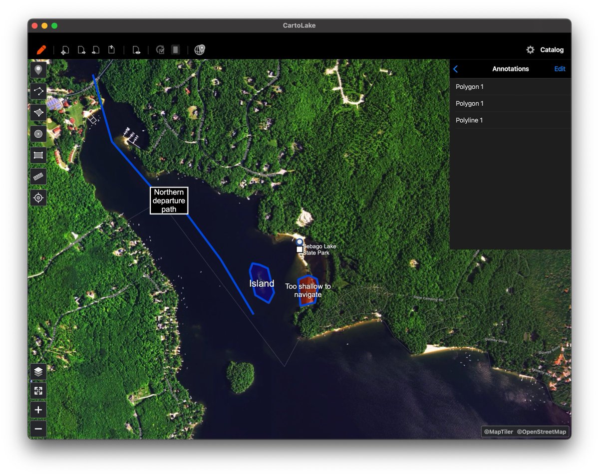
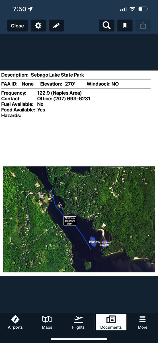
Quick demo of creating a @ForeFlight content pack in @CartoLake. Add geographic annotations to every navigation waypoint and have them exported as PDFs.
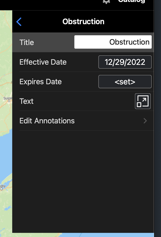
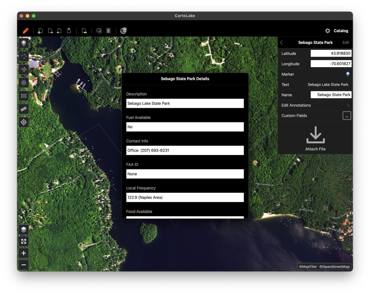
ProTip: CartoLake allows you to create map annotations for each @ForeFlight content pack navigation waypoint by tapping "Edit Annotations" on the waypoint properties.
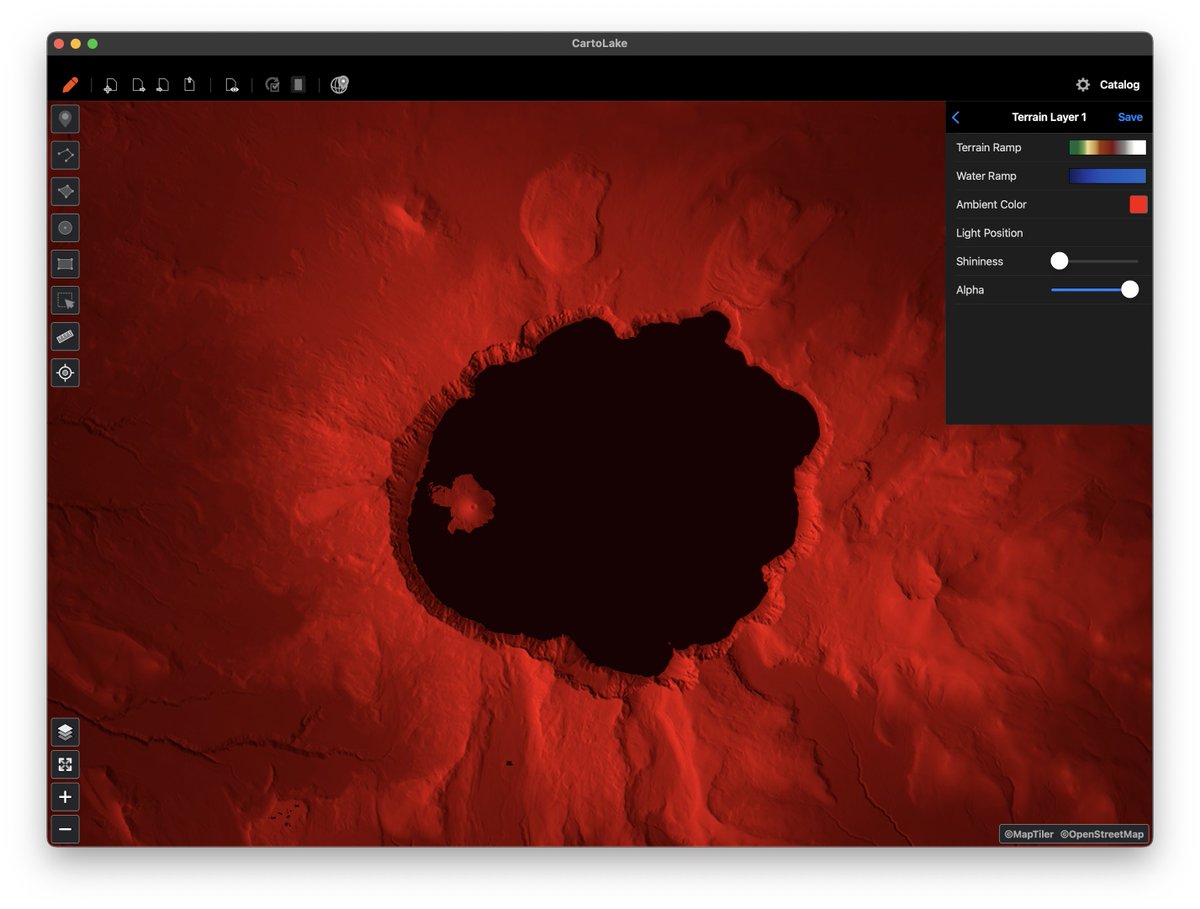
CartoLake can georeference even the craziest of images, like this oblique shot from a DJI drone. The image can then be processed into a tile set for use in other mapping applications. #gis#dronemapping#dji
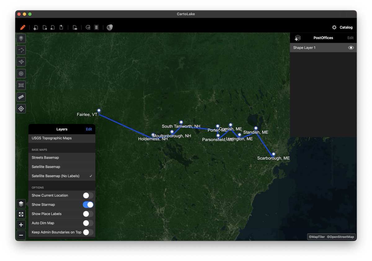
What base layers do you find easiest to add content on top of? Pending version of CartoLake will come with a satellite layer without labels for cleaner user maps. #gischat
Custom Fields (user defined), PDF Layout, Waypoint annotations that are drawn in the PDF and more coming to @ForeFlight content pack authoring very soon!
Version 1.2 is now available in the App Store and includes some new supported file formats and simple georeferencing capabilities!
https://t.co/B44nG01xgO
Dynamic Georeferencing is coming soon in the app. This allows for instant feedback on moving reference points. Useful for nudging non-standard maps into the best fit. #gis#mapping