Municipal Emergency Manager | Former Healthcare EM and in a past life a Biomed | current volunteer first responder, retired Hazmat Chief | opinions are my own.
The Office of the Fire Marshal wants to remind residents and business owners to take care when clearing snow and ice from buildings.
Falling ice and snow can damage propane storage tanks, piping, lines and other equipment. Avoid tossing snow where equipment is located.
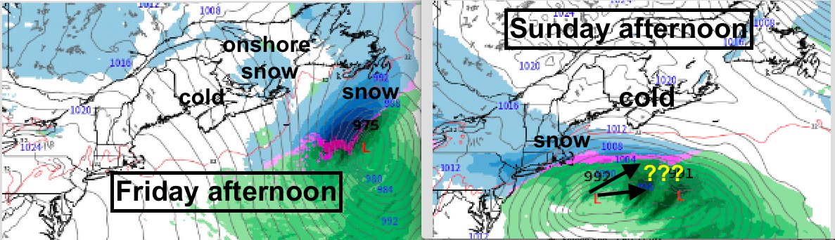
Storm watch: fine next 3 days.
Snow from a storm passing south NS Friday may be a miss; a COLD north flow with onshore Gulf snow the most likely outcome.
On Sunday another storm approaches; cold air may keep snow to south?
Next Wed's storm forecast to be wind & rain?
Stay tuned.
During storms, you often ask us how we decide who gets their power back on first. Chris, our Director of Customer Care, has the answer.
For more information on how we prioritize power restoration for our customers, visit https://t.co/IuaqGzBWlI.
Emergency alerts share critical information about potentially life-threatening situations. We’ll be testing the emergency alert system on TV, radio and cell phones at 1:55 pm on November 15, 2023. Visit https://t.co/B6qjPQj9xr for more information. #AlertReady
When using a portable generator, always follow the manufacturers maintenance and operating instructions.
When choosing your exterior location, be sure that exhaust fumes will not enter the house through exterior vents or nearby windows or doors.
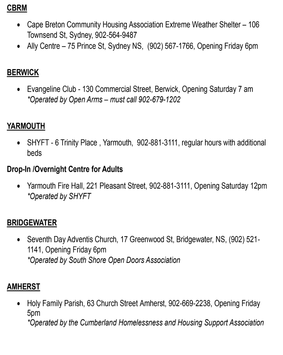
DCS, in cooperation with its service providers and municipalities, is preparing for the potential impacts of Hurricane Lee in the coming days. The following thread will detail shelter options. Anyone looking for supports can also call @211NS for resources in their community. 1/12
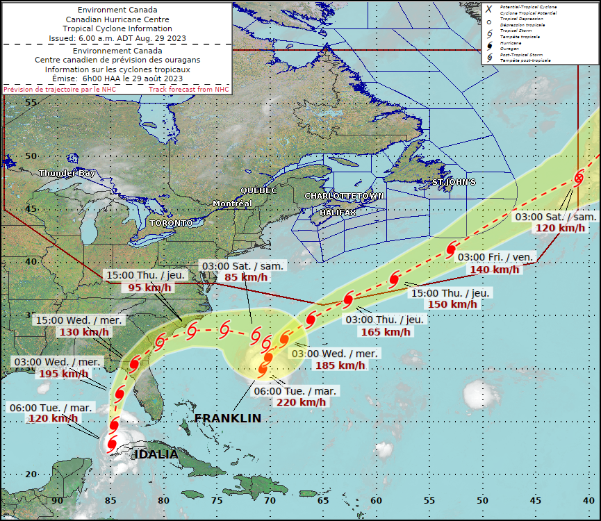
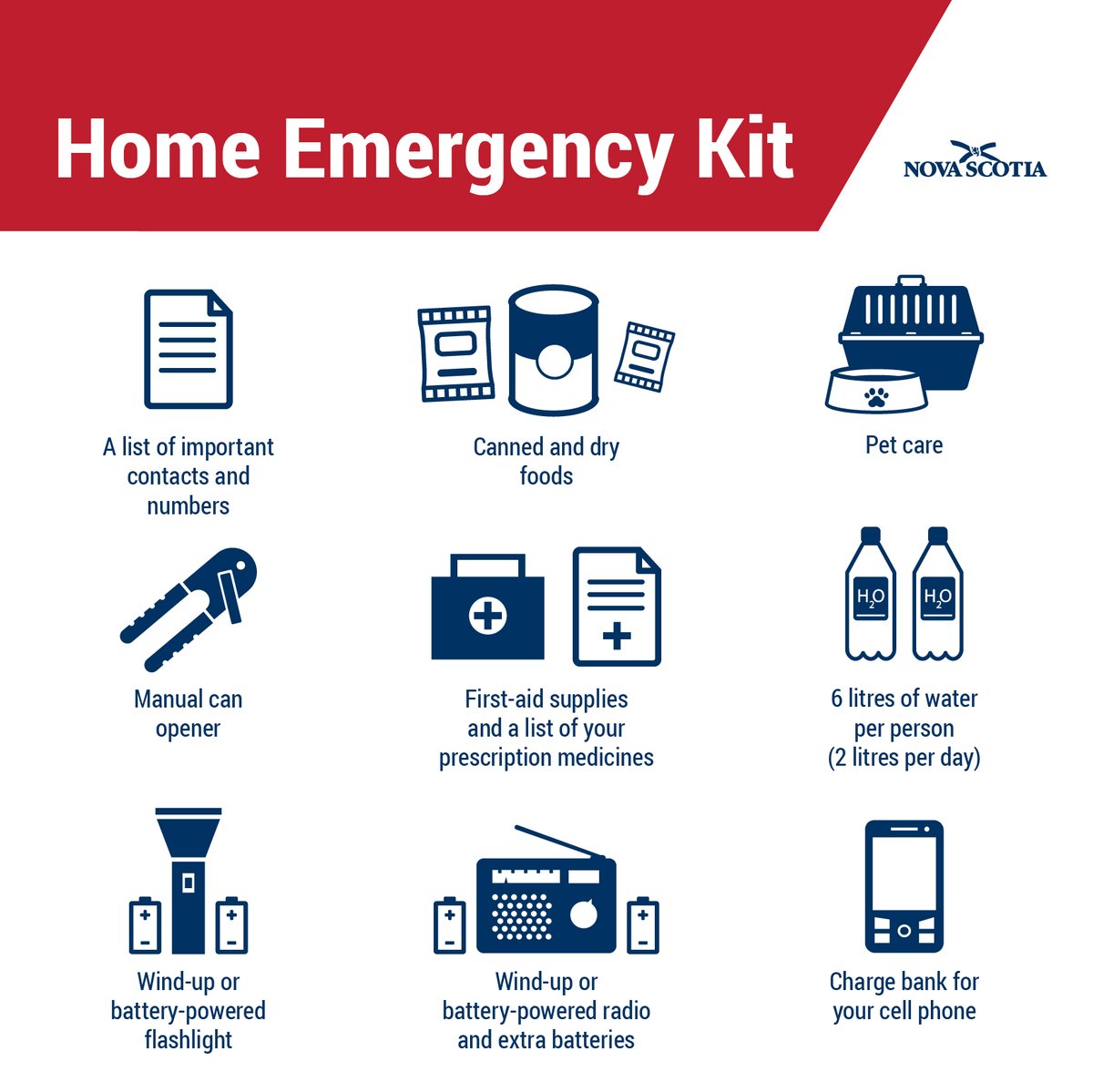
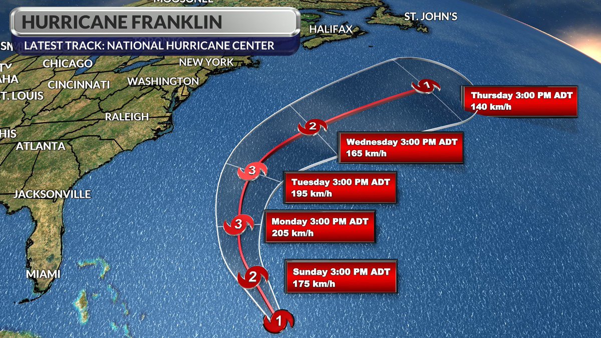
Franklin’s path has moved further from Nova Scotia, but we are still in hurricane season. Now is a good time to prepare an emergency kit with enough food, water and medicine for your family for at least 72 hours. Here is a checklist for your emergency kit: https://t.co/6Z1qr7NbYW
The high resolution models correctly identified most of the threat areas for heavy rain; the Fundy coast being the most impressive... pic shows totals up until 6am this morning.
You can prepare for hurricanes before they reach our shores. Cut down dead trees or branches, remove loose outdoor objects, and prepare your emergency kit. For an emergency kit checklist, visit: https://t.co/vR8s3a8afJ
Mainly sunny today. Starts off sunny Fri then cloud followed by late day showers in the west.
Rain moves across Maritimes Sat; tapers to showers W to E Sunday.
Almost all models keep the centre of Franklin offshore NS (still a heavy rain & surf risk).
Landfall threat for NFLD.
I could honestly rant about this for hours, but I’ll conclude by saying that even if some of said information verified (which I’m not saying will) the fear-mongering right now does nothing but make an already anxious Atlantic Canada more panicked.
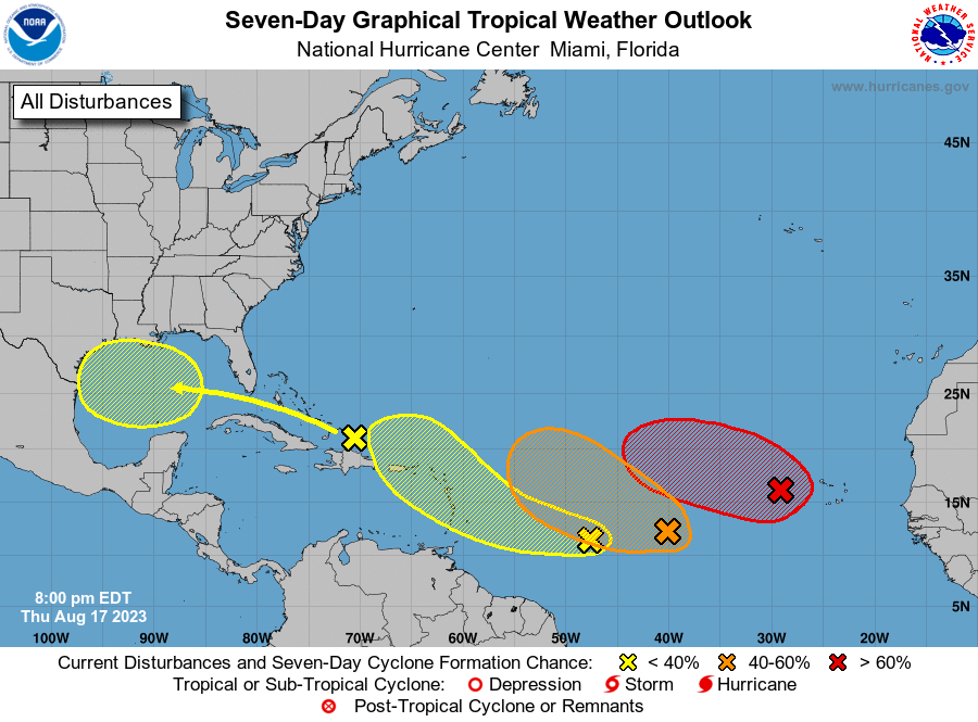
8pm EDT Thursday 17 Aug -- It is a busy outlook map tonight in the Atlantic. In addition to #98L & #99L with a high 🔴 & medium 🟠 chance of genesis respectively, 2⃣more areas further west have a low 🟡 chance of genesis in next 7 days.
Latest Outlook-->https://t.co/DboWSR44Dt
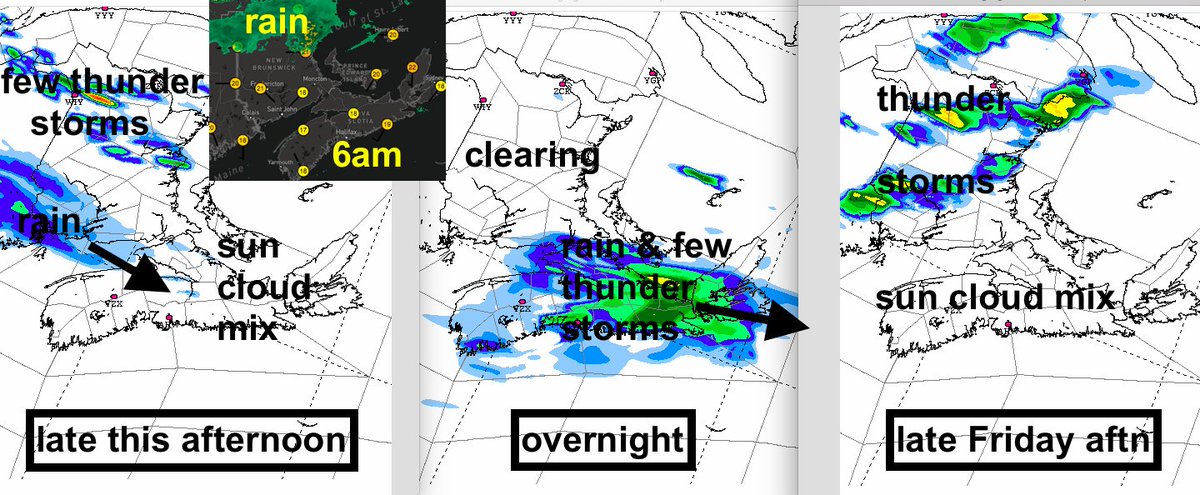
Fog/low cloud retreats to a warm sun-cloud mix today. Rain in extreme N NB moves off this am, but a few late day thunderstorms develop.
In S Maritimes a band of rain/thunder moves in tonight leaving Fri am; 15-25mm (double that in t-storms).
Skies clear Fri; a few t-storms NB.