The latest visible satellite imagery shows some breaks in the clouds developing across central NC, particularly over the western Piedmont. This will help to further destabilize the atmosphere and assist in severe storm development. #ncwx
Preliminary analysis of snowfall during the last 48 hours ending at 7 pm Sunday December 9th. This analysis will be refined as additional reports are received overnight and tomorrow morning. We will post an updated map on Monday.
[ALERT] All WCPSS schools will be closed on Monday, Dec. 10. More: https://t.co/w9dI173Gc2 // [AVISO] Todas las escuelas de WCPSS estarán cerradas el lunes, 10 de diciembre. Mȧs: https://t.co/w9dI173Gc2
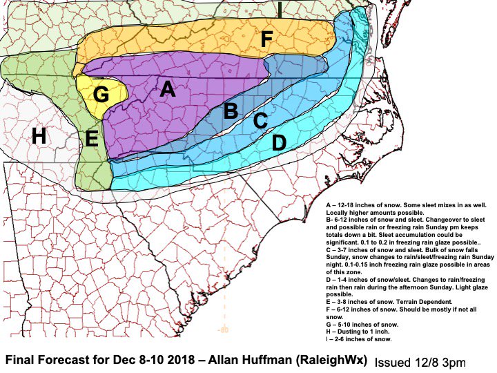
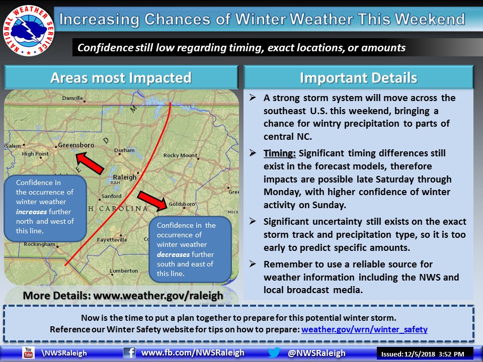
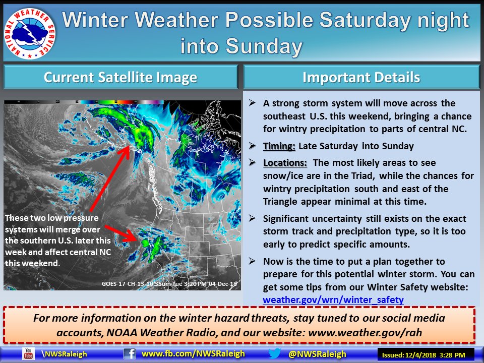
Increasing chances of winter weather this weekend, but too early to predict specific amounts. Continue to monitor for updates on our website, Facebook, and Twitter pages! #NCwx#winterweather
Winter weather is possible in parts of central NC late Saturday into Sunday. The best chance for snow/ice is across the Triad, with chances decreasing farther south and east. However, significant uncertainty still exists, and it is too early to predict exact amounts. #ncwx
The scenario for many is precip starts as snow or snow/rain changes to sleet/freezing rain, rain (depending on how much the CAD erodes), then ends as snow. Event could begin as early as Saturday evening/night for some, and may last through Tuesday for many.
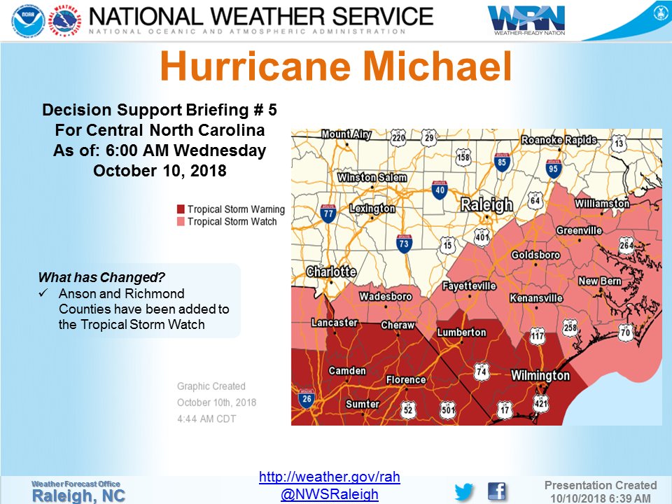
Here are the 6 AM briefing slides for central NC for Hurricane #Michael. As of this advisory, Anson and Richmond Counties have been added to the Tropical Storm Watch. #ncwx
For a .PDF of the briefing please visit:
https://t.co/MgPmEWs1wV
RUMOR CONTROL: PWC is NOT shutting the water off to customers. We aren't sure where this completely false rumor started, but it is 100% incorrect. Your water services will remain in tact.
The Cape Fear River has reached flood stage at Fayetteville this morning, with SIGNIFICANT rise still to come. This will be very dangerous flooding over the next few days. #HurricaneFlorence
#NCNG Major General Gregory Lusk: Over the next few days, it is important to note that there will be a lot of helicopters in the air. Please keep drones out of the air. It will make it hard for rescue helicopters to fly.
WITN is looking for a John boat or something similar in the Jacksonville area so we can get fuel to our news crews. If you can help please contact our news room at WITN 252-439-7770