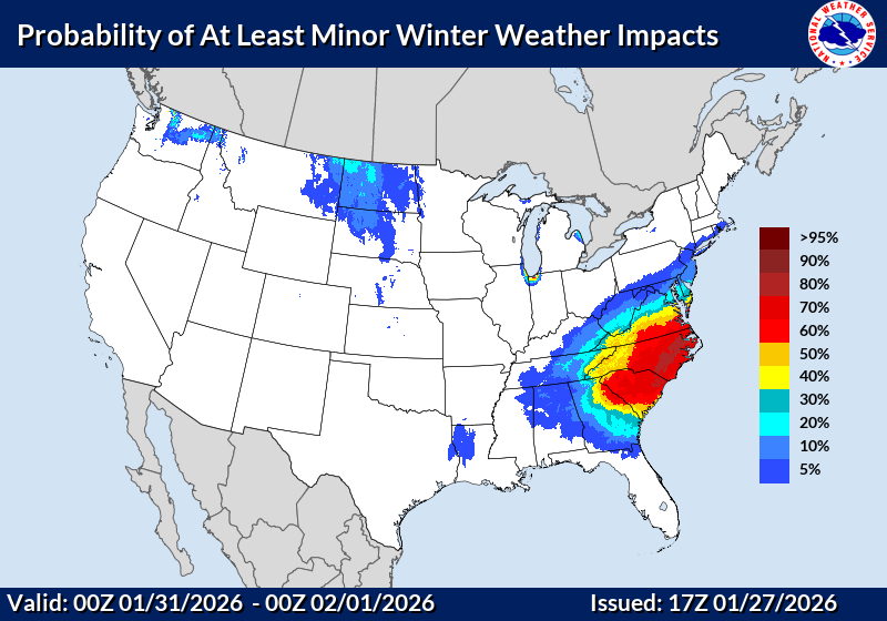
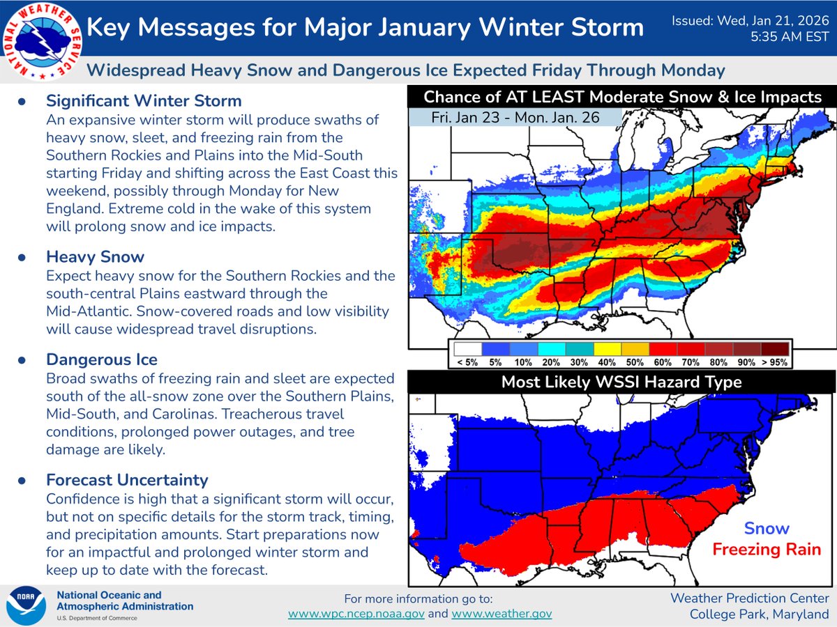
There is growing confidence in potential winter weather that favors snow this weekend. Details including timing, impacts, and amounts are low in confidence with the event 3-5 days out. We will continue to monitor trends through the week and keep you up to date.
#scwx#ncwx#gawx
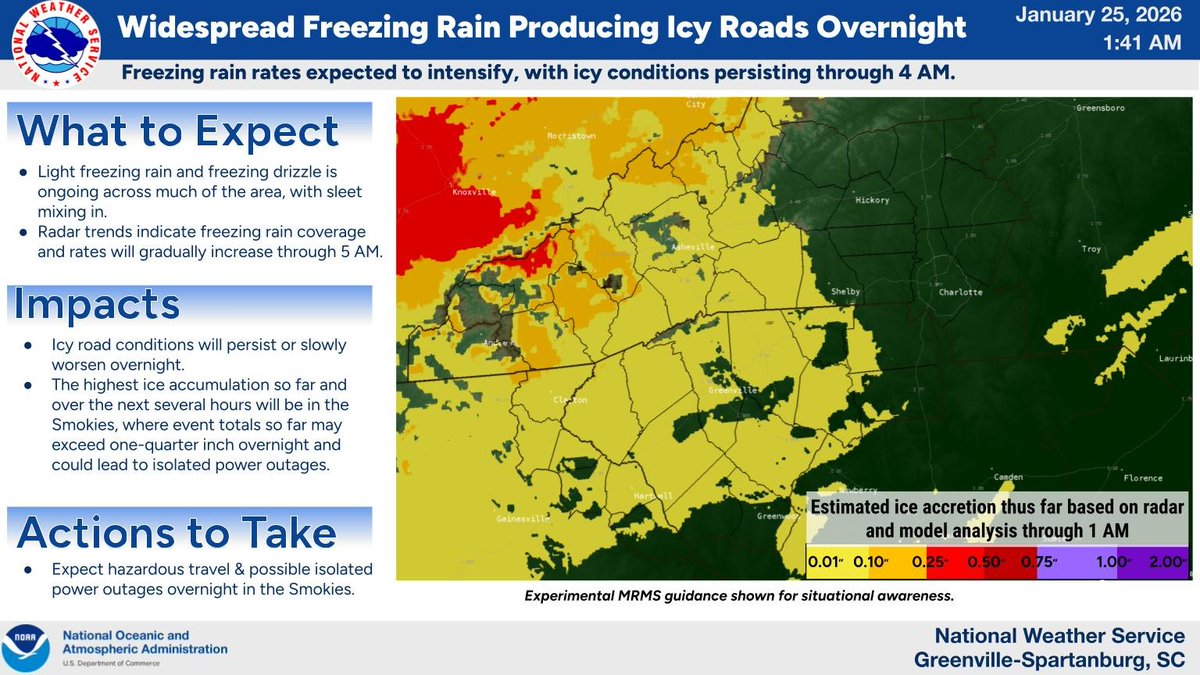
Freezing rain and freezing drizzle is ongoing, with icy roads already reported. Radar trends indicate coverage and intensity of freezing rain will gradually increase overnight, leading to worsening travel conditions into the early morning hours.
Here's the latest forecast on storm total snow/sleet and ice accumulations today through Sunday night. A major ice storm is still on tap. Make sure to finish any preparations today. Precipitation rates ramp up this evening.
#ncwx#scwx#gawx
Guidance for the Major Winter Storm shifted north a little overnight, further expanding the areas forecast to be impacted Friday through this weekend. Here are the latest Key Messages.
Very windy conditions develop across the area today behind a departing cold front. This combined with a cold airmass moving in as well, will lead to wind chills in the single digits above and below zero across the NC mountains and teens to lower 20s elsewhere. #ncwx#scwx#gawx