Not a cloud in the sky across mid-MO! The sunshine has been amazing, but these winds are kind of stealing its thunder. Tomorrow the winds die down and we finally warm up, but we don't get the sun for too long with rain rolling in later this week! I'll have more details at 5 & 6!
Looks like a beautiful night down at the lake! Overnight tonight the clouds will head out of mid-Missouri, and we will be welcomed with abundant sunshine tomorrow. The only downside is that the wind looks to stick around for the next couple of days. I'll have more details at 10!
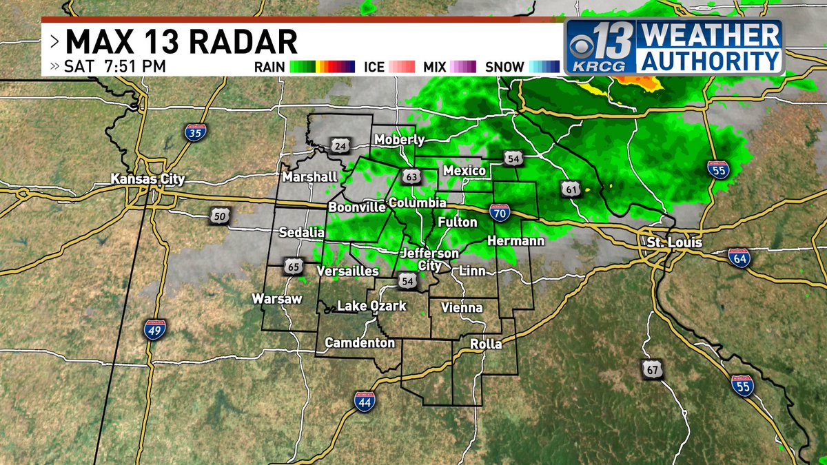
As the cold front approaches, we are seeing showers move through before the cold air digs in. Conditions behind the front will be chilly and breezy, dropping temperatures to the low 40s overnight. Waking up tomorrow, it will be another chilly day. I'll have more details at 10pm.
Scattered showers are moving through Pulaski, Phelps, and Camden counties. Those will continue for the next couple of hours before we are dry overnight. Most of us will reach 70 degrees tomorrow before cooler air moves in Sunday. I'll have more details tonight at 6 and 10!
A beautiful sunset down at the lake! Don't let that fool you because we still are expecting chilly temperatures near freezing overnight. Hopefully the mostly sunny sky and southerly breeze will make up for it tomorrow! I'll have more details at 10. #midmowx
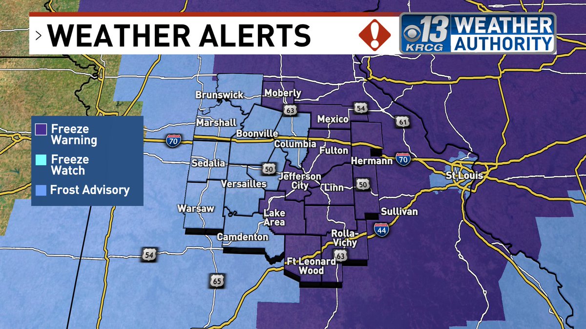
After a very chilly Earth Day, colder air builds in to the area overnight. Morning lows will be in the low 30s along with frosty conditions. The sun will come out tomorrow, but mid-Missouri will hold on to below average temperatures for a while. I'll have more details at 10pm.
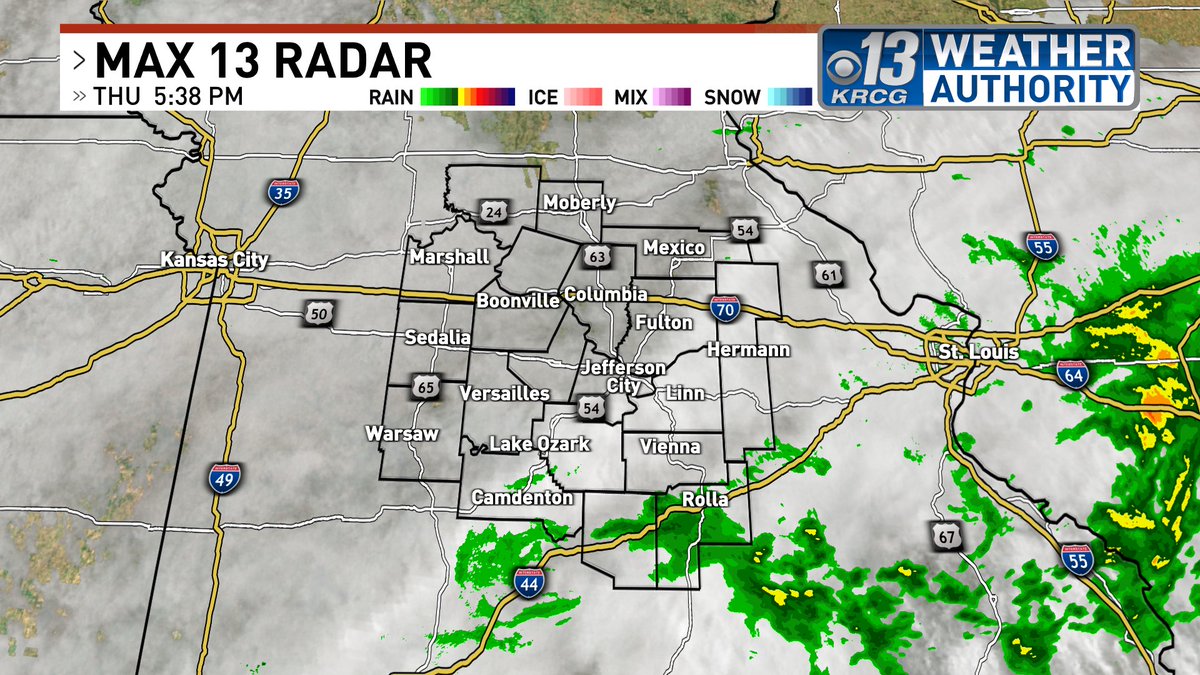
Scattered showers and storms have moved across the area this afternoon following a warm front. We will stay dry overnight tonight and tomorrow, but showers and thunderstorms move in Thursday. I'll have more details tonight at 5 & 6. #midmowx
After a very stormy and cloudy weekend, we finally got a glimpse of sun before sunset. Tomorrow is looking up for mid-Missouri with abundant sunshine, but rain looks to return late in the week. I'll have more details tonight at 10pm. #midmowx
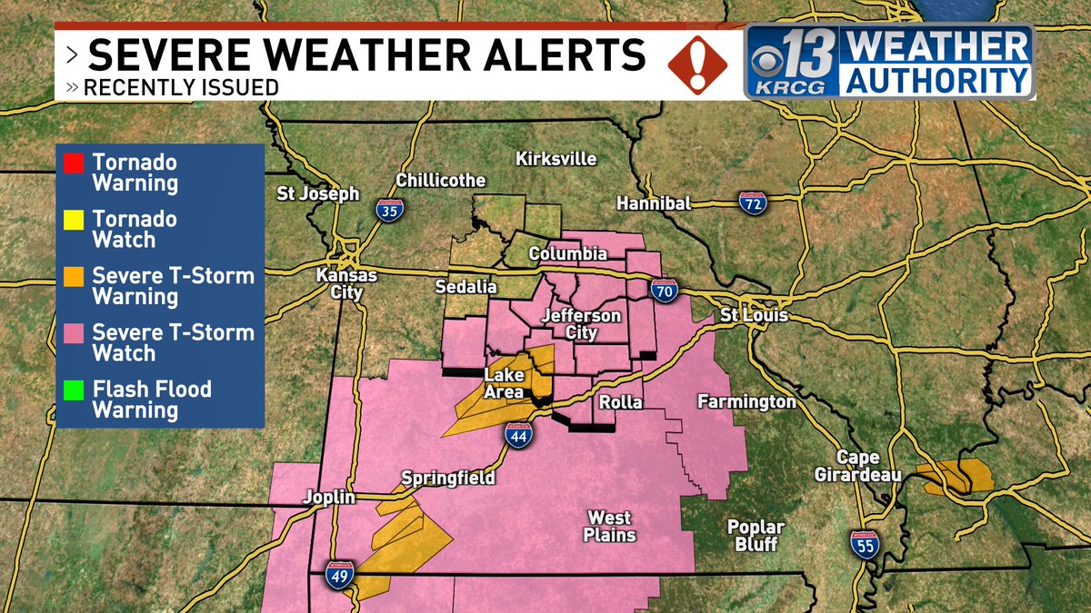
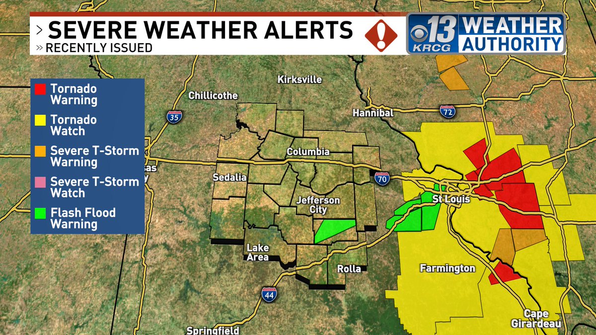
Updated severe weather alerts. The line of severe storms has moved past the St. Louis Metro and into Illinois. For us, we are still dealing with some flash flooding in Maries county.
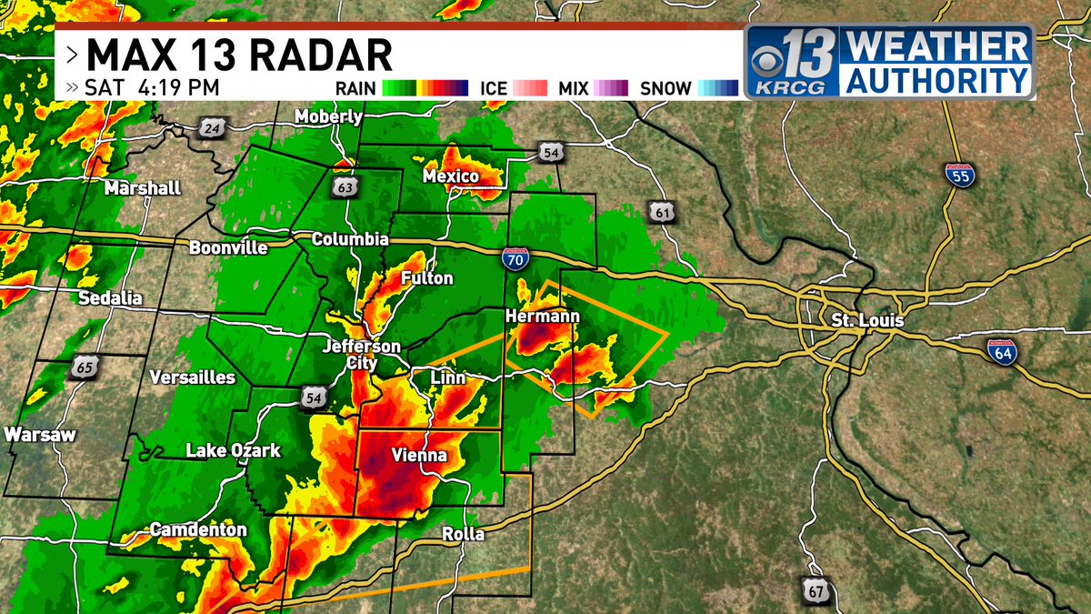
The cell that is heading towards Hermann is capable of producing ping pong ball sized hail to golf ball sized hail. There have been multiple reports, so make sure you stay safe.
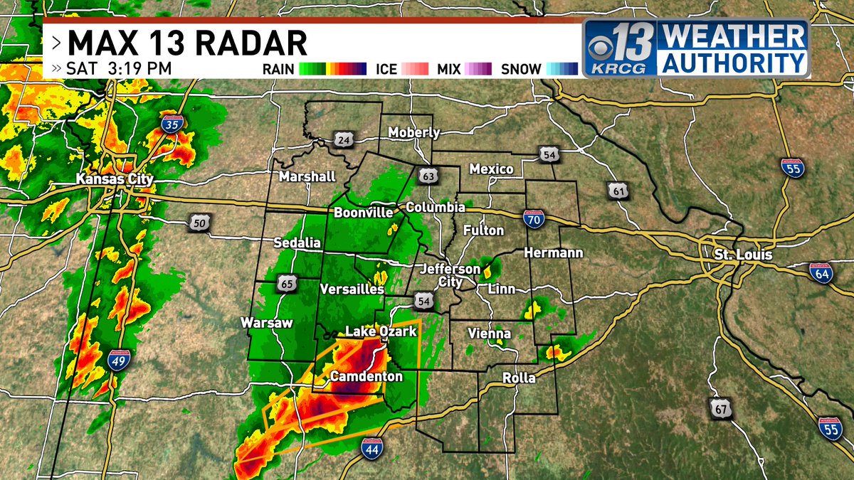
Two more severe thunderstorm warnings have been issued. The first one for for Cole and Osage counties and will expire at 4:45pm. The second one for Maries, Phelps, and Pulaski counties. Both warn for golf ball to egg sized hail and damaging winds.
A severe thunderstorm warning has been issued for Gasconade and Montgomery counties until 4:30pm. These storms will continue to strengthen and are capable of producing severe hail.
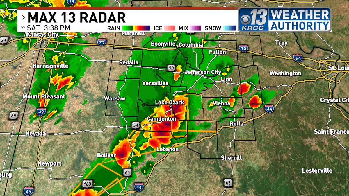
The severe thunderstorm warning has been extended until 4:30pm for Miller, Camden, and Pulaski counties. This new warning specifies hail as large as baseballs and 60 mph winds.
Baseball size hail has been confirmed with the severe storms that will pass through Camdenton into Decaturville and southern portions Lake of the Ozarks. Prepare Now.
A severe thunderstorm warning has been issued for Camden and Miller counties until 4:00pm. Damaging large hail is embedded in these cells. Baseball sized hail has been seen west of Osage Beach.
Ping pong ball sized hail has moved into Camden county. Keep in mind that there will be multiple rounds of storms, so make sure you are staying updated.
A severe thunderstorm warning has been issued for Benton county and southwest corner of Morgan county. Once again, the primary threat is large hail. Take the necessary precautions and stay indoors. Golf ball sized hail or larger is expected.