Special guest speaker tonight is the warmhearted Mitch Morse, former Mizzou and Chiefs center who movingly spoke of his brother and parents: Their story (from 2017): https://t.co/gcFq8Tb3jG
There is a high risk of severe thunderstorms today across parts of northeast Arkansas, far southeast Missouri, far southern Illinois, western Kentucky western Tennessee and extreme northwest Mississippi.
Hey! Did you know the National Weather Service and NOAA provide:
-Weather Watches/Warnings/Advisories
-Current Observations: Temperature, Pressure, Humidity, Visibility, Wind Speeds, etc. (at over 10,000 observation sites)
-Satellite Observations and Data
-Doppler Radar Data (from 159 radars)
-Weather Models
-National Forecast Data
-Severe Weather Outlooks
-And much more...
We get all of this for roughly $3 per person in taxes per year.
Who uses and relies on this data?
-All weather apps
-All meteorologists
-All online streamers
Making cuts to the NWS instead of expanding it could lead to untold numbers of injuries/fatalities
#FundTheNWS
Zach Paul (@weatherzach) of Special Olympics Missouri (@somissouri) shares about the March 8th "Polar Plunge" on March 8 at Finger Lakes State Park.
https://t.co/6GN9vjbOaP
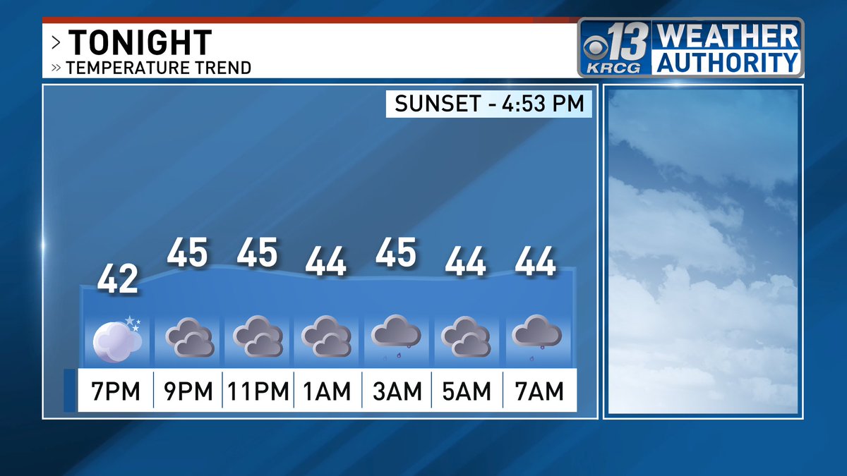
A Winter Weather Advisory will be in effect for much of the area from 6PM Thursday to 6PM Friday. Highest accumulations are expected around and south of the I-44 corridor. I'll have the latest timeline tonight on KRCG 13 Live at 5, 6 & 10.
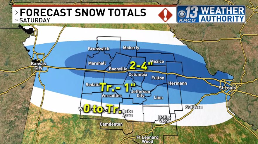
Mid-Missouri has now been upgraded to a Winter Storm Warning ahead of this weekend's system. These warnings will be in effect from Saturday night to Monday morning. You still have time to get any last minute errands done. You'll want to do so as travel will become dangerous.
Winter Storm Watches starting to go out ahead of this weekend's winter storm. Now is the time to prepare as travel could become hazardous at times Saturday night through Sunday. I'll have the latest tonight on KRCG 13 Live at 5, 6 & 10.
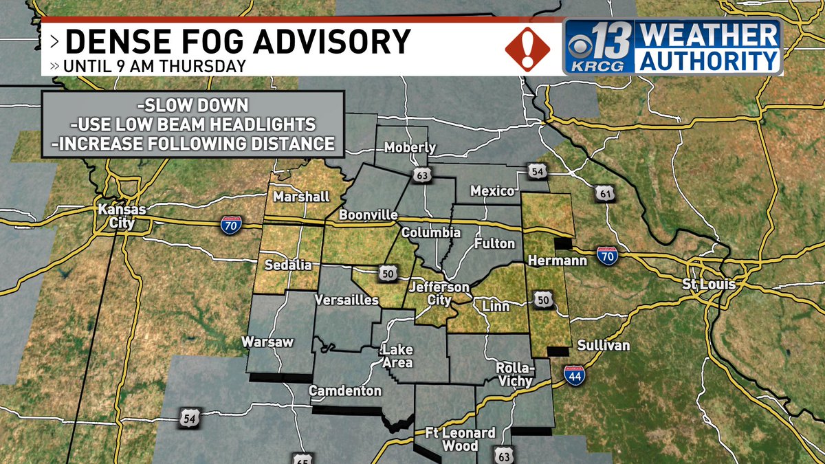
Dense Fog Advisory in effect for much of Mid-Missouri until 9AM Thursday. Some soggy conditions for the night along with the fog but temperatures will begin to rise early thanks to a warm front moving through. Spotty showers Thursday, heavier rain Thursday night. Merry Christmas!
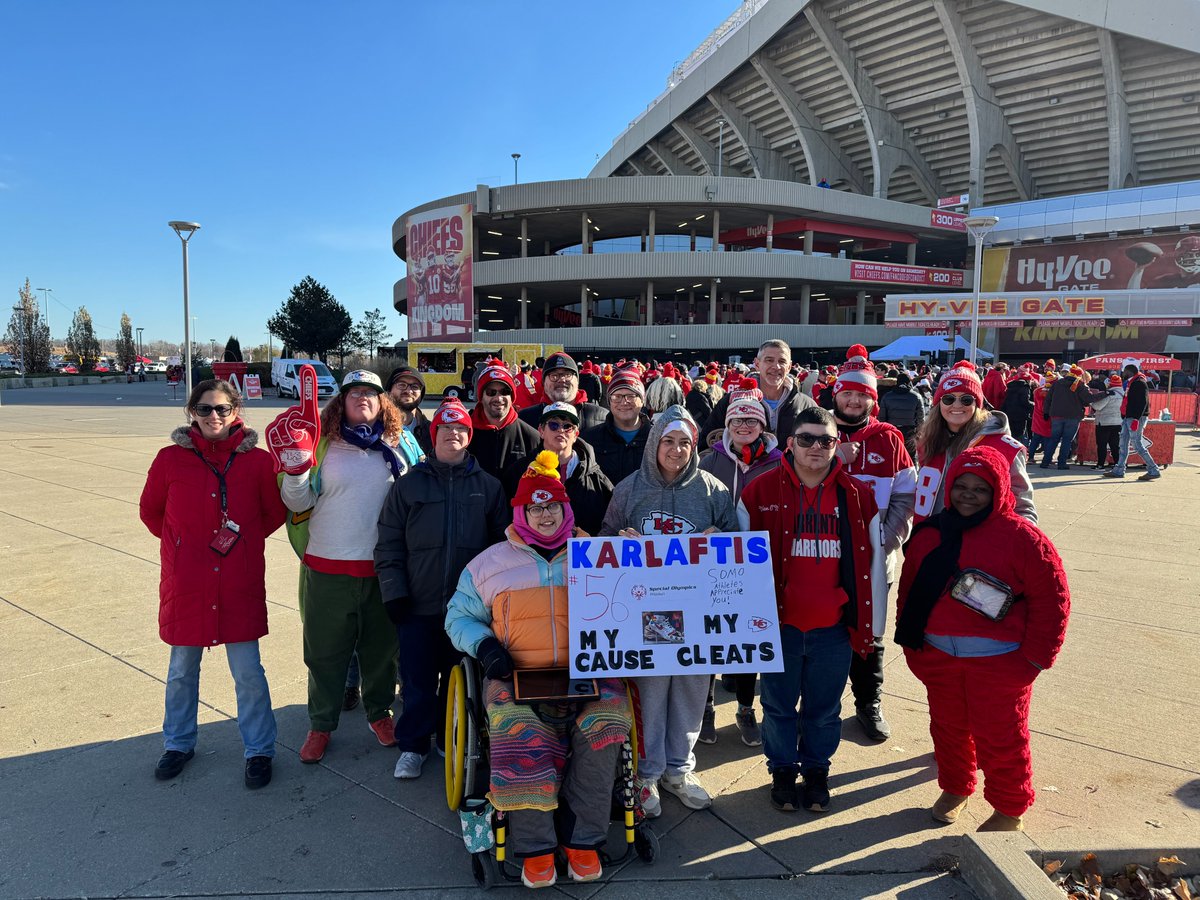
What an Unforgettable Journey! 💙🏈
From designing @TheGK3#MyCauseMyCleats to cheering him on Friday, our athletes had the experience of a lifetime! 👟✨
Thank you, George, for championing inclusion! Support our mission: https://t.co/GLoXwJKUg4 ❤️💪
#ChiefsKingdom
A band of snow will move across mid-MO Saturday with areas close to or north of I-70 seeing an inch or more of snowfall with much lower amounts farther south. Most snow will fall in the morning but could linger into afternoon in eastern Missouri.
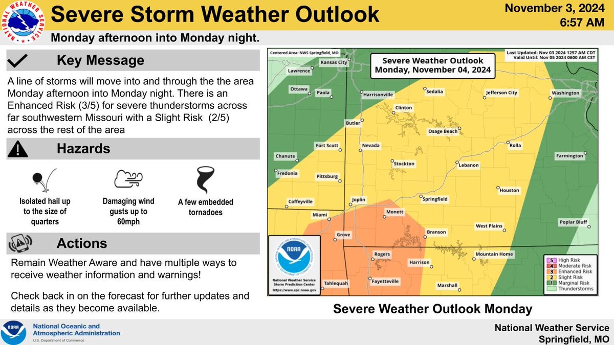
A line of storms will bring the risk of severe weather to the Ozarks on Monday and overnight, with far SW MO in an Enhanced (level 3 of 5) Risk. The primary hazard with these storms will be damaging winds, but a few embedded tornadoes in the line are also be possible. #mowx#kswx
Get ready to dive into the coolest event of the year! This is your chance to brave the icy waters or tackle a 5k and support Special Olympics Missouri athletes. Don’t miss out on the fun, the challenge, and the glow!
#GlowWithSOMO#PlungeForSOMO