Another weather system is expected to impact the Midwest on Wednesday into Thursday causing potential Thanksgiving travel impacts. Local impacts are unlikely (10-20%), but we are monitoring the system in the event that changes. Check https://t.co/Dpsa1cR2kn for updates.
Temperatures will remain cooler through the upcoming week. Most locations will stay dry through the period, with a low chance (30%) for light rain on Wednesday across IL. There is a very low chance that light, unimpactful snow mixes in with the rain at times. #stlwx#mowx#ilwx
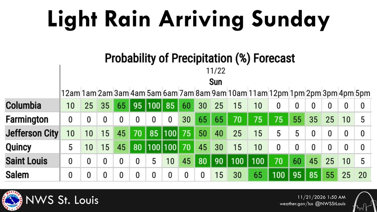
Widespread showers associated with a cold front will move through the region Sunday morning, with much cooler temperatures in their wake. This will return temperatures back closer to normal for this time of year.
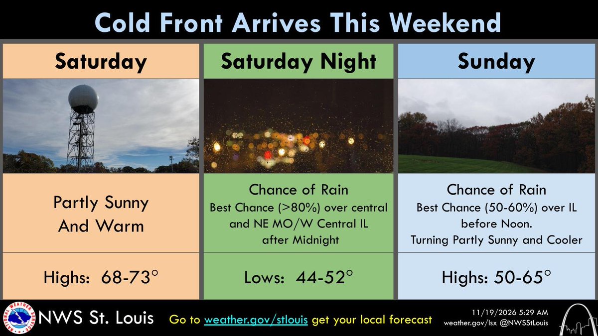
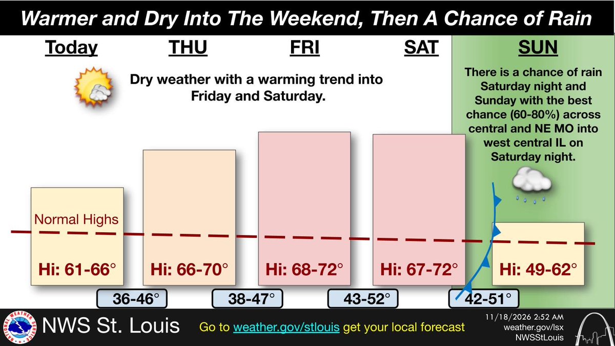
Warm & dry conditions will continue one more day Saturday, but a cold front will pass through the region late Saturday night through Sunday. Showers will accompany the front along with the arrival of much cooler temperatures in its wake.
#stlwx#mowx#ilwx
The temperature outlook for the Thanksgiving Holiday has trended cooler, with dry conditions expected through much of next week. While temperatures are trending cooler for Thanksgiving, record-setting values are not expected. #stlwx#mowx#ilwx
A strong cold front will pass through the region Saturday night and bring an end to our recent warmth. It will also bring light rain to most of the area Saturday night into Sunday morning, with cooler air moving in on Sunday. #stlwx#mowx#ilwx
The combination of dry fuels, low relative humidity values, and southeasterly surface winds is expected to yield elevated fire danger FRI PM across parts of the area. More specifically, SE + EC MO as well as SW IL. #stlwx#mowx#ilwx#midmowx
The dry and warm weather will continue through Saturday before a cold front moves across the area Saturday night bringing a chance of rain and cooler temperatures. Go to https://t.co/kFDoKHE43R to get you local forecast. #stlwx#midmowx#mowx#ilwx
Dry and warmer weather is expected into the weekend before a cold front moves through the area Saturday night bringing a chance of rain and cooler temperatures. Go to https://t.co/kFDoKHE43R to get you local forecast. #stlwx#midmowx#ilwx#mowx
🚨 TODAY’S REMINDER: This is only a TEST! At 1:20 central time, @FEMA and the @FCC are conducting a routine scheduled test of the Emergency Alerting System (EAS).
✅ Federal law requires conducting nationwide tests of public alert and warning capabilities at least once every three years.
✅ Today’s test will only air on TV and radio. Your cell phone will not beep, buzz, or receive a notification.
✅ No action is required. Regular programming will pause for about one minute while the test message plays.
Learn more from FEMA at https://t.co/iWktGVyNZ3.
Curious what the Thanksgiving Holiday forecast will be? While it's still too far out to determine specifics, the general weather pattern is looking favorable for warmer than normal temperatures and near normal precipitation chances. #stlwx#mowx#ilwx
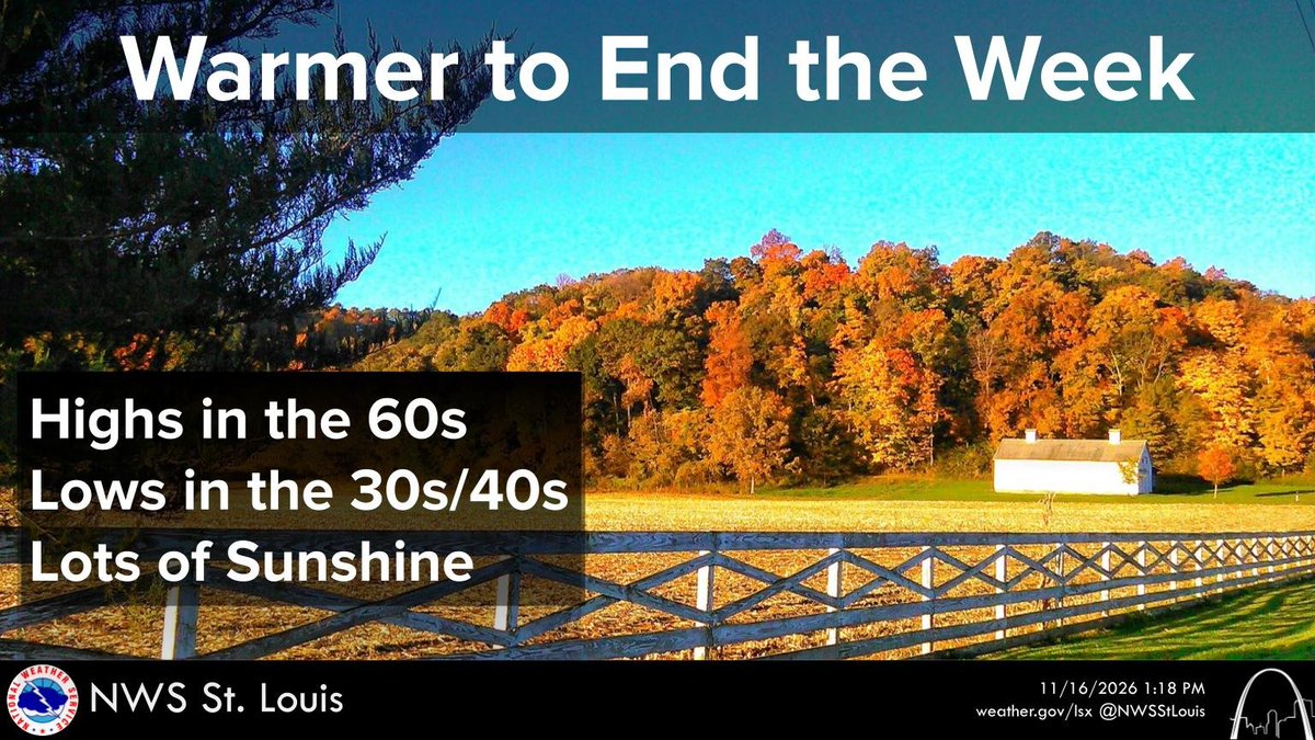
Temperatures will continue to moderate through the end of the week, with highs mostly in the 60s and lows in the 30s/40s. Plenty of sunshine is also expected each day. #stlwx#mowx#ilwx#midmowx
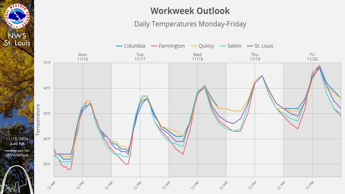
Temperatures trend warmer through the end of this upcoming workweek as conditions stay dry for a majority of the region. Look up your forecast at https://t.co/Dpsa1cR2kn! #stlwx#mowx#ilwx
Through the first half of this upcoming week, temperatures will gradually warm to above normal. Dry conditions are expected across the region. Check your specific forecast at https://t.co/Dpsa1cR2kn! #stlwx#mowx#ilwx
In case you heard otherwise, there is no radar outage and https://t.co/sKhgAVX4eI is fully operational! Outdated content from isolated webpages stating otherwise has been circulating, but NWS radars are operating normally.
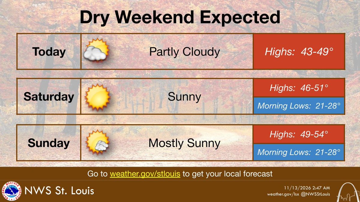
A winter-like chill continues across the entire area through the weekend with a hard freeze each night. Afternoon highs will be chilly and only reach the 40s on Saturday becoming slightly warmer by Sunday with mid 40s/lower 50s in the afternoon. #stlwx#mowx#ilwx