We are not quite done with impactful weather after tonight and tomorrow morning. We are expecting additional rounds of severe storms late Thursday into Friday morning, and again Friday afternoon and evening. With the multiple rounds of storms, flooding is expected. #okwx#txwx
If you're reading this, it probably means you're more tuned in to the weather than a lot of your neighbors, family and friends. Be sure they know about the potential for severe weather from this afternoon through the weekend.
10:47 AM- While the isolated storms across southwest Oklahoma are not severe, they are producing cloud-to-ground lightning.
Some of these lightning strikes are occurring several miles from rain.
Any thunderstorm is dangerous if you're outdoors due to lightning! #okwx#texomawx
There is a chance of a few strong to severe thunderstorms late this evening across northwest Oklahoma. A better chance of severe weather will occur late Thursday into Friday morning. A few strong storms may linger through Friday morning, mainly east of I-35. #okwx#texomawx
Soooooo there's a chance that we could see widespread high temperatures on Saturday below 90 F. Just how likely is that chance?? Well, take a look for yourself! Best chances will really be confined to along and north of I-40. Although it will be cooler, it won't be cold!
UPDATED: We're keeping an eye on the severe potential today and tonight. Discrete storms are expected to develop this afternoon ahead of a line of storms that will move through tonight.
Severe hail and winds, as well as a few tornadoes are expected.
#okwx#txwx#texomawx
2:08 PM-Showers and some storms will continue to move across portions of the area through the afternoon hours. Locally heavy rain will be possible in some locations. #okwx#texomawx
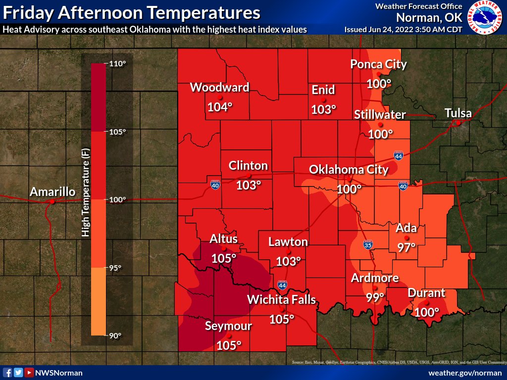
Breezy SW winds will make it hotter today, with triple digit highs of 100-105 deg. Muggiest air will be across SE OK, where a Heat Advisory will be in effect this afternoon. Relief from the heat will come on SUN.
#okwx#texomawx
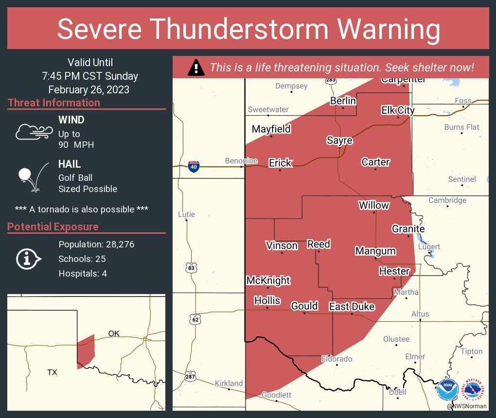
847p-Storms continue to move across portions central and southwest OK and western north TX. Some of the storms are severe. Large hail, strong winds, and heavy rain possible. Tornado possible with a few of the storms. #okwx#texomawx
@TMobile My service is so bad. Even worse in my own house. I really like your company. Just not happy with not being able to talk in my own house without people I’m talking to saying “huh” all the time. My husband and family live in another state so I don’t like not being able to talk.