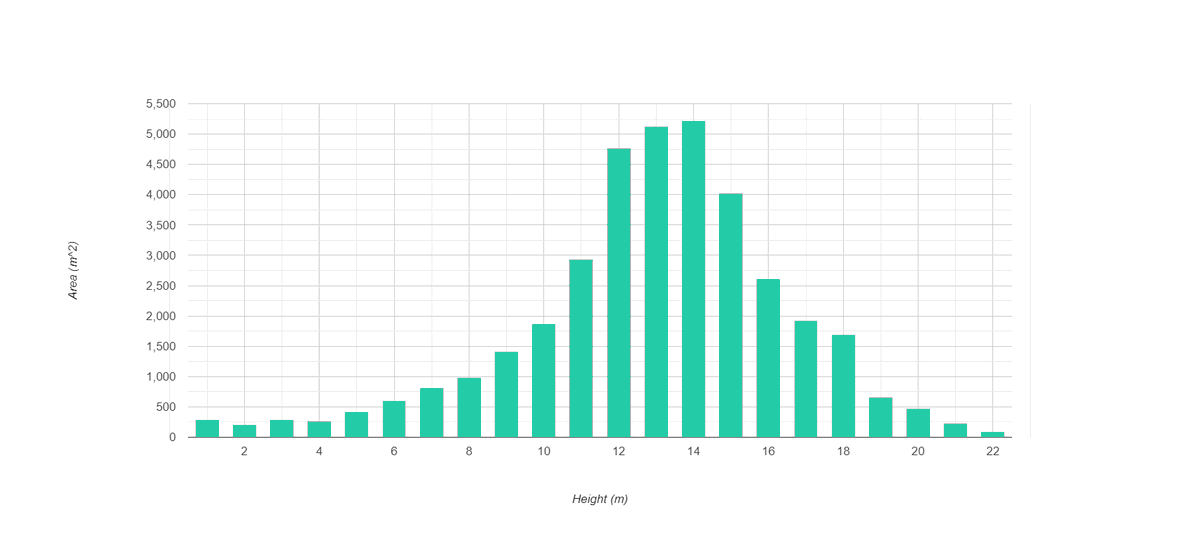
Awesome new dataset by @Meta . Very high resolution (1m) canopy height map. Among others, incredibly useful in forest inventories, estimation of deforested area, etc.
#AI , #lidar, @GoogleEarthEng , #RemoteSensing, #GIS
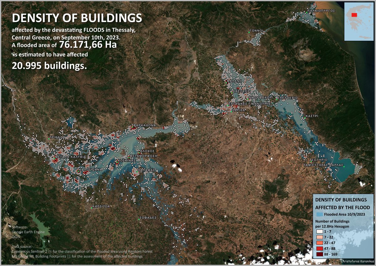
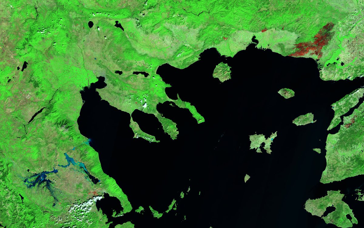
Two sides of the same coin: Floods ↙️ & a huge wirldfire ↗️ in Greece. Catastrophic extreme events separated by few hundred kilometers & occurred just one after the other during summer 2023. A paradigmatic image that will be remembered 🔥💦
#Copernicus #Sentinel2 🛰️
Full Size: https://t.co/fpvk98b5ie 🧐
Check this out https://t.co/c7fIi7h4st #EOBrowser#EarthObservation#RemoteSensing
The huge wildfire in Alexandroupoli, GR, that has been burning for four days and claimed the life of 18 refugees, 2 children among them...
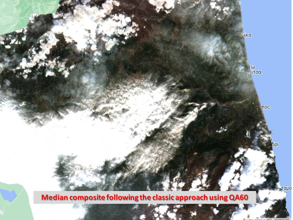
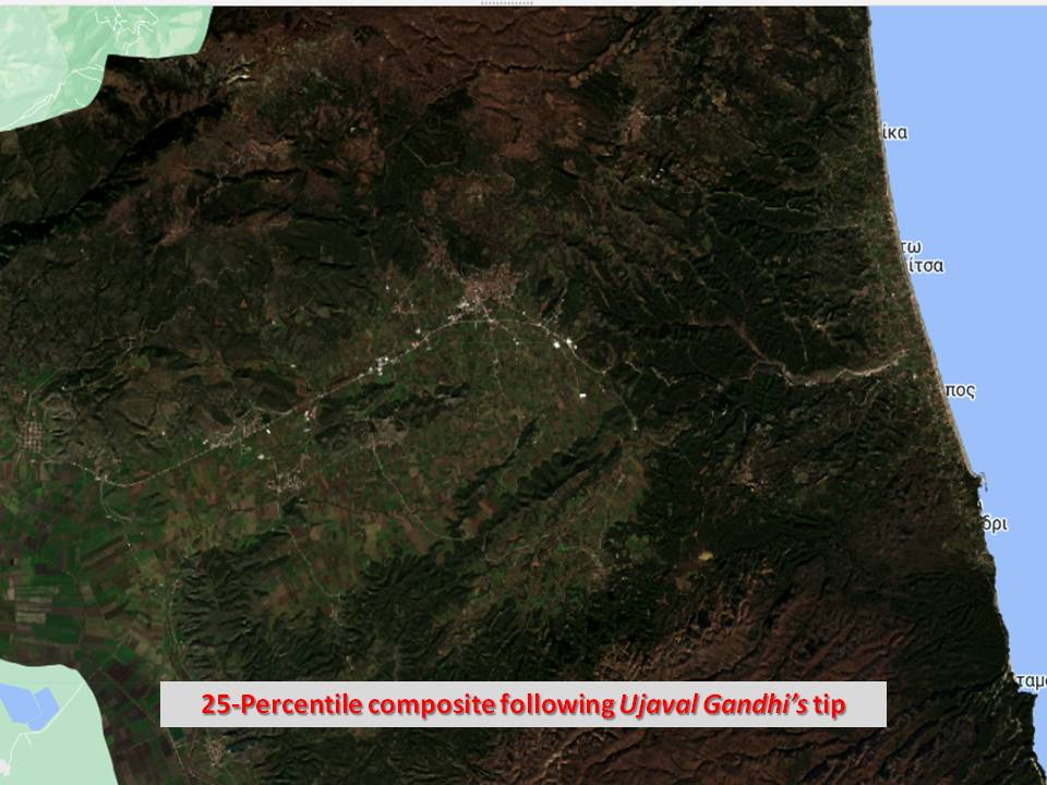
Following Ujaval Gandhi 's script for cloud-free images using median composite and percentile composite gives really good results comparing to median composites based on QA60 filtering. #spatialthoughts#GEE#Sentinel2
#GEE#Levelup Tip: Median composites are widely used for obtaining cloud-free images from optical data. If your composite images still contain cloud artifacts, try a 25-Percentile composite instead - that works better for very cloudy regions. https://t.co/jOk3e7Fyvg
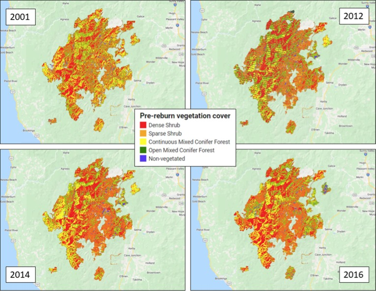
Investigates locations with multiple burns using #Landsat and #LandTrendr. Link reburn severity to post-fire veg recovery rates. #forestrecovery#GEE
Weber et al. Vegetation recovery rates provide insight into reburn severity in southwestern Oregon, USA.
https://t.co/Bos80SQy1T
#CEMS activities during the #2022WildfireCrisis🔥
📍Focus: #Greece🇬🇷
Our #RapidMapping service was activated 1⃣1⃣ times by @GSCP_GR between 1 June & 30 September 2022 and delivered a total of 3⃣2⃣ maps💡
Read more👇
https://t.co/23E4MJDaVu
😃 to receive the honoray distinction in the category Forest Prevention and Protection in Smart Forest Innovation Challenge organized by the Ministry Of Environment 🇬🇷 for my change detection and time series analysis proposal! #EarthEngine, #Sentinel2, https://t.co/FQeizSA1Sl,