Here we observe the seismic waves racing out across North America from the recent very anomalous M6.1 reverse thrust earthquake that struck just off the west coast of Cuba. Weak shaking/jolts were felt across Cuba, Mexico's Yucatan Peninsula, and most of Florida.
I really don't think enough people fully comprehend the worlds that are about to collide here.
You already have people in geopolitical circles warning about the threat of famine based on surging prices / availability of fertilizer components, and you also have long-term weather modeling all converging on a worst case scenario for a building El Nino event, which will peak near the end of the year. These are two slow moving but entirely predictable disasters that when coupled together will each make the other orders of magnitude worse. (This will take months to fully unfold, but at this point, the die is cast.)
There's no event in our history books that combines the current global population with the impending fertilizer shortage and the strength of the El Nino that's coming. We are about to witness an unprecedented event that will push crops around the globe to their limit.
The flash density product really shows this anomalous "flash" which is pretty distinctive of a bolide/meteor reentry. east of Boston. This is the likely source of the loud boom/explosion.
The terrifying view of the tornado near Enid, Oklahoma this evening as it crossed the road. Join our live streams & watch the full chase edit coming up via https://t.co/nieJn2YwxP
Federal prosecutors in Manhattan are exploring whether certain lucrative bets placed on prediction markets have violated insider trading and other laws, multiple sources told CNN. https://t.co/lYwxPRIRJI
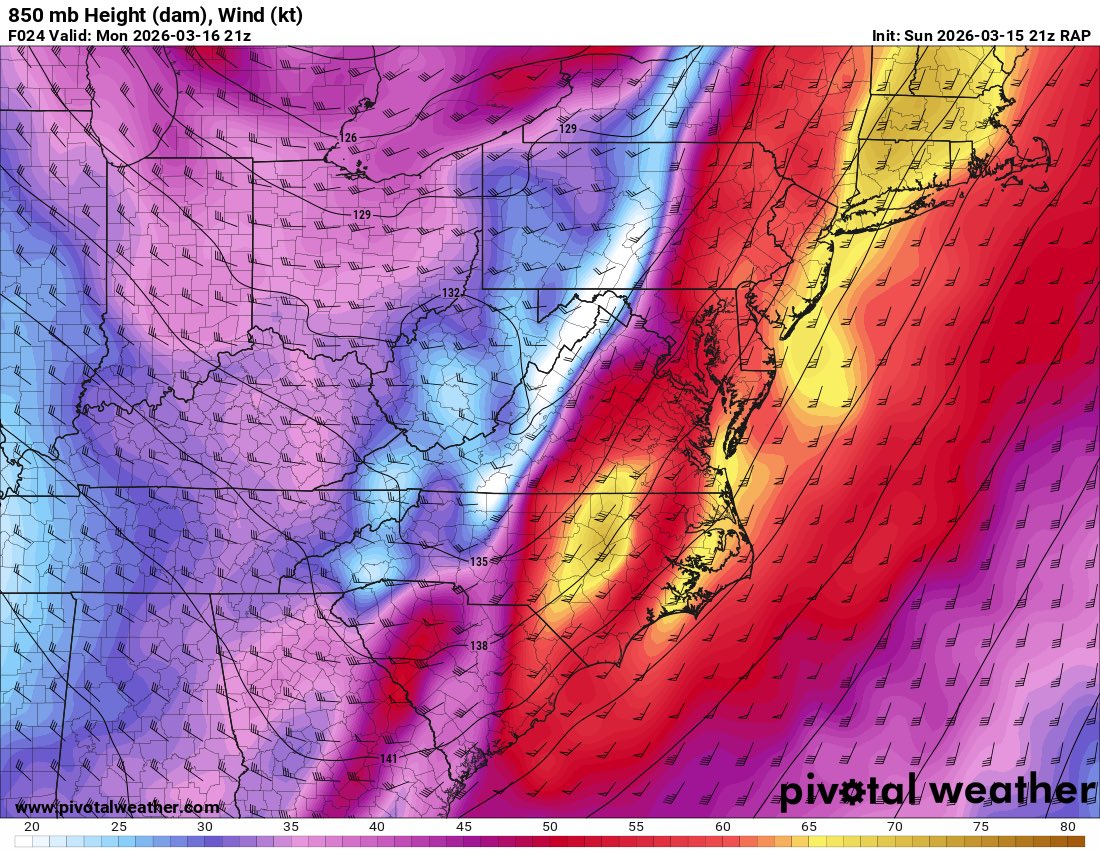
We have used up all of the instability, but wind shear and the LLJ remain very strong. A skinny QLCS is expected to move in later tonight, with widespread wind gusts 50-60mph, and isolated gusts to 75mph possible.
Tornado Watch, canceled. One last chance for damaging winds with a cold front that moves E across the area 6-10pm. Possible a Severe Thunderstorm Watch gets issued for that. Regardless, it will be gusty with & after the front with temps dropping 20-30 degrees overnight.
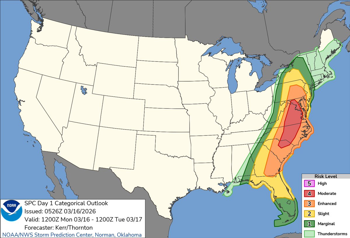
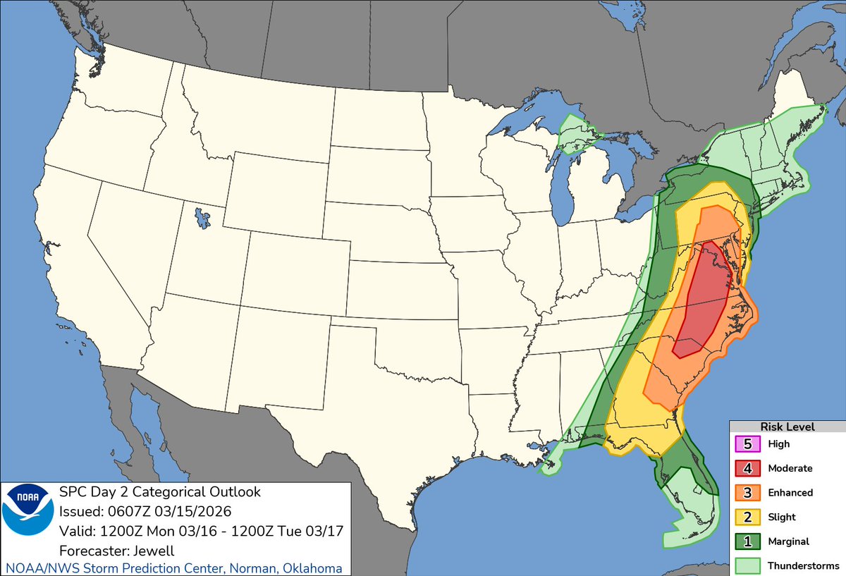
12:28am CDT #SPC Day1 Outlook Moderate Risk: this afternoon across parts of central Maryland much of central and eastern Virginia central North Carolina and adjacent portions of South Carolina https://t.co/TgJgC6cj9Y
Prefrontal supercells or not, the QLCS should be a rather prolific tornado and wind damage producer. A 50-60kt LLJ, >300m/s 0-1km SRH, sickle shaped hodos, very low LCLs, all indicate a high end QLCS with potential for hurricane force gusts and numerous tornadoes.
I have declared a State of Preparedness ahead of significant risk for widespread, severe storms and a heightened tornado threat across the state tomorrow, with @MDMEMA coordinating readiness efforts across state government.
The safety of Maryland families comes first, and I am urging everyone to prepare early, stay informed, and adjust plans – including postponing travel – as conditions change.
Please review preparedness recommendations at https://t.co/R9mRCAfT2G
Ahead of tomorrow afternoon's severe weather risk, many school districts are opting to close early! Below is a map of currently reported early dismissals. I will work to keep this map updated! You can also stay up to date on early dismissals and closings at https://t.co/KqauLuO0tE
In our local region, this includes: Anne Arundel, Charles, and King George County Schools!
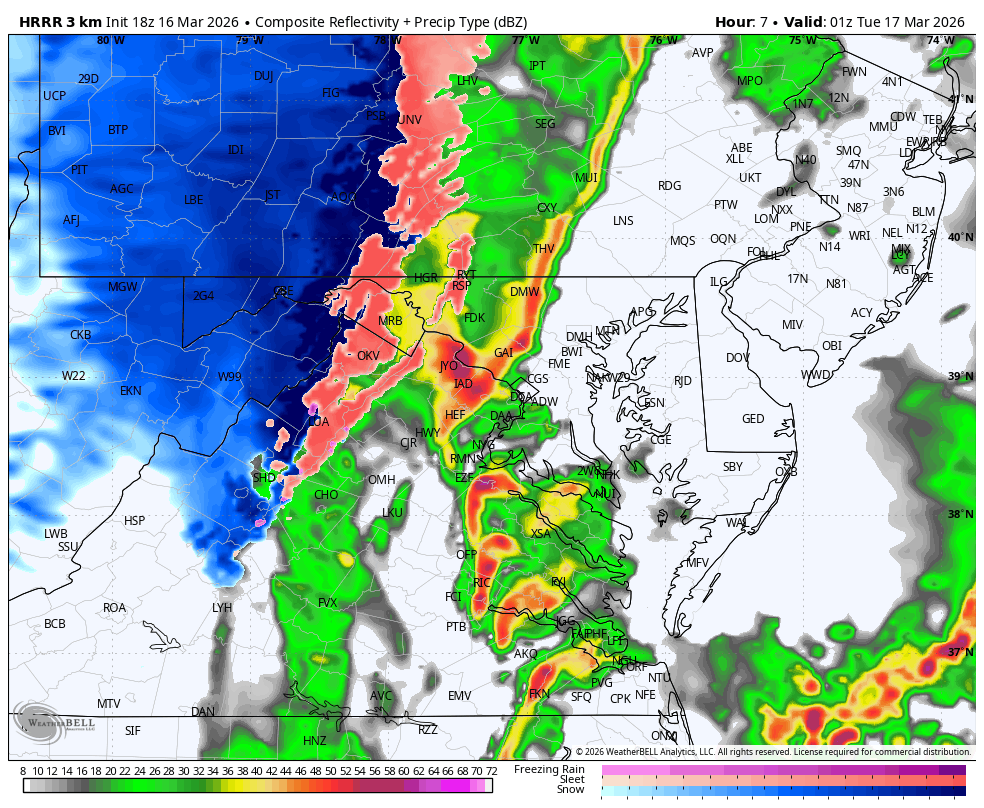
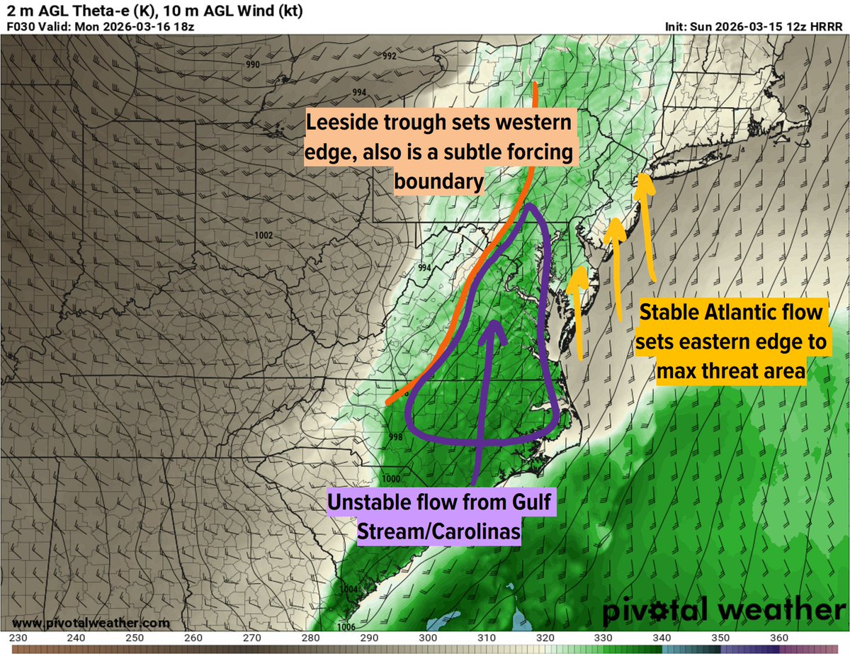
Trends have not been the Mid-Atlantic's friend. The prefrontal trough has trended slower. Besides the obvious implication of greater instability, the more worrying consequence is how the warm sector now aligns with an ejecting negatively tilted shortwave. (1/3) #vawx#ncwx
Our maximal threat region is likely to experience some sort of QLCS in association with our cold front, and may additionally see prefrontal convection (supercells) that fires along our leeside trough. Regardless of how exactly this evolves, the low-level parameter space...(1/3)
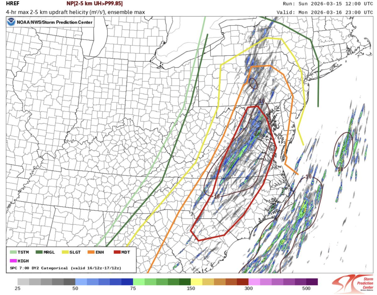
New HREF analysis from the SPC showing plenty of rotation centered right in their moderate risk area, including right around the DC metro, but especially central Virginia.
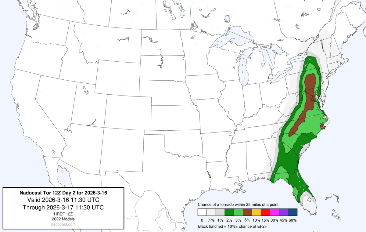
MODERATE RISK issued for the DC Region for thunderstorms Monday! ⚡️⛈️🌪️
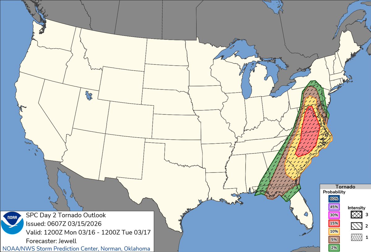
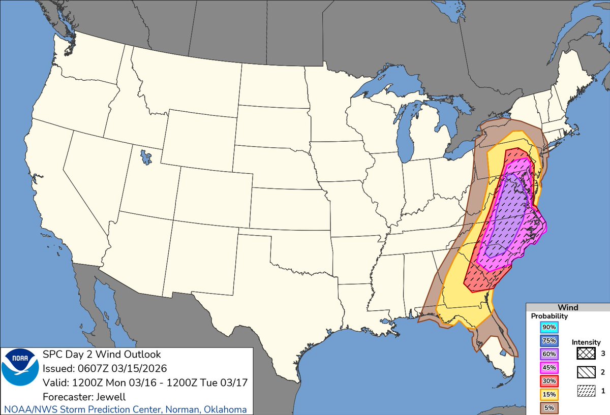
This is the second highest level that the SPC issues. Monday’s severe weather has the potential to be serious. They’ve gone 15% significant tornado risk, and 60% significant wind damage risk.
To give you an idea how rare this is for our region, DC has not been included in a DAY 2 moderate risk for severe weather in over a decade…since June 12th, 2013! And that was back before the level 3 “enhanced” category existed.
Take the threat seriously. The SPC does not issue these lightly.