@Djpuco Furthermore I noticed there was still more of a kink to those isobars near NW Germany, which seemed to align with the early supercells/best couplets of the day
@Djpuco Just my opinion but these sorts of setups that lack a clear shortwave and rely on broad synoptic troughing tend to need an extra kick. The environment on paper is favorable but without better lift storms can not fully utilize their environment
@Sausius_wx Peculiar thermodynamics, low topped but thick CAPE profiles. Here in southern Germany I would imagine lower dews limit the threat. Seems like a sweet spot in the middle of the country with combination of thermo and forcing
@Djpuco I will hopefully be out there somewhere btwn MUC and Rosenheim to start the day. Really intrigued by the sfc low with backed easterlies and moisture pooling.
@GMengel Better than me man. For my first tor I was in so much shock that for once, the storm actually produced. I was the classic “oh my god, wow! Holy crap!” person that so many despise 😂
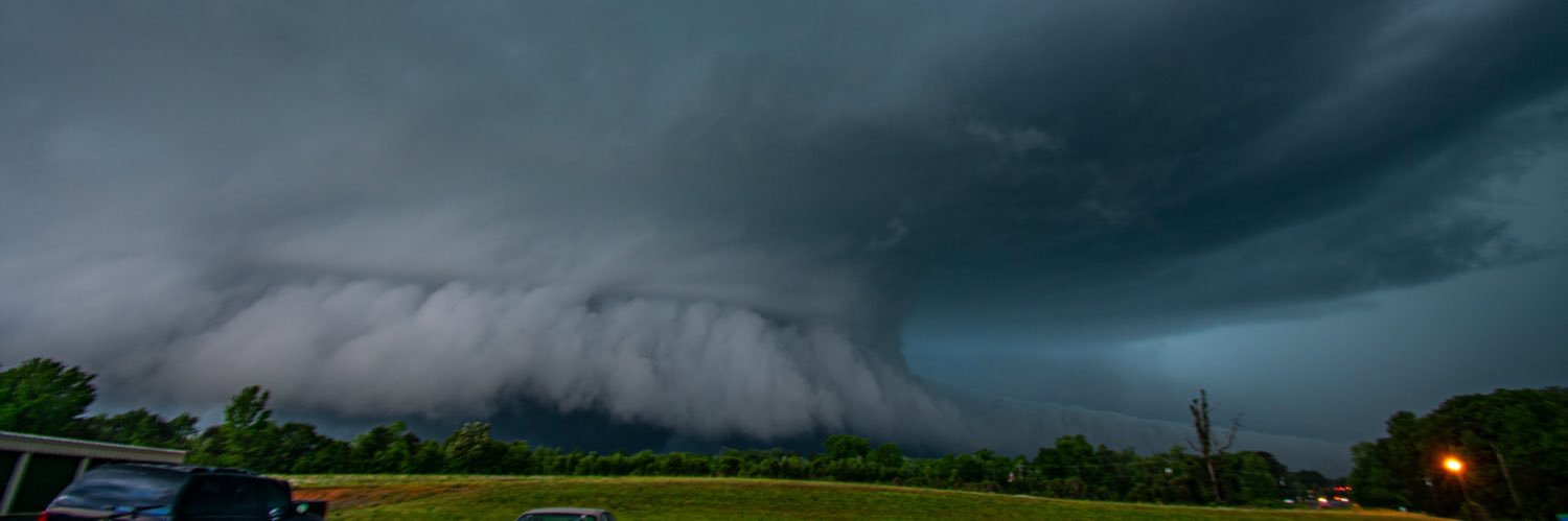
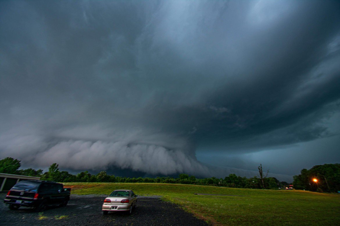
Unrelated but that really is a top tier visible RFD cut by mid Atlantic standards
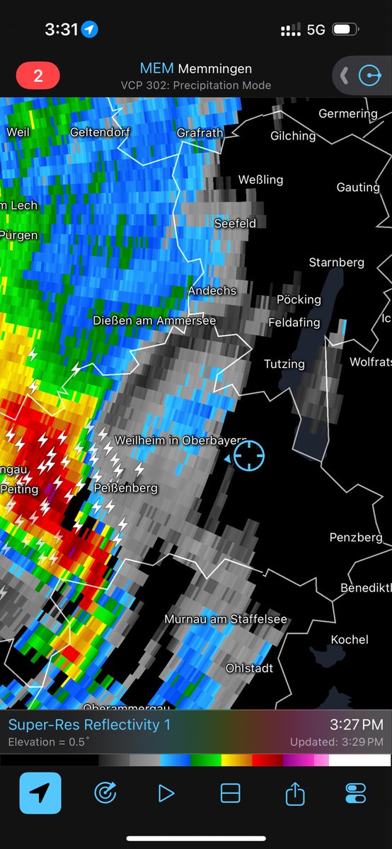
Convection season has commenced in Bavaria with a shortwave firing a cluster of thunderstorms west/south of Munich today, bringing frequent lightning and small hail #gewitter
@Kachelmann@Kachelmannwettr@Alpinwetter UPDATE:
Gewitter bei Memmingen in Bayern aktuell! Wir sind weiterhin LIVE auf Twitch und Youtube. Schaut vorbei! ⛈️🌪️
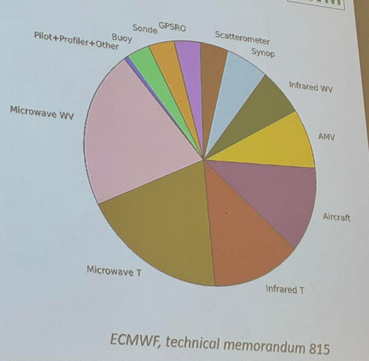
@sambrandt99 Found this from a satellite lecture I had last semester. It represents your tweet very well. Satellite data is king for model performance.
@WxScholl Yo if you’re still dealing with this, any other peculiar issues? Car turning off by itself when idle? Electric issues?
Also check oil for coolant
My old car would do the exact same thing, light would come on just long enough for me to notice, then disappear.
@AriWeather@ScottDimmich@dalesamsWx Unrelated to verification or not, but want to add:
Actual observed (instrumentation) severe gusts are quite uncommon east of the Appalachian Mountains, and observed sig gusts are very rare.
Hard to have a forecast go off the rails as hard as today did. Have to feel for forecasters who must both respect the obvious potential of the event and face the consequences of the floor being realized.
Trends have not been the Mid-Atlantic's friend. The prefrontal trough has trended slower. Besides the obvious implication of greater instability, the more worrying consequence is how the warm sector now aligns with an ejecting negatively tilted shortwave. (1/3) #vawx#ncwx