The Belfast "Circle Line": The Proposal - reconnecting Belfast City Centre with @belfastairport, @BELFASTCITY_AIR, rural villages and commuter towns, with services every 15mins, 6am - Midnight, and later at weekends. BUILD the Circle Line already!
https://t.co/miACAc2EYC
@seatonsbelfast@UlsterUni@StJoesBelfast@The_AmericanBar Businesses and residents have an opportunity here to effect this. Improvements outside your premises are detailed. New route passes your front door. I see no secure bike parking anywhere. Secure and covered bike parking would be a big plus on Dock St for businesses.
CONSULTATION
––
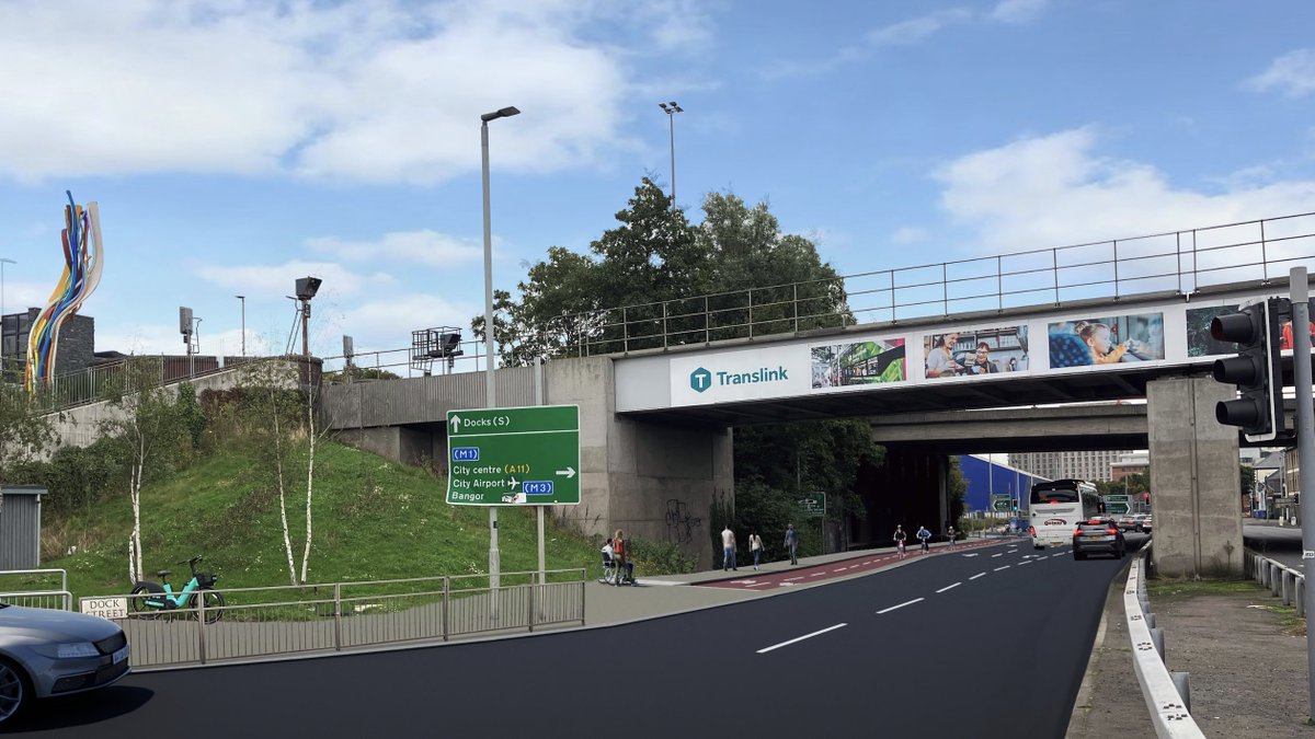
Proposals for Sailortown Walking & Cycle route.
Phase 1 = from York St station to Clarendon Dock and Corporation St.
Future routes linking Corporation St to @UlsterUni
Great for: @StJoesBelfast@The_AmericanBar@seatonsbelfast
Details: https://t.co/dSwOu6mnTo
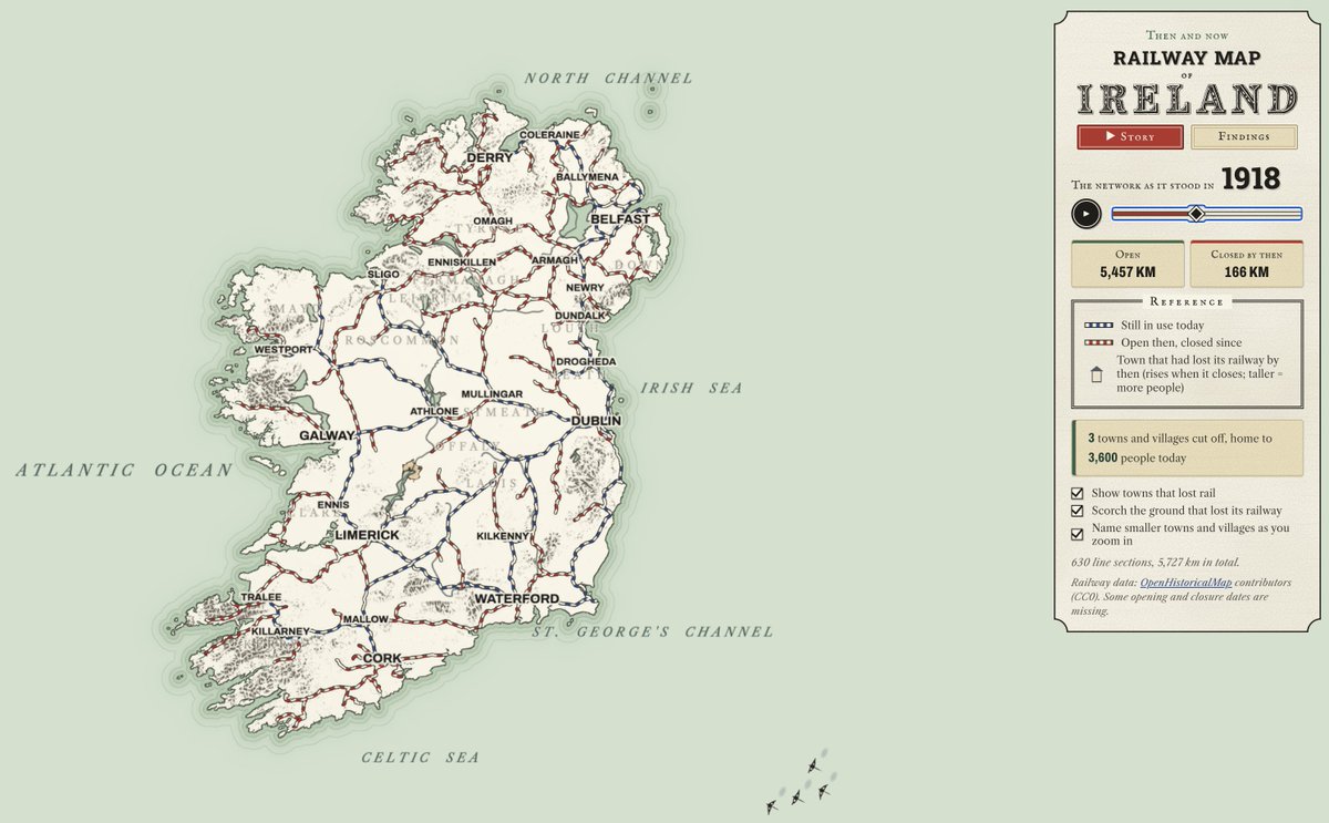
It's genuinely sad to see just how much of Ireland's railway network we've lost over the years. So many towns and communities once connected by rail, with much of that infrastructure now gone.
This brilliant interactive map really brings home the scale of what we threw away.
https://t.co/QxQZInmQw0
The Belfast "Circle Line": The Proposal - reconnecting Belfast City Centre with @belfastairport, @BELFASTCITY_AIR, rural villages and commuter towns, with services every 15mins, 6am - Midnight, and later at weekends. BUILD the Circle Line already!
https://t.co/miACAc2EYC
It's good to see the focus on pedestrianisation and better public transport, but isn't it odd that rail has been left out of the ETP? There are over 30 railway stations in the plan area, plus the proposed reopening of the Knockmore Line. Surely rail should be part of the conversation about modal shift and connectivity?
It's good to see the focus on pedestrianisation and better public transport, but isn't it odd that rail has been left out of the ETP? There are over 30 railway stations in the plan area, plus the proposed reopening of the Knockmore Line. Surely rail should be part of the conversation about modal shift and connectivity?
🎧 NEW episode of 'Little Changes' podcast!🎧
The Eastern Transport Plan (ETP) consultation is LIVE, it’s the plan for a future transport network that’s sustainable, safe and accessible.
In this episode we sit down with:
🔊 CEO of @LinenQuarterBID@ChrisMccracken_ ,
🔊@JamesEHennessey from @PaulHogarthCo and
🔊 ETP project manager Tony Rafferty
We discuss how this year’s @fleadhcheoil highlighted the social & economic benefits when #Belfast city centre streets were transformed from busy car corridors, to lively, colourful & safe pedestrianised streets.
Listen in full:
https://t.co/ta4BUYxNwQ
Back to the Future: Could Belfast’s DeLorean Test Track Become a Linear Park?
Whenever I visit a new city, I usually spend a fair bit of time scrolling through Instagram and doing countless web searches to find interesting things to see and do while I’m
https://t.co/YdZ5zmuLfG
Ireland’s Railway Past, Present and Future 🐴🚂🚋🚆
I created this interactive map, which lets you explore how railways and tramways across Ireland have changed over time, from historic routes and stations to today’s network, heritage railways and proposed future projects.
Click on the link below to explore the map:
https://t.co/ynWKXmhb3c
What can you do with it?
-Search for a station, route, place or railway company and zoom to the result.
-Choose layers to show or hide particular routes, stations, stops and names.
-Travel through time using the Year Explorer slider or play button, watching dated routes appear and disappear.
-Explore individual routes using the View buttons, which zoom to a line and can also show its stops and names.
-Click a line or marker to see its details, including dates, sources and research notes where available.
-Switch backgrounds between OpenStreetMap and a simplified built-in map, and open the legend and map-contents panel for more information.
What does the map include?
Historic Railways:
A broad collection of former railway lines and stations across Ireland, including researched sections of the Westport–Achill and Galway–Clifden branches and several County Donegal routes. It also includes a separate 2012 railway timeline dataset, covering selected lines and stations rather than the complete island-wide network.
Historic Tramways:
Belfast, Cork, Dublin and Galway tram networks, as well as the Lucan, Castlederg and Victoria Bridge, and Giant’s Causeway tramways. Selected stops or termini are shown, and some routes have historical photographs that can be displayed over the map.
Narrow-gauge Railways:
Dedicated controls for routes including the Ballycastle, Ballymena and Larne, Clogher Valley, Londonderry and Lough Swilly, Schull and Skibbereen, and Cork and Muskerry railways, among others. The historic Listowel–Ballybunion Lartigue monorail is also included.
Present-day Transport and Heritage:
Modern railway lines, DART and Dublin Luas are included, alongside the reconstructed Lartigue demonstration railway in Listowel and the Giant’s Causeway and Bushmills Railway. The latter two are shown separately from their historic predecessors.
Future Projects:
The map includes illustrative layers for Cork Luas, MetroLink and Luas Finglas, plus the reinstated Limerick–Foynes freight line. Luas Lucan and Poolbeg have project links but no routes drawn yet.
#History #Ireland #NorthernIreland #IrishRail #Trains #Trams #RailwayHistory #MetroLink #Luas #Transport #TheColourOfIreland
Discover Ireland’s Railway Past, Present and Future! 🚂
I created this interactive map to explore Ireland’s railway and tram lines, past and present, as well as future projects such as the Dublin MetroLink and the proposed Luas lines for Cork and Finglas.
Search for routes or stations and travel through time with the Year Explorer.
https://t.co/Adfl33V0Xz
#History #IrishRail #Trams #RailwayHistory #MetroLink #Luas #TheColourOfIreland
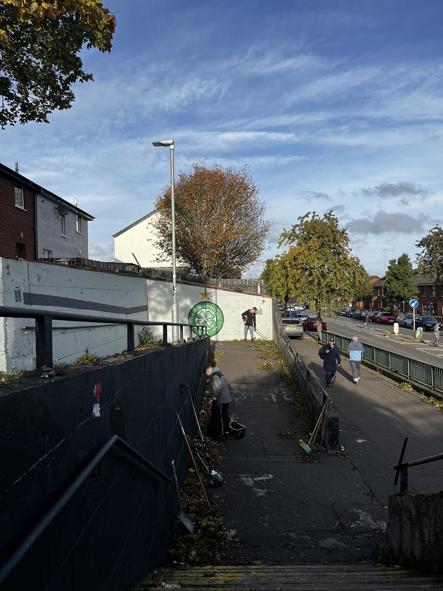
Today, the Lads power washed a pensioner’s back yard to clear slippery moss, took out the weeds from the outdoor spaces of another resident and cleared up leaves, rubbish, overhanging branches and painted out graffiti to make the barrack steps a less intimidating space. 💪
My sold-out train on the busiest rail corridor in the world's largest economy moved at an average speed of 46.5 mph to NYC. I'm not asking for much; I'm asking for better.
@BBCNewsNI With budget talks underway, how does any of this help Northern Ireland? How does it help secure funding for much-needed public transport infrastructure, like reopening the Knockmore Line?
#openknockmore
With budget talks underway, how does any of this help Northern Ireland? How does it help secure funding for much-needed public transport infrastructure, like reopening the Knockmore Line?
#openknockmore
Northern Ireland's First Minister Michelle O'Neill has said Deputy First Minister Emma Little-Pengelly has "blocked" them from attending an economic summit involving Prime Minister Andy Burnham. https://t.co/sVbNDSNaNi
Since @PLACENI closed in 2019, Belfast and Northern Ireland have lost an important focal point for good ideas about our towns and cities.
There are plenty of people with ideas for making places better, but no shared platform to bring them together.
We need something like PLACE again.
Still wild that the Northern Ireland Transport Holding Company owns this site beside the railway line @abbeycentre.
@ANBorough has already identified it as a potential location for a future rail halt in its Local Development Plan, yet @Translink_NI has no current plans for it.
North Belfast has around five miles of railway running through it without a single stop. That feels like a huge missed opportunity.
#belfastcircleline