Tropical Storm #Lala Advisory 5 (5 AM HST, Thu Aug 13): Tropical Storm Lala Forms. Hurricane Watch Issued for the Big Island of Hawaii. https://t.co/NyUGSIFCuo
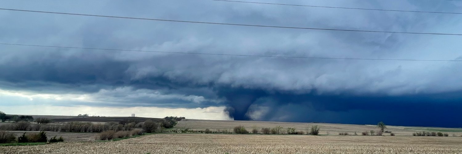
Incredible hyper-lapse video of a large tornado moving across south Enid, Oklahoma! Captured with our Enid cam, you will see the tornado disappear into a curtain of hail only to remerge moments later! #okwx@KOCOMichael@NWSNorman@KOCOdamonlane@MikeMorganKFOR
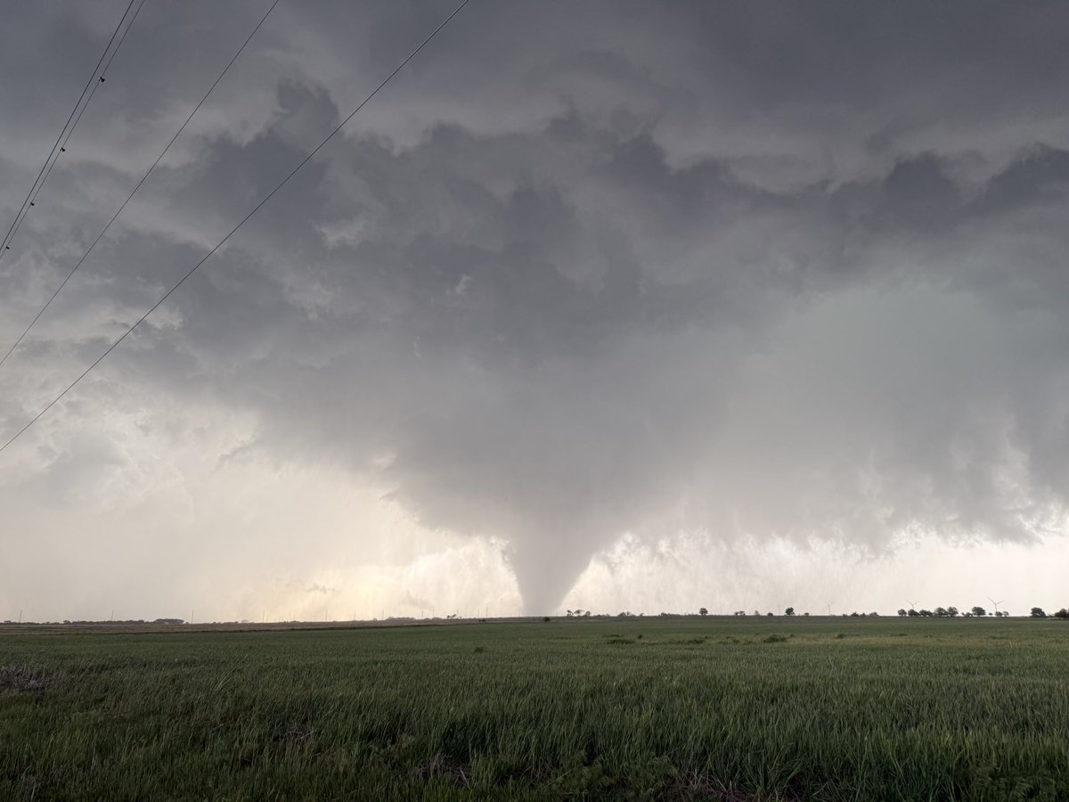
We found several points of EF4 damage southeast and southwest of Enid from the tornado last night. Damage surveys still ongoing, but we have found EF4 damage. #okwx
The spiral banding of West Pacific typhoons is always an incredible sight on satellite imagery, and #Sinlaku is no exception as it head northwest towards Guam and the Mariana Islands. This is probably the first of several high end systems out there this year with #ElNiño developing.
Typhoon #Sinlaku is undergoing rapid intensification, with satellite estimates reaching Cat. 4 strength. It is plausible (if not likely) that we will soon have our first Cat. 5 cyclone of 2026 in the Northern Hemisphere as it moves toward the Mariana Islands just north of #Guam.
For days, the traditional guidance (ECMWF/GFS) has been focused to the west, almost to the Philippines at one point. AI guidance has always been clustered near Guam/the Mariana Islands. It's clear which camp is caving. AI is significantly aiding forecasts in the tropics.
Over in the West Pacific, Tropical Storm #Sinlaku is quickly becoming better organized, with much more symmetry to its appearance. It seems likely to become a large and very strong (Category 4+) #typhoon as it moves toward #Guam & the Mariana Islands over the coming days.
Over in the West Pacific, Tropical Storm #Sinlaku is quickly becoming better organized, with much more symmetry to its appearance. It seems likely to become a large and very strong (Category 4+) #typhoon as it moves toward #Guam & the Mariana Islands over the coming days.
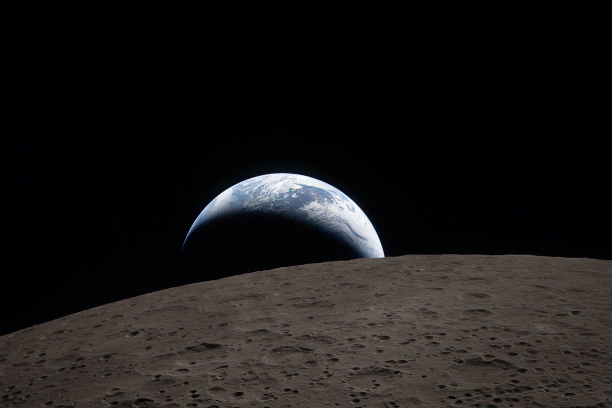
Earthset.
The Artemis II crew captured this view of an Earthset on April 6, 2026, as they flew around the Moon. The image is reminiscent of the iconic Earthrise image taken by astronaut Bill Anders 58 years earlier as the Apollo 8 crew flew around the Moon.
A lot of people (including myself!) tend to scoff at the notion that these Mediterranean storms can be something other than (sub)tropical. However, from time to time, the atmosphere reminds us that classifying convective lows is hard! Take a look at this polar low near Alaska:
Awful situation happening now along Hwy 287 3 miles SE of Quanah. Multiple vehicle pickup occurring in the southbound lanes. Listen to the vehicles slamming into each other. This is bad. @NWSNorman
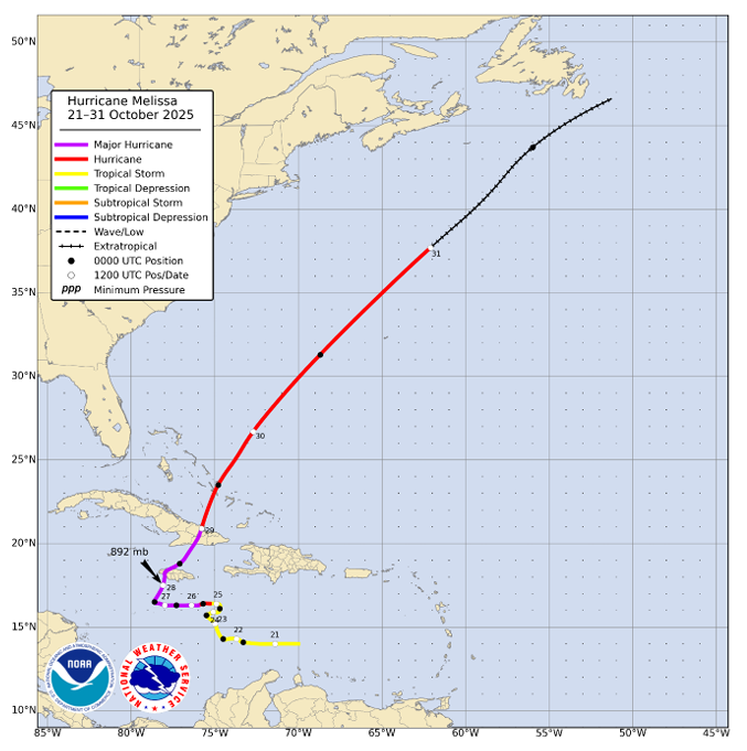
NHC has completed its post-analysis and Tropical Cyclone Report for Hurricane #Melissa.
Melissa, one of the strongest hurricanes on record in the Atlantic basin, reached category 5 intensity (on the Saffir-Simpson Hurricane Wind Scale) with a minimum central pressure of 892 mb and brought catastrophic wind and storm surge impacts to portions of western Jamaica. Melissa’s slow motion also produced heavy rainfall and catastrophic flood impacts across portions of the Greater Antilles. As of the release of the report, Melissa is responsible for 95 fatalities.
The report is available at https://t.co/ysyBlHTvYC
All reports for the 2025 Atlantic hurricane season can be found at https://t.co/c52ijljbXV
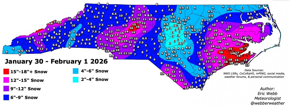
Here's my preliminary analysis for this weekend's snowstorm over North Carolina.
This storm will be one for the record books in a lot of NC.
Hopefully, I'll be able to find some time later this week to look at South Carolina.
Thanks for all the reports everyone
#ncwx