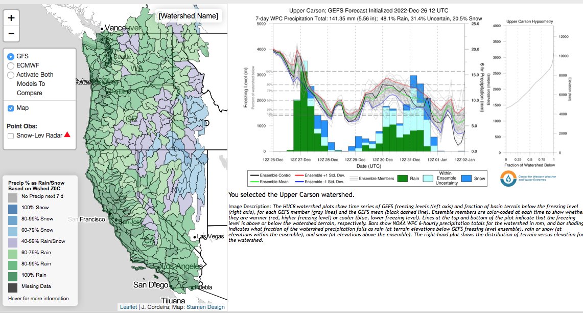
With serious ARs barreling down on us, its time for a reminder of this nifty tool from the folks @CW3E_Scripps: For every watershed on the map you can call up current forecasts of snow vs rain fractions & amounts from GEFS ensembles.
Be safe out there!
https://t.co/jCxlKQopIm
Powered by Google Cloud’s geospatial & data analytics technologies, @SCJohnson OFF!Cast Mosquito Forecast is the first technology platform that provides the public with free & accurate mosquito forecasts, a critical asset in disease prevention. https://t.co/dmkc1tAt4y
With Google Cloud, @ClimateEngine fuses Earth and economic data to help organizations forecast drought conditions along the supply chain, determine wildfire risk and more.
Read more of our work with partners to create sustainability tools → https://t.co/kY3JCLtBGB #EarthWeek
Over 700 software partners are now powering their applications with Google’s data cloud. We are grateful for our expanding partner ecosystem who help our customers use data in more innovative ways.
The Climate Engine team is growing! We've added new roles to our careers page. Looking for 3-4 Python developers and 1-2 DevOps engineers. See https://t.co/OVTDO5ryk1 and apply to join our team as we scaleup! #climatejobs#googlecloud#googleearthengine#pythonjobs#devopsjobs
Climate Engine is a proud partner of @BMO's Financial Group Climate Institute. Tune in to this Sustainability Leaders Podcast where @BMO's Michael Torrance speaks with our CEO and CSO about spatial analytics for climate risk and monitoring solutions. https://t.co/lsjPndleNq
As a @googlecloud Partner and Google Cloud Marketplace solution provider, @ClimateEngine will provide a commercial conduit for GHGSat's data to customers in a variety of sectors worldwide.🛰️🌎 https://t.co/UCksxhOkJF
BIG Water News: #OpenET, a new online platform that uses satellites to estimate water consumed by crops, launched today, making critical data for water management widely available in 17 western states amid record #drought. #ValueWater https://t.co/hSnq44UeFT
We're thrilled to announce a strategic partnership with @ghgsat to provide GHGSat methane emissions insights via the Climate Engine Enterprise offering on the @googlecloud Marketplace. https://t.co/mIxL9C9IXA
"The time for businesses to act on climate is now.... To make sure businesses can make the most out of Google Earth Engine, we’re working with partners, like NGIS and @ClimateEngine, to help businesses identify and manage risks related to climate change." https://t.co/yLExH3pjUw
We are excited to announce the next chapter in the Climate Engine story. Please see the attached message from Dr. Justin Huntington, Chief Science Officer and Founder. Thanks to @DRIScience for their partnership and for supporting this successful technology transfer.
New @googleearth#EarthEngine App to make #Landsat satellite image time-lapse vids yourself anywhere on #Earth. Imagery is cloud-free and smoothed using LandTrendr algorithm. The results are powerful demonstrations of landscape change. #scicomm
👉https://t.co/Gd0GWk92nr
“Climate Engine maps and time series help scientists and managers see and study earth observation data” by Google Earth. Thanks to funders and supporters @googleearth @DroughtGov @blmnv @FEWSNET @NASA_WWAO and others https://t.co/xtSQ3b1hvA
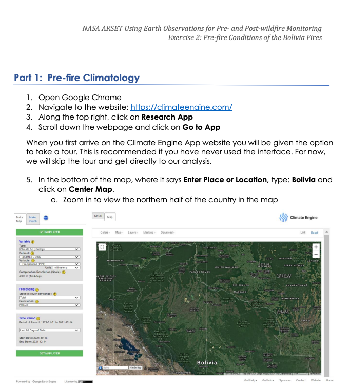
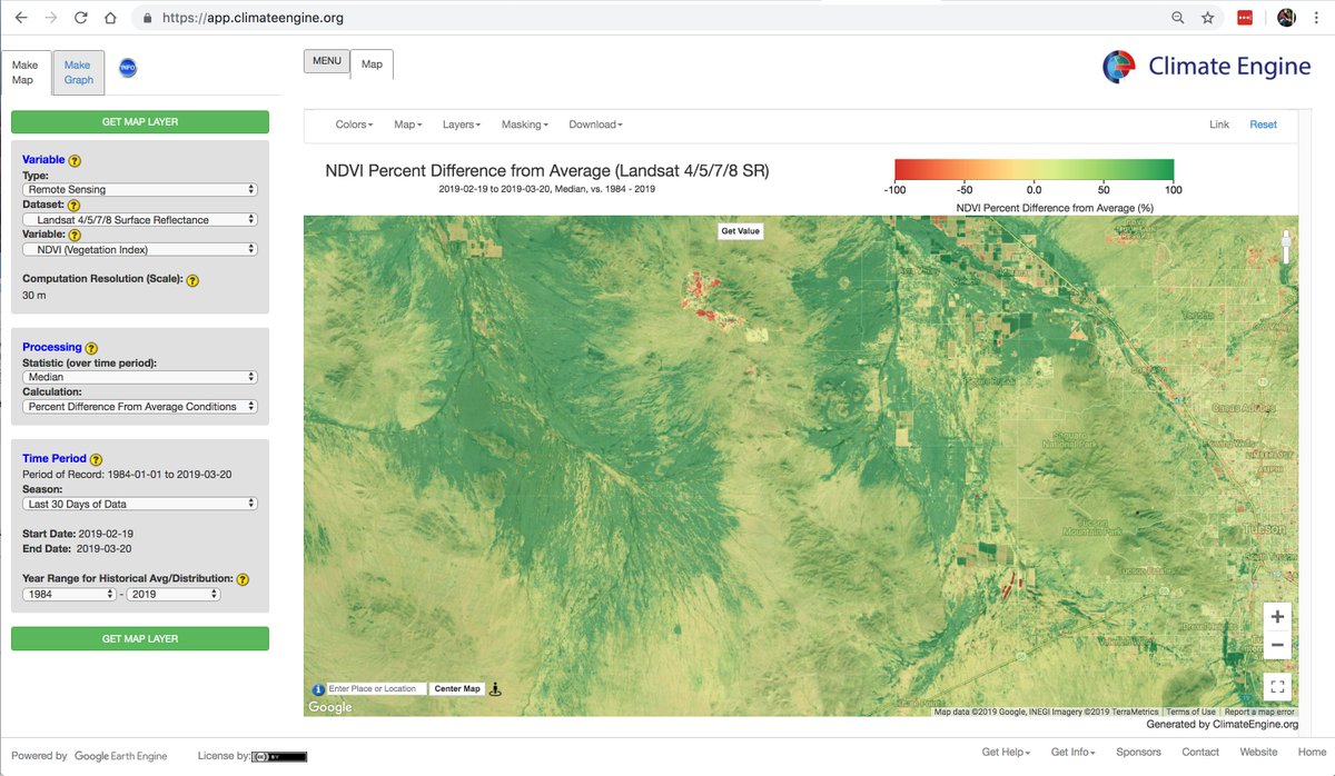
Looking for Super Blooms? Find them making NDVI anomaly maps using @USGSLandsat data. Here's an example near Tuscon, AZ - https://t.co/Wq5c0WWEkk with some pictures for reference https://t.co/eKeCoutEAF
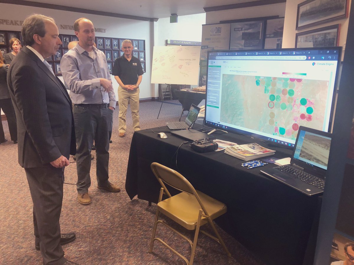
Chris Pearson is here demonstrating the power of @climate_engine—an app developed by DRI & @uidaho—to map climate & satellite data and visualize historical changes in precipitation, vegetation, & more. #DiscoverDRI#NVLeg
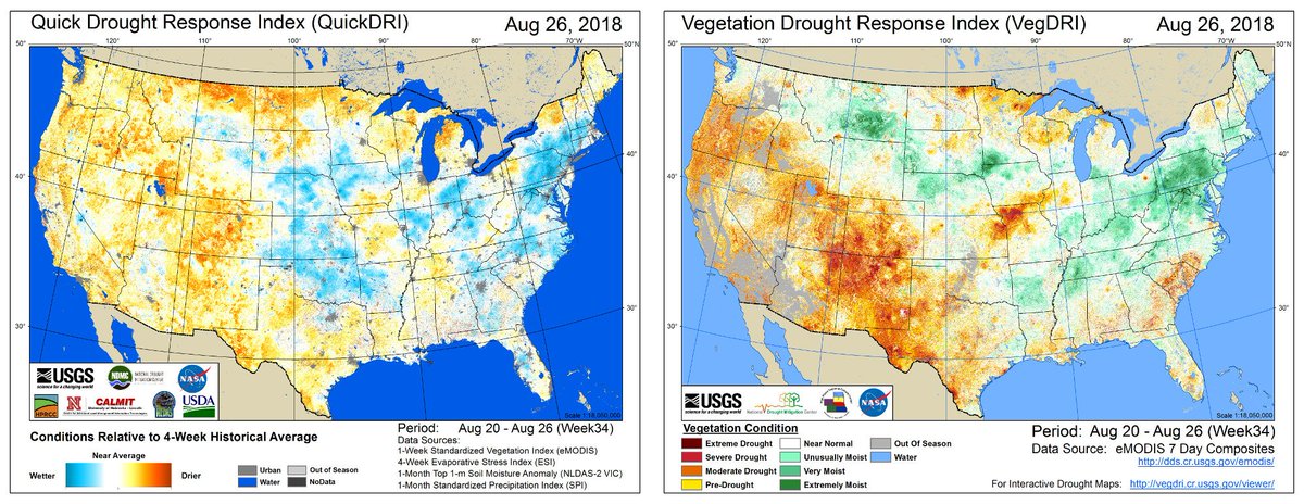
What can vegetation conditions tell us about #drought and precipitation trends in the conterminous United States? Here’s what our VegDRI and QuickDRI maps say this week. See the change week-to-week by following this link: https://t.co/9ASafX9K0J
Make anomaly maps with #Landsat, #MODIS, and different climate datasets. A good example is the current European drought and associated heat wave via MODIS land surface temperature - a reflection of plant water stress. Check it out for the last 30 days - https://t.co/Kejkd0xfYc
Our new study in PNAS (@PNASNews) assesses how natural and human-modified watersheds are reacting to recent climate change. Check it out! Open access!
Co-authors: @climate_guy@indianaclimate@JasonKnouft
and, absent from Twitter, Sarah Null.
https://t.co/vaGjBHb2Ad