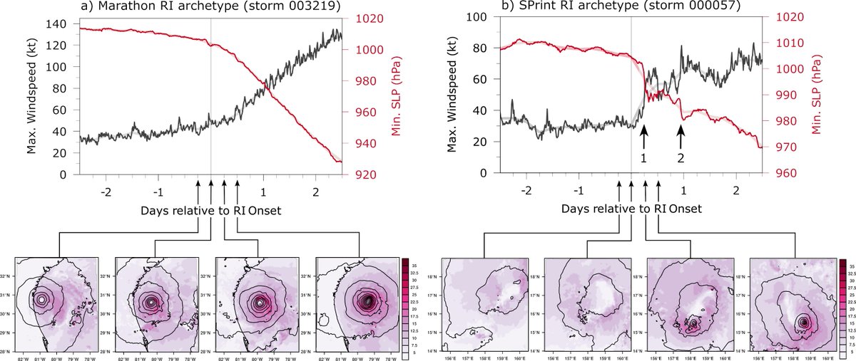
What do hurricanes and athletes share in common?
They can both be marathoners and sprinters! 🌀🏃♂️
Check out our study on "Marathon vs. Sprint: Two Modes of Tropical Cyclone Rapid Intensification in a Global Convection-Permitting Simulation" for more insights. 🧵(1/16)
Downslope wind storm in Boulder, Colorado: clouds cresting over the Front Range and cascading downward. The "dust front" with the strongest winds kept sweeping eastward from the base of the foothills. A peak wind gust of 71 mph was recorded at my location during the event.
@ryanweather Marathon. AFAIK there was no evidence of center reformation that led to a brief spike in intensification before being arrested by unfavorable conditions.
Any storm that RIs from TS/Cat1 to major hurricane will most likely be a marathoner (though it could be a fast one).
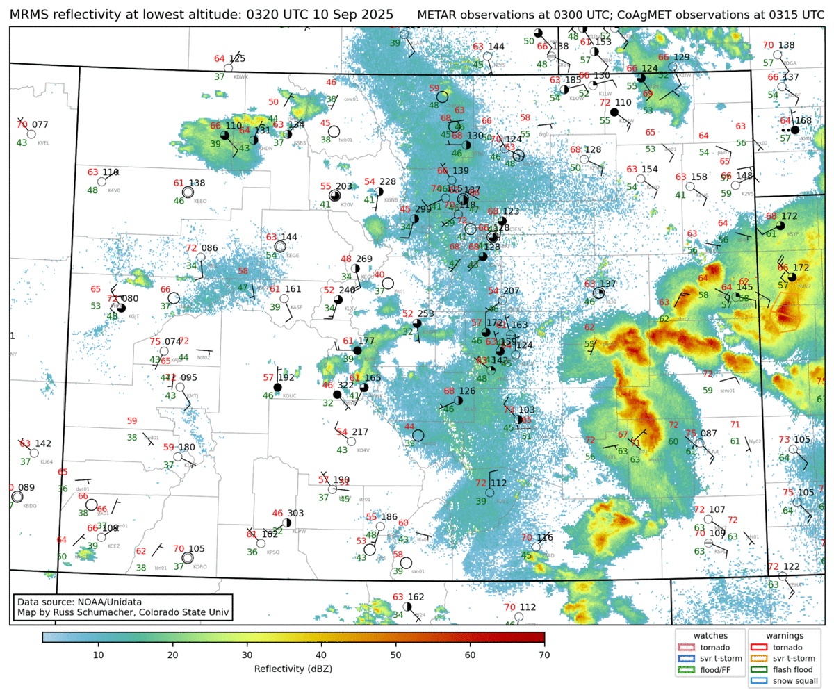
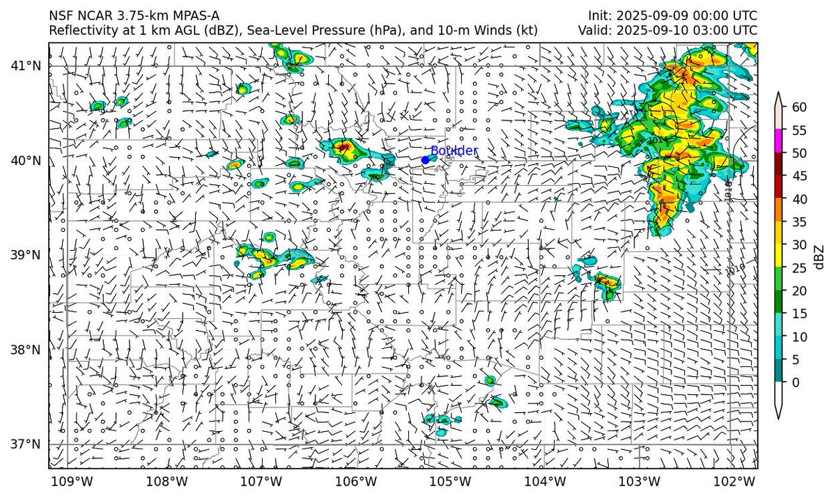
While a Mesoscale Convective System did form this evening over the Colorado plains (left), the MPAS forecast had it farther north than observed (right)
🌍 The @NCAR_MMM lab at @NCAR_Science is running experimental realtime forecasts with a global 3.75-km MPAS model.
Goal: Highlight the power of global km-scale models for weather prediction from local to planetary scales, incl. tropical cyclones.
👉 https://t.co/eB3BtLx5lj
One advantage of hi-res global models is their ability to resolve topography and its influence on weather. In this 5-day rainfall forecast for Puerto Rico, the model predicts little to no rain along the southern coast but more than 200 mm (8 inches) in the northwestern interior.
New EOR & Graphical Abstract
Judt, F., and R. Rios-Berrios, 2025: Sensitivity of tropical wave structure to resolution and convection treatment in a global non-hydrostatic model.
https://t.co/ChOTFRxs6y
https://t.co/XXjYh0LCX5
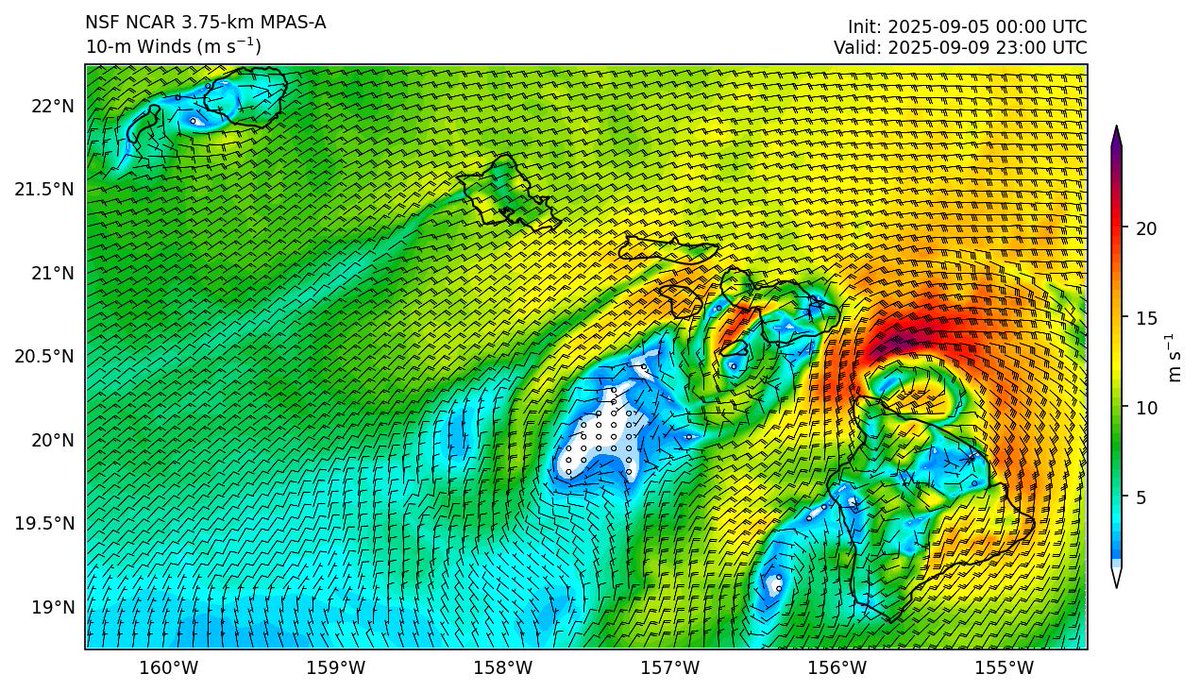
MPAS brings Hurricane Kiko close to Hawaii (as a 45-kt tropical storm) in ~4 days creating some interesting topographical flow features
👉 https://t.co/eB3BtLx5lj
Variable: 10-m Winds, Domain: Hawaii
🌍 The @NCAR_MMM lab at @NCAR_Science is running experimental realtime forecasts with a global 3.75-km MPAS model.
Goal: Highlight the power of global km-scale models for weather prediction from local to planetary scales, incl. tropical cyclones.
👉 https://t.co/eB3BtLx5lj
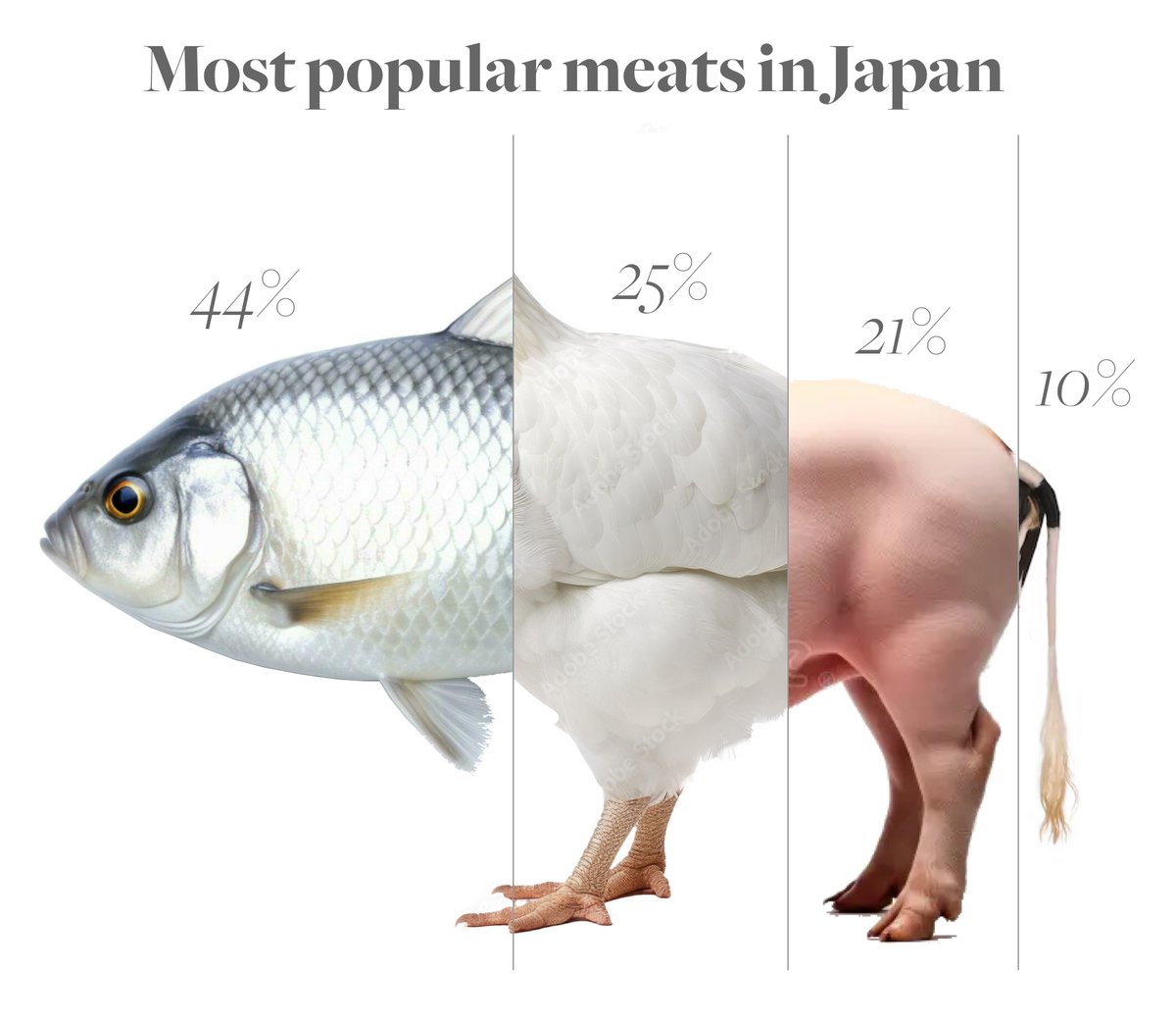
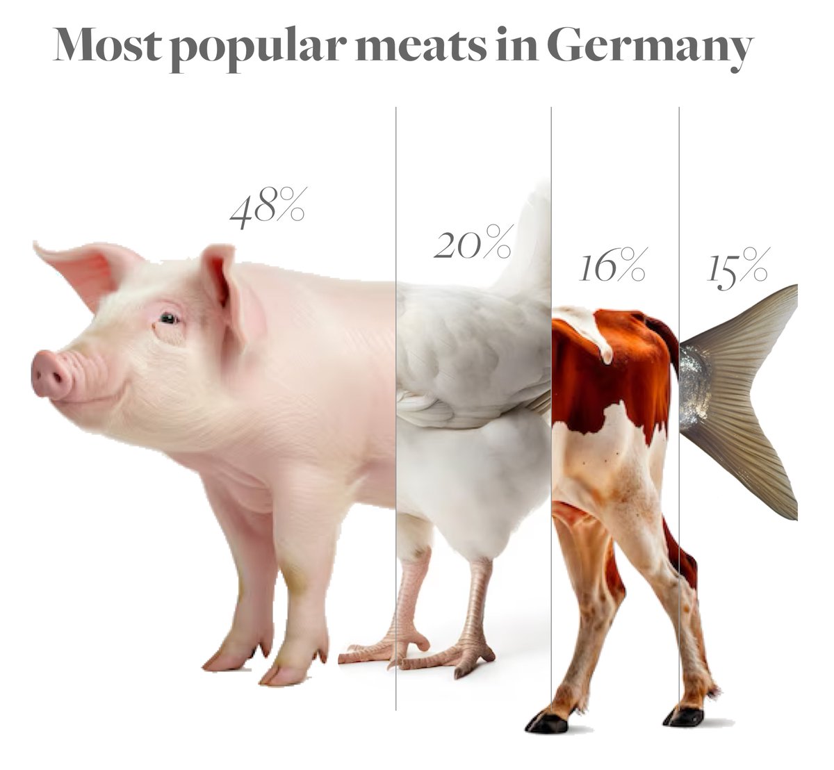
Ever wondered what a country’s meat supply looks like? 🍗🐄🐖🐟 Here’s a breakdown of meat preferences in Japan, the US & Germany—visualized as hybrid animals! A fun (and slightly cursed) way to see food stats. 🧵👇
Cool cold front in Colorado today. We see:
1) northerly winds & colder behind the front; southerlies & warmer ahead of the front
2) convergence and initiation of showers along the front
3) the actual front is detected by radar (thin green lines just south of the showers)
#cowx
Every time a hurricane hits land, people question the intensity: "If it was a Cat 4, where are the Cat-4 wind reports?" The answer? Friction.
It’s like biking from pavement (ocean) to gravel (land)—an instant slowdown.
I am happy to announce that I am actively looking for two PhD students to join my research group starting Fall 2025 at @MiamiRosenstiel! These positions are fully funded. Please see the slide for more info and feel free to reach out with any questions via email or DM here.
Hurricane models performed well with #Milton. The 15-h forecast from @HRD_AOML_NOAA's HAFS-B correctly captured: an eyewall open to the south(west), the large stratiform rainshield to the north, supercell-producing rainbands over FL, and even the weaker rainband down to Key West.
The cirrus clouds that were obscuring the eye of #Milton have since dissipated as temperatures within the core continue to warm.
Very curious to see what recon finds in a little while
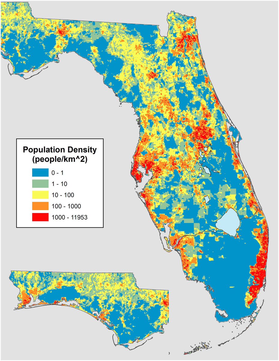
Population density maps help with *roughly* estimating human impacts. Lots of real estate in #MILTON’s way. (Also, nicely showing the “step function” of the Miami metro and its swampy hinterlands)
Source: https://t.co/wpr6RAgPDd