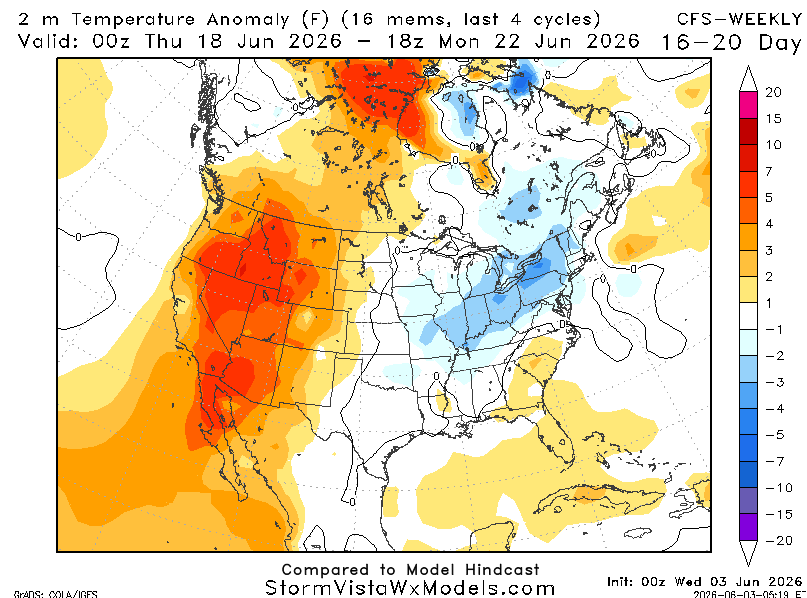
Climatological warming trends in the coming weeks will likely limit the odds for the storm track to continue to dive south of the Midwest, as has been common during May. https://t.co/sjGzzurpt4
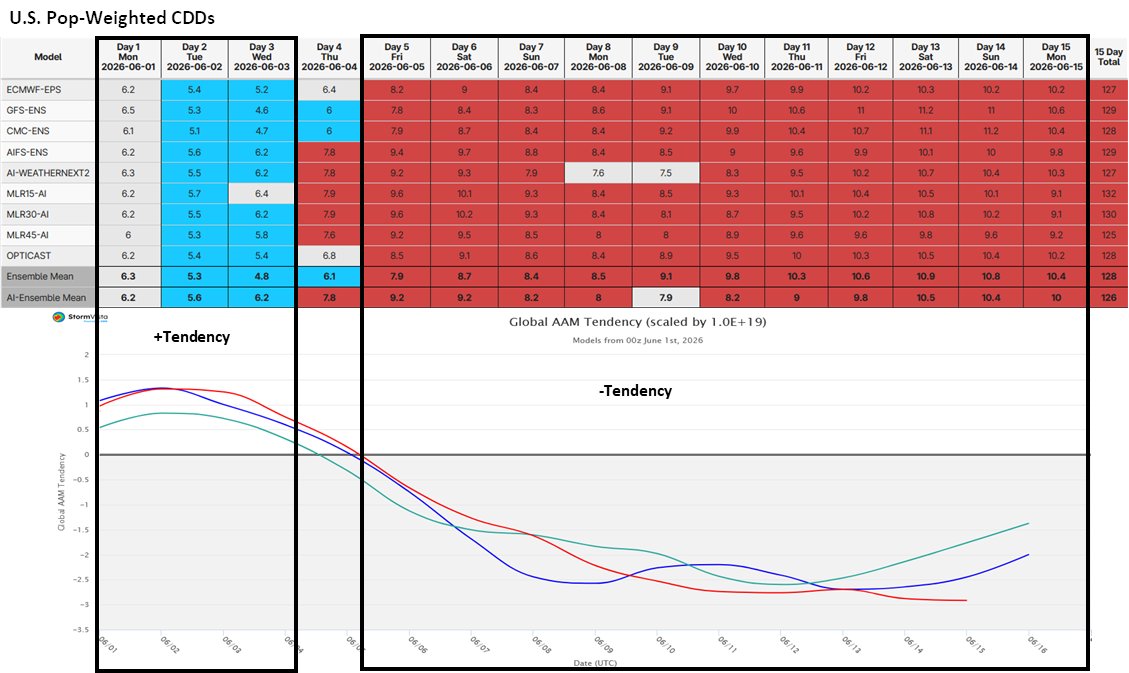
GLAAM tendency seems to be driving train currently for U.S. prevailing pattern. Lower tendency, despite continued positive anomalies, are helping to expand heat, even if disrupted at times by active El Niño precipitation.
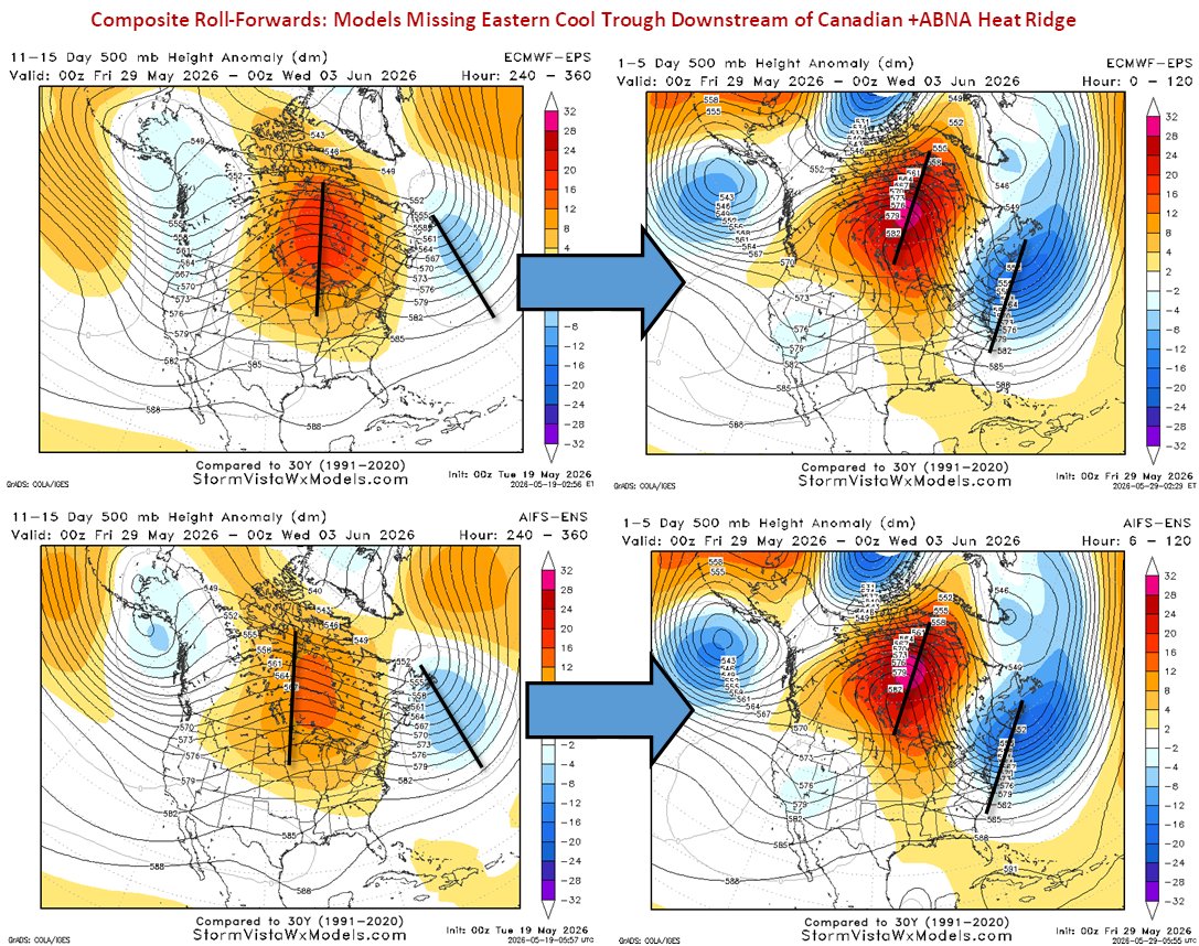
11-15 day models have been capturing ridge position fairly well, but have been missing downstream troughing, causing significant forecast errors for East Coast cities.
Midwest rain deficits are favored to expand in early June, but there is essentially no correlation to final corn/soy yields at this very early stage. https://t.co/Eulzj9Pz3k
Active 15-day pattern ahead with both cooler and warmer to hotter periods, but main warmth focused North with more cooler risks South (very niño-like).
Drier trends into early June and warmer/drier ENSO summer correlations elevate risks for the N. Plains/Canada spring wheat, although yield impacts were mixed. https://t.co/GwnUnrKUbx