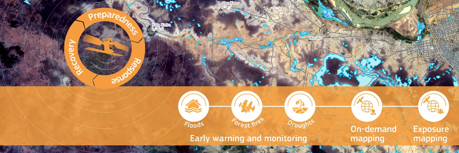
Copernicus Emergency Management Service provides mapping products based on satellite imagery as well as #ForestFires#Flood and #Drought early warning products.
🌍On #WorldPopulationDay, discover how #CEMS Global Human Settlement Layer data provide insight on population and settlements around the world
▶️Madrid🇪🇸
▶️Kinshasa🇨🇩
▶️Manila🇵🇭
▶️Bogotá🇨🇴
▶️Vancouver🇨🇦
▶️Brisbane🇦🇺
More about #GHSL at https://t.co/cvC3vEmtHr
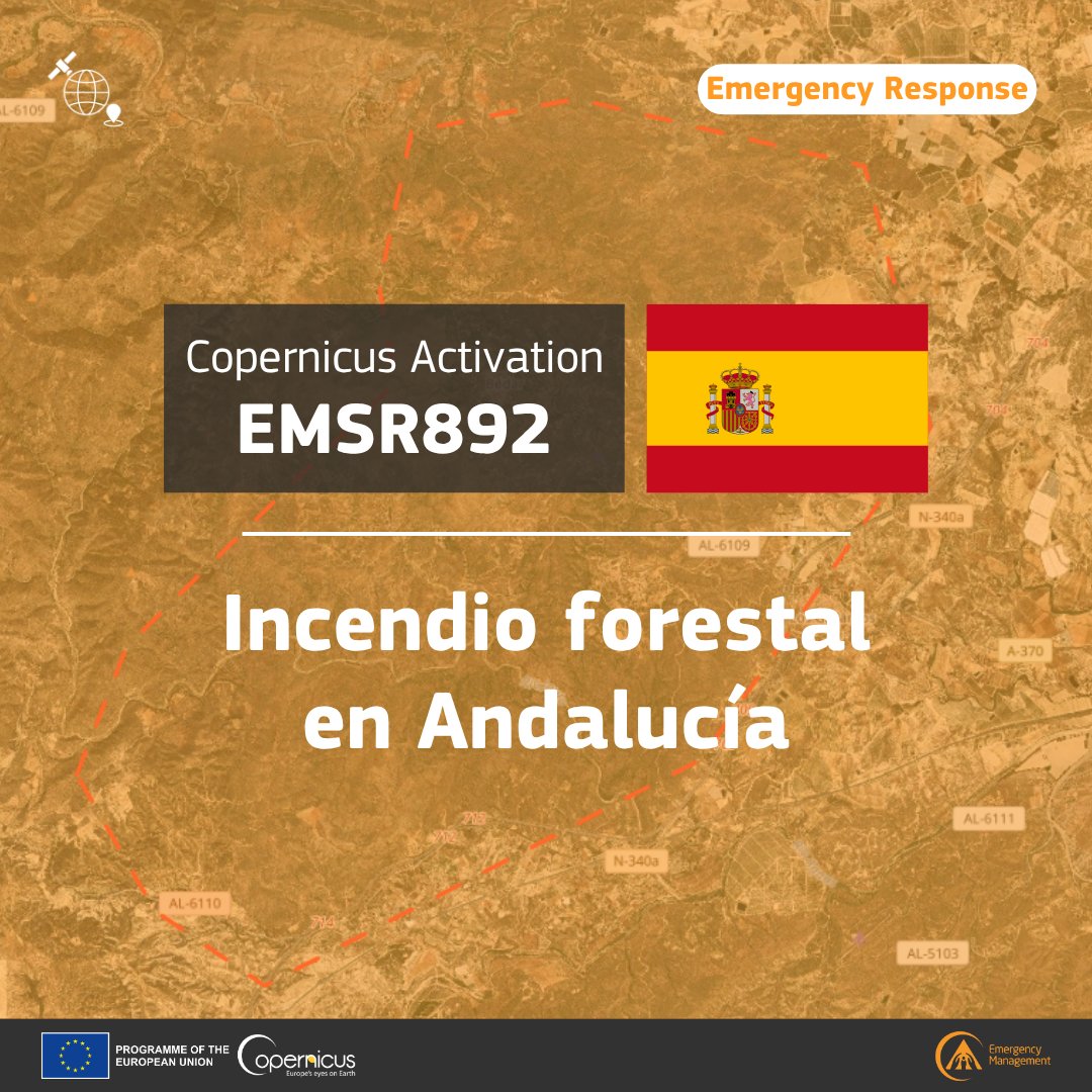
We stand with Spain as flames continue to blaze in Andalucía.
We are closely monitoring the situation and have activated @CopernicusEMS satellite mapping service to help local authorities assess the damages and monitor the extent of the wildfire.
Spain, you're not alone.
🔥 #EMSR892#Andalucia#IFLosGallardos Incendio forestal activo en las proximidades del municipio Los Gallardos, en la provincia de #Almeria, #España. Varias zonas evacuadas; 12 fallecidos hasta el momento
Nuestro #MappingTeam ha sido activado
https://t.co/UAlJxXJqzN
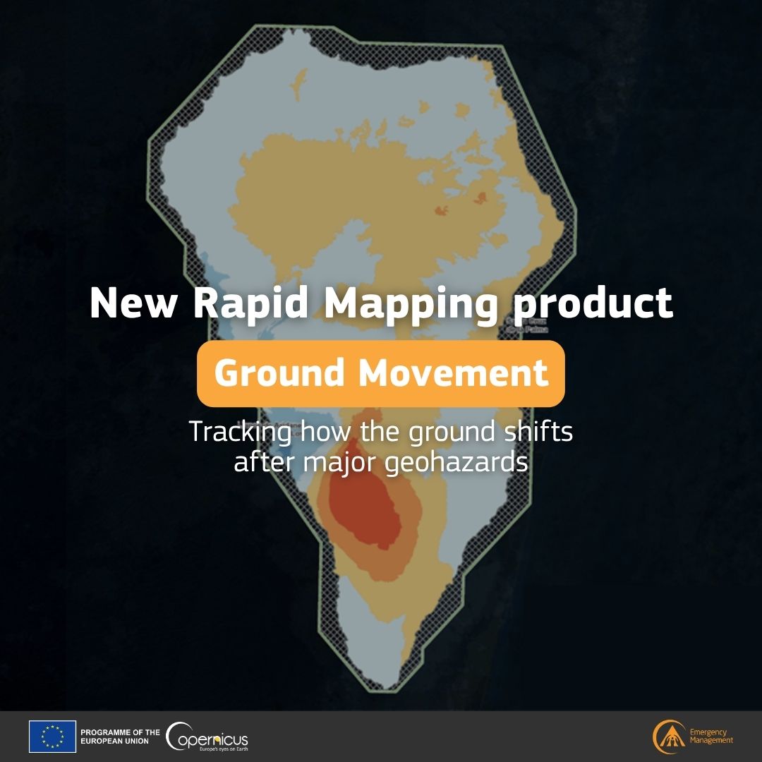
¿ #Sabíasque@CopernicusEMS ha lanzado un nuevo producto de cartografía rápida?
▶️Movimientos del terreno
Gracias a las imágenes radar de #Sentinel1🇪🇺🛰️ de #Copernicus, se miden de forma oportuna los cambios en la superficie tras un terremoto o una erupción volcánica.
Más información: https://t.co/AmSSd2aQ4X
#IGNSpain #CNIG #Cartografía #VigilanciaSísmica #VigilanciaVolcánica #GestióndeEmergencias @CopernicusEMS
#DYK that we launched a new Rapid Mapping product?
▶️Ground Movement
Using #Copernicus#Sentinel1🇪🇺🛰️ radar imagery, we can timely measure surface changes after earthquakes or volcanic activity
Read more: https://t.co/EA6aIaXXJA
🔥How is Europe using satellites and AI to fight wildfires?
Our European Forest Fire Information System #EFFIS has been featured in the latest @EIB story
Discover how we help local authorities by turning data from 🛰️ into faster action on the ground👇
https://t.co/MzGgqItH8T
🔔Stay updated on our #CEMS On-Demand Mapping activities❗️
We’ve set up a new notification system to alert you when:
▶️Activations start in selected countries
▶️New products are delivered within activations you follow
▶️News or events are published
👉 https://t.co/Xc8YxTqOSO
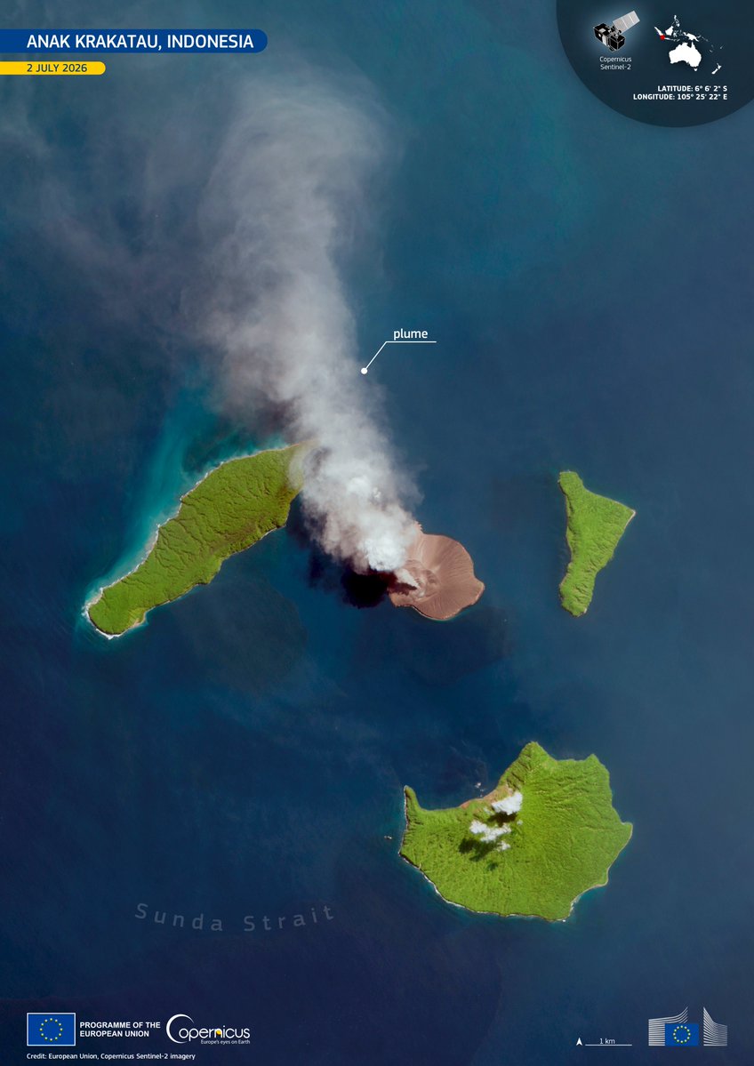
🌋 Indonesia 🇮🇩 raised the alert level for Anak Krakatau on 2 July following increased volcanic activity.
🛰️ This #CopernicusEU Sentinel-2 #ImageOfTheDay captures the ash plume drifting over the Sunda Strait, supporting monitoring.
🔗 https://t.co/fr8zZoOWk1
From 1 July, #Ireland🇮🇪 holds the Presidency of the Council of the EU
#DYK that last November we supported Irish local authorities in the aftermath of #StormClaudia?⛈️
🔽Dataviz showing population density and estimated flood depth🌊 caused by the storm as of 17 November 2025
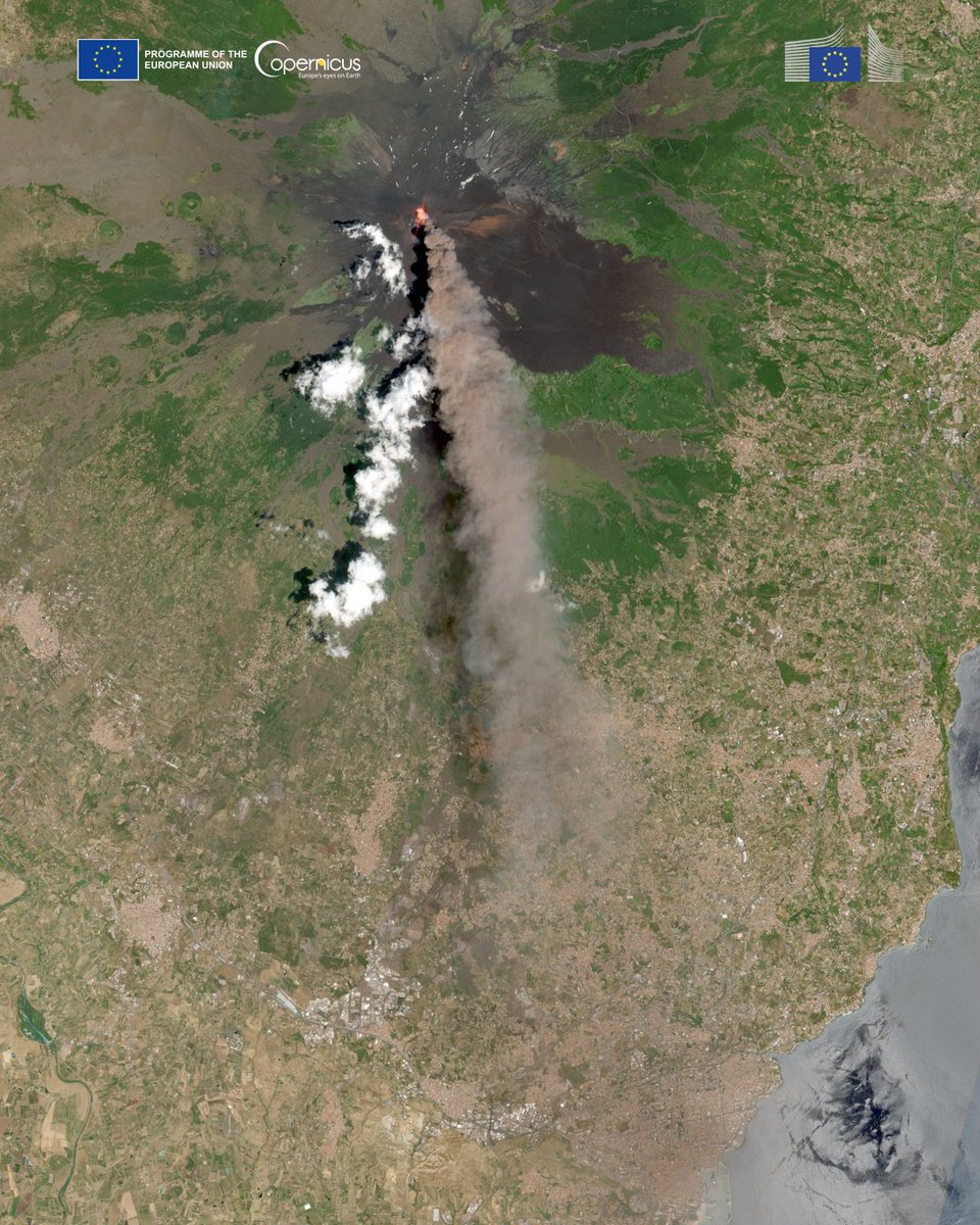
🌋 Mount Etna's latest eruption continues in Sicily 🇮🇹
🛰️ This #CopernicusEU Sentinel-2 image from 5 July captures a large volcanic ash plume that led to the closure of Catania Airport, supporting tracking, hazard assessment & situational awareness.
🔗 https://t.co/atn5px5iZg
🔥 A wildfire in Spain's Aragón region 🇪🇸 spread rapidly across the Sierra de Alcubierre, affecting forests and protected areas.
🛰️ This #CopernicusEU Sentinel-2 image from 1 July captures active fire fronts and burn scars.
🔗 https://t.co/6n2qqyCUlV
#ImageOfTheDay
🔥 Wildfires spread across north-west Portugal 🇵🇹 on 2 July, with over 1,100 firefighters deployed near Vouzela.
🛰️ This #CopernicusEU Sentinel-3 #ImageOfTheDay captures a smoke plume stretching around 620 km over the Atlantic.
🔗 https://t.co/h4tCfUOHa3
📈 On 24 June, two earthquakes (M7.2 & M7.5) struck N Venezuela 🇻🇪, causing severe damage & casualties.
🛰️ @CopernicusEMS (EMSR884) has been activated to support rapid assessment.
Mapping in Caraballeda identifies affected buildings.
🔗 https://t.co/jd9TbcN75p
#ImageOfTheDay
☀️ Madagascar 🇲🇬 continues to face serious drought conditions.
🛰️ @CopernicusEMS data show drought intensifying across much of the country during the first half of 2026, driven by low rainfall and above-average temperatures.
🔗 https://t.co/SCYH2vcT4P
#ImageOfTheDay
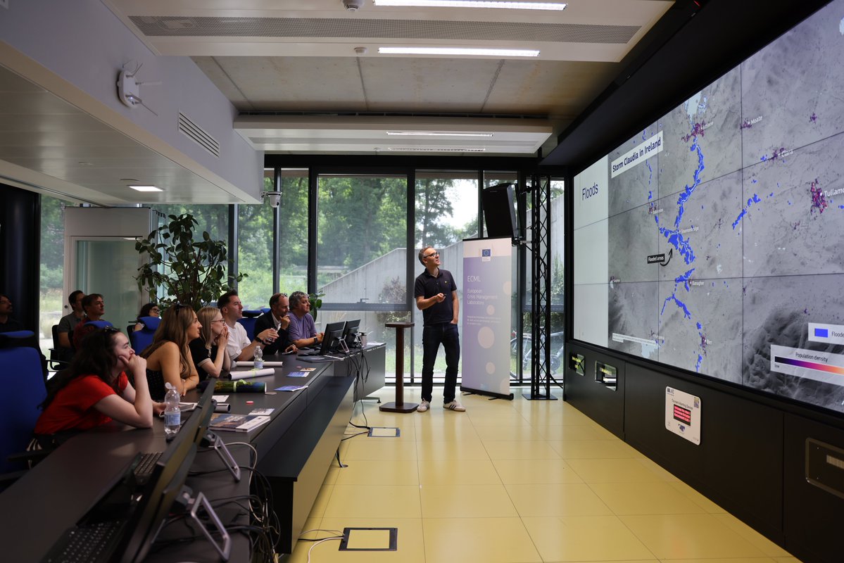
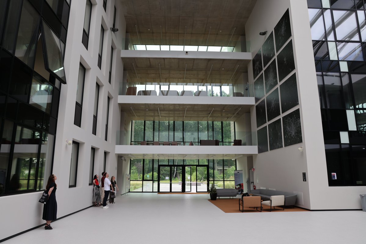
As @Ireland2026eu 🇮🇪 takes over the Presidency of the Council of the EU from 1 July, the @EU_JRC this week welcomed Irish content creators to showcase #CEMS' work in supporting disaster management
Thank you for your visit! 💚
🔔Stay updated on our #CEMS On-Demand Mapping activities❗️
We’ve set up a new notification system to alert you when:
▶️Activations start in selected countries
▶️New products are delivered within activations you follow
▶️News or events are published
👉 https://t.co/Xc8YxTqOSO
🗺️ NEW: Following the Venezuela earthquakes, we have created a damage exposure tool consolidating satellite-derived damage assessments from @CopernicusEMS, @hotosm, @MSFTResearch and others.
Explore the visual: https://t.co/md3ZRhis8v
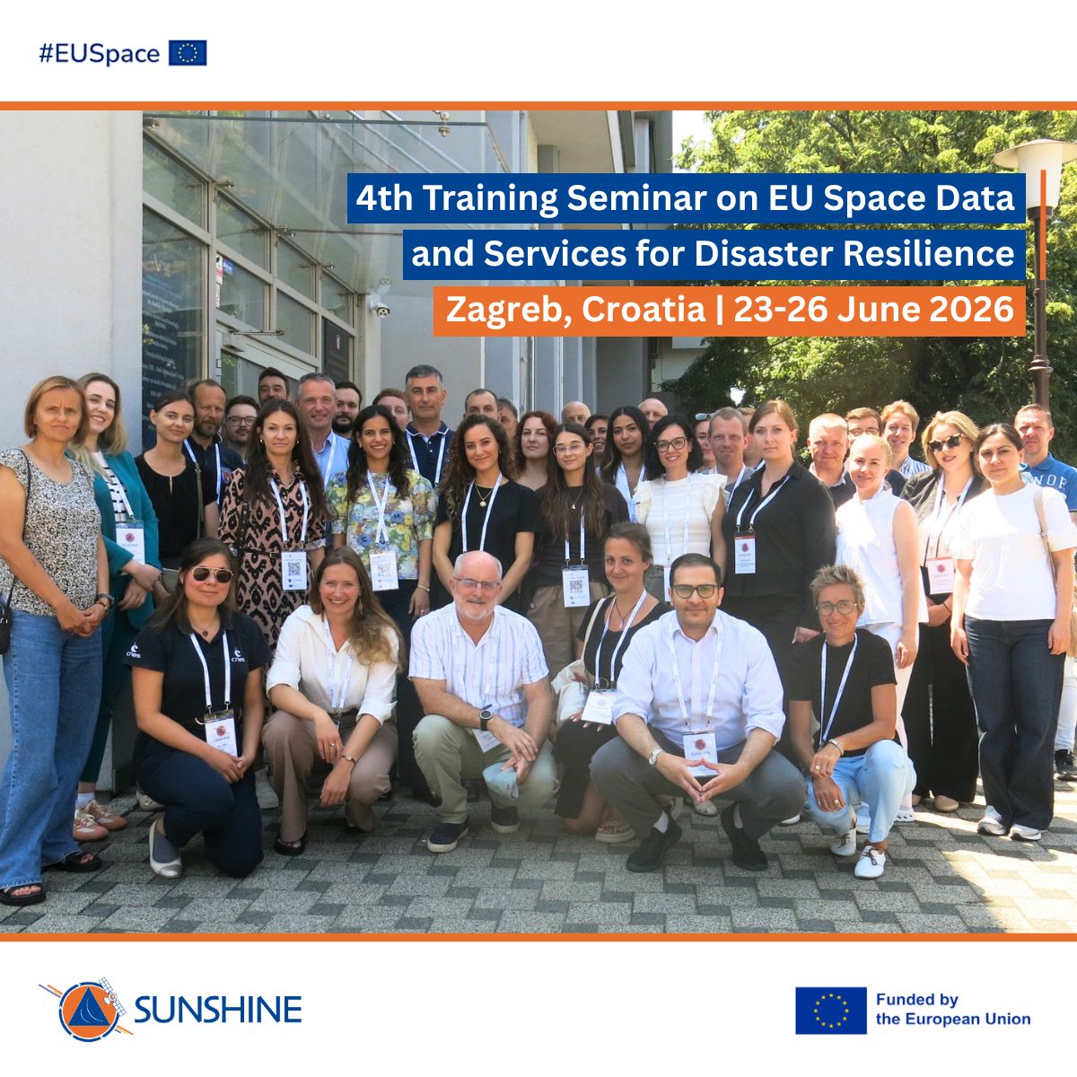
#DYK the final #SUNSHINE Training Seminar took place in #Zagreb 🇭🇷 last week?
Civil protection professionals strengthened their #CEMS expertise and joined a Europe-wide network of ~100 trained #EUSpace services practitioners💡
More at: https://t.co/SfspKNKH3L