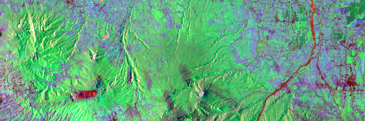
Resultados preliminares de mi investigación de zonas inundadas en la Cuenca hidrográfica Río Frío en la Zona Norte de Costa Rica utilizando imágenes SAR-GRD de Sentinel-1, algoritmos de umbralización automática y refinamiento con lógica difusa.
New #Jupyter Notebook Data Recipe: How to Generate Earthdata Prerequisite Files (e.g, .netrc, .urs_cookies, .dodsrc) needed to access the NASA's #GESDISC archives manually, or via #Python.
Access Notebook: https://t.co/YswEsSeUth
Explore resources: https://t.co/4uMaPkbEYN
🚀 ANNOUNCING: The release of my free and open e-book, "Applied #MachineLearning in Python: A Hands-on Guide with Code"! 🎉
🔗 Access it here: https://t.co/kRPpZDexWa
📚 16 chapters packed with well-documented #Python workflows, open-source code, and datasets — with direct links to my YouTube lectures for deeper learning! This e-book blends theory with practical coding and effective visualizations to help you understand and apply #MachineLearning concepts.
⚙️ Try the examples, explore the code, and follow along with hands-on exercises. It’s a living document, so I’ll continue adding new chapters and improving content over time.
I'm here to help you dive into #DataScience and #ML — let’s learn together! I'm having an awesome sabbatical! Stoked!
��� I am teaching an Introduction to GIS Programming course this semester! All course materials are freely available online. New video lectures will be uploaded twice a week. Check out the links below to learn #geospatial 🌍 data visualization and analysis using #opensource Python packages 📊
Website: https://t.co/2dK3d0n9Rz
GitHub: https://t.co/yBth77q1pC
YouTube playlist: https://t.co/9sbsl5SHNk
#geospatial #python #jupyter
✨A million downloads & counting!✨Read how our most popular resource is helping people use synthetic aperture radar #SAR for understanding ecosystems & the impacts of #climatechange 🛰️🌎📖https://t.co/Pwwk88edg4
.@luisd187 helped launch the 1st 🛰️ from #CentralAmerica. In 🇸🇻 he partnered with SERVIR to inspire the next generation of #ClimateLeaders to pursue their own dreams beyond the stratosphere 🌎🌌
Learn more in this @climatelinks feature: https://t.co/WyAEVx4mPD
@NASA@USAIDES
In addition to the Mountain Pine Ridge Forest Reserve (damage in yellow), the Vaca Forest Reserve (damage in red, next to the western border) has also been impacted by the recent #fires 🔥 in #Belize 🇧🇿. 😬
📢Did you know that @NASA + @ISRO are launching a satellite called #NISAR that will collect information on the world's ecosystems and other applications? Connect to the following Spanish-language webinar: https://t.co/xxABfxWuso. @BzGEO@UAH_LAS
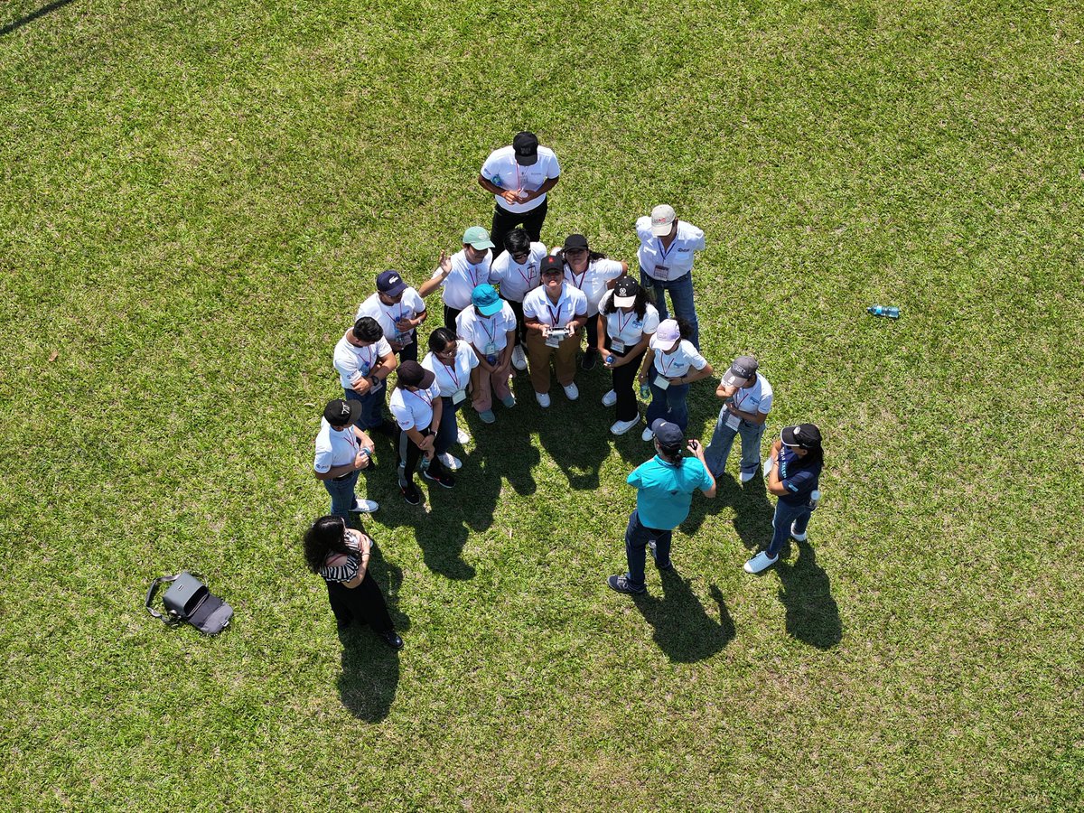
After just 1 weekend at #JóvenesGeoespaciales, 45 students from el salvador are already applying @NASA data to develop prototypes for #climateresilience, from creating maps for monitoring crop health to creating tools for tracking wildfires.
45 students from #ElSalvador have kicked off their #geospatial journey! 🛰️🇸🇻
We're at the #JóvenesGeoespaciales workshop led by our partners at RAC and @IICAnoticias. Check out their unique approach to connect women & youth with geospatial technology: https://t.co/hn7ImD7DfD
Read about our work with @sinac_cr & local organizations in Costa Rica 🇨🇷 using radar (#SAR) to see forests and land through the clouds ☁️ https://t.co/quusCUzmIY
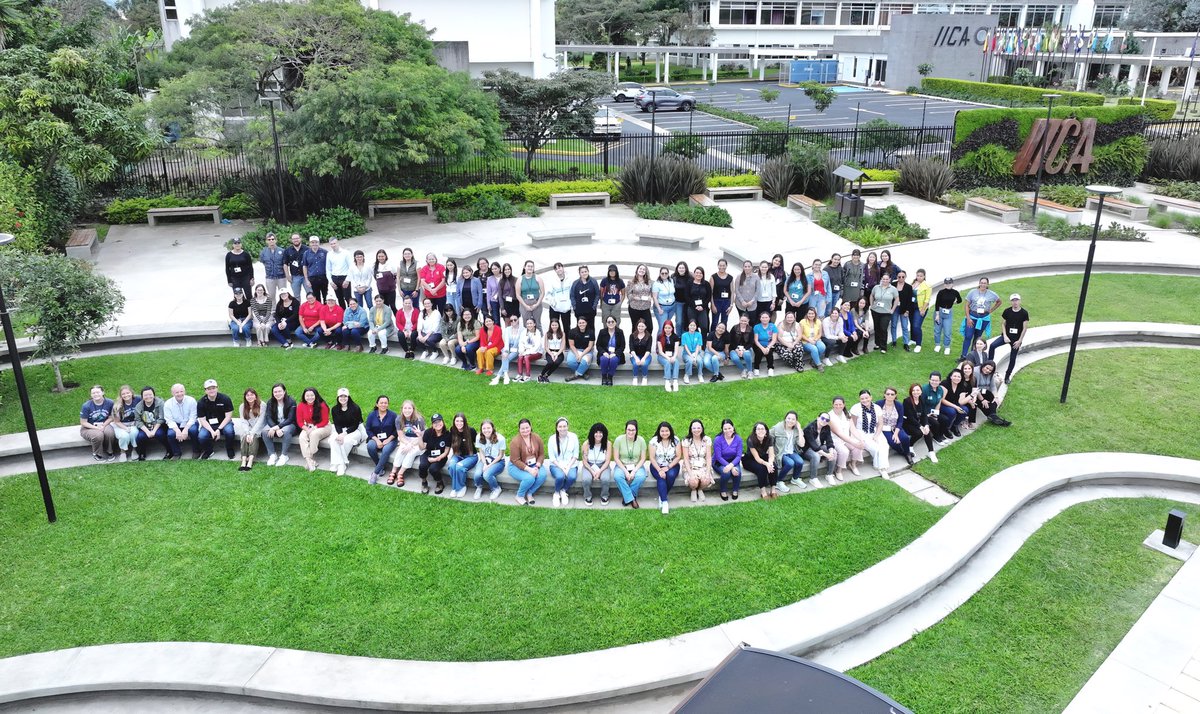
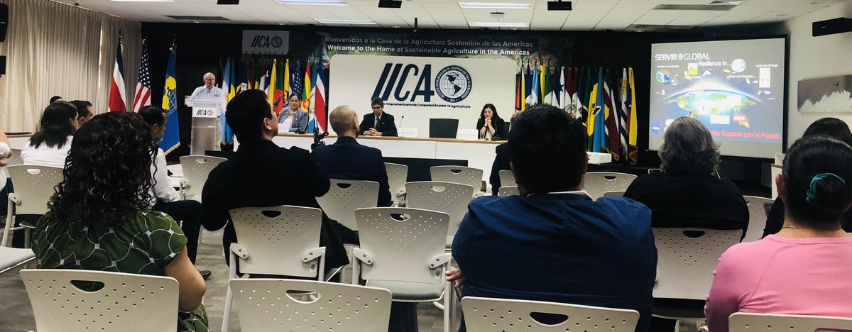
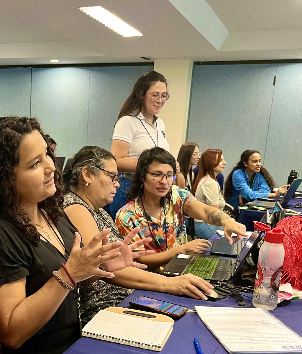
"100 women connected to the agri-food sector from rural Costa Rica regions enhanced their skills in digital & geospatial technologies at IICA's HQ."
📰👉https://t.co/HwzllTWhaZ
Special thanks to Harvest's @asgalve for training attendees on @G20_GEOGLAM tools for ag monitoring!
Impressive flooded extent in #Greece 💧
The images show the pre/post event situation between the 6th and 7th of September, 2023 by #Copernicus#Sentienl1 🛰️
You can find more information & geospatial datasets at: https://t.co/igTTcbdLBk by @CopernicusEMS.
Check our web application to visualize and explore at the country level the datasets created across all the tropics
"Spatial and Temporal Availability of Cloud-free Optical Observations in the Tropics to Monitor Deforestation"
👇
https://t.co/tp36BJQYgh
https://t.co/GxsLuq1dtd
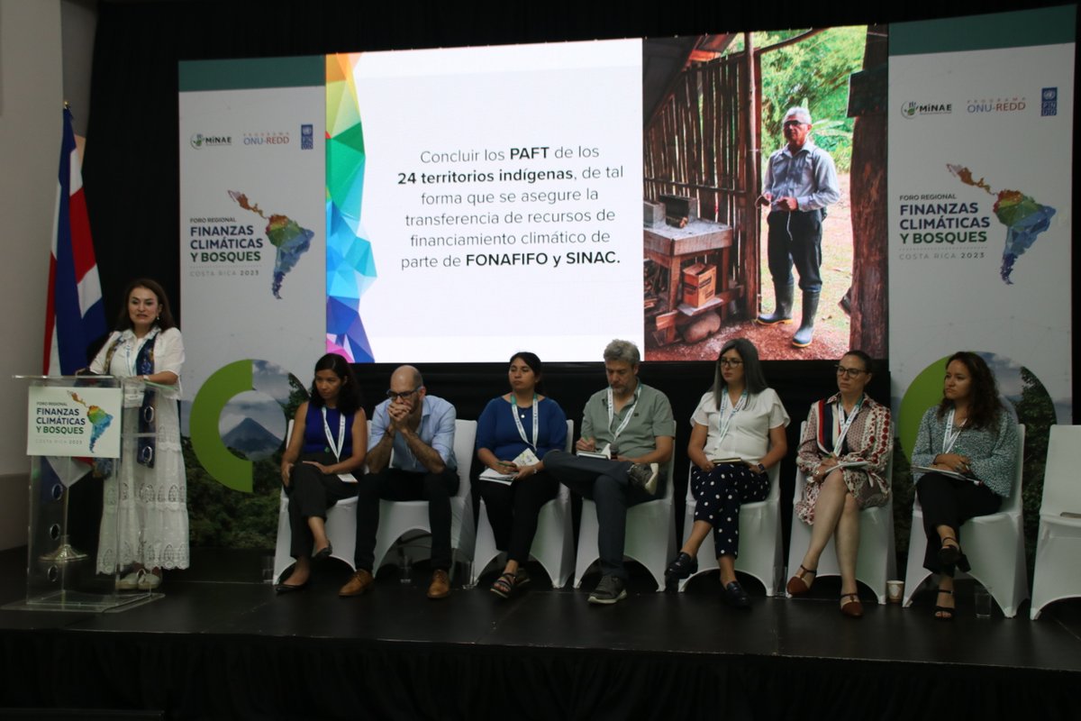
🟢Foro regional finanzas climáticas y bosques reúne representantes de países que implementan proyectos REDD+, agencias socias de ONU-REDD, países donantes y las secretarías del Fondo del Medio Ambiente Mundial, así como representantes de los estándares del mercado de carbono