«¿Qué dirán?» de Guerrita & Ciclo con Tremendo ya en el canal. Un vídeo de 2AM.
Aprovechamos para recordar que desde hoy están saliendo los pedidos de las ediciones físicas. Podéis elegir la vuestra en nuestra tienda además de la edición especial en la tienda del El Sótano Shop.
🔉 COMUNICADO ESPECIAL AMETSE ⚠️
Ante la noticia que hemos conocido hoy relativa a la apertura de un proceso penal contra la presidenta de AEMET por lo sucedido en Valencia el pasado 29-O, desde la asociación meteorológica del Sureste-AMETSE queremos manifestar lo siguiente:
DESTELLO POR IMPACTO de un meteoroide sobre la Luna, en el lado no iluminado todavía. Filmado a 370 fotogramas/s desde Japón anoche (7 Nov.) a las 19:00:39.2. Reproducido a baja velocidad. Al no tener atmósfera, los meteoroides excavan cráteres. Podría tratarse de una #Táurida🧐
Esta es buena. Detenido el jefe de Antiblanqueo de la Policía en Madrid con 20 millones escondidos en la pared de su casa. O bien eran los ahorrillos o estaba esperando a blanquear ese dinero. https://t.co/4C9oEPcLaj
We've published a short article on the meteorological conditions leading to the deadly flooding in the Valencia region. We've approached the situation from the perspective of ingredients-based forecasting and also analysed the satellite imagery. https://t.co/8JEkHHare4 1/2
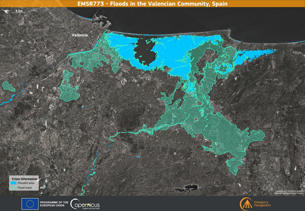
This data visualisation depicts the situation in the province of Valencia on 31 October 2024 at 18:02 UTC. It highlights areas directly affected by the floods, marked in blue, and areas with residual flood traces, indicated by light green lines. ⬇️
https://t.co/uhLqFKWBti
Subtropical Storm #Patty Advisory 6: Patty Beginning to Pull Away From the Azores. Expected to Become a Post-Tropical Cyclone Later Today Or Tonight. https://t.co/tW4KeGe9uJ
#Milton is the fastest Atlantic hurricane to intensify from a Tropical Depression to a Category 5 Hurricane, taking just over 48 hours. This animation shows Milton as it intensified, with the heaviest rains (red) concentrated near the center. https://t.co/uXpdGH1yEd
Hurricane Kirk is racing towards Europe as we speak but will lose its tropical characteristics in the next few hours. It is still expected to be a powerful extratropical cyclone when it makes landfall along France’s western coast midweek.