@DaddyyPanda We are watching another cold system dropping into the neighborhood, but still working out rain totals and how cold it would be (which would also affect rain totals/intensity).
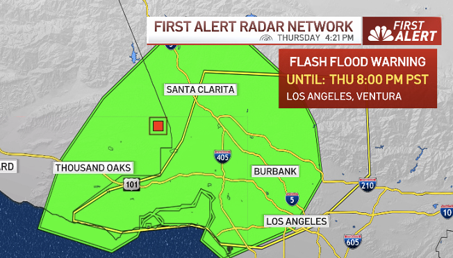
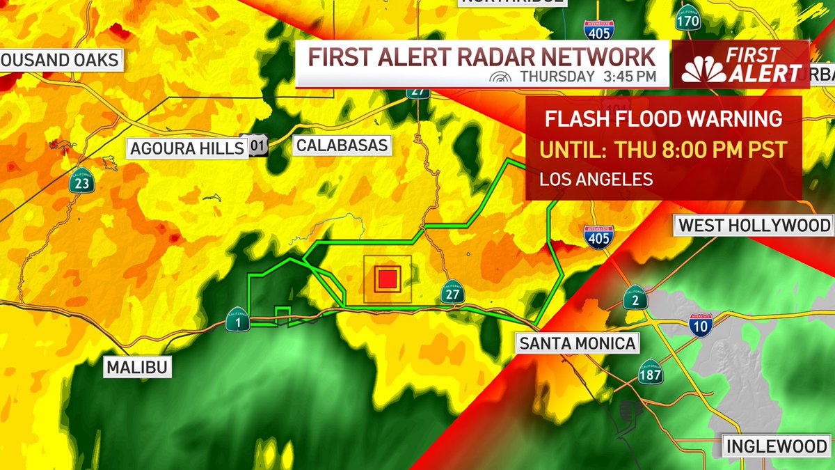
@4t9rs Late Wednesday night - Early Thursday AM. We will have a cold front move overhead and bring a period of very heavy rain. This is also the highest concern for flooding problems.
Tomorrow will have a heavy shower or two, but not like the cold front. Wed AM is nuisance showers.
For the latest evacuation shelter locations for residents impacted by the #PalisadesFire, #EatonFire, #KennethFire and other wildfires, please visit https://t.co/p46PbDz31o.
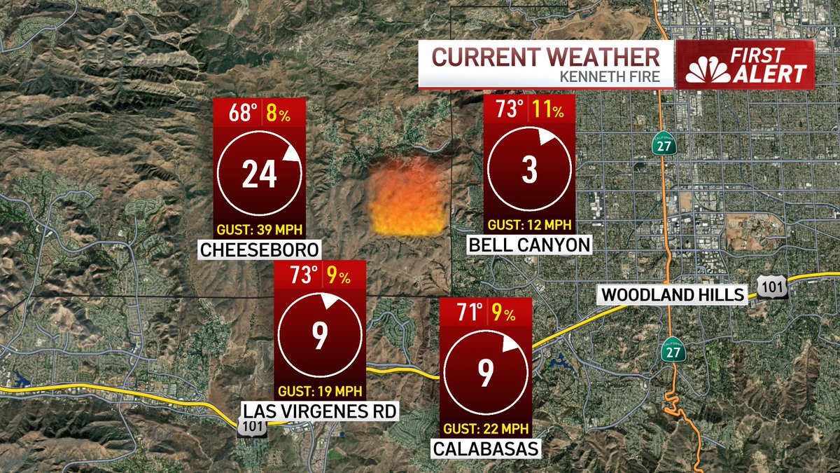
#kennethfire; Forward progress of the Kenneth fire has been stopped, and the fire is currently holding at 960 acres with 0% containment. Approximately 400 Firefighters will remain on scene through the night, continuing to provide structure protection and knock down hot spots. There are no reported structures damaged or destroyed.
All evacuation orders in Los Angeles County have been reduced to evacuation warnings. Evacuation warnings issued in Ventura County have been lifted.
I have been informed the evacuation warning that many of us just received on our phones was mistakenly issued countywide due to a technical error.
A correction will be issued shortly.
GOES "Fire Temperature" showing more activity with #EatonFire & #PalisadesFire compared to last night...you can also see the new #KennethFire pop onto the map. @NBCLA