❄️MOTORIST ALERT❄️
I-5 is FULLY CLOSED in the Tejon Pass between Parker Rd in Castaic and Grapevine Rd in Kern County due to snow. Use US 101 as your north/south detour to your destination. Closure duration unknown. See https://t.co/O37QesJHpw for current conditions.
A Flash Flood Warning is in effect until 11PM tonight for the Franklin Burn Scar and the western portion of the Palisades Burn Scar. Heavy rain will cause flash flooding of creeks and streams. Debris flows are possible, too. #NBCLA#CAwx
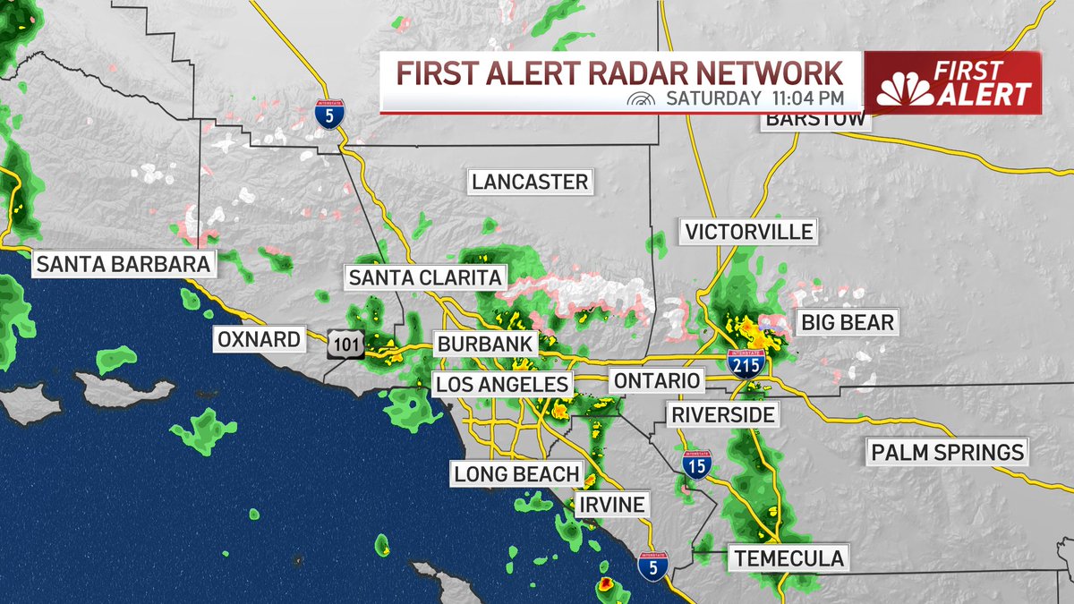
It's been a LONG time since we've seen rain like this is Southern California! Scattered showers and some heavier downpours tonight. Although the rain is very much welcomed, it also brings concerns of runoff and potential debris flows. Stay safe and prepared out there! #NBCLA
The start and rapid growth of the #HughesFire in Los Angeles County seen from ALERTCalifornia's Whitaker Ridge camera. Check conditions live on multiple cameras at https://t.co/Azu4PbZNY7 and look to @Angeles_NF and @LACOFD for updates.
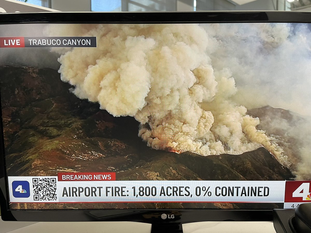
Do you see smoke in the area? The City is currently monitoring a fire on Lake Hughes Road near Castaic Lake. Please avoid the area. We will provide updates as they become available. #wildfire#hughesfire
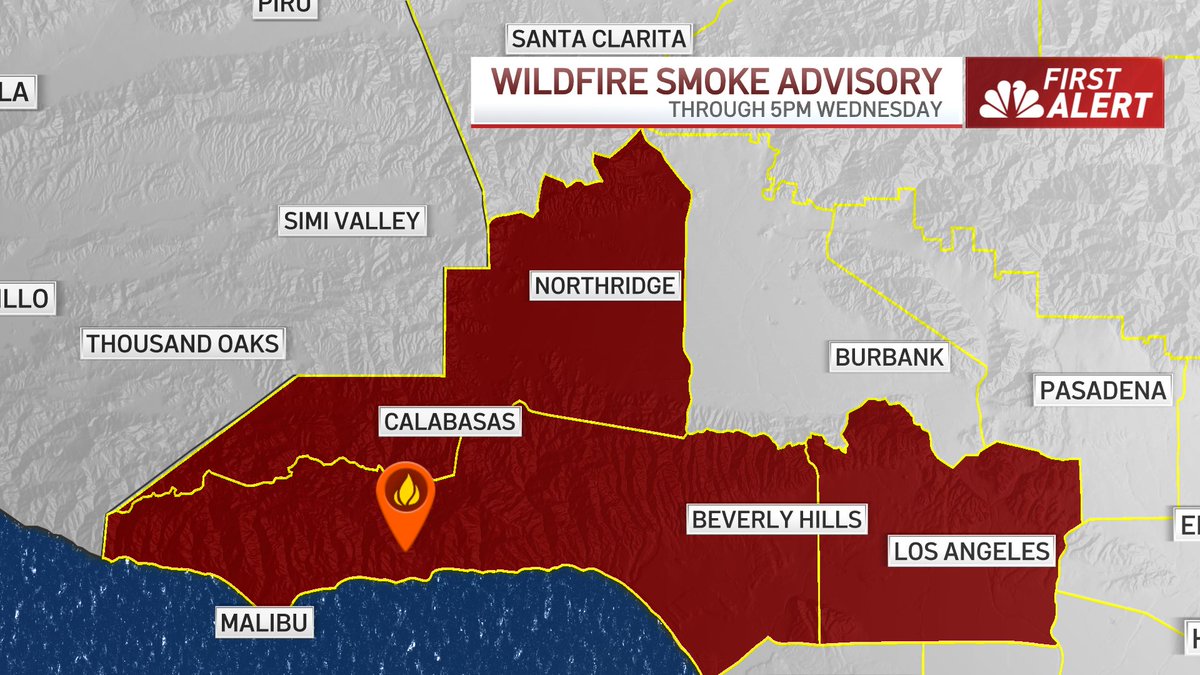
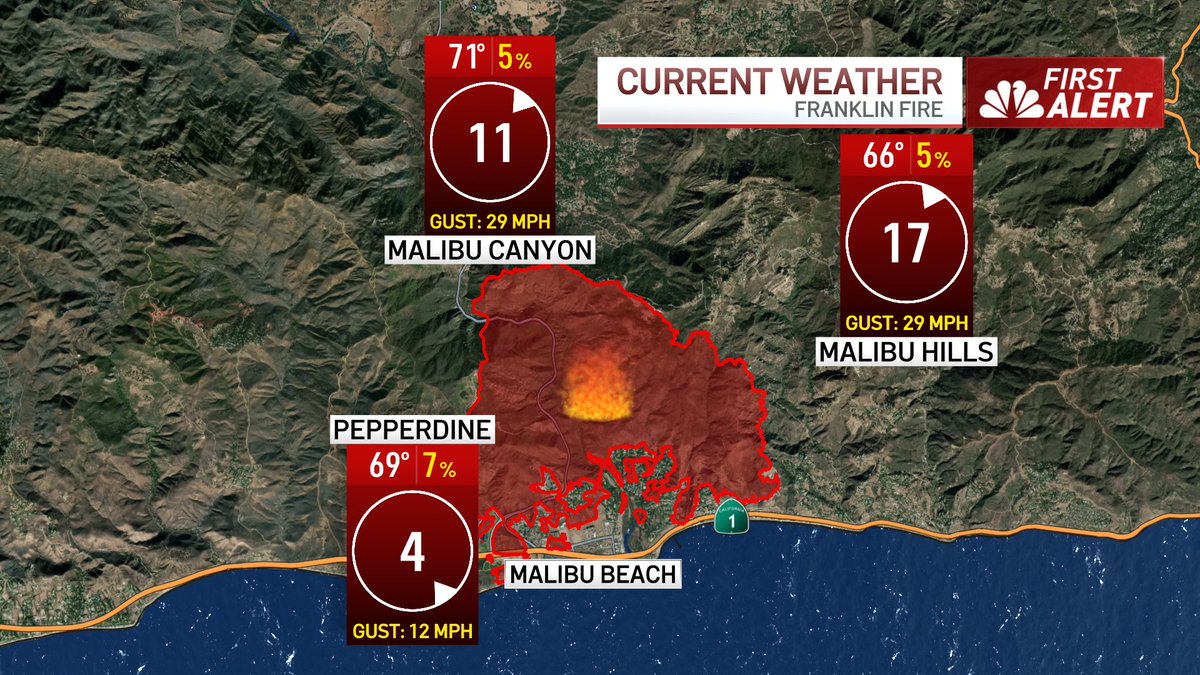
A Wildfire Smoke Advisory remains in effect until 5pm Wednesday due to the #FranklinFire burning in Malibu.
If you live near the area and see or smell smoke, head indoors and close all windows to limit exposure. #NBCLA
3PM conditions around the #FranklinFire continue to show winds gusting into the 25-30MPH range, with very low humidity.
We are still looking at another increase in gusts around/after sunset, but the intensity will not be as strong as last night into this morning. @NBCLA
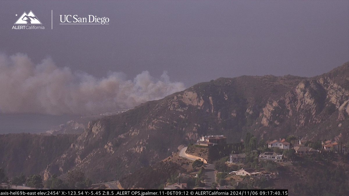
The #BroadFire is another recent start in Malibu. It is visible from ALERTCalifornia's LACFD Helibase 69 Bravo E camera. See the conditions live at: https://t.co/flKBn1Cm4e
No changes to the midweek forecast with a *very serious* fire weather event expected due to strong, dry, long duration Santa Ana winds. Winds will ramp up as soon as late tonight and early Wednesday. Utilize quieter weather today to review emergency plans! #CAwx
Extreme fire weather conditions are expected across southern California Wednesday into Thursday due to dangerous Santa Ana winds. Wind gusts around 50 to 80+ mph will be likely. Any fires that develop will spread rapidly. #NBCLA#SantaAnaWinds
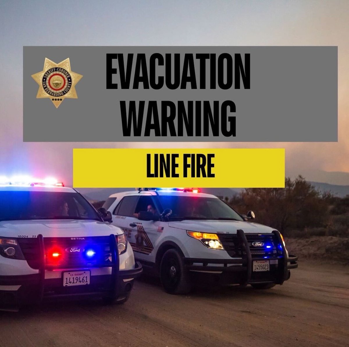
The Line Fire is moving to the northwest in the Santa Ana river drainage. It is on the north side of the river drainage and has made it to the Mile Creek drainage. ⬇️
#LineFire Evacuation Warning ⚠️
Effective immediately, as of September 29, 2024:
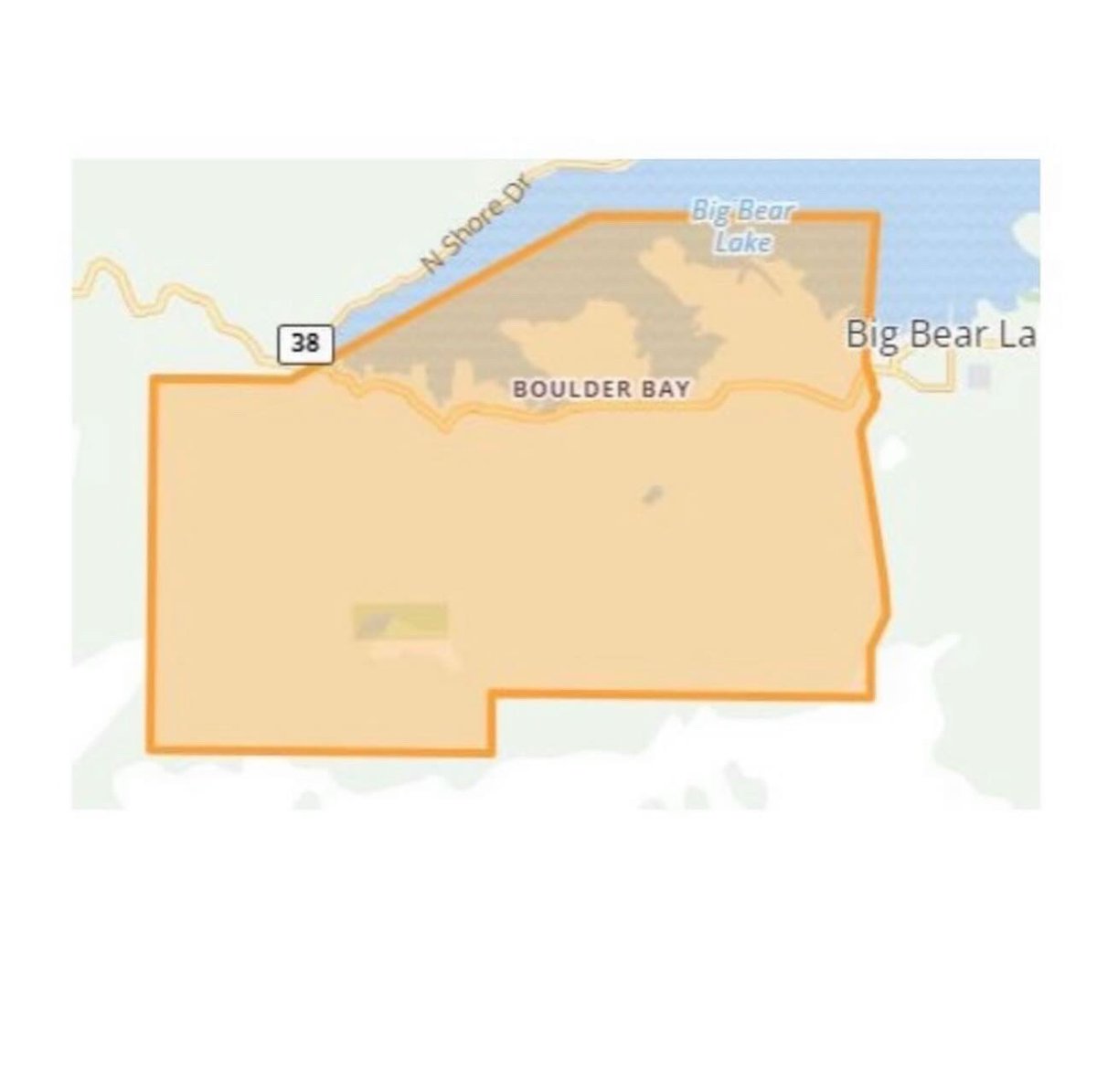
The Boulder Bay area of Big Bear, from the dam east to Wildrose Lane, is now under an evacuation WARNING. Those who require additional time to evacuate, and those with pets and livestock should leave now.
#linefire
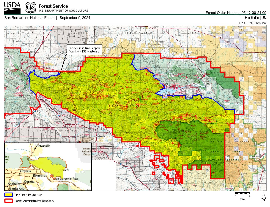
The San Bernardino National Forest has issued a closure order for the area affected by the Line Fire. To read the order, the details, and the many roads and trails closed per the order go to https://t.co/ttJ2mkD3oM
#LineFire#SBNF#SanBernardinoNationalForest
It was another scorcher of a day in SoCal. Several cities set record high temperatures this afternoon. 🥵
Excessive Heat Warnings remain in effect through 8pm Monday. #NBCLA