To the sunrise and the sunset
The master and his servant
Have exactly the same fate
It's a sunrise and a sunset
From a cradle to a casket
There is no way to escape
The sunrise and the sunset
Hold your sadness like a puppet
Just keep putting on the play
@fergieweather Awesome sky just before sunrise in Yatton this morning. Camera never captures the pink shades that are so vibrant to the eye but the way it brought out all the texture of the cloud base was very cool.
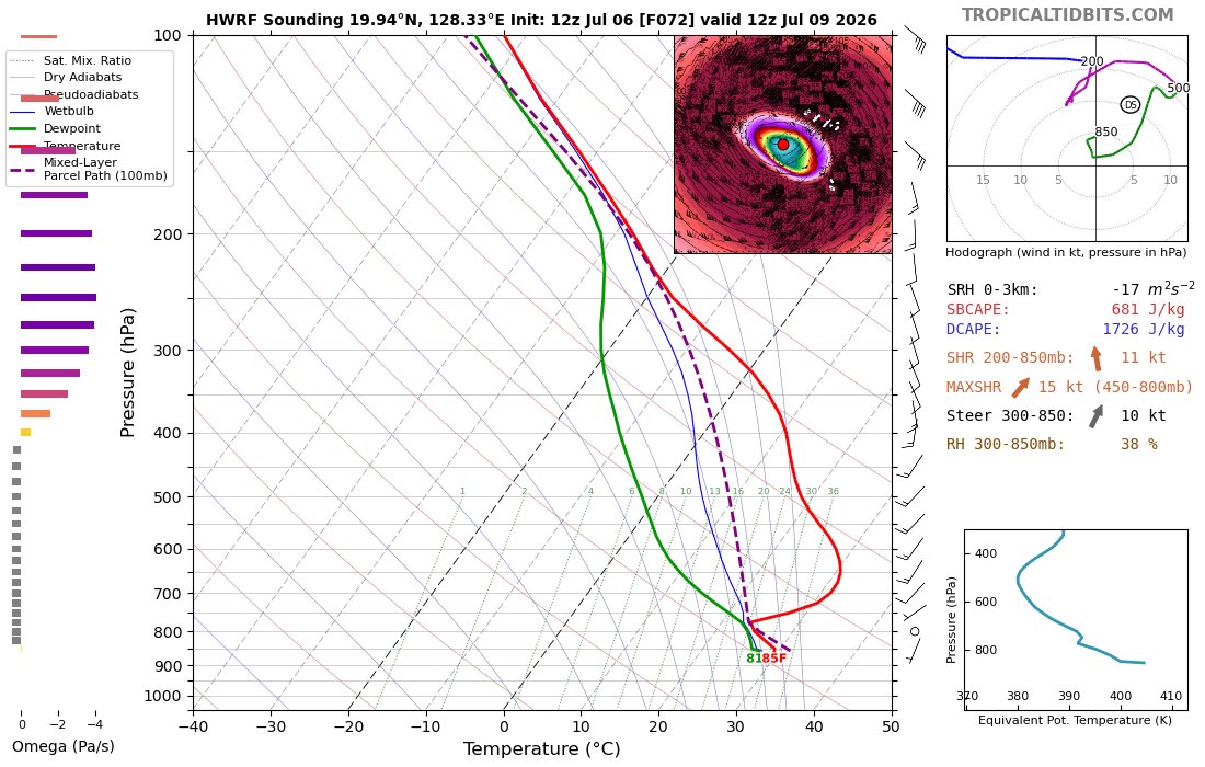
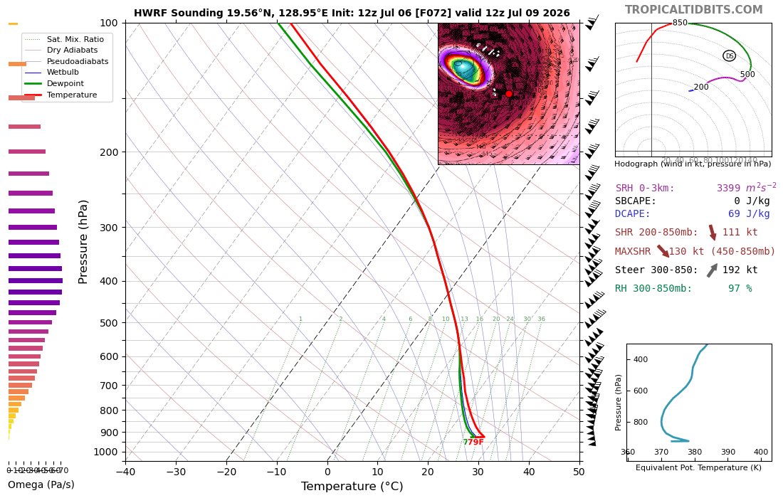
@AndyHazelton@VORTEXJeff Also enjoyed the -60Pa/s large-scale vertical velocity, summoning of the 400K potential temp contour, bizarre yet foreboding sim IR sat, and absurd vertical temp profile within the eye.
The simulated IR sat was also quite the bizarre sight, and the deep warmth of the eye astonishing. Deeply unphysical of course but cool to see all the same.
@fergieweather STY Bavi broke several HWRF runs in a quite fascinating way. 192kt 10m winds, 285kt at 850hPa, w/ central pressures as low as 826hPa so only a few hundred feet up! Also large-scale vertical velocities -50 to -60Pa/s and 400K pot. temp contour making an appearance.
@fergieweather The altitude explains the diurnal oscillations in 850mb temps but what causes the sub-daily oscillation of 500mb height? My best guess is it’s an artefact of the way the model handles GPH over mountainous terrain since it seems to be every 6hr step?
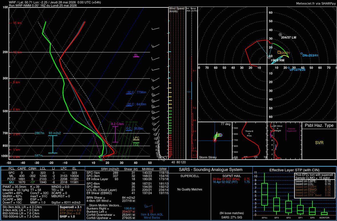
@PaulBlight6 Of course no more than a curiosity at this range, but 12Z EC develops a weak heat low that advects 20-22°C Td’s into E Anglia and backs low-level winds to generate a parameter space that would present substantial tornado risk by UK standards.
@fergieweather Some rather ‘interesting’ Skew-T’s from 12Z EC for East Anglia Friday, with a weak heating-driven surface low advecting 20-22°C Td’s and backing low-level winds…
@MesocastUK@ThermoConveyor Looks like it could be quite a potent setup for elevated storms into the evening if forcing is present. Large hail analogues, ~1100J/kg DCAPE and steep lapse rates just above the LFC plus the shear sorely lacking from today’s setup.
@fergieweather Elevated storms tmrw evening could be quite active it appears - much more respectable shear compared to today/tmrw afternoon. 4.25” hail analogue is eye-catching, as is the ~1100J/kg DCAPE. Good thing not surface-based looking at 0-1km SRH too!
@fergieweather This CAPE/shear mismatch feels like some sort of cruel joke. Not uncommon to see big CAPE without the other necessary ingredients tail-end of UK heatwaves of course but this one is so close to delivering, add 20-30kt to those mid-level SW-lies and it’s a real one.