Unseasonably hot and humid conditions will continue into next week. There will only be a few afternoon thunderstorms to break the heat each day. Normal late August highs are 91-92 across the area, so this is a bit unusual. Maybe some relief by the end of next week. #lawx#mswx
Boaters be aware there are multiple storms moving into Lake Pontchartrain and Lake Maurepas. These storms are producing gusty winds and have the potential to produce large hail. Seek shelter or move to safe harbor! #lawx
Hot conditions will continue through the week, but there could be some afternoon relief in the form of isolated showers and thunderstorms. Unfortunately, not everyone will experience relief. #lawx#mswx
Here's the outlook for the first half of the work week. It's still going to be hot, but the afternoon heat index values should come down a little by midweek.
[8/14 1:30p]
⚠️ Dangerously hot conditions will ramp up this weekend and likely continue into early next week.
🥵 Heat indices especially along the I-10/12 corridor will be as high as 115 degrees.
‼️ Remember: Risk for heat illness is cumulative!
Stay hydrated & cool out there!
Hot conditions continue through the weekend and into the start of the new workweek. Highs will climb will into the 90's each day and with humidity values increasing, "feels like" temperatures will climb up to around 115°F. Extreme Heat Warnings remain in effect. #lawx#mswx
Low rain chances going into the weekend with temperatures climbing into the upper 90s to near 100°F. Humidity values increase going into Saturday and Sunday leading to "feels like" temperatures increasing to 110 to 115°F #lawx#mswx
A Heat Advisory has been issued for tomorrow (Thursday) from 11am-8pm. Heat index values of up to 110 degrees are forecast.
The heat will increase through the weekend with additional heat headlines likely each day Friday through at least the end of the current 7-day period.
🥵 Feeling hot, hot, and more hot through extended range forecast.
‼️ Prolonged heat has a cumulative impact and makes people more susceptible to heat-related illness.
👉 Stay hydrated and take frequent breaks indoors or in the shade during the peak afternoon heat!
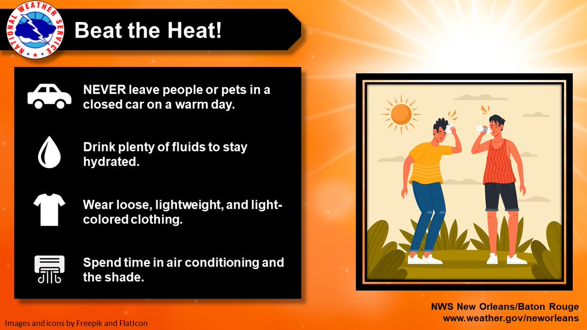
Heat is on the rise this week. Don’t let the routine stuff become the dangerous stuff
💧 Stay hydrated
🌳 Take breaks in the shade or A/C
🚗 Always check the back seat before you leave your car. A few simple habits can prevent a heat-related emergency. #lawx#mswx
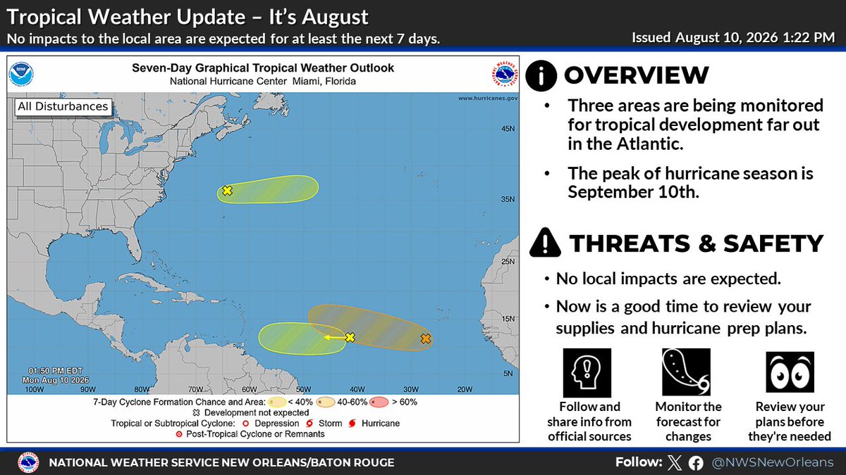
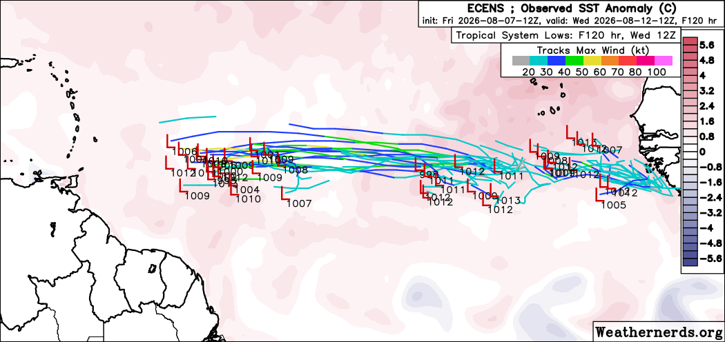
August 10 evening update: NHC is still watching 3 disturbances over the basin. The easternmost system is likely to become a tropical depression during the latter portion of the week. Remember every outlook is at https://t.co/tW4KeGdBFb
A look at the forecast for the rest of the workweek. A drier and warmer trend as we move toward the end of the week with heat index values increasing to 102-110 degrees by Friday with lower rain chances by Wednesday.
It's August and on cue the tropics are heating up.
Despite 3 areas being monitored, ❌ NO local impacts are expected for our area for at least the next 7 days.
Stay tuned to the latest: https://t.co/RHpWwT5JIX
Prepare before you need to: https://t.co/TqermSr1bf
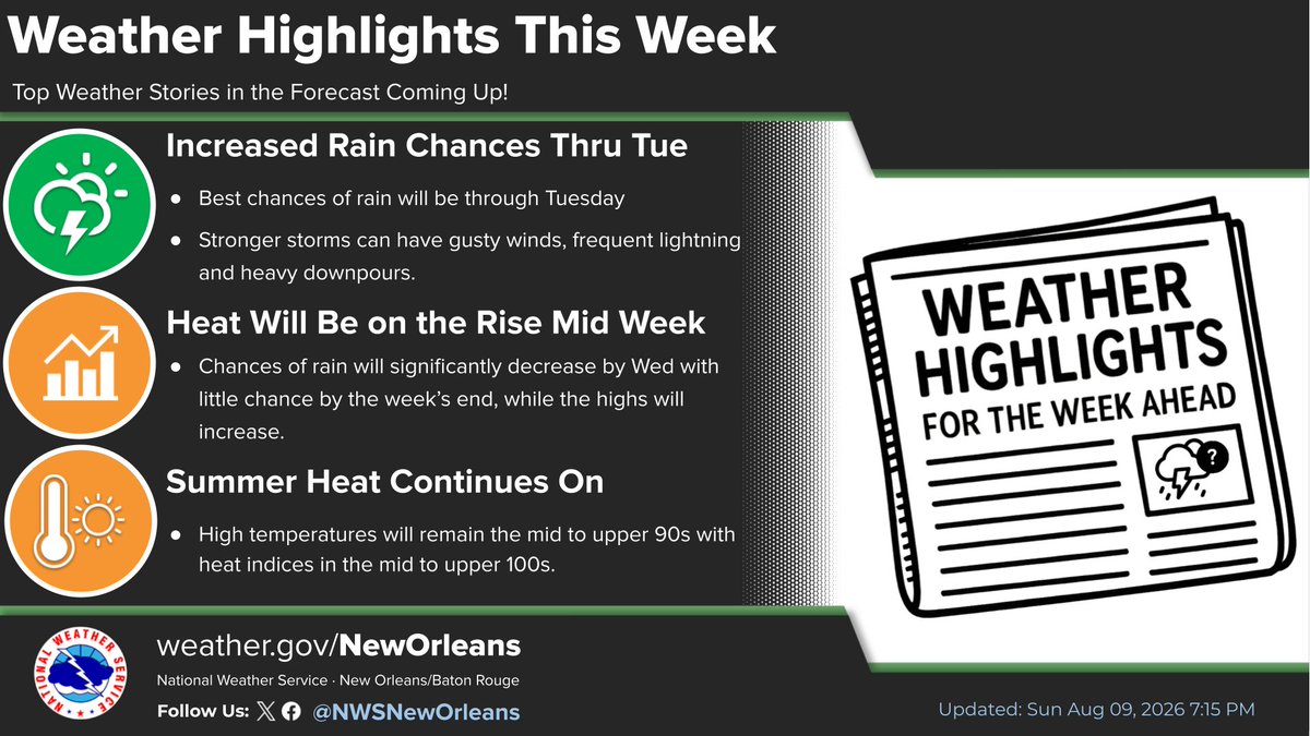
🌦️ Rain chances will gradually decrease thru the week as temps climb. Scattered storms today and Tuesday, becoming more isolated Wednesday. By Thursday and Friday, most locations should stay dry and mostly sunny. 🥵 Heat indices could reach 102°–110°F later this week. #lawx#mswx
We'll continue to have isolated to scattered rain chances remain through Tuesday before the rain chances drop for the second half of the week. Summer heat will continue with highs in the mid to upper 90s and heat indices in the mid to upper 100s. #LAwx#MSwx
Rain chances will be highest tomorrow and Tuesday and will taper off during the second half of the week, allowing afternoon temperatures to rise into the mid to upper 90s.
Here's a look at the week ahead: Slightly warmer than normal temperatures (especially overnight) and isolated to scattered showers and thunderstorms each day.
Generally speaking? It'll feel like August.
4:45p - Scattered showers and storms are still moving westward across the area, mainly across the SE LA coast, Pearl River County, and Baton Rouge. Main threats with these storms are brief gusty winds and heavy rainfall. Don’t drive through flooded roads!
Development in the eastern Atlantic is looking increasingly possible, with most forecast models now showing at least some weak tropical development within the next 7 days. We expect the NHC may soon highlight this area with a low chance of formation.
At this time, any system that develops is expected to remain relatively weak, but conditions and model trends will continue to be monitored closely. No immediate threat to land.
Stay with Hurricane Tracker (Outlook Section) for the latest updates. 🌀
https://t.co/Dtrf9557oi
#HurricaneTracker #Tropics #AtlanticHurricaneSeason #TropicalWeather


![NWSNewOrleans's tweet photo. [8/14 1:30p]
⚠️ Dangerously hot conditions will ramp up this weekend and likely continue into early next week.
🥵 Heat indices especially along the I-10/12 corridor will be as high as 115 degrees.
‼️ Remember: Risk for heat illness is cumulative!
Stay hydrated & cool out there! https://t.co/oVTMGIgI5O](https://pbs.twimg.com/media/HPs9CzdXQAAOuj7.jpg)
![NWSNewOrleans's tweet photo. [8/14 1:30p]
⚠️ Dangerously hot conditions will ramp up this weekend and likely continue into early next week.
🥵 Heat indices especially along the I-10/12 corridor will be as high as 115 degrees.
‼️ Remember: Risk for heat illness is cumulative!
Stay hydrated & cool out there! https://t.co/oVTMGIgI5O](https://pbs.twimg.com/media/HPs86WQWcAA3cAa.jpg)








![iembot_lix's tweet photo. LIX continues Heat Advisory for 38 forecast zones in [LA] and 11 forecast zones in [MS] till Aug 22, 8:00 PM CDT https://t.co/uUSaOgNnTt https://t.co/USy92pdCmb](https://pbs.twimg.com/media/HQVxJdIWwAA5rs6.png)


![NWSNewOrleans's tweet photo. [8/14 1:30p]
⚠️ Dangerously hot conditions will ramp up this weekend and likely continue into early next week.
🥵 Heat indices especially along the I-10/12 corridor will be as high as 115 degrees.
‼️ Remember: Risk for heat illness is cumulative!
Stay hydrated & cool out there! https://t.co/oVTMGIgI5O](https://pbs.twimg.com/media/HPs--_dXMAE5TNC.jpg)