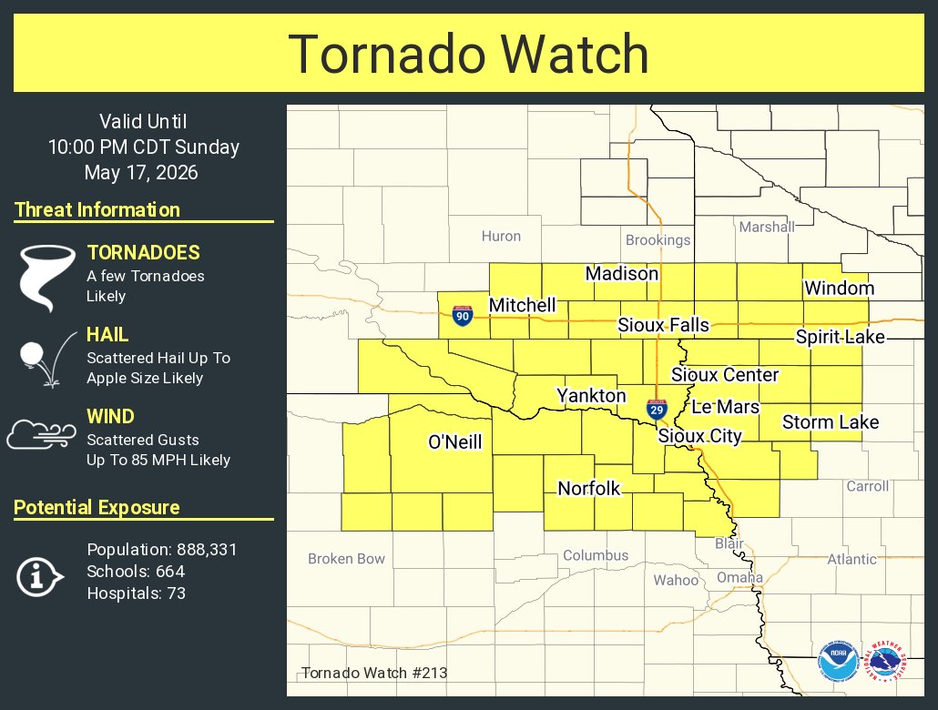
Significant severe weather is possible today. Large hail, damaging wind, & tornadoes are possible. The first graphic shows area of greatest risk. The second shows timing of risk. Please ensure you have multiple ways to receive warnings.
[Radar update at 8:22 pm on Friday, 5/15]:
Thunderstorms continue to push eastwards this evening, a few of which remain severe.
The severe weather threat is beginning to wind down but locally heavy rain, large hail, and damaging winds will continue for about another hour.
Chances for strong to severe storms return to parts of the area later today and this evening. Severe risks continue across the region through the weekend into early next week. Review your severe weather safety plans now. Have multiple ways to receive warnings and stay prepared!
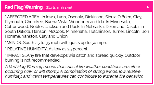
⚠️ RED FLAG WARNING FOR THURSDAY
🚫 NO OPEN BURNING
RED FLAG WARNING REMAINS IN EFFECT FROM 10 AM THIS MORNING TO 7 PM CDT THIS EVENING FOR WIND AND LOW RELATIVE HUMIDITY
⚠️Areas of Blowing Dust This Afternoon/Evening
Strong northwest winds gusting to 35 and 45 mph will continue to produce blowing dust through the region. In very localized areas, visibility may fall between 1 and 2 miles, and may even fall to one half mile in open farm fields.
FROST ADVISORY IN EFFECT FROM 1 AM TO 8 AM CDT FRIDAY
Temperatures as low as 30° will result in frost formation.
Frost could harm sensitive outdoor vegetation. Sensitive outdoor plants may be killed if left uncovered.
Take steps now to protect tender plants from the cold.
90 years ago today a devastating tornado tore through NW Iowa including parts of Dickinson County. The twister claimed 4 lives, injured many more, and damaged or destroyed 40+ farms, causing considerable property and livestock losses.
Read more here: https://t.co/12SYe6wVHo
Chances for a few severe thunderstorms increase by late afternoon near, and especially east of I-29. As we enter a new severe weather season, now would be a good time to brush off your severe weather safety plan and ensure you have multiple ways to receive warnings.