Chief Meteorologist of @FirstWarnNJ, Publisher/Owner of @PineBarrensNews weekly newspaper. Reporter. Have gardening green thumb. Value trees=greatest asset.
Video Forecast for 6/29: Heat dome will bring extreme heat to the state mid to late week. New Jersey could be on the edge of the ring of fire, and we'll need to watch for any mesoscale convective complexes. #NJ#NJWX#WX#Weather
Three supercells right now in NJ - one has already produced a wall cloud near Philly. The tightest couplet/gate-to-gate shear as of 3 p.m. is in the one near I-78. Updates on @FirstWarnNJ
8:35 p.m. 2/22/2026 -
A very intense snow band is just SE of the I-95 corridor. This will slowly meander northwest and may even stall a bit over the next hour. This band is capable of 2"-3" per hour rates.
Meanwhile, wind gusts have been persistently 35-55 mph from the coast to about 15-20 miles inland, where several power outage groupings are. JCP&L is up to about 13,000 without power.
However, there are signs that strong winds are about to ramp up inland, as expected after 9 p.m., and am noticing a stronger wind field over the Delaware Bay that will lift northward. So inland locations S&E, between the increasing snow amounts and wind, should start to have more problems in short order.
Highest winds between 12-7 a.m. #NJ #NJWX #WX #Weather
@BianchiWeather Yep. Every winter my friend in Arizona tells me it is warm there, it is cold here. Every winter she tells me it is cold there with snow, it is warm here. What goes up must come down effect.
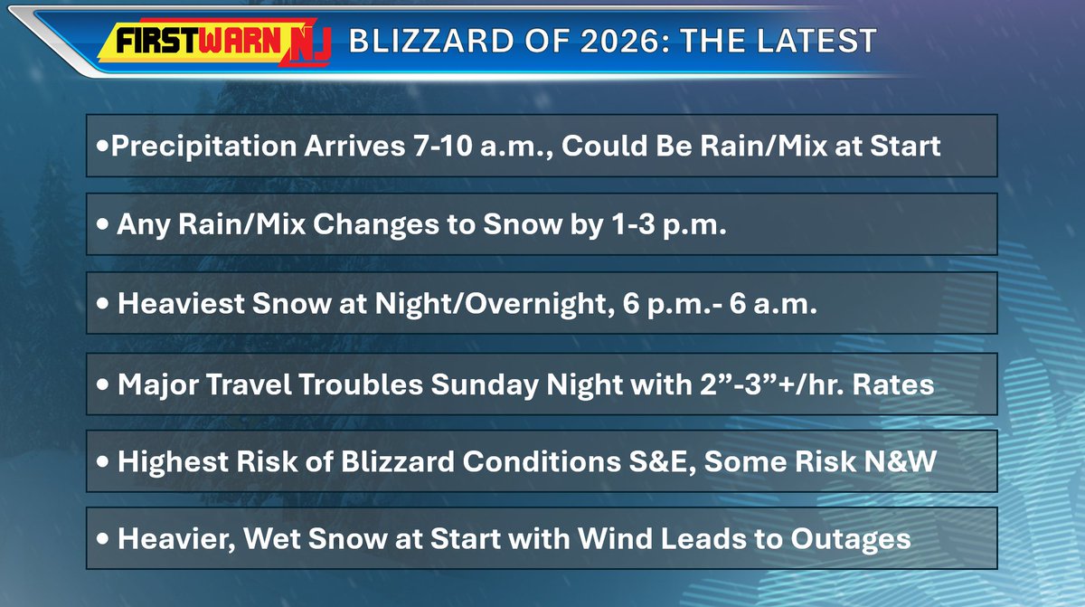
Here's a noontime recap of what to expect with our blizzard.
>Any rain will switchover to snow over the next couple hours.
>Heaviest snow falls from 6 p.m. to 6 a.m.
>Highest wind gusts from 10 p.m. to 10 a.m. Peak gusts 40+ mph inland to 60 mph at the coast.
>Best chance of blizzard conditions S&E of Philly, Newark, Trenton. Some risk N&W of I-95.
>Widespread moderate coastal flooding at high tide tonight on Atlantic coast. NWS now forecasts major coastal flooding near AC.
>Snow will start as wet & heavy, and as wind picks up, power outage risk will become enhanced tonight/overnight.
>Snow ends Monday afternoon - the last half of the storm the snow may become drier, so some blowing snow is possible
>Major travel disruptions anticipated tonight, and travel may become impossible in some areas, especially closer to the shore
>Best chance for totals nearing 18-24 inches in Ocean, Monmouth, Southeastern Burlington counties, with terrain driven secondary maximum possible in eastern Sussex, western Morris, western Passaic counties.
>Still some uncertainty about higher totals getting elsewhere N&W of I-95, but an impactful snowfall still anticipated
#NJ #NJWX #WX #Weather
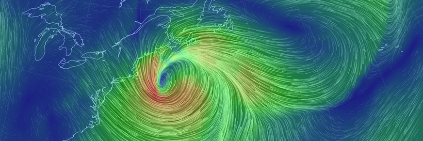
A blizzard, potentially crippling for at least parts of the state, will unfold Sunday night into Monday morning. #NJ#NJWX#WX#Weather
https://t.co/X2xmxLqGxA
Here is our updated snowfall forecast and wind forecast for Sunday night into Monday.
We are anticipating a crippling blizzard, especially S&E of I-95. Snowfall amounts ranging from 8-10 inches N&W to up 18-24 inches S&E. Top wind gusts of around 25 mph N&W to 60 mph along the coast, especially coastal Ocean and Monmouth counties.
There remains some uncertainty as to whether the big snow tallies will get north and west of I-95. Some guidance is persistent with a sharp cutoff the further north and west you go. Others show the coastal low being pulled toward the coast and covering the entire state with higher figures of 18"+. A number of models - but not all - show two to three feet of snow occurring in a corridor S&E, a possibility that remains on the table. Some of the high-res guidance shows a secondary bullseye along the border of Sussex/Passaic. All little things that bear watching.
Coastal flooding will be especially significant along the Atlantic coastline. Several gauges are now forecast to enter high-end moderate coastal flooding Sunday night.
One final note is not be fooled by potentially initial rain Sunday, before a switchover to snow later in the afternoon. And this also hints at a heavy, wet snow, at least initially, and if it is a wet snow, combined with the winds, power outages will become an issue.
#NJ #NJWX #Weather #WX
This right here reflects why forecasting in NJ, and for mixed precipitation events, can be very difficult even on the day of. Look at this wide variety of weather conditions and temperatures throughout the state. Heavy snow, freezing fog, heavy rain, blowing snow, unknown precip. #NJ #NJWX #WX #Weather
BREAKING NEWS: Embattled Pemberton Township Mayor Jack Tompkins has submitted his resignation letter to the municipality, and will leave office tomorrow, Dec. 31: https://t.co/H1SGGLSBZZ #Pemberton#NJ#News#Pines#BurlCo#Breakingnews
9:45 p.m. Update-
Showery precipitation, mostly sleet and freezing rain, expected from here on out, along with freezing drizzle. Considerable dry slot in North Jersey should eventually fill in with some upstream showers of sleet, freezing rain and snow. Roads and sidewalks will remain slippery as temps at or below freezing. In SE NJ, all liquid rain as here temps have come up above 32.
Highest reported snowfall total so far in state is Bergen, near Pearl River, at 2.2". Lake Hopatcong 1". #NJ #NJWX #WX #Weather
8:30 p.m. Update:
Sleet and freezing rain continuing over much of New Jersey with some snow in the far NE corner. Looks like for the rest of the night it will come in waves/pockets. Will continue to watch the icing amounts over the next few hours.
Lack of returns upstream to NE NJ, as well as some sleet mixing in at times really leads me to believe the window is closing for snow.
Looks like the snow jackpot shifted N&E at the last minute (northeast of the mixing) into Long Island, CT, and may also clip Rhode Island.
Nevertheless, sleet and freezing rain makes travel treacherous and as a couple people noted, is probably worse.
#NJ #NJWX #WX #Weather
Here is the latest information on our winter storm for Friday into Saturday.
A mess of precipitation types and chaotic picture.
Guidance continues to struggle with the extent of sleet and freezing rain, but the general trend over the last three model cycles is for a quicker transition to or even start as sleet along and south of I-195, in particular, which may now account for much of the totals south of there (more than a half inch of sleet is a lot). There may be some communities that see significant sleet accumulation. Also, interior Southern New Jersey, especially closer to the riverfront, will need to be monitored for prolonged icing, while closer to the ocean may even switchover to plain rain at some point. How fast any transition from sleet to rain occurs remains uncertain.
The heaviest snow will occur north of the battle zone, and right now it looks like the axis will be in Northern New Jersey, possibly down into North Central NJ into Long Island. Should this axis setup, some guidance has suggested up to or even more than 10 inches within it, esp. along the NJ/NY border region. But because it'll be a heavy, wet snow and this system has clipper origins, I am cautious to go higher than that.
A couple other things to note - there have been one or two outlier models that are even further north and warmer, and that results in the heaviest snow axis over southern New York. There have also been one or two outlier models thar are colder, and thus that heavier snow axis would shift south, back to where it was looking like previously. Not all models are in agreement currently. Again, this forecast is based on a consensus. Shifts in either direction, with accompanying major implications, remain on the table.
Also, some of the mesoscale models have hinted at a changeover back to snow, with one or two showing this happening fairly progressively. I think once that warm nose develops, it'll be hard to transition back, but all bears watching.
The short of it is we remain walking a fine line with big implications, and mixing is going to play havoc. #NJ #NJWX #WX #Weather
Latest on Winter Storm for Later Friday-Saturday:
We have released our first call snow and ice maps. The National Weather Service has issued a winter storm watch from Burlington, Camden, Ocean counties and points north and east. Uncertainty exists with totals from around and along I-195 to the AC Expressway as there will be a battle zone in-between there with precipitation types. Stay tuned for further updates as there could be shifts in this area.
We have two impact graphics to break things down for you. We have concerns for power outages where wet snow accumulates past 3.5" and also where icing could occur, with the most likely area for more than two-tenths of an inch near the Delaware River in Gloucester and Salem counties. So we believe there could be two distinctive pockets of power disruptions.
A big unknown for SW NJ is whether sleet will temper the icing threat. If there is less sleet, ice storm potential could increase markedly there. Right now, soundings and guidance suggest a decent chance for several hours of heavy sleet. That sleet will also cut down snowfall totals in SW NJ.
One thing that looks certain is that whether it is sleet, freezing rain or snow, travel will become difficult Friday night, and where there is freezing rain, potentially very dangerous. #NJ #NJWX #WX #Weather
Early Take on Late Friday/Saturday Winter Storm:
There has been a variety of solutions on 12z/18z guidance for late Friday into Saturday’s storm. It all comes down to the track of the low pressure center and the influence of high pressure to our north.
The GFS is one of the coldest models, showing a heavy thump of snow for much of the state, with sleet working its way into interior Southern NJ. It only has rain making it into SE NJ.
The Canadian has snow to start in the NE half of NJ, sleet in the SW half, and rain in the SE part. Rain/mix ultimately wins out south of I-195, while sleet takes over north of there.
The EURO is kind of the in-between solution, with snow to start in the NE half of NJ, sleet and freezing rain in the SW portion, and rain S&E, and then has the snow linger north of I-195.
The ICON has frozen precipitation well to our north and rain virtually everywhere (currently an outlier).
The 18z NAM is just getting the storm in view (as it only goes out to 84 hours) and seems to be in the GFS camp initially.
The 18z RGEM (high resolution Canadian model), seems to be similar to the NAM and GFS outputs.
18z GFS held to the 12z run for the most part
Overall, I do think a swath of the state will thump with snow, while another part will get a lot of sleet, and there is the potential for a smaller section, closer to the river, to get freezing rain. Areas closer to Cape May have the best chance of getting more wet than white.
#NJ #NJWX #WX #Weather
Friday/Saturday Potential Storm Thoughts:
There has been a shift on the computer model guidance over the last 12 hours with regard to a low pressure system that will likely eject from the west Friday into Saturday, and that is to be colder as a result of a meandering frontal boundary perhaps slipping south before the low approaches.
We will be riding a fine line, literally, as that front will separate an airmass of temperatures in the 20s and 30s (supportive of frozen precipitation) from one of 40s and 50s.
There are three solutions at this point that guidance has thrown about:
Scenario 1:
The front is further north, and hence the low tracks to our north, just giving most of us rain, with some icing well NW. The better precipitation rates would be to our north.
Scenario 2:
The front is right over the region, allowing for sleet and freezing rain NW, rain south. Those that see prolonged freezing rain could see an ice storm.
Scenario 3:
The front slides to our south, allowing for snow, sleet and freezing rain for almost all, and given its position, we would see heavier rates and plowable snow/sleet.
At this point, such a setup is very tricky and these fronts can be a bit unpredictable with the meandering. I suspect different scenarios will continue to be modeled until mid-week, when a better idea of the front's positioning will be known. A 50 to 100 mile shift is all it would take to impact the outcome. #NJ #NJWX #WX #Weather